My Store
Antique Frederick, Maryland 1894 US Geological Survey Topographic Map – Gaithersburg, Rockville, Mt Airy, County, Bethesda, Virginia, MD VA
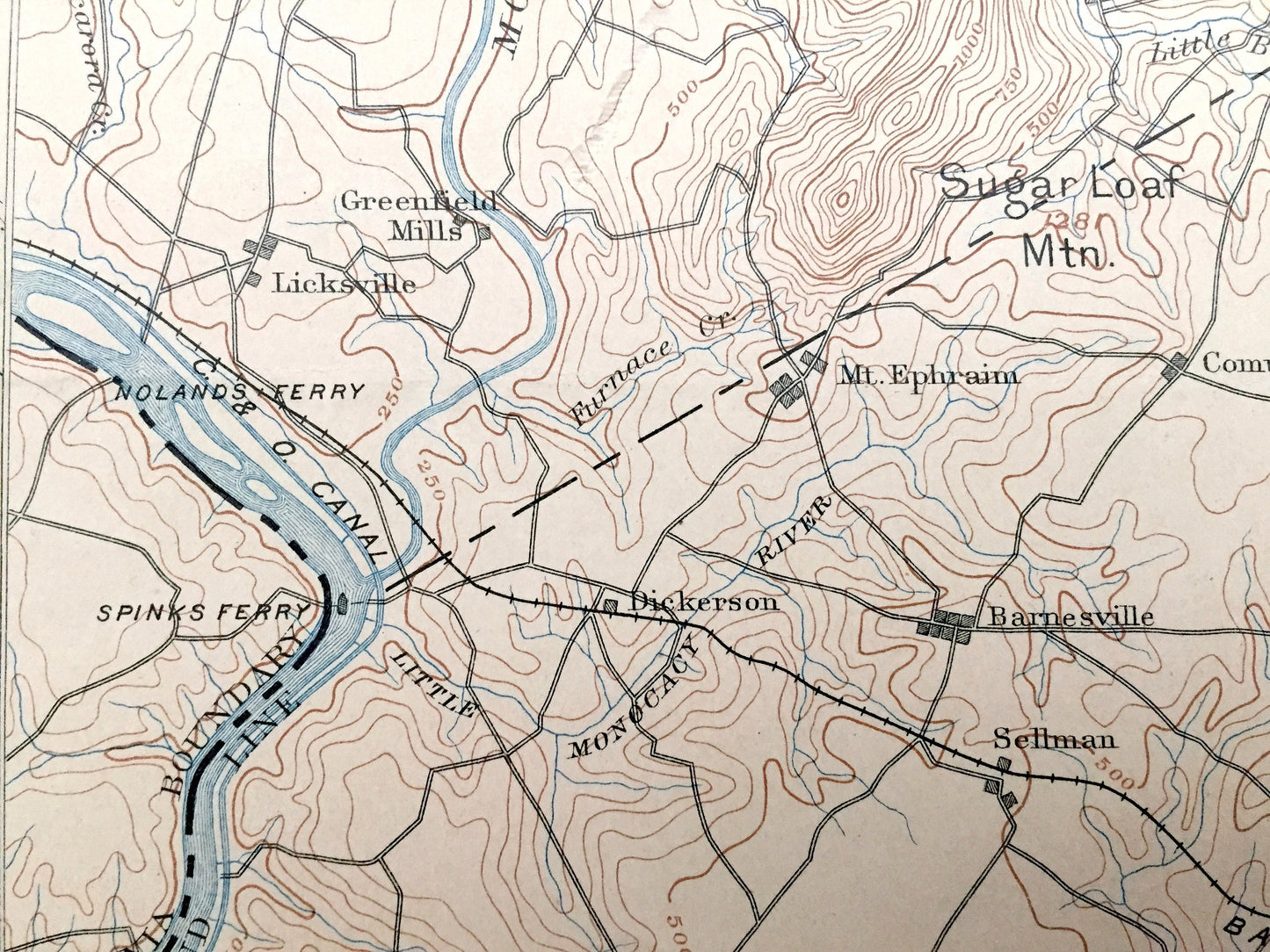
Antique Frederick, Maryland 1894 US Geological Survey Topographic Map – Gaithersburg, Rockville, Mt Airy, County, Bethesda, Virginia, MD VA
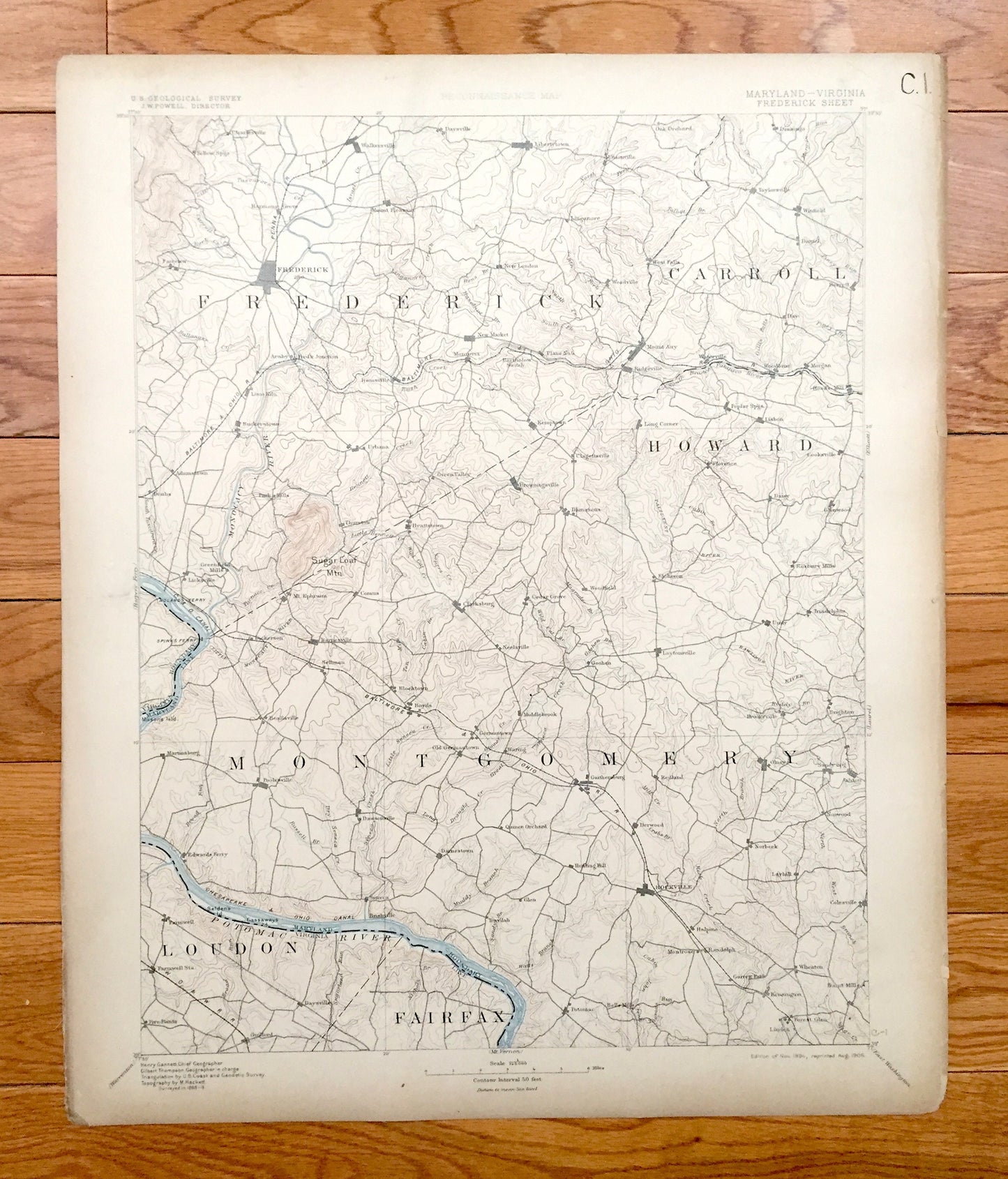
Beautiful, antique map of Virginia and Maryland, including Frederick, Carroll, Howard, Montgomery, Loudon & Fairfax County. This is an authentic 1894 edition, 1906 print from the U.S. Geological Survey and NOT a computer reproduction.
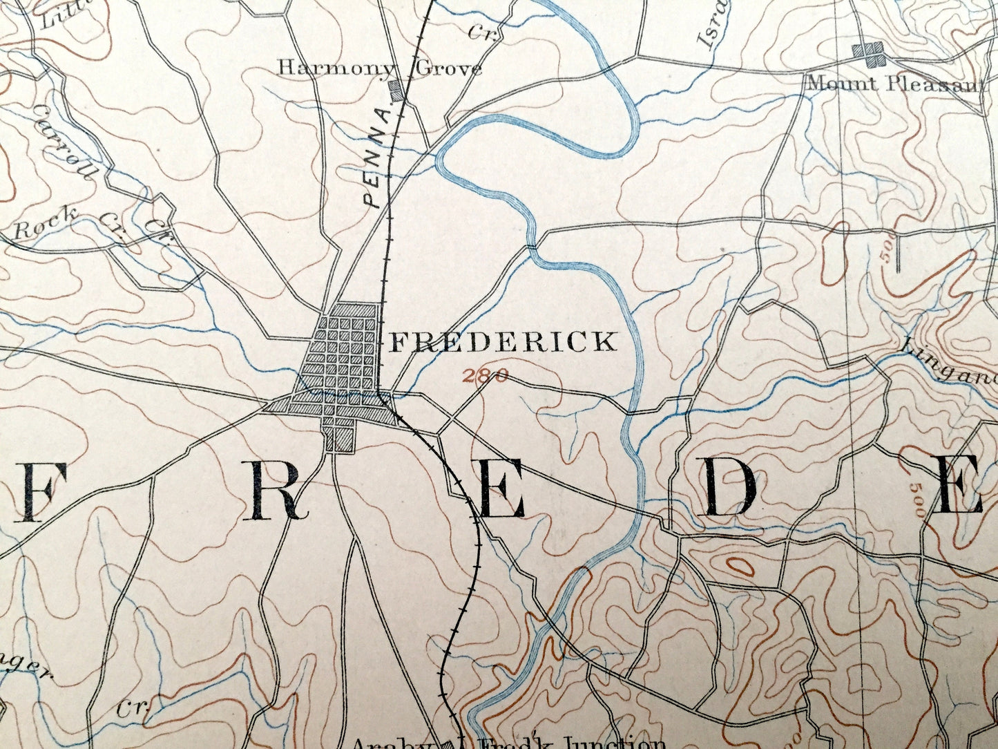
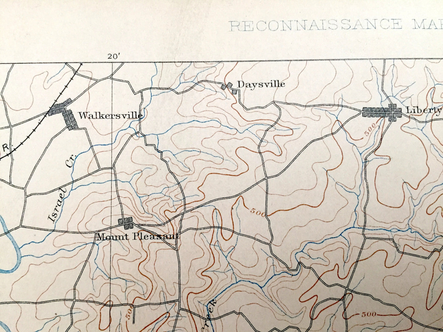
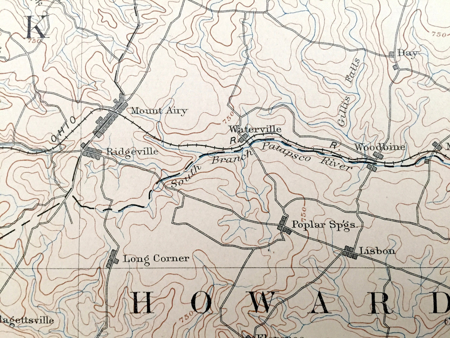
See what Maryland & Virginia looked like more than 125 years ago. Printed in the very large 30 minute scale, this map covers an immense amount of landscape. Lots of intricate details and geological contours. Map even has little squares for every city and town block that existed at the time. The USGS cartographers were very thorough back then! Map is canvas-backed.
Perfect for the historian, map-lover, the curious or just as a conversation starter. Wonderful and rare. Vintage maps such as these make great gifts.
Edition of 1894, printed 1906
Dimensions: 16 1/2" width x 20" height
----
Features
Cities & Towns: MARYLAND: Frederick, Walkersville, Charlesville, Harmony Grove, Araby, Lime Kiln, Buckeystown, Fairview, Yellow Springs, Mount Pleasant, Daysville, Libertytown, New London, Linganore, Unionville, New Market, Ijamsville, Monrovia, Kemptown, Oak Orchard, Dennings, Taylorsville, Winfield, Daniel, Bay, West Falls, Mount Airy, Waterville, Woodbine, Poplar Springs, Lisbon, Morgan, Berrett, Adamstown, Doubs, Licksville, Mt Ephraim, Barnesville, Sellman, Beallsville, Urbana, Thurston, Park Mills, Greenfield Mills, Dickerson, Green Valley, Browningsville, Clagettsville, Damascus, Woodfield, Hyattstown, Clarksburg, Neelsville, Cedar Grove, Goshen, Blocktown, Boyds, Germantown, Middlebrook, Florence, Elchison, Laytonsville, Daisy, Cooksville, Glenwood, Roxbury Mills, Unity, Triadelphia, Brookeville, Brighton, Martinsburg, Pooleville, Edwards Ferry, Dawsonville, Seneca, Rushville, Old Germantown, Darnestown, Waring, Gaithersburg, Glen, Travilah, Potomac, Belle Mills, Redland, Rockville, Olney, Sandy Springs, Norwood, Layhill, Colesville, Halpine, Montrose, Wheaton, Linden, Bells Mills, Burnt Mills, Linden, Kensington, Forest Glen.
VIRGINIA: Farmwell, Five Points, Daysville, Guilford.
Points of Interest: Frederick County, Carroll County, Howard County, Montgomery County, Loudon County, Fairfax County, Potomac River, Sugar Loaf Mountain, Monocacy River, Ballanger Creek, Seneca Creek, Hawlings River, South Branch Patapsco River, Chesapeake & Ohio Canal, and lots more hills, creeks, towns, schools, churches, roads, islands, points, coves and marshes.
Condition: Good Vintage condition, commensurate with age. This map is in great shape for being 115 years old. Has some edge-wear, toning and pen in margins, but this will all read as vintage character when framed.
----
We will happily adjust shipping price for multiple purchases. Maps are rolled up and shipped in sturdy mailing tubes, never folded.
Couldn't load pickup availability
Share