My Store
Antique Fredericksburg, Virginia 1887 US Geological Survey Topographic Map – Potomac, Port Royal, Bowling Green, Stafford, King George VA MD
Antique Fredericksburg, Virginia 1887 US Geological Survey Topographic Map – Potomac, Port Royal, Bowling Green, Stafford, King George VA MD
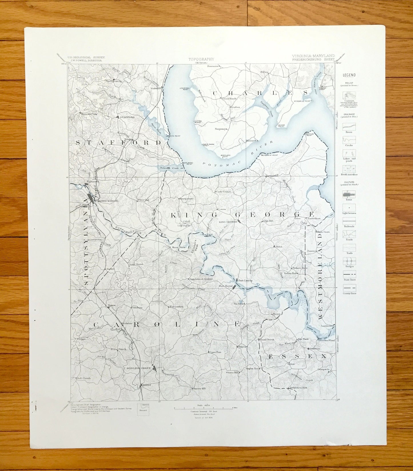
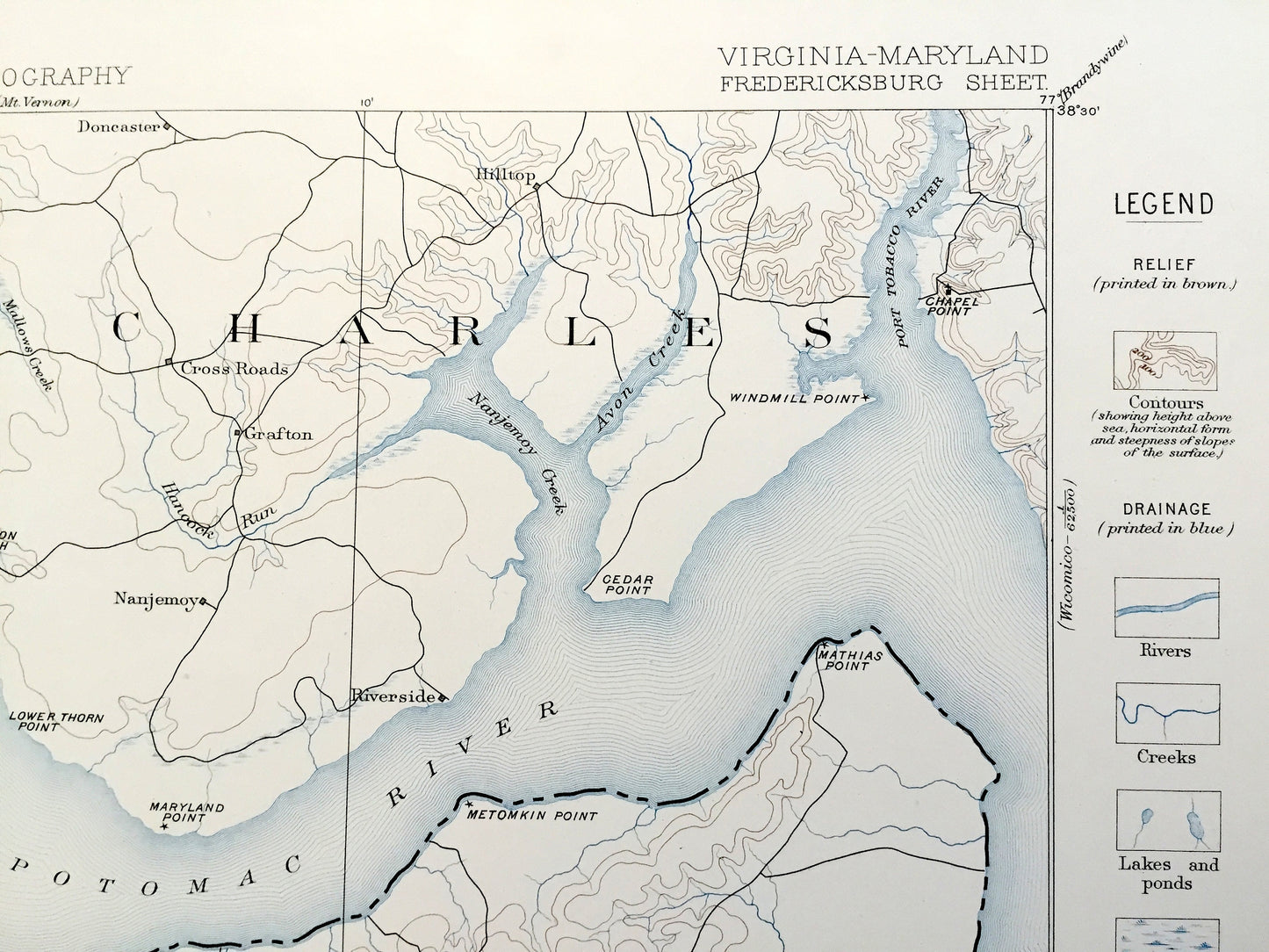
Beautiful, antique map of historic Fredericksburg, Virginia and surrounding area on the Potomac River. This is an authentic 1887 edition, 1894 print from the U.S. Geological Survey and NOT a computer reproduction. It is from a Geologic Atlas folio.
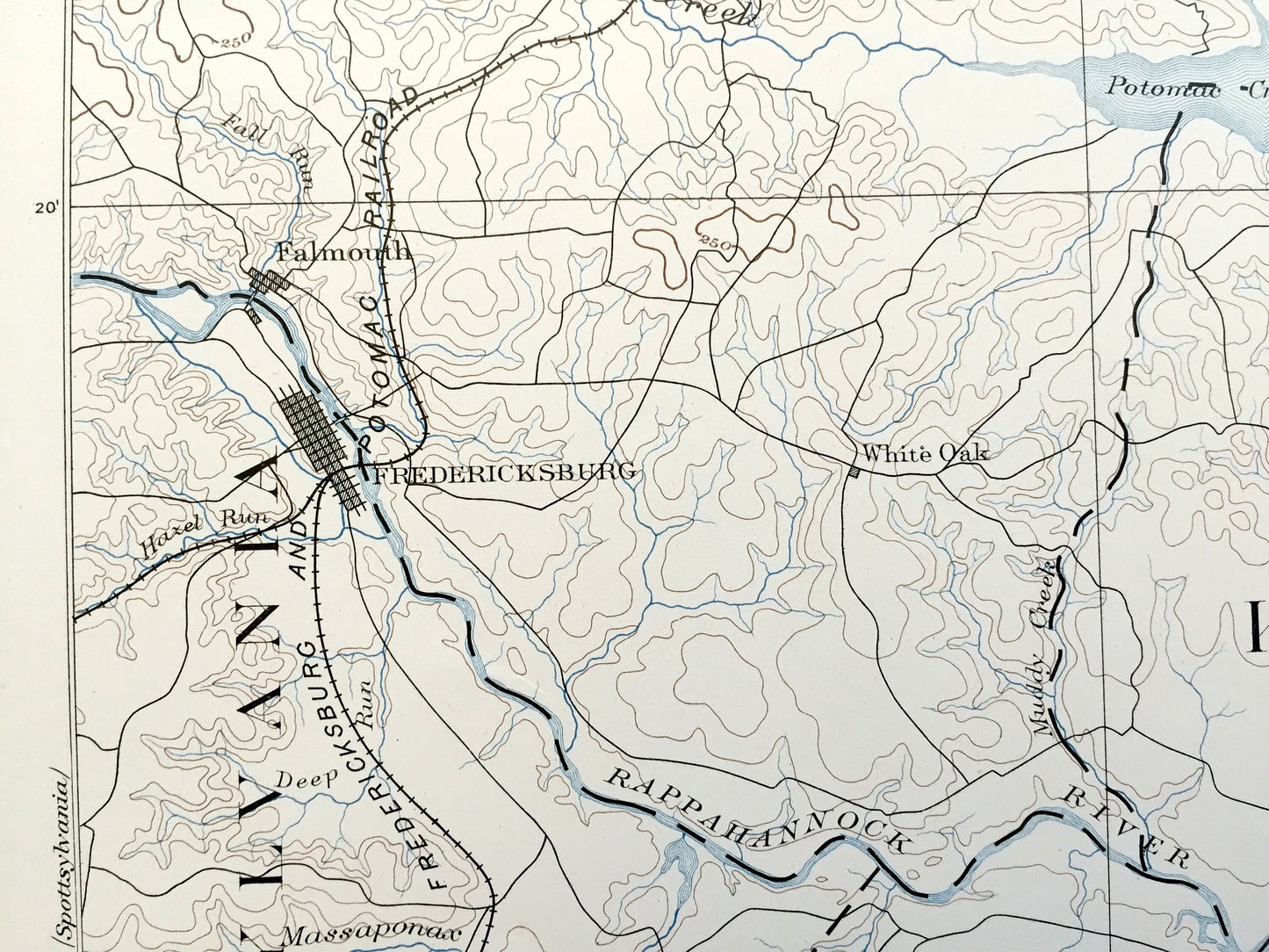
See what Maryland looked like over 125 years ago. Lots of intricate details and geological contours. Map even has little squares for every city block that existed at the time. The USGS cartographers were very thorough back then! This is one of the rare maps where the topographic symbols and map guide are on the front.
Perfect for the historian, map-lover, the curious or just as a conversation starter. Wonderful and rare. Maps such as this make great gifts.
Edition of 1887, printed 1894
Dimensions: 18 1/2" width x 22" height
----
Features
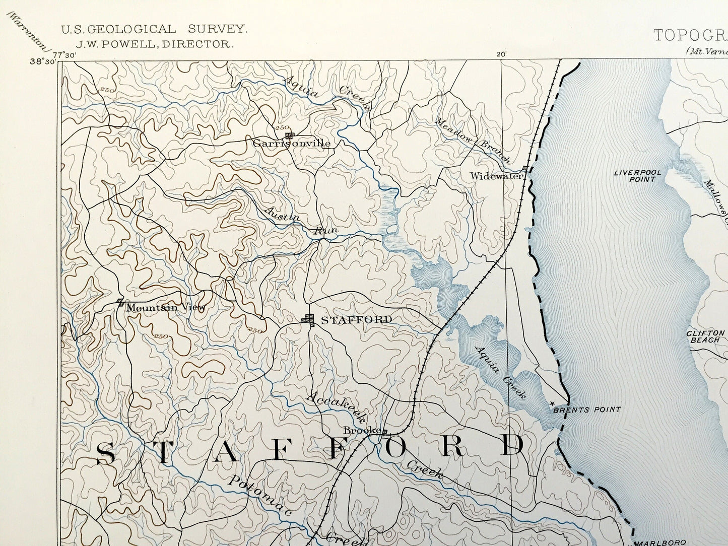
Cities & Towns: VIRGINIA: Garrisonville, Mountain View, Stafford, Widewater, Hampstead, Falmouth, Fredericksburg, White Oak, Passapatanzy, Cash Corner, Comorn, King George, Hop Yard, Port Royal, Port Conway, Lagrange, Edge Hill, Shiloh, Alden, Nindes Store, Maple Grove, Pomona, Parkers Store, Rollins Fork, Guinea, Villeboro, Woodslane, Flippo, Peace Church, Bull Church, Bowling Green, Milford, New London, Pin Hook, Upper Zion, Plainview, Whites Mill, Smooths Mill, Return, Elm Wood Leedstown, Loretto, Eagles Nest, Taylors, Occupacia, Bethlehem Fork, Saunders Wharf.
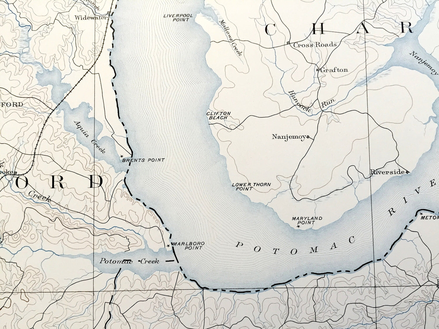
MARYLAND: Doncaster, Cross Roads, Grayton, Nanjemoy, Hilltop.
Points of Interest: Potomac River, Rappahannock River, Nanjemoy Creek, Aquia Creek, Potomac Creek, Port Tobacco River, Mathias Point, Persimmon Point, Metomkin Point, Marlboro Point, Windmill Point, Chapel Point, Moss Neck, Skinkers Neck, Richmond Frederick & Potomac Railroad, and many more small towns, roads, train tracks, hills, islands and creeks.
Condition: Very Good Vintage condition, commensurate with age. This map is in great shape for being over 125 years old. Has staple-holes in margin from folio, foxing, toning and edge-wear but this will all add to vintage character when framed.
----
We will happily adjust shipping price for multiple purchases. Maps are rolled up and shipped in sturdy mailing tubes, never folded.
Couldn't load pickup availability
Share