My Store
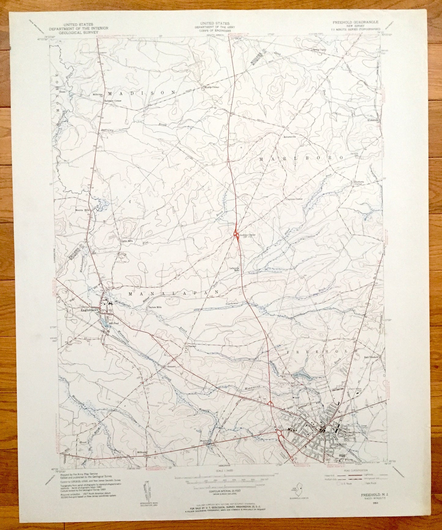
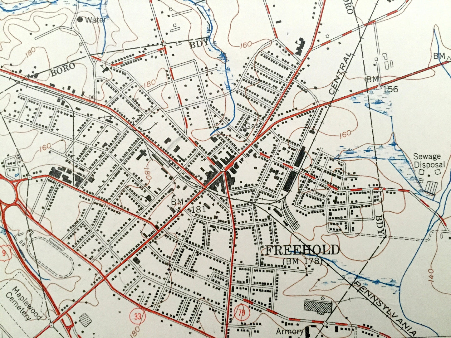
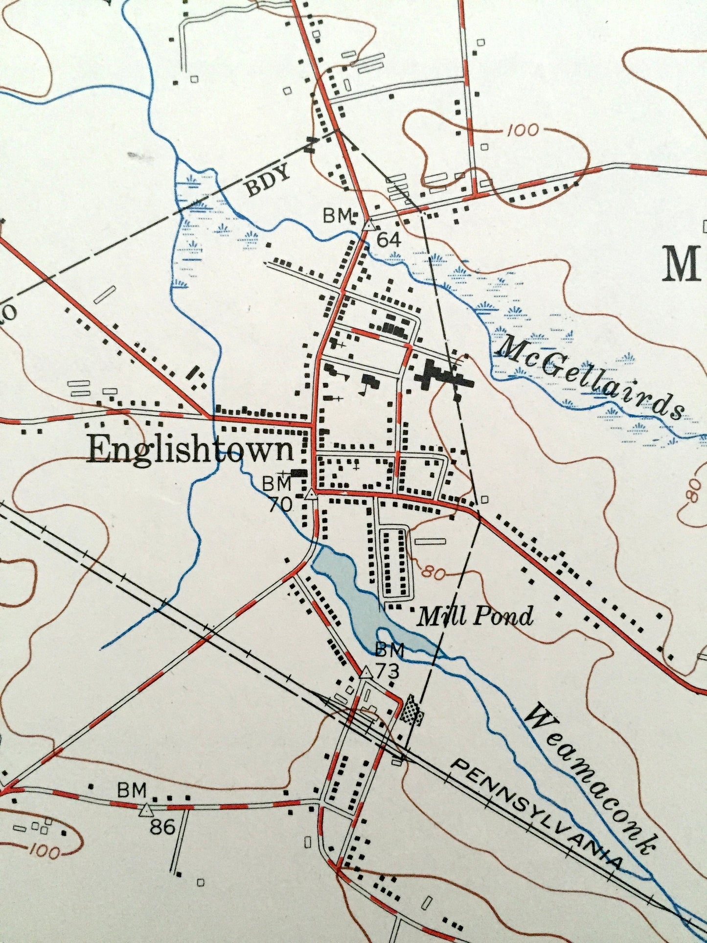
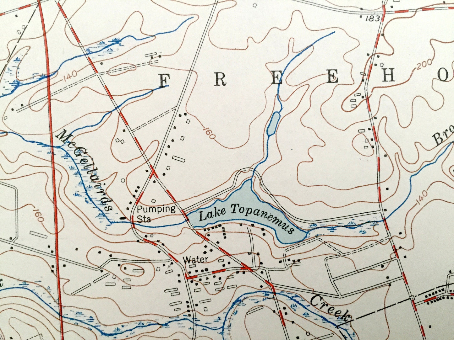
Antique Freehold, New Jersey 1953 US Geological Survey Topographic Map – Manalapan, Marlboro, Madison, Englishtown, Millhurst Gordons Corner
Antique Freehold, New Jersey 1953 US Geological Survey Topographic Map – Manalapan, Marlboro, Madison, Englishtown, Millhurst Gordons Corner
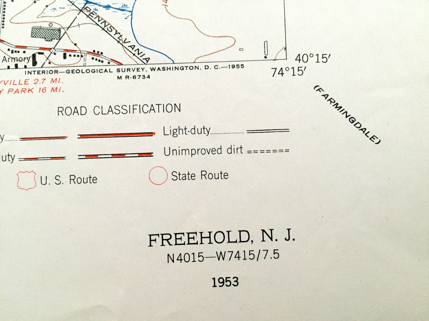
Beautiful, antique map of Freehold, Marlboro, Robertsville, Madison, Clarks Mills, Manalapan, and Englishtown,New Jersey. This is an authentic 1953 print from the U.S. Geological Survey and NOT a computer reproduction.
See what Monmouth and Middlesex Counties of New Jersey looked like almost 65 years ago. Lots of intricate details and geological contours. Map even has little squares for every house that existed at the time. The USGS cartographers were very thorough back then!
Perfect for the historian, map-lover, the curious or just as a conversation starter. Wonderful and rare. Vintage maps such as these make great gifts.
Edition of 1953, printed 1953
Dimensions: 22" width x 27" height
----
Features
Cities & Towns: Monroe, Madison, Redshaw Corner, Morerls Corner, Spring Valley, Robertsville, Marlboro, Herberts Corner, Gordons Corner, Claytons Corner, Lafayette Mills, Manalapan, Taylors Mills, Englishtown, Clarks Mills, Millhurst, Tennent, Freehold.
Points of Interest: Old Bridge Airport, Monmouth Battlefield State park, Freehold Armory, Lake Topanemus, Wemrock Pond, Marlboro Airport, Golf Course, Millbridge Church, and lots more hills, streams, ponds, churches, houses, and roads.
Condition: Very Good condition, commensurate with age. There are 2 small tears on the right side (less than 1/2") that will not appear after framing. This map is in incredible shape for being over 60 years old.
----
We will happily adjust shipping price for multiple purchases. Maps are rolled up and shipped in sturdy mailing tubes, never folded.
Couldn't load pickup availability
Share