My Store
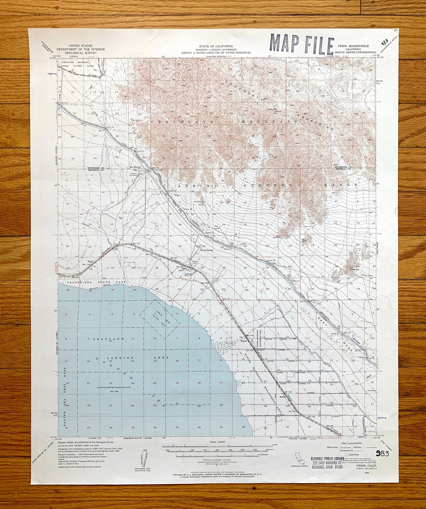
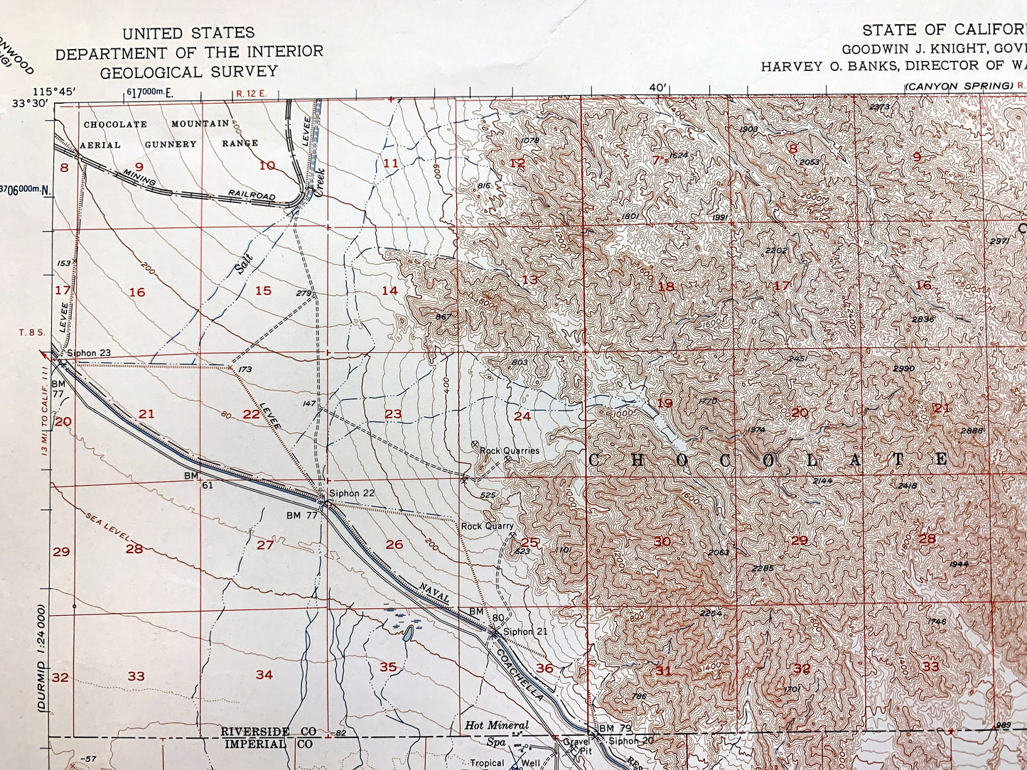
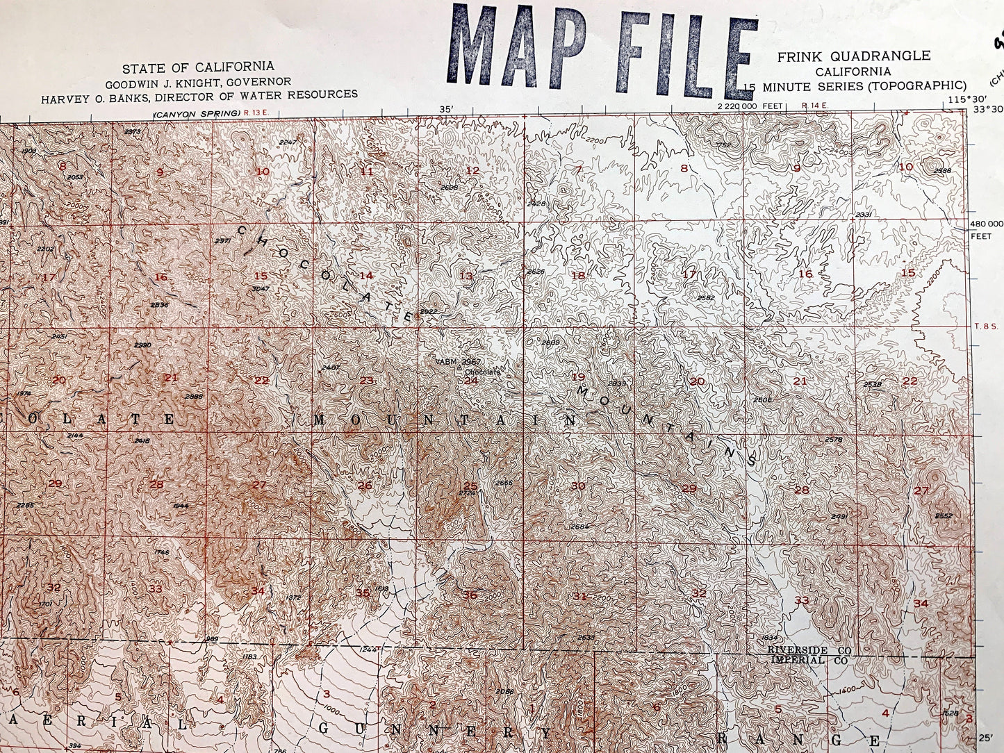
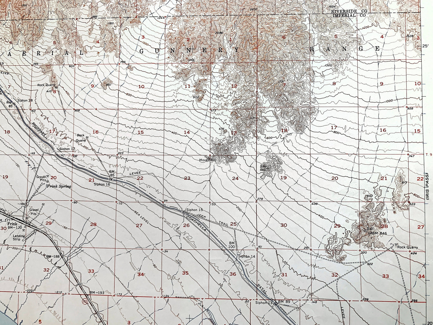
Antique Frink, California 1956 US Geological Survey Topographic Map – Salton Sea, Mundo, Pope, Imperial, Riverside County, Coachella CA
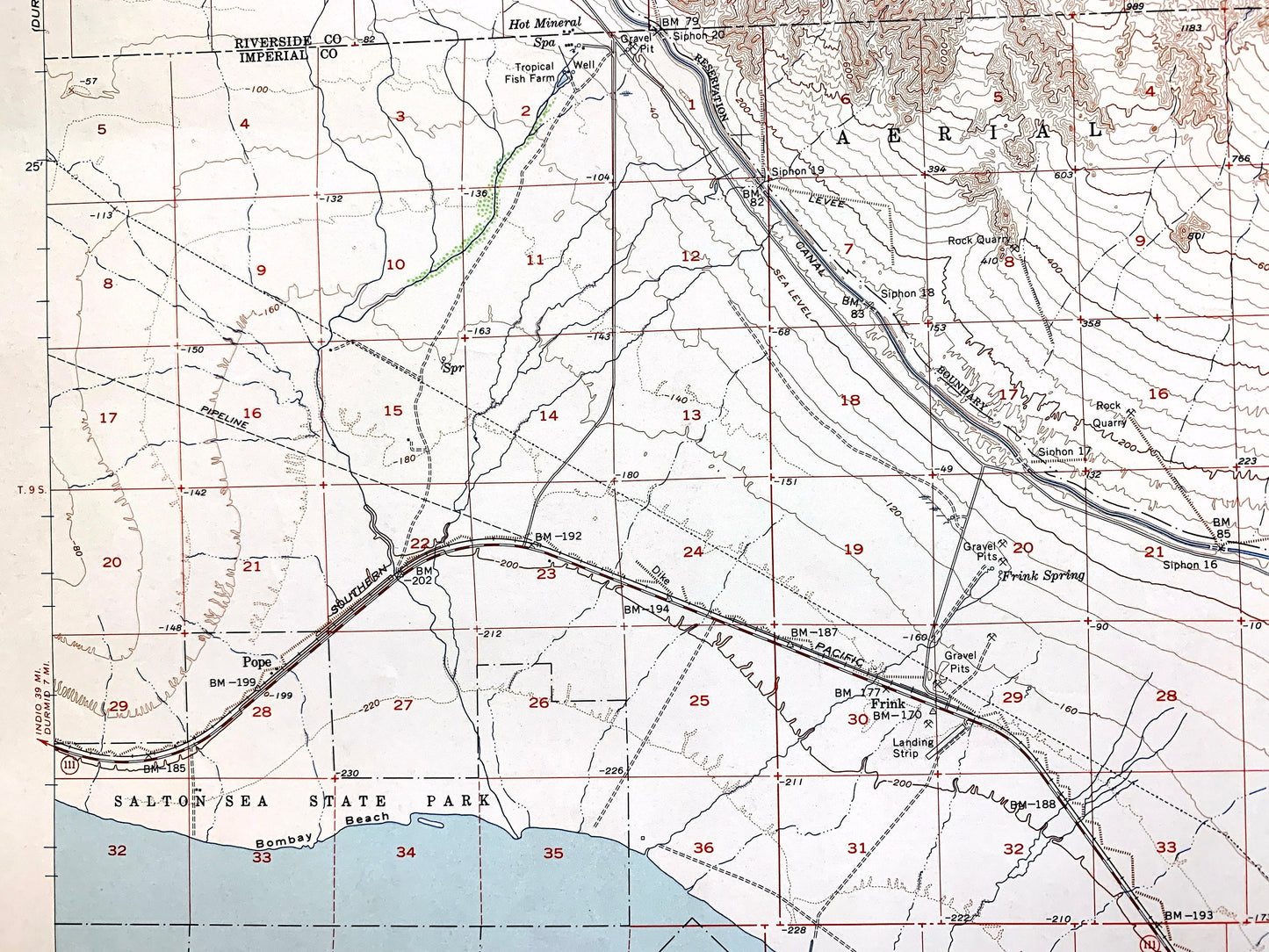
Antique Frink, California 1956 US Geological Survey Topographic Map – Salton Sea, Mundo, Pope, Imperial, Riverside County, Coachella CA
Beautiful, antique map of Frink, California and surrounding Imperial County & Riverside County area. This is an authentic 1956 edition, 1956 print from the U.S. Geological Survey and NOT a computer reproduction.
See what California looked like about 70 years ago. Lots of intricate details and geological contours. Map even has little squares for every house that existed at the time. The USGS cartographers were very thorough back then!
Perfect for the historian, map-lover, the curious or just as a conversation starter. Wonderful and rare. Vintage maps such as these make great gifts.
Edition of 1956, printed 1956
Dimensions: 17" width x 21" height
----
Features
Cities & Towns: Frink, Wister, Mundo, Pope.
Points of Interest: Imperial County, Riverside County, Salton Sea, Chocolate Mountains, Coachella Canal, Salton Sea State Park, Aerial Gunnery Range, Bombay Beach, and lots more hills, mountains, rivers, streams, ponds, lakes, houses, churches, schools and roads.
Condition: Good Vintage condition, commensurate with age. This map is in great shape for being almost 70 years old. Has some edge-wear, ex-libris stamp in margin and pen marks, but this will all add to the real vintage character when framed.
----
We will happily adjust shipping price for multiple purchases. Maps are rolled up and shipped in sturdy mailing tubes, never folded.
Couldn't load pickup availability
Share