My Store
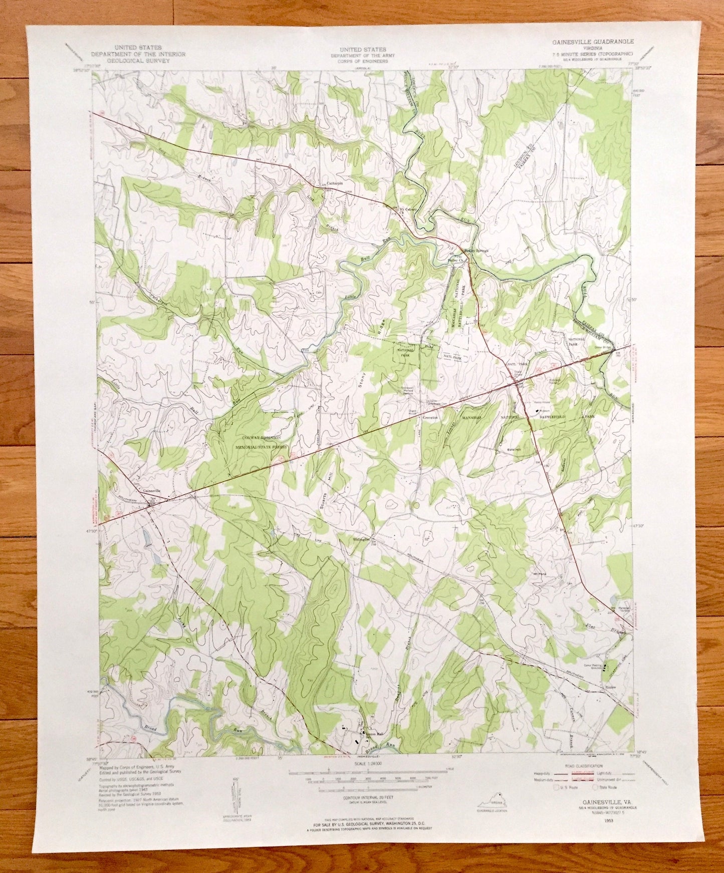
Antique Gainesville, Virginia 1953 US Geological Survey Topographic Map – Prince William County, Wellington, Rixlew, Manassas Battlefield VA
Antique Gainesville, Virginia 1953 US Geological Survey Topographic Map – Prince William County, Wellington, Rixlew, Manassas Battlefield VA
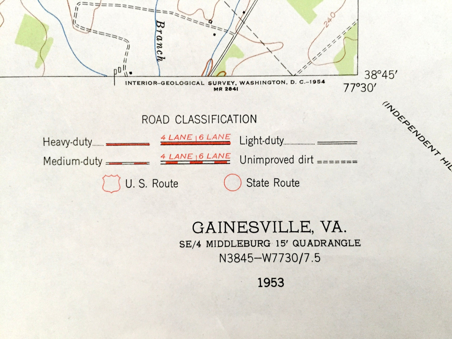
Beautiful, antique map of Gainesville, Virginia and surrounding Prince William, Fairfax, and Loudoun County area. This is an authentic 1953 edition, 1954 print from the U.S. Geological Survey and NOT a computer reproduction.
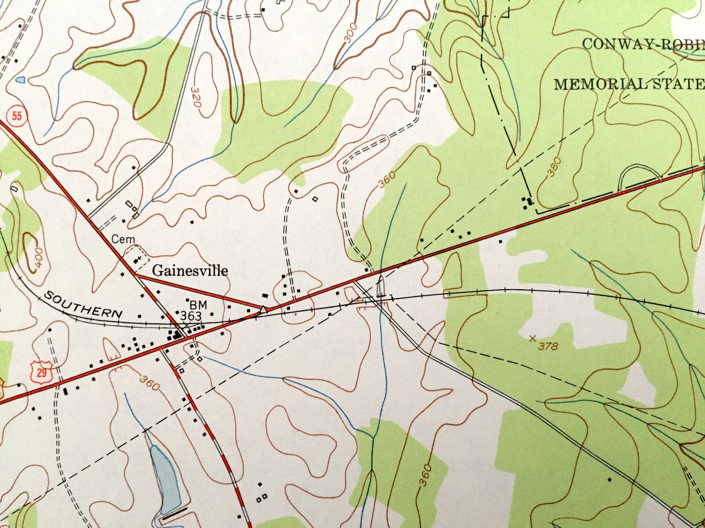
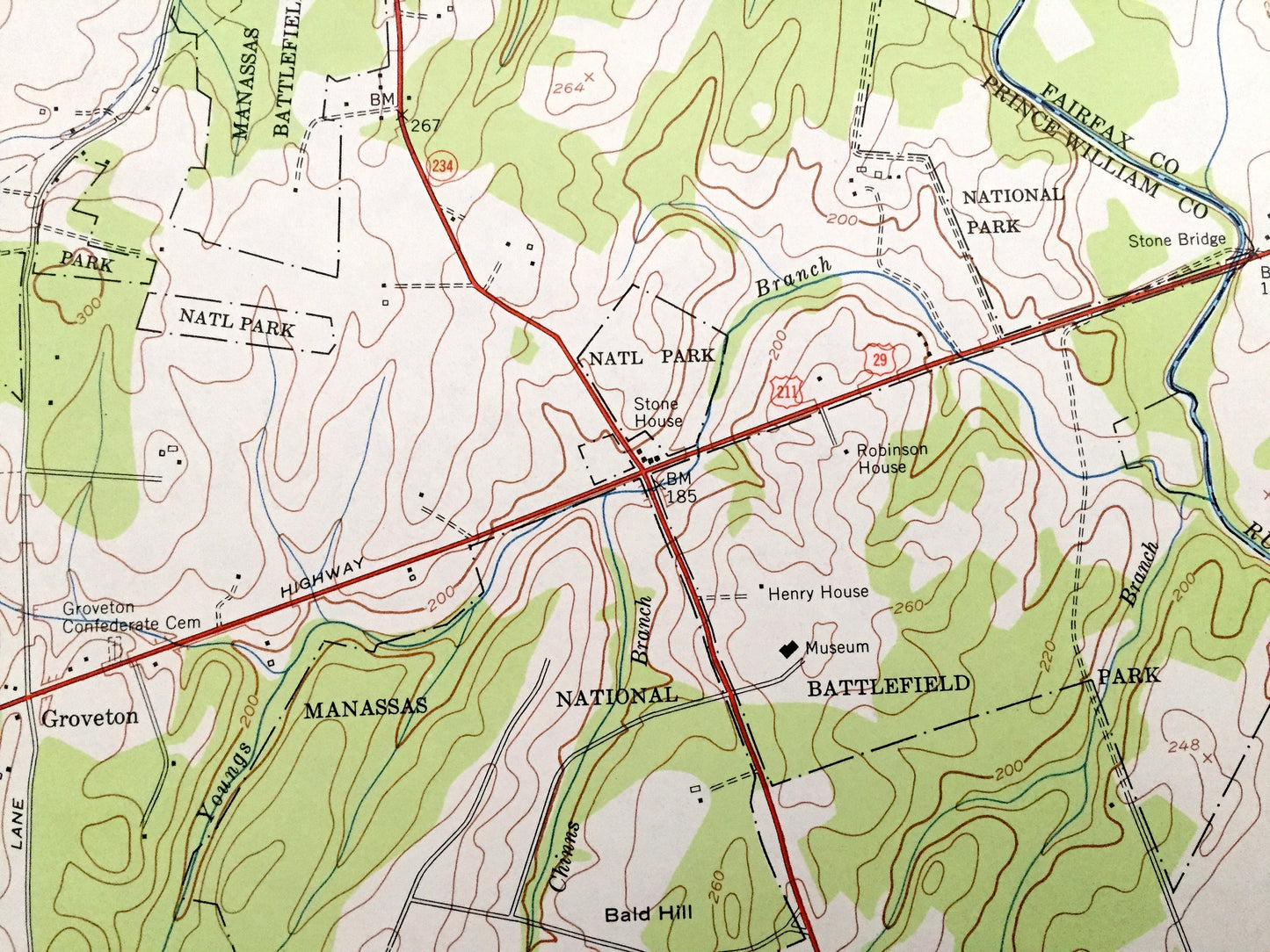
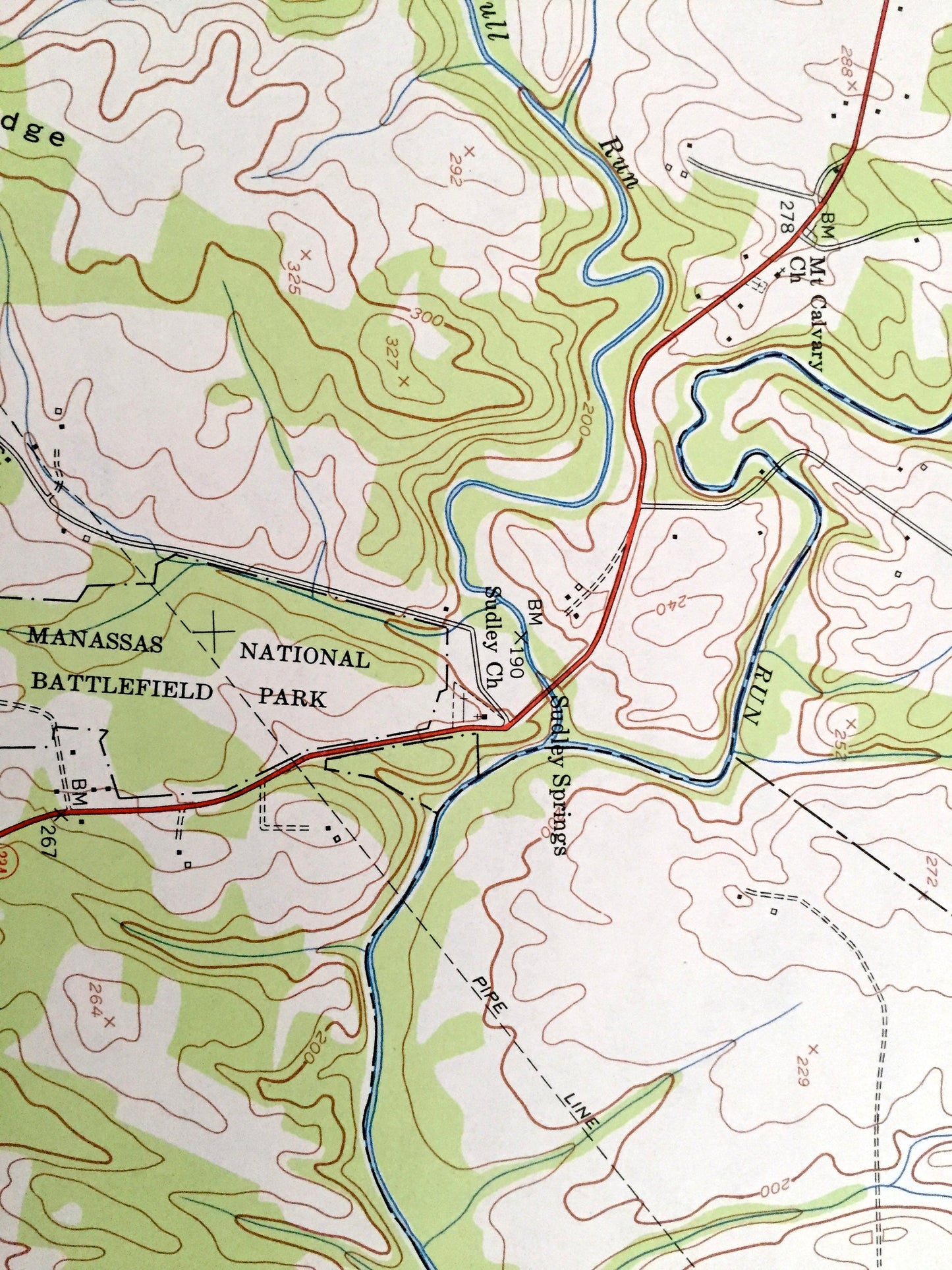
See what Virginia looked like over 65 years ago. Lots of intricate details and geological contours. Map even has little squares for every house that existed at the time. The USGS cartographers were very thorough back then!
Perfect for the historian, map-lover, the curious or just as a conversation starter. Wonderful and rare. Vintage maps such as these make great gifts.
Edition of 1953, printed 1954
Dimensions: 22" width x 27" height
----
Features
Cities & Towns: Gainesville, Wellington, Rixlew, Groveton, Sudley Springs, Catharpin.
Points of Interest: Bull Run, Manassas National Battlefield Park, Catharpin Run, Stony Ridge, Broad Run, Stuarts Hill, Bald Hill, Southern Railroad, and many more hills, streams, ponds, houses, schools, churches and roads.
Condition: Very Good Vintage condition, commensurate with age. This map is in great shape for being over 65 years old.
----
We will happily adjust shipping price for multiple purchases. Maps are rolled up and shipped in sturdy mailing tubes, never folded.
Couldn't load pickup availability
Share