My Store
Antique Galena, Illinois 1915 US Geological Survey Topographic Map – Menominee, Rawlins, Scales Mound, Rice, Hanover, Bremen, Aiken, Iowa IL
Antique Galena, Illinois 1915 US Geological Survey Topographic Map – Menominee, Rawlins, Scales Mound, Rice, Hanover, Bremen, Aiken, Iowa IL
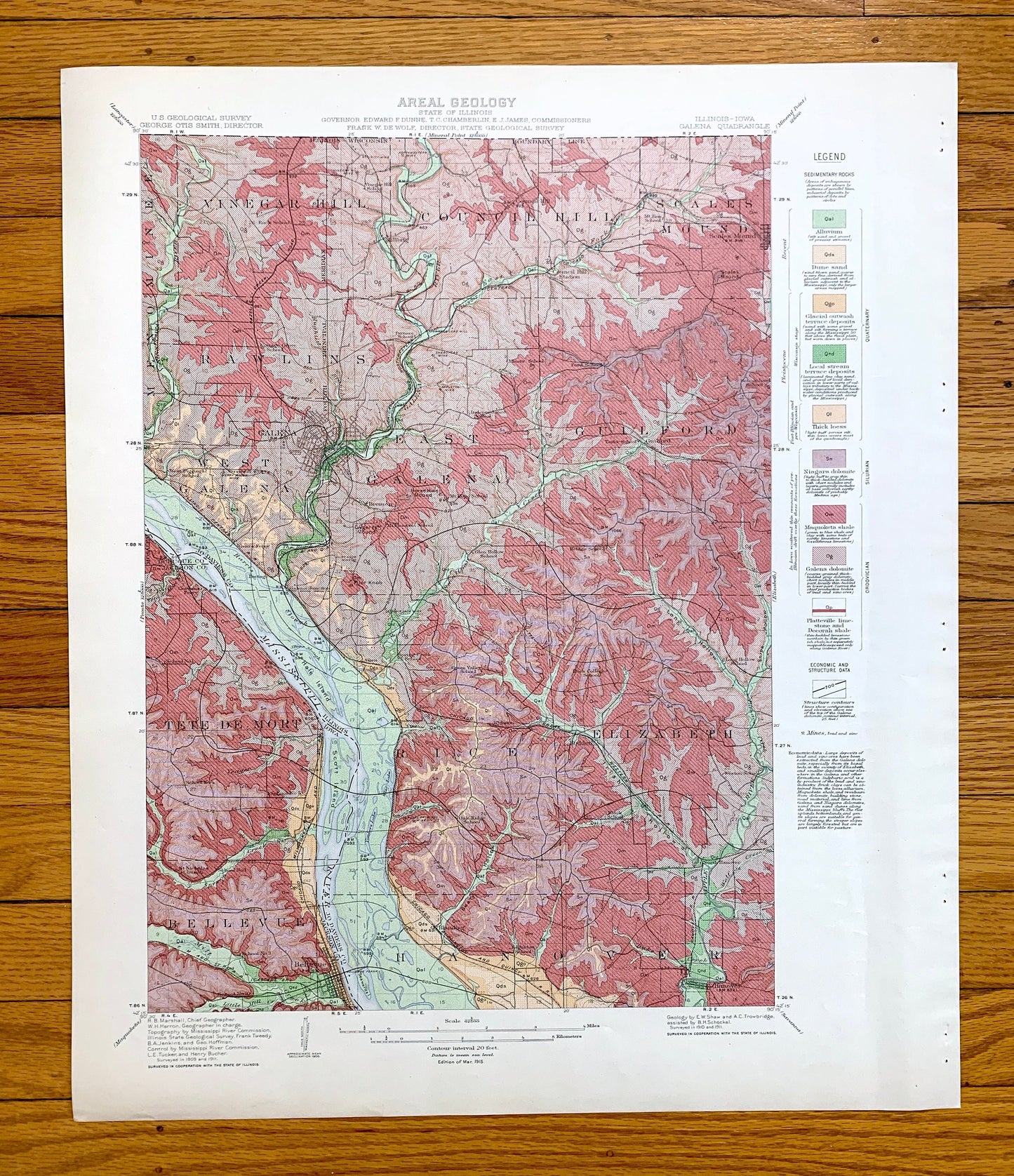
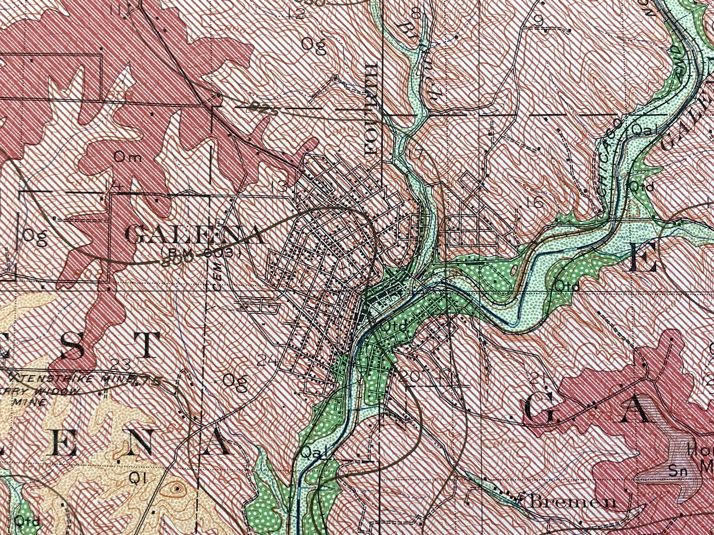
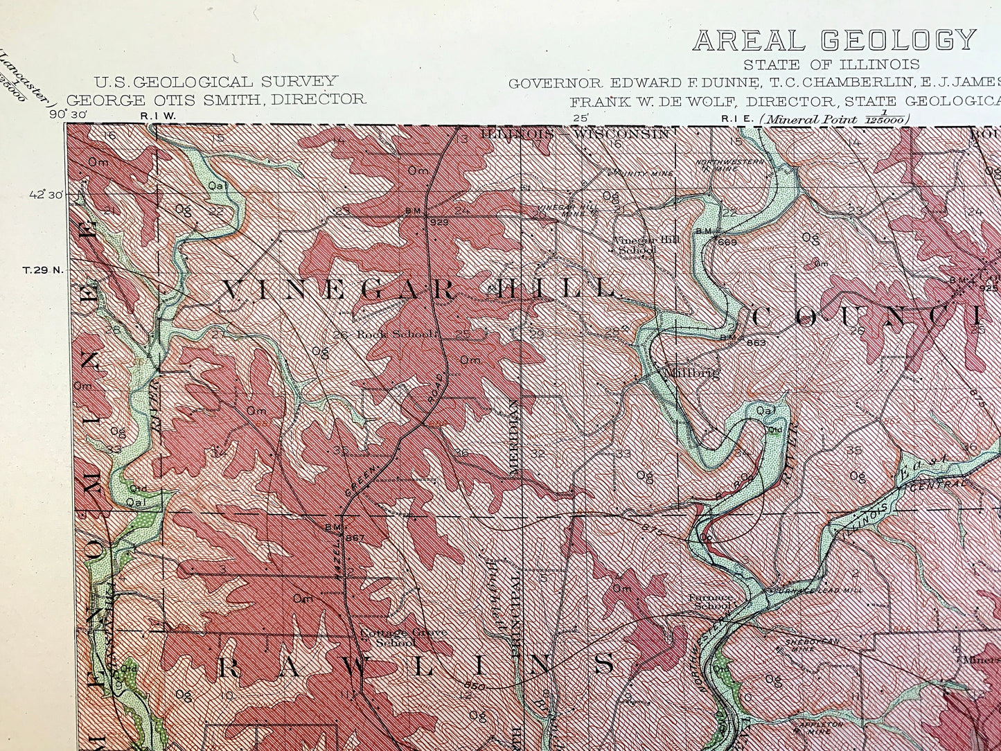
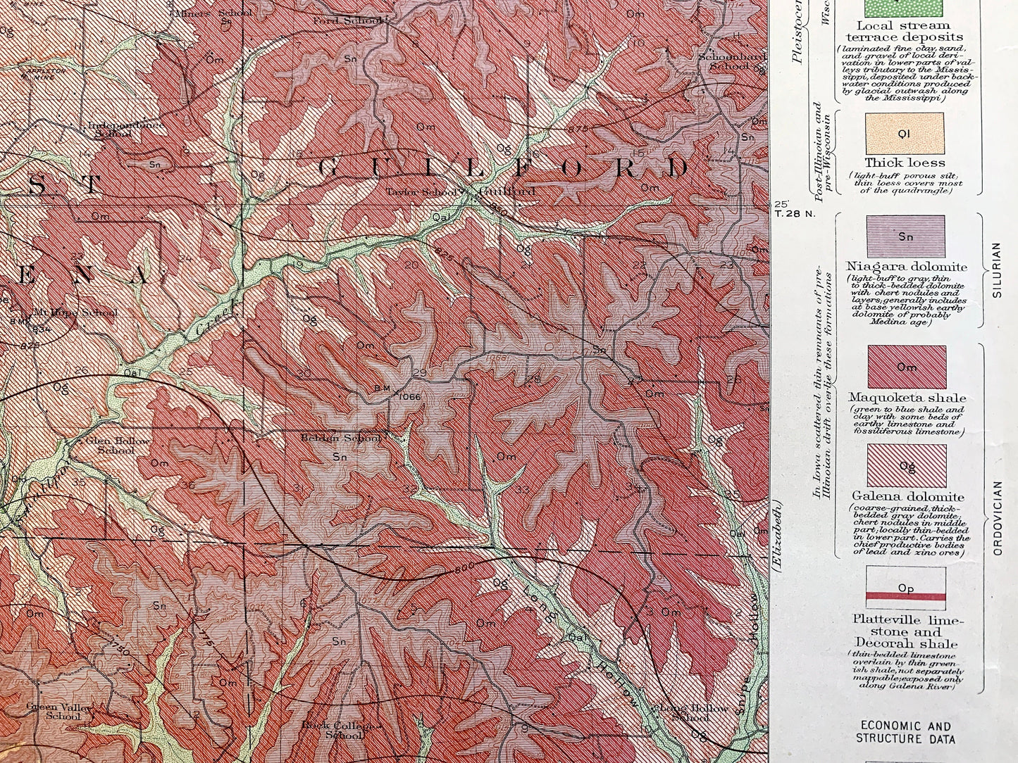
Beautiful, antique Areal Geology map of Galena, Illinois and Jackson County, Iowa area. This is an authentic 1915 edition, 1915 print from the U.S. Geological Survey and NOT a computer reproduction. It is from a Geologic Atlas folio.
See what Illinois and Iowa on the Mississippi River just southeast of Dubuque looked like more than 100 years ago. Lots of intricate details and geological contours. Map even has little squares for every house that existed at the time. The USGS cartographers were very thorough back then! This is one of the rare maps where the topographic symbols and map guide are on the front.
Perfect for the historian, map-lover, the curious or just as a conversation starter. Wonderful and rare. Vintage maps such as these make great gifts.
Edition of 1915, printed 1915
Dimensions: 18 1/2" width x 22" height
----
Features
Cities & Towns: ILLINOIS: Menominee, Vinegar Hill, Rawlins, West Galena, Galena, Council Hill, Scales Mound, East Galena, Guilford, Rice, Elizabeth, Hanover, Millbrig, Gears Ferry, Bremen, Aiken, Rodden, North Hanover.
IOWA: Tete De Mort, Bellevue, Gordons Ferry, Smiths.
Points of Interest: Jo Daviess County, Jackson County, Dubuque County, Mississippi River, Hale Island, Scott Island, Sewards Island, Sinsinawa River, Galena River, Irish Hollow, Apple River, Snipe Hollow, Yeager Creek, Dygerts Mound, Horseshoe Mound, Pilot Knob, Fourth Principal Meridian, Royal Princess Mine, Long Hollow, Smallpox Creek, Chicago & Northwestern Railroad, Illinois Central Railroad and lots more hills, brooks, mounds, towns, schools, churches, roads and train tracks.
Condition: Very Good Vintage condition, commensurate with age. This map is in great shape for being more than 100 years old. Has some edge-wear and staple holes in the margin, but this will add to the real vintage character when framed.
----
We will happily adjust shipping price for multiple purchases. Maps are rolled up and shipped in sturdy mailing tubes, never folded.
Couldn't load pickup availability
Share