My Store
Antique Geneva, New York 1902 US Geological Survey Topographic Map – Ontario, Seneca, Yates County, Varick, Fayette, Junius, Tyre Romulus NY
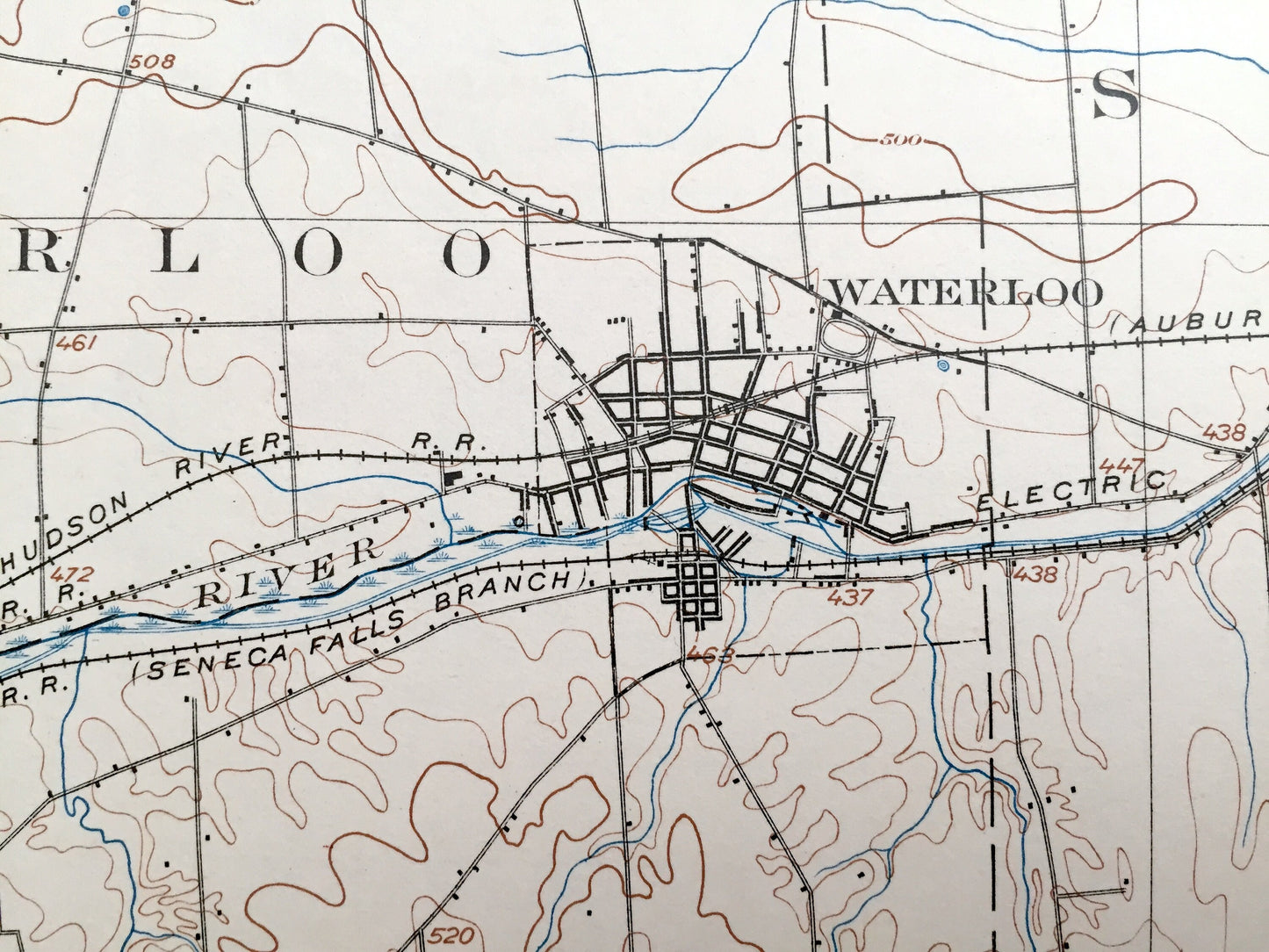
Antique Geneva, New York 1902 US Geological Survey Topographic Map – Ontario, Seneca, Yates County, Varick, Fayette, Junius, Tyre Romulus NY
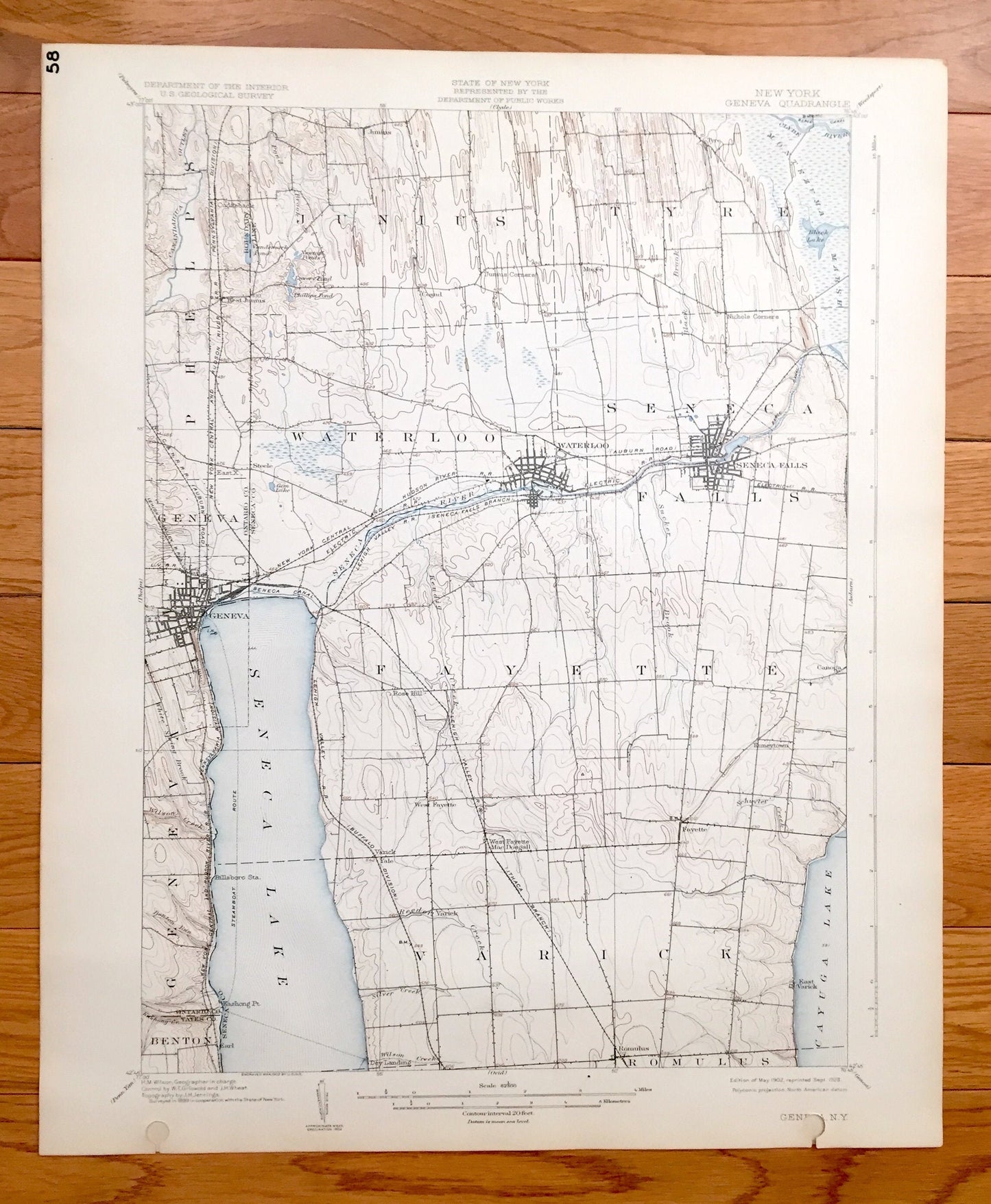
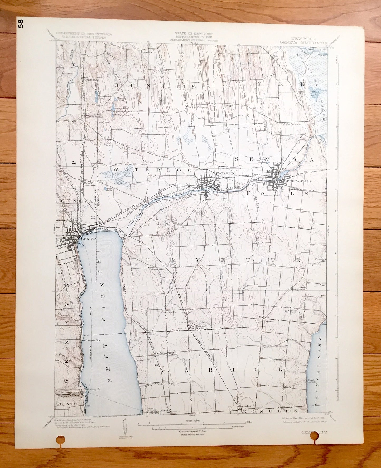
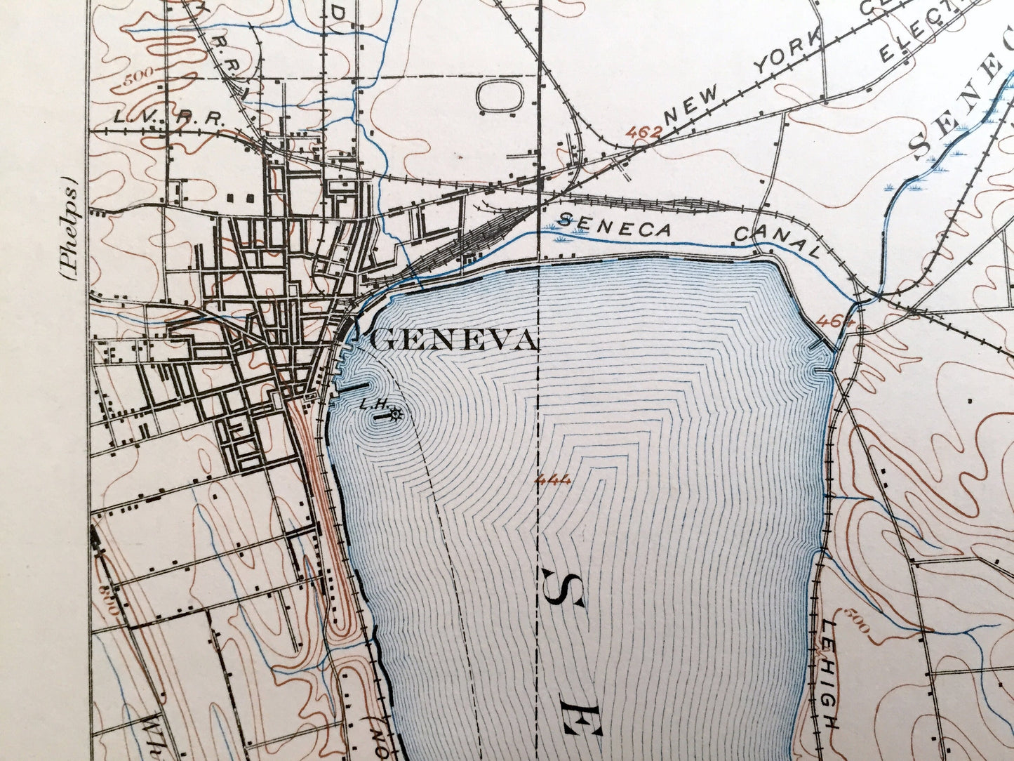
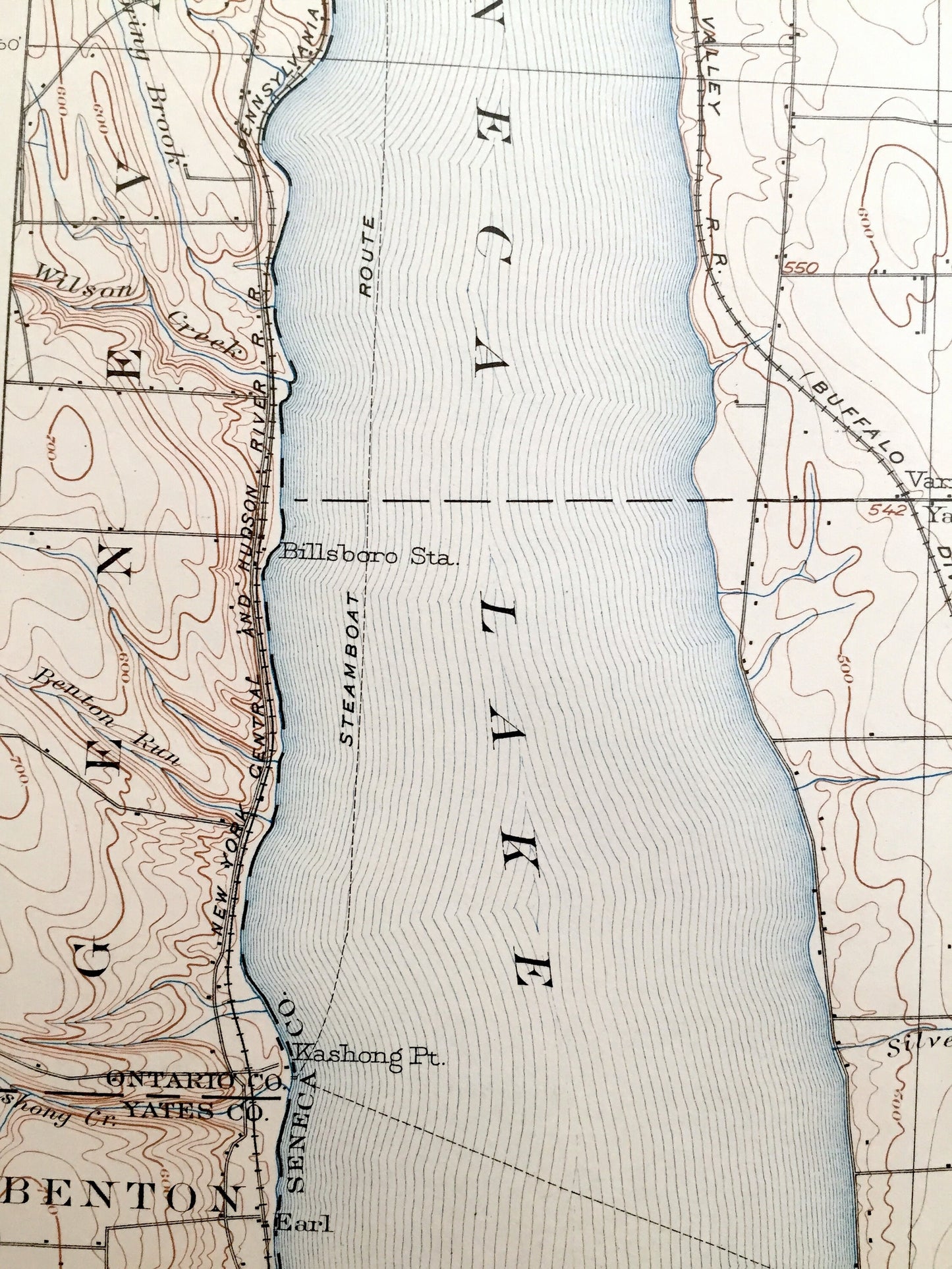
Beautiful, antique map of Geneva, New York and surrounding Ontario County, Seneca County and Yates County areas. This is an authentic 1902 edition, 1928 print from the U.S. Geological Survey and NOT a computer reproduction.
See what New York looked like over 115 years ago. Lots of intricate details and geological contours. Map even has little squares for every house that existed at the time. The USGS cartographers were very thorough back then! On the back is a description of topographic symbols and map guide.
Perfect for the historian, map-lover, the curious or just as a conversation starter. Wonderful and rare. Vintage maps such as these make great gifts.
Edition of 1902, printed 1928
Dimensions: 16 1/2" width x 20" height
----
Features
Cities & Towns: Geneva, Seneca Falls, Earl, Dey Landing, Yale, West Fayette, Kuneytown, Canoga, East Varick, Rose Hill, Steele, West Junius, Cuddeback, Cosad, Nichols Corners, Mac Dougall, Varick, Fayette, Junius, Tyre, Romulus, Benton, Phelps, Waterloo, Magee.
Points of Interest: Ontario County, Seneca County, Yates County, Seneca Lake, Cayuga Lake, Black Lake, Clyde River, Seneca River, Montezuma Marsh, Phillips Pond, Lowery Pond, Sucker Brook and more roads, railroads, houses, ponds, hills, creeks, and lakes.
Condition: Good Vintage condition, commensurate with age. This map is in incredible shape for being over 90 years old. This map has punch holes towards the bottom. This is easily concealed by placing a similar piece of paper behind it as shown in the above photos. Also has light edge-wear, but this will add to vintage character when framed.
----
We will happily adjust shipping price for multiple purchases. Maps are rolled up and shipped in sturdy mailing tubes, never folded.
Couldn't load pickup availability
Share