My Store
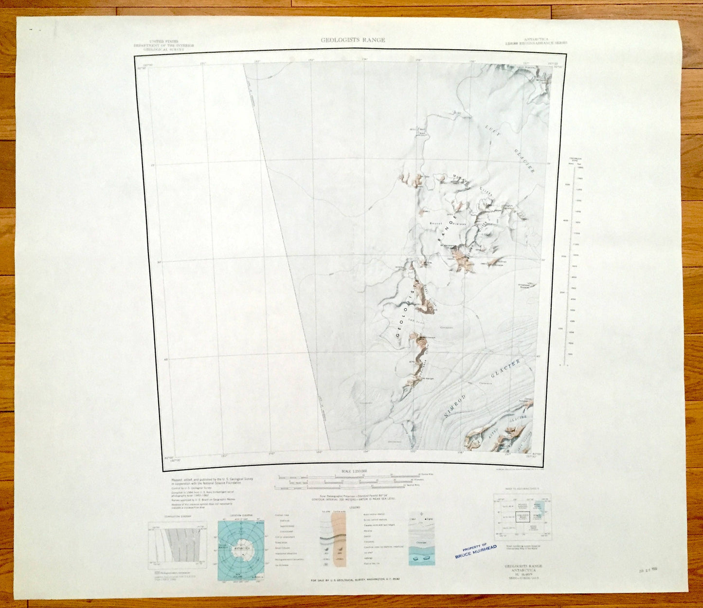
Antique Geologists Range, Antarctica 1964 US Geological Survey Topographic Map – Nimrod Glacier, McKay Cliffs, Wllman Cliffs, Endurance
Antique Geologists Range, Antarctica 1964 US Geological Survey Topographic Map – Nimrod Glacier, McKay Cliffs, Wllman Cliffs, Endurance
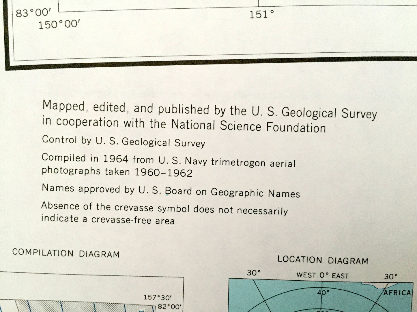
Beautiful, antique map of the Explorers Range and Nimrod Glacier of Antarctica. This is an authentic 1964 print from the U.S. Geological Survey Reconnaissance Series and not a computer reprint.
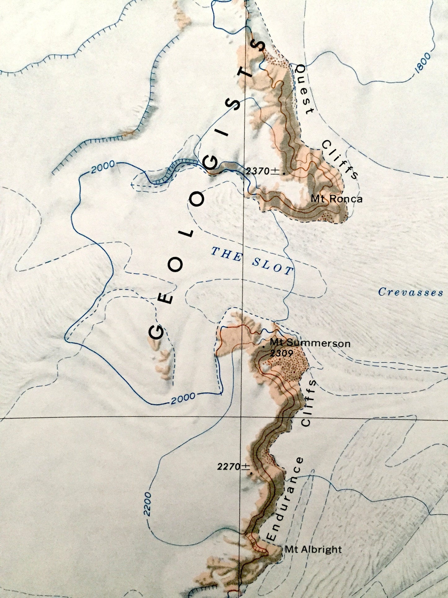
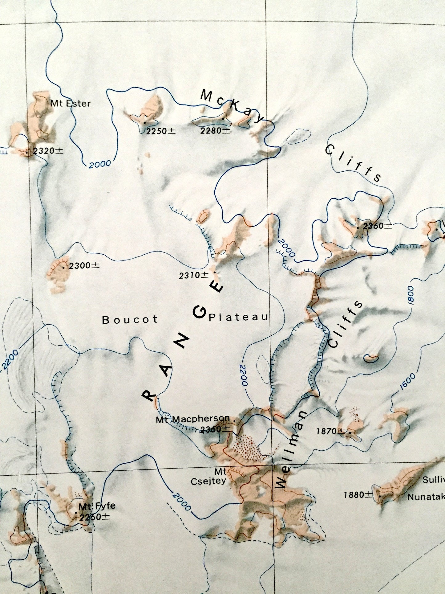
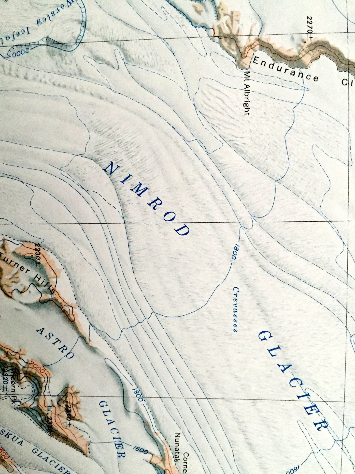
See what Antarctica looked like almost 60 years ago. Lots of intricate details and geological contours. The USGS cartographers were very thorough back then!
Perfect for the historian, map-lover, the curious or just as a conversation starter. Wonderful and rare. Vintage maps such as these make great gifts.
Edition of 1964, printed 1964
Dimensions: 30" width x 26" height
----
Features
Points of Interest: Geologists Range, Nimrod Glacier, Lucy Glacier, McKay Cliffs, Boucot Plateau, Endurance Cliffs, Astro Glacier, Skua Glacier, Wellman Cliffs, The Slot, Quest Cliffs, Mt. Fyfe, Mt. Ronca, Mt. Summerson, Mt. Albright, Vogt Peak, Arrowhead Nunatak, Mt. Ester, Davis Knoll, Mt. Macpherson, Mt. Csejtey, Mt. Hayter and many more mountains, glaciers, inlets, promontories, crevasses, névés, massifs and bays.
Condition: Good condition, commensurate with age. This map is in incredible shape for being almost 60 years old. Has light edge-wear, all of which will read as vintage character when framed.
----
We will happily adjust shipping price for multiple purchases. Maps are rolled up and shipped in sturdy mailing tubes, never folded.
Couldn't load pickup availability
Share