My Store
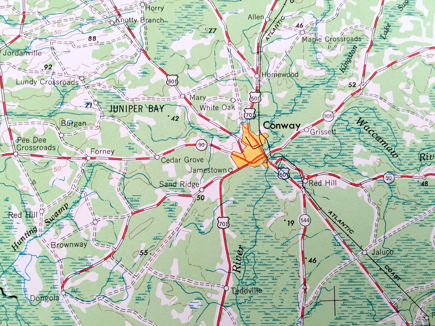
Antique Georgetown, South Carolina 1949 US Geological Survey Topographic Map – North Carolina, Andrew, Myrtle Beach, Conway, Kingstree
Antique Georgetown, South Carolina 1949 US Geological Survey Topographic Map – North Carolina, Andrew, Myrtle Beach, Conway, Kingstree
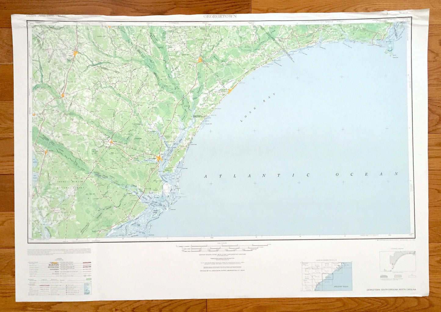
Beautiful, antique map of Georgetown, South Carolina, North Carolina and surrounding areas. This is an authentic 1949 edition, 1967 print from the U.S. Geological Survey and NOT a computer reproduction.
See what South Carolina and North Carolina looked like over 70 years ago. Lots of intricate details and geological contours. Map is incredibly large and in the grand 1:250,000 scale. The USGS cartographers were very thorough back then!
Perfect for the historian, map-lover, the curious or just as a conversation starter. Wonderful and rare. Vintage maps such as these make great gifts.
Edition of 1949, printed 1967
Dimensions: 32" width x 22 1/2" height
----
Features
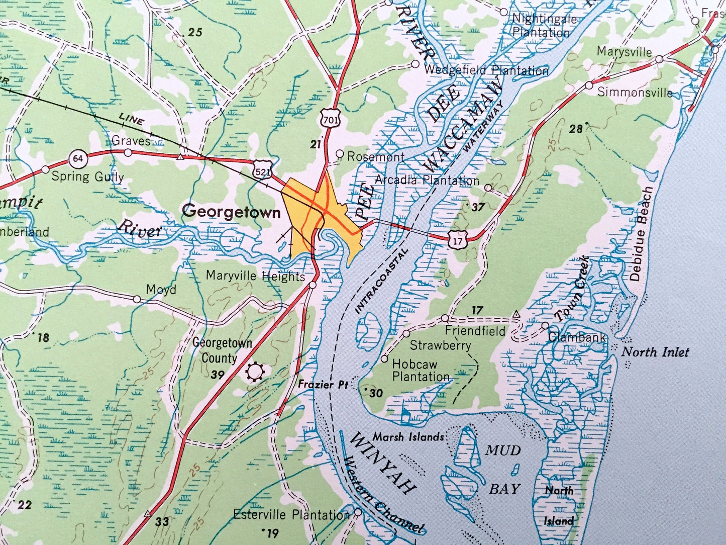
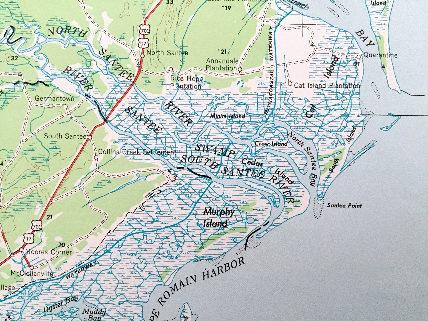
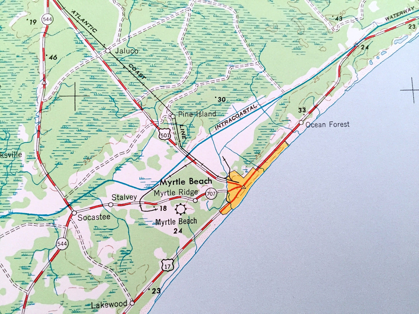
Cities & Towns: South Carolina - Gerogetown, St. Stephens, Lake City, Brown Field, Plamplico, Baker Crossroads, Crescent Beach, Grove Beach, Floral Beach, Garden City, Ocean Drive, Oak Ridge, Andrew, Myrtle Beach, Conway, Kingstree.
North Carolina - Thomasboro, Grissettown, Cool Run, Russtown, Fulford, Shell Point, Oak Grove, Gores Landing, Long Beach, Southport, Midwav, Cape Fear.
Points of Interest: South Carolina - Atlantic Ocean, Long Bay, Cape Roman Harbor, Oyster Bay, Murphy Island, Cat Island, Winyah Bay, Murrells Inlet, Santee Swamp, Wambam Swamp, North Santee River, Santee River, Francis Marion National Forest and lots more hills, mountains, lakes, islands, bays, highways, railroads.
North Carolina - Atlantic Ocean, Cape Fear River, Smith Island, Onslow Bay, Shallotte Inlet, Tubbs Inlet, Lockwoods Folly River and lots more hills, mountains, lakes, islands, bays, highways, railroads.
Condition: Very Good condition, commensurate with age. This map is in incredible shape for being over 50 years old. Has light edge-wear and tears, all of which will read as vintage character when framed.
----
We will happily adjust shipping price for multiple purchases. Maps are rolled up and shipped in sturdy mailing tubes, never folded.
Couldn't load pickup availability
Share