My Store
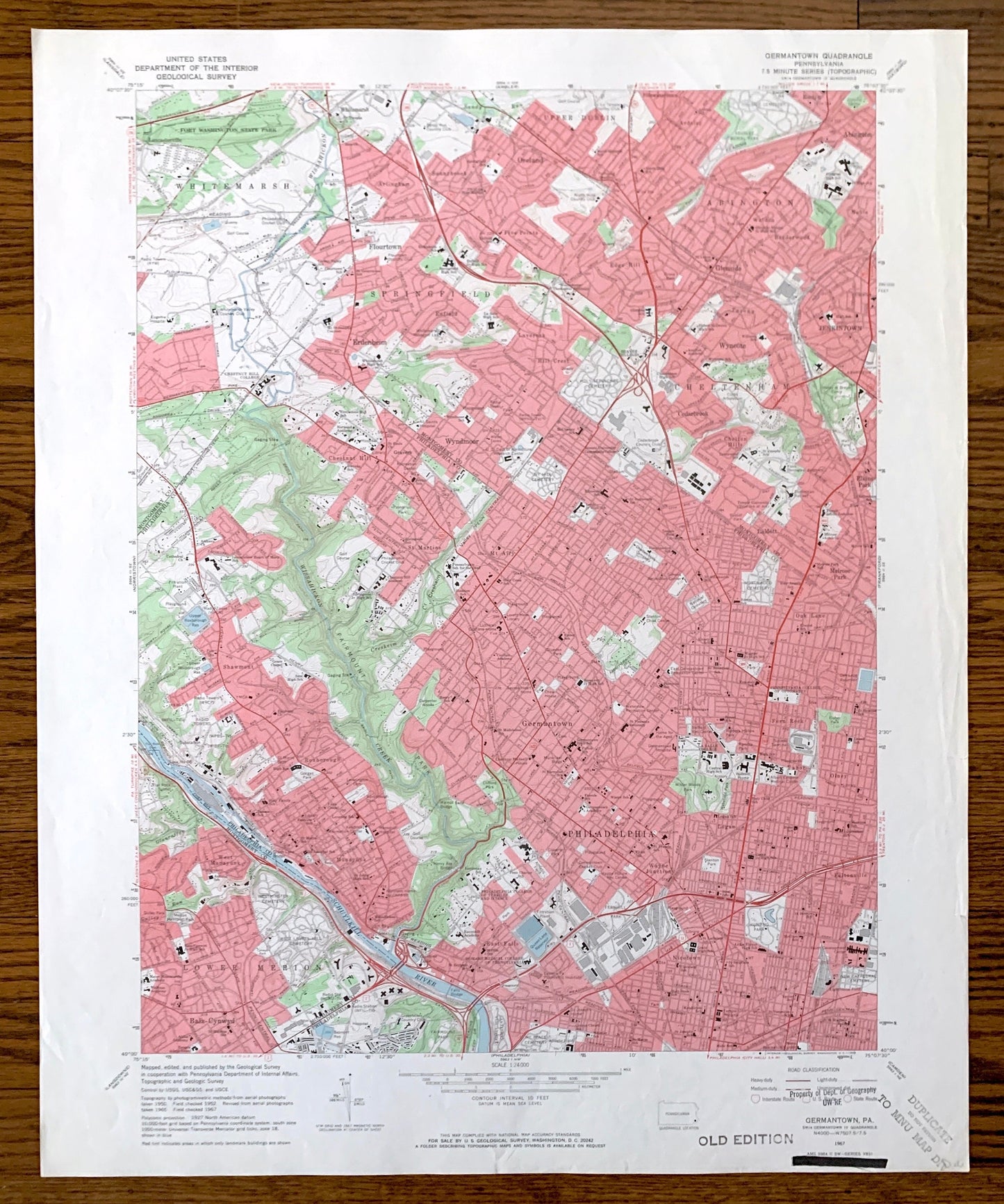
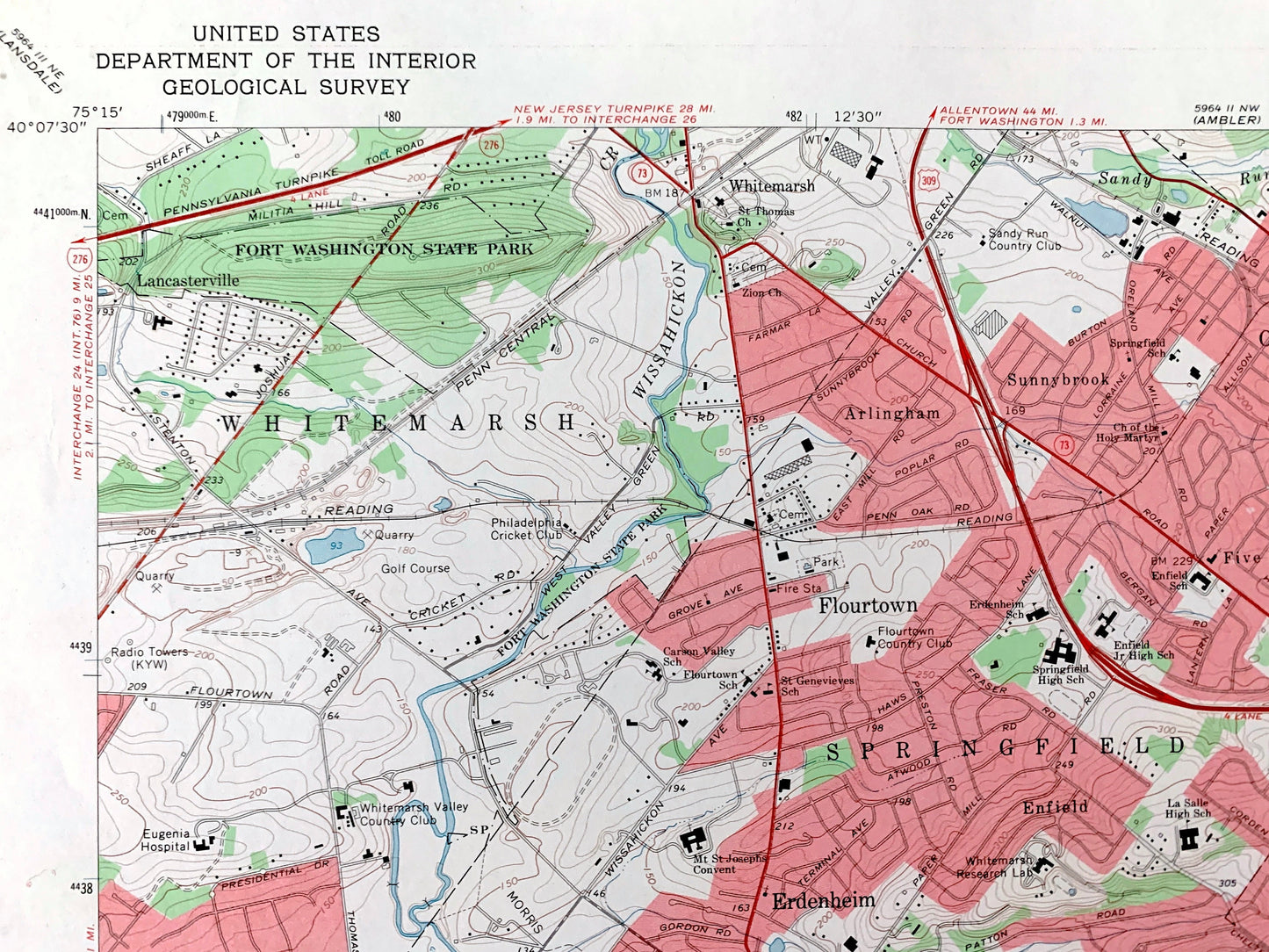
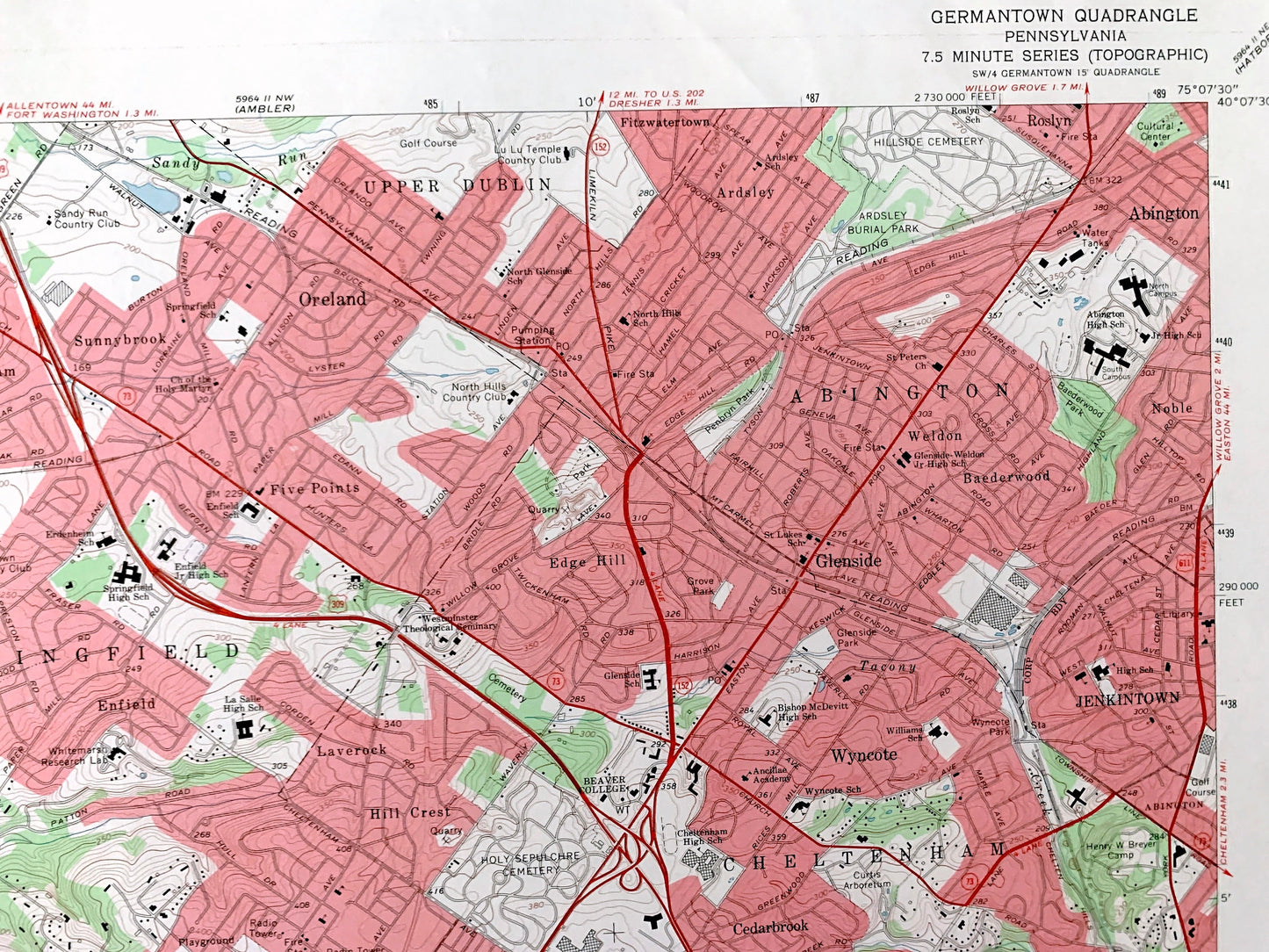
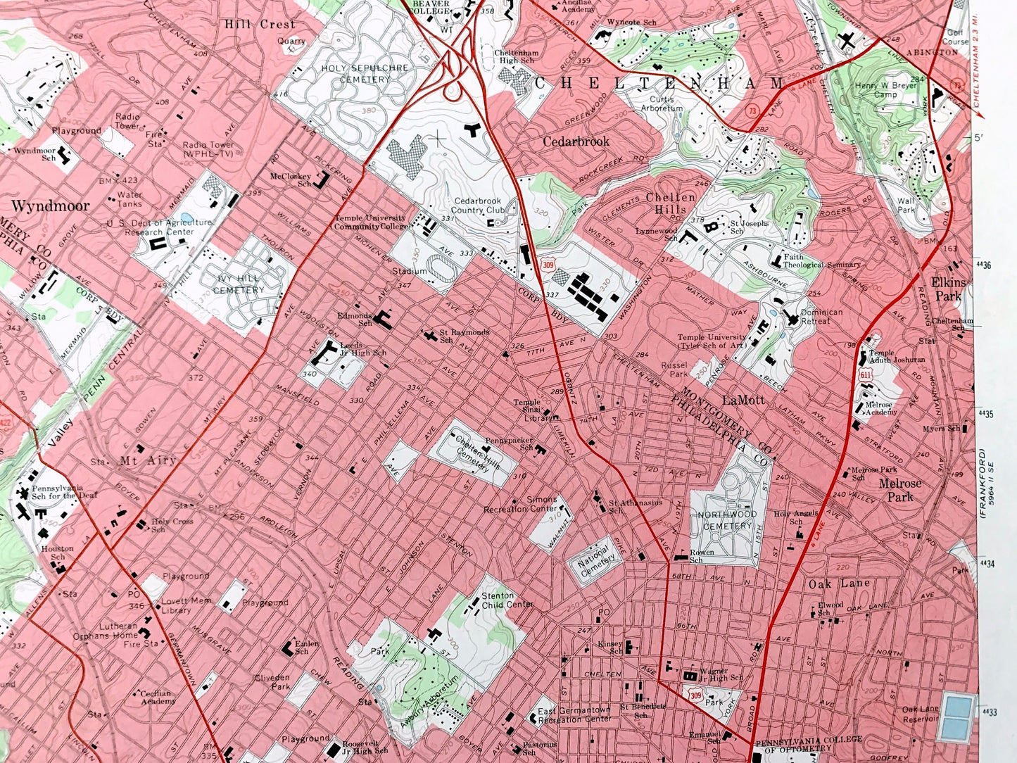
Antique Germantown, Pennsylvania 1967 US Geological Survey Topographic Map – Philadelphia, Montgomery County, Whitemarsh, Springfield, PA
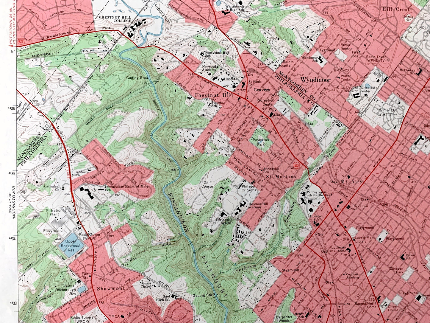
Antique Germantown, Pennsylvania 1967 US Geological Survey Topographic Map – Philadelphia, Montgomery County, Whitemarsh, Springfield, PA
Beautiful, antique map of Germantown, Pennsylvania and surrounding Philadelphia County and Montgomery County areas. This is an authentic 1967 edition, 1969 print from the U.S. Geological Survey and NOT a computer reproduction.
See what Pennsylvania looked like over 55 years ago. Lots of intricate details and geological contours. Map even has little squares for every house that existed at the time. The USGS cartographers were very thorough back then!
Perfect for the historian, map-lover, the curious or just as a conversation starter. Wonderful and rare. Vintage maps such as these make great gifts.
Edition of 1967, printed 1969
Dimensions: 22" width x 27" height
----
Features
Cities & Towns: Lancasterville, Upper Dublin, Cheltenham, Wyndmoor, Gravers, Philadelphia, Lower Merion, Erdenheim, Flourtown, Jenkintown, Chestnut Hill, La Mott, Melrose Park, Mt. Airy, St Martins, Shawmont, Roxborough, Manayunk, West Manyunk, Bala-Cynwyd, Nicetown, East Falls, Wayne Junction, Feltonville, Olney, Logan, Fern Rock, Oak Lane, Elkins Park, Cedarbrook, Hill Crest, Chelton Hills, Laverock, Enfield, Edge Hill, Wyncote, Baederwood, Noble, Five Points, Sunnybrook, Oreland, Ardsley, Fitzwatertown, Roslyn, Weldon.
Points of Interest: Fort Washington State Park, Chestnut Hill College, Beaver College, La Salle College, Temple University Tyler School of Art, Philadelphia College of Textiles and Science, Women’s Medical College of Pennsylvania, US Department of Agriculture Eastern Regional Research Laboratory, Independence National Historical Park Deshler-Morris House, Philadelphia Cricket Club, Awbury Arboretum, Wister Woods Park, Fairmount Park, Schuylkill River, Wissahickon Creek, and many more hills, streams, ponds, houses, schools, railroads, churches and roads.
Condition: Very Good Vintage condition, commensurate with age. This map is in good shape for being over 50 years old. Has light edge-wear and stamps on the bottom right margin but will read as character when framed.
----
We will happily adjust shipping price for multiple purchases. Maps are rolled up and shipped in sturdy mailing tubes, never folded.
Couldn't load pickup availability
Share