My Store
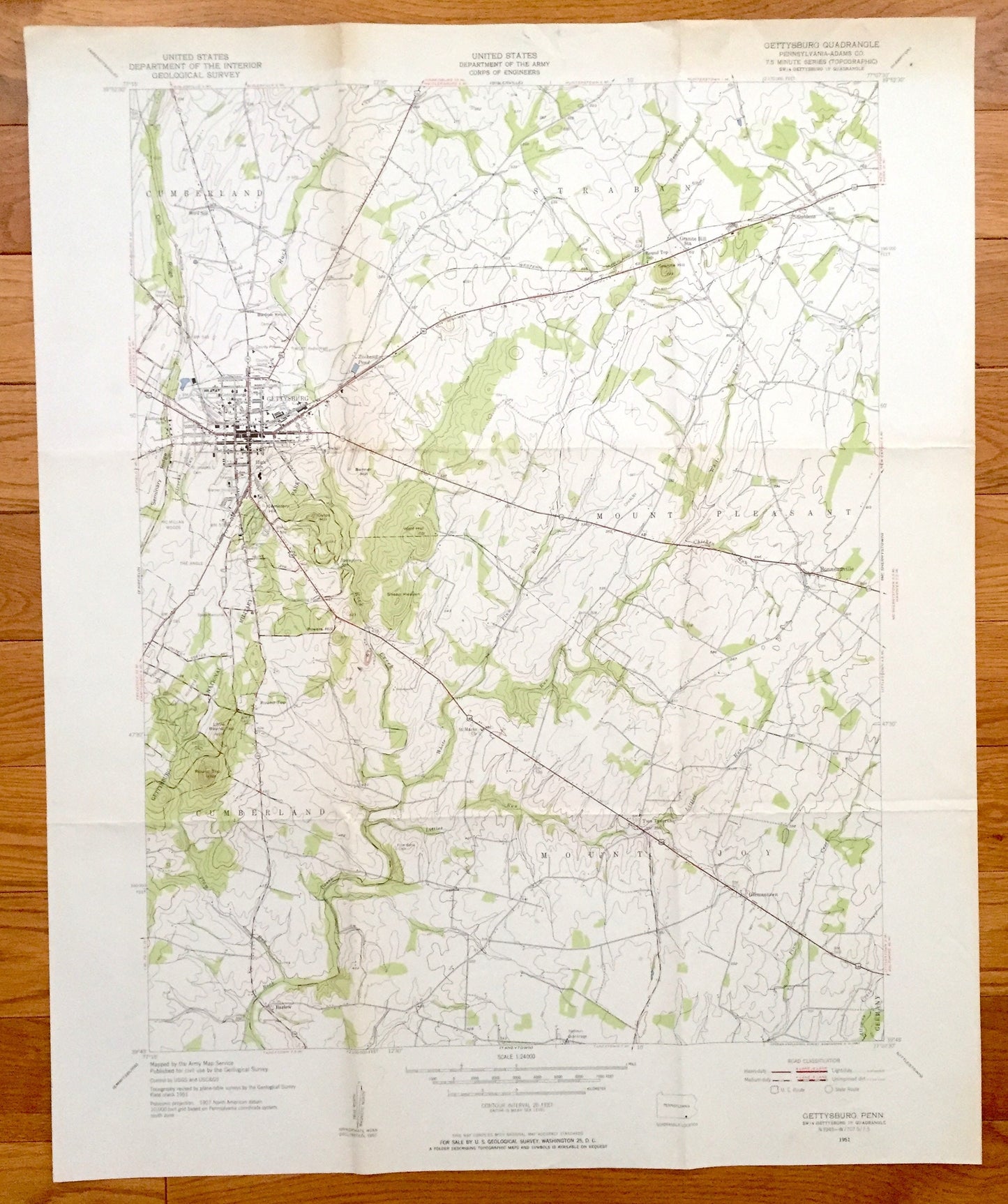
Antique Gettysburg, Pennsylvania 1951 US Geological Survey Topographic Map – Cumberland, Mount Joy, Straban, Mount Pleasant, Civil War, PA
Antique Gettysburg, Pennsylvania 1951 US Geological Survey Topographic Map – Cumberland, Mount Joy, Straban, Mount Pleasant, Civil War, PA
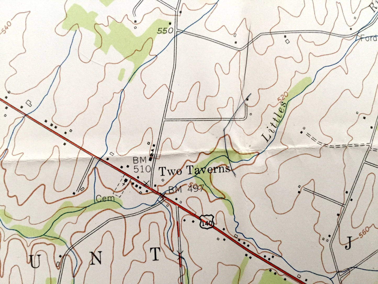
Beautiful, antique map of Gettysburg, Pennsylvania area. This is an authentic 1951 print from the U.S. Geological Survey and NOT a computer reproduction.
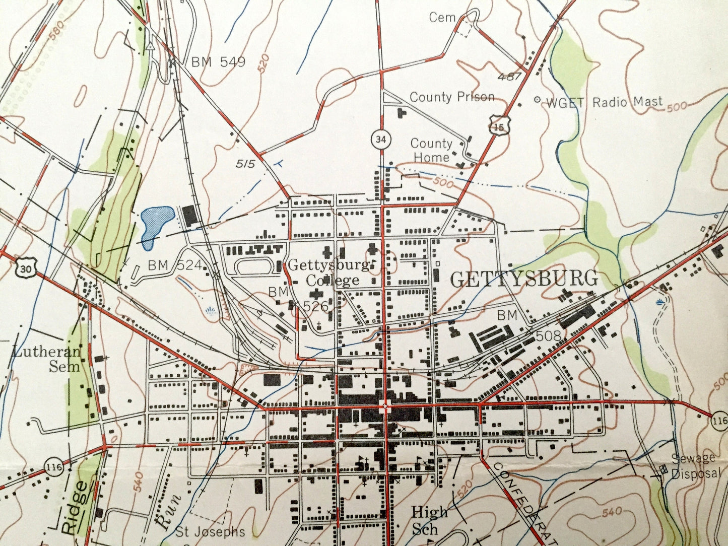
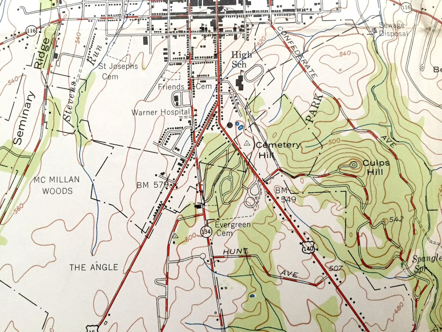
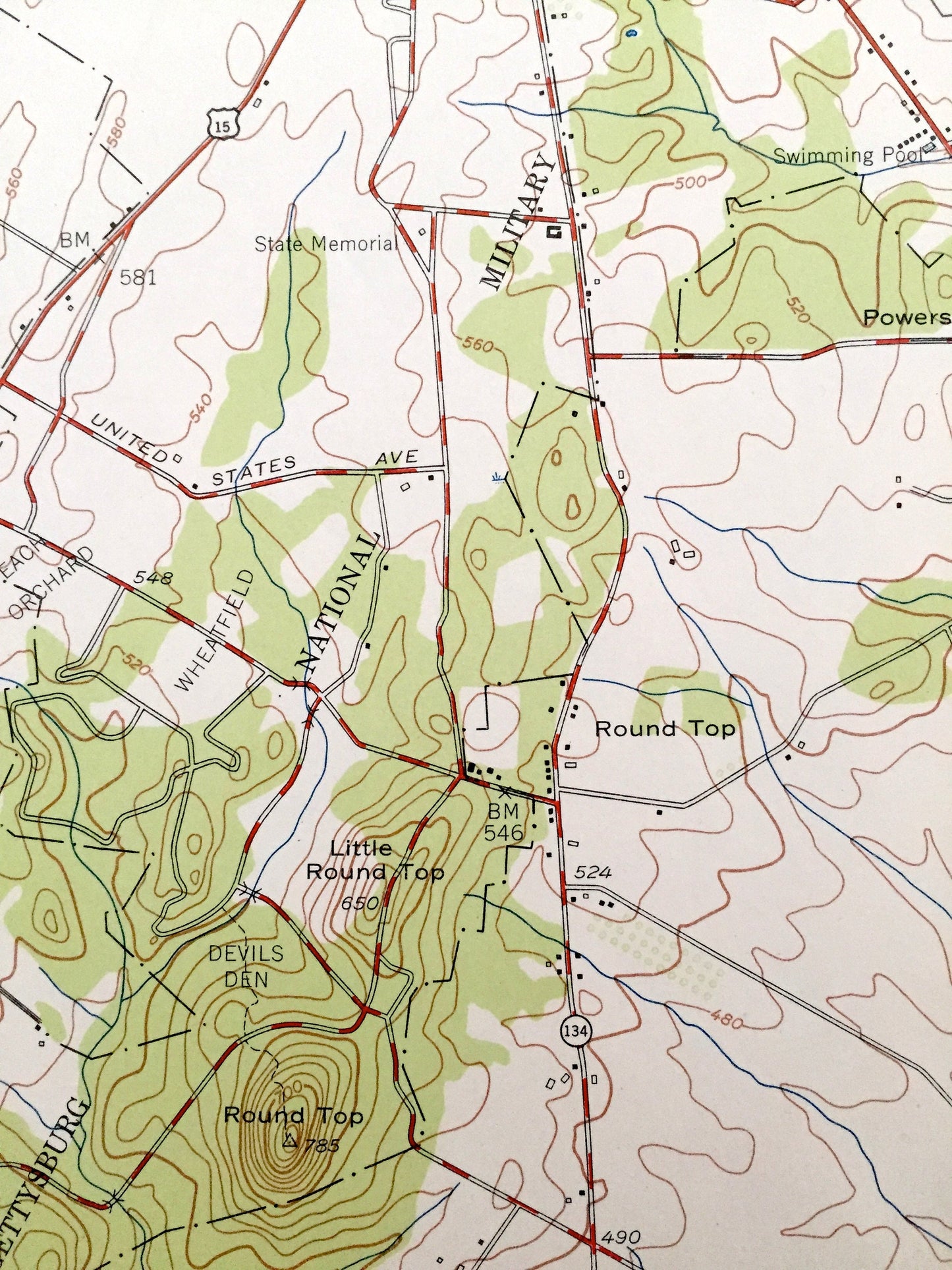
See what historic Gettysburg looked like over 70 years ago. Lots of intricate details and geological contours. Map even has little squares for every house that existed at the time. The USGS cartographers were very thorough back then!
Perfect for the historian, map-lover, the curious or just as a conversation starter. Wonderful and rare. Vintage maps such as this make great gifts.
Edition of 1951, printed 1951
Dimensions: 22" width x 27" height
----
Cities & Towns: Gettsyburg, Cumberland, Mount Joy, Straban, Germany, Mount Pleasant, Bonneauville, and many more small towns.
Points of Interest: Gettysburg Battlefield, Round Top, Culps Hill, Sheep Heaven, Wolf Hill, Oak Ridge, Devils Den, and many more small towns, roads, train tracks, mountains, hills and creeks.
Condition: Good Vintage condition, commensurate with age. There are fold marks that should not be noticeable after framing. This map is in great shape for being over 70 years old. Some edge wear and fold lines, all of which will read as character when framed.
----
We will happily adjust shipping price for multiple purchases. Maps are rolled up and shipped in sturdy mailing tubes, never folded.
Couldn't load pickup availability
Share