My Store
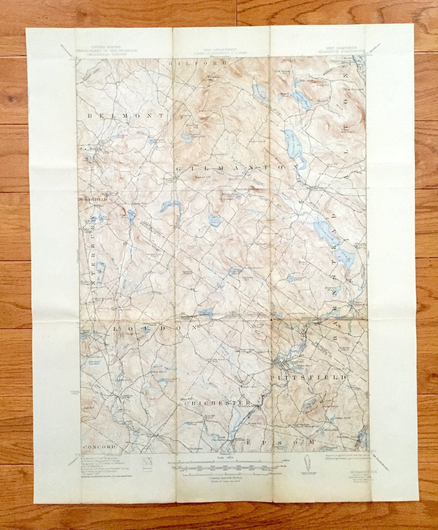
Antique Gilmanton, New Hampshire 1927 US Geological Survey Topographic Map – Loudon, Alton, Pittsfield, Belmont, Canterbury, Barnstead, NH
Antique Gilmanton, New Hampshire 1927 US Geological Survey Topographic Map – Loudon, Alton, Pittsfield, Belmont, Canterbury, Barnstead, NH
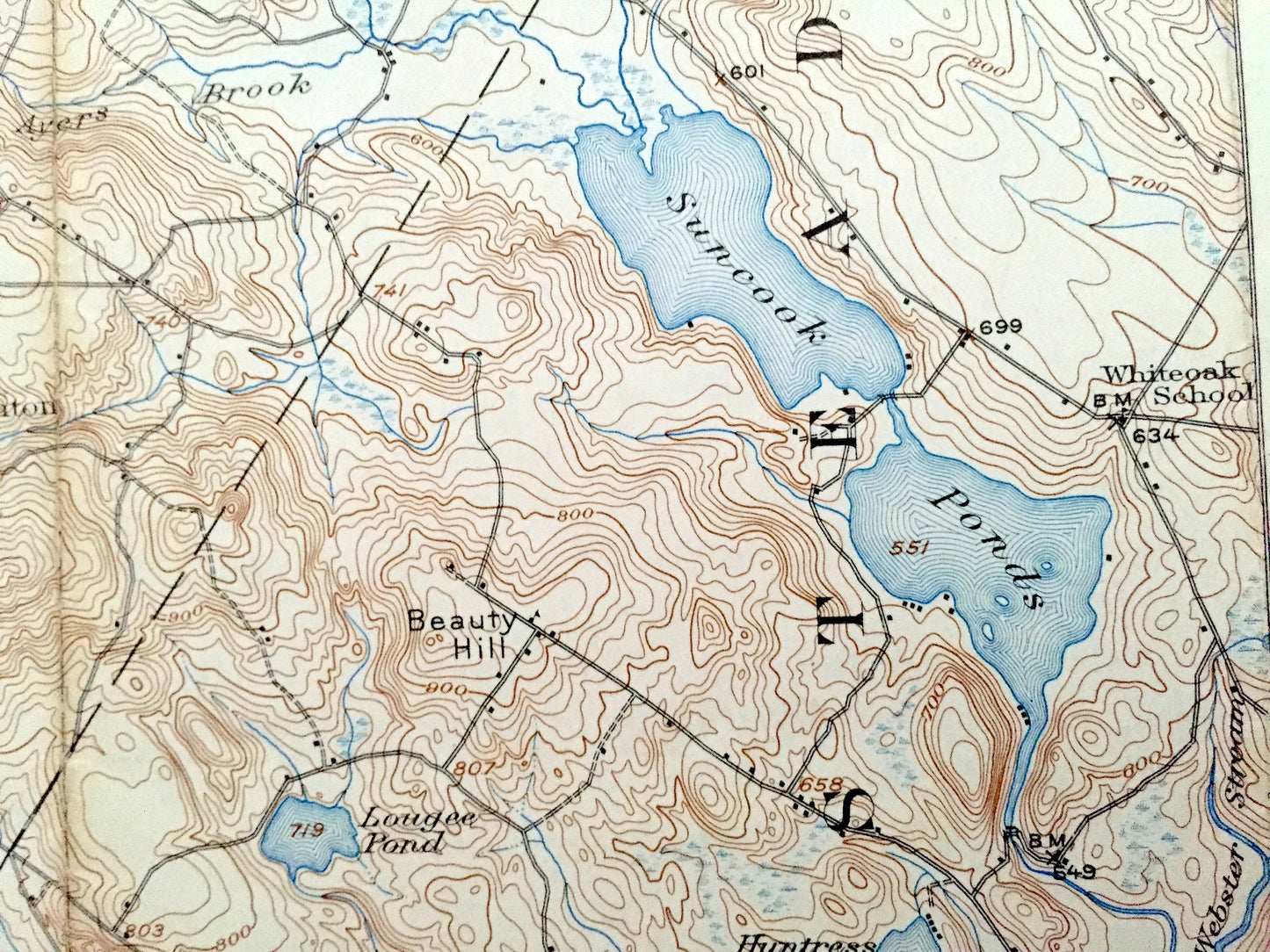
Beautiful, antique map of Belknap County & Merrimack County, New Hampshire, including Loudon, home of the New Hampshire Motor Speedway. This is an authentic 1927 edition, 1944 print from the U.S. Geological Survey and NOT a computer reproduction.
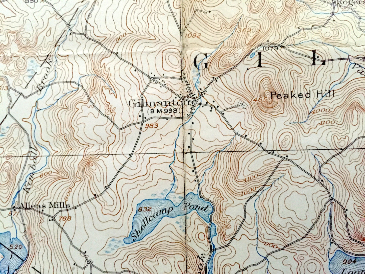
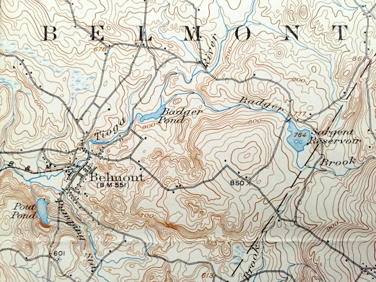
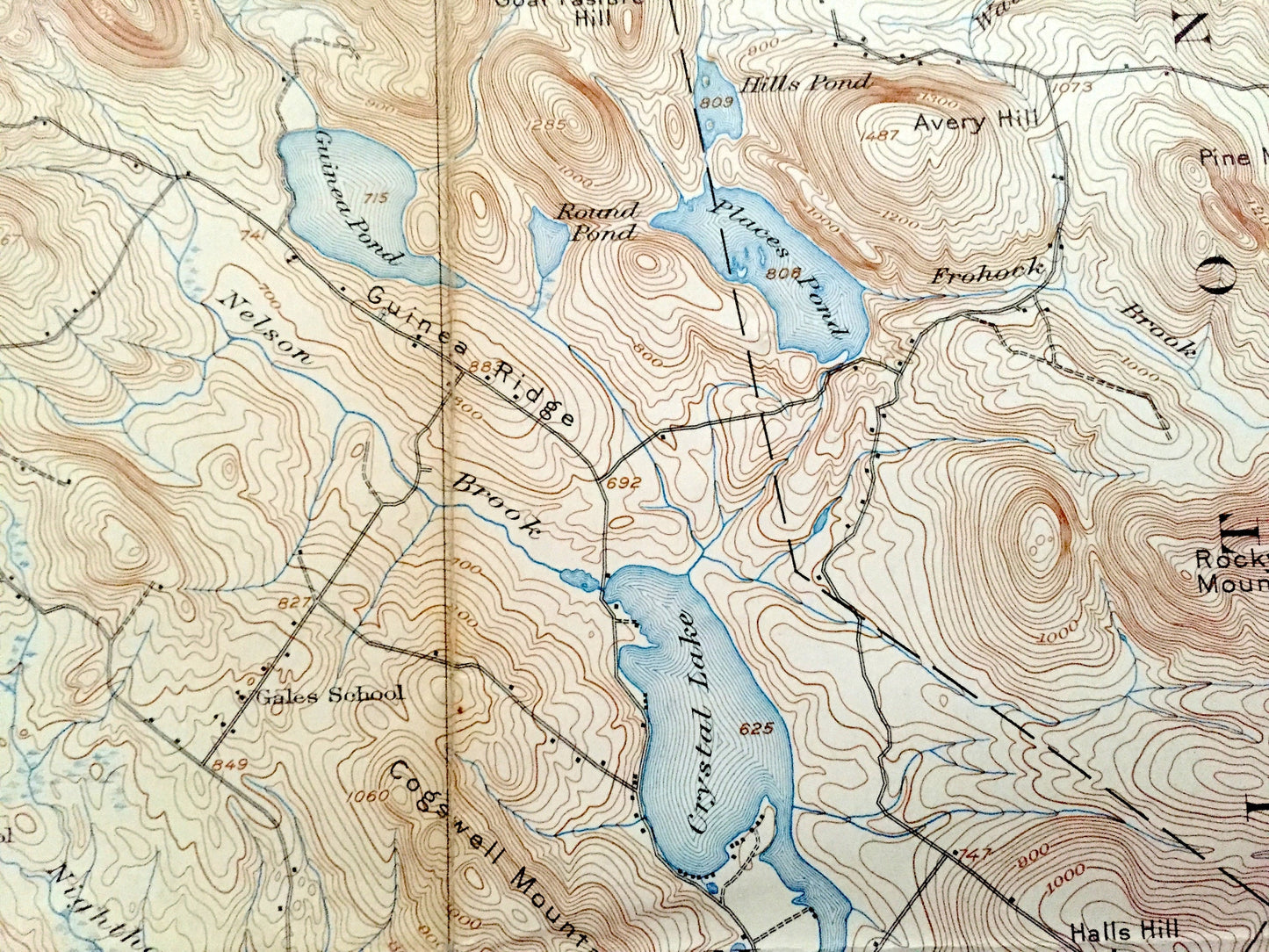
See what New Hampshire, just south of the Belknap Mountains looked like almost 100 years ago. Lots of intricate details and geological contours. Map even has little squares for every house that existed at the time. The USGS cartographers were very thorough back then!
Perfect for the historian, map-lover, the curious or just as a conversation starter. Wonderful and rare. Vintage maps such as these make great gifts.
Edition of 1927, printed 1944
Dimensions: 17" width x 21" height
----
Features
Cities & Towns: Belmont, Gilford, Gilmanton, Alton, Northfield, Barnstead, Canterbury, Loudon, Pittsfield, Concord, Chichester, Epsom, Northwood, Gilmanton Ironworks, Hills Corner, Shaker Village, Loudon Center, Lower Gilmanton, Center Barnstead, Rings Corner, Websters Mill, Kelleys Corner, North Chichester, Pearls Corner.
Points of Interest: Guinea Pond, Place Pond, Lake Winnipesaukee, Alton Bay, Crystal Lake, Suncook Ponds, Loon Pond, Shellcamp Pond, Sanborn Pond, Webster Stream, Suncook River, Grant Hill, Cogswell Mountain, Rocky Mountain, Pine Mountain, Peaked Hill, Beauty Hill, Huntress Pond, Loudon Ridge, future site of New Hampshire Motor Speedway, Clough Hill, Leavitt Hill, Catamount Mountain, Shaker Village, Boston & Maine Railroad, Bumfagon Brook, Huntin Swamp, Oak Hill, Lamprey Hill, Bradford Hill, Sawyer Reservoir, and lots more hills, streams, ponds, marshes, houses, islands, coves, roads, railroads.
Condition: Good or "Very Vintage" condition, commensurate with age. This map is in great shape for being over 75 years old. Has edge-wear, toning, foxing and folds as-issued, but these will flatten and all will read as vintage character when framed.
----
We will happily adjust shipping price for multiple purchases. Maps are rolled up and shipped in sturdy mailing tubes, never folded.
Couldn't load pickup availability
Share