My Store
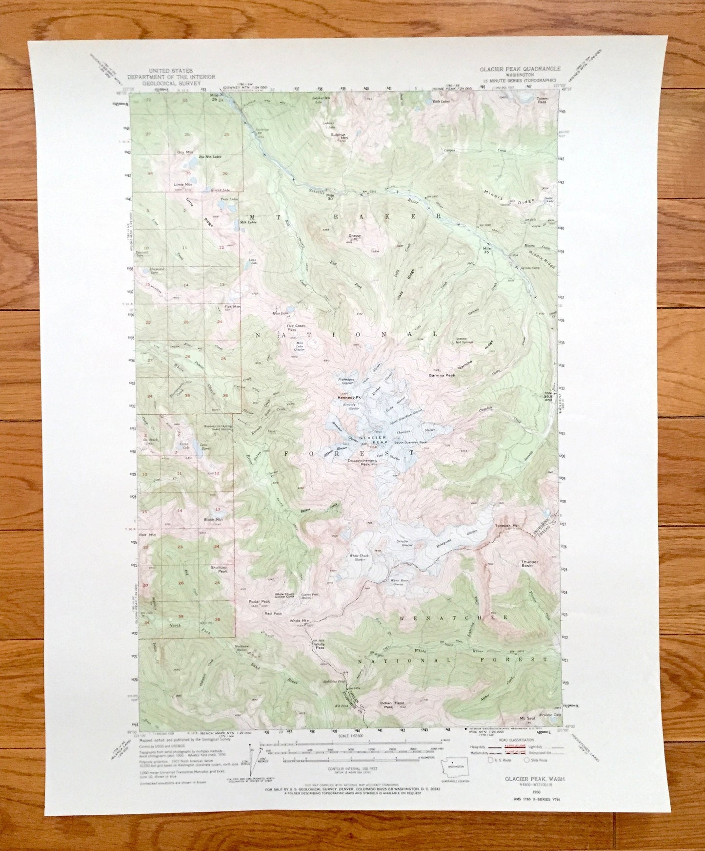
Antique Glacier Peak, Washington 1950 US Geological Survey Topographic Map – Chelan, Snohomish County, Mt Baker National Forest, Wenatchee
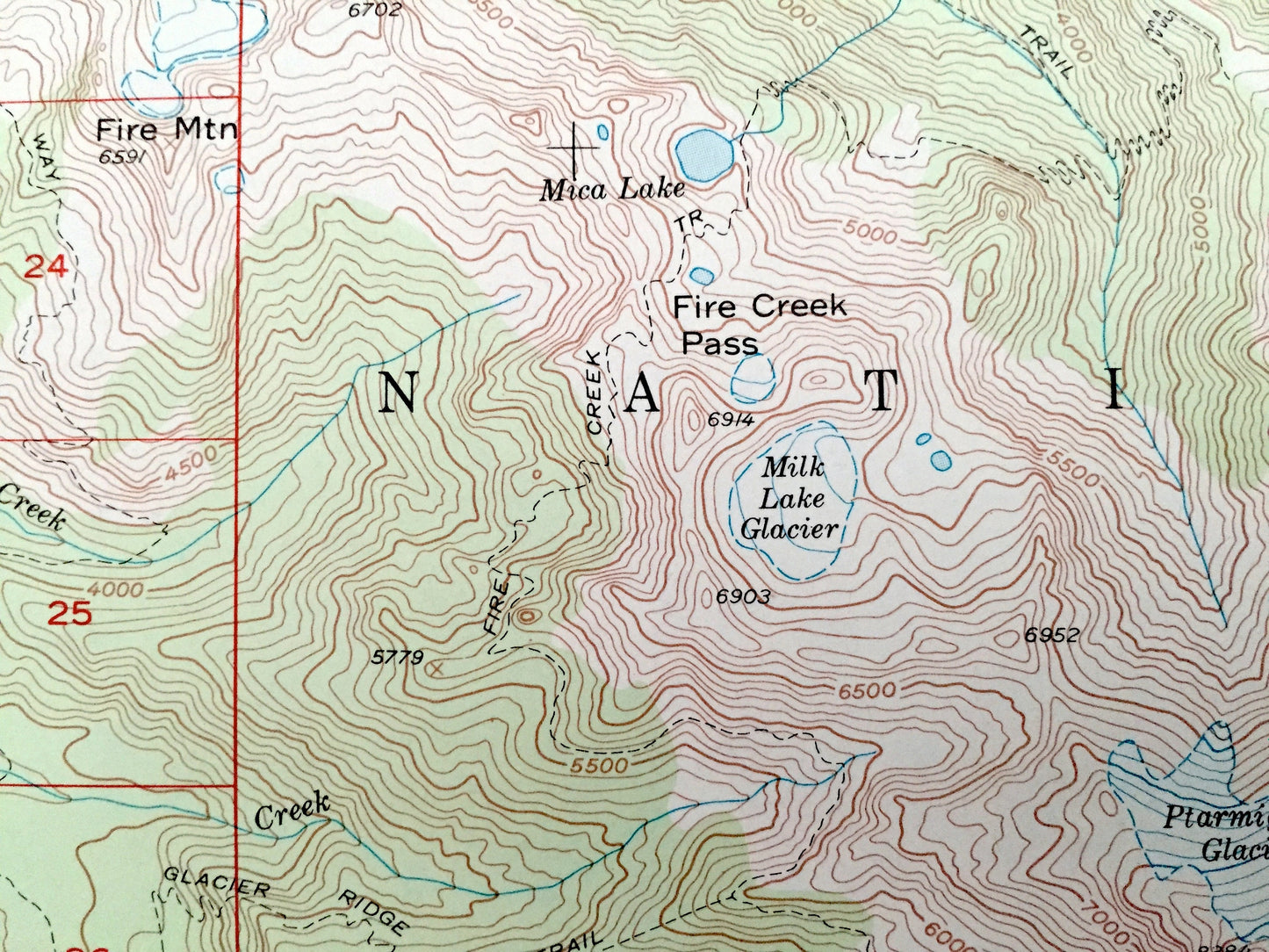
Antique Glacier Peak, Washington 1950 US Geological Survey Topographic Map – Chelan, Snohomish County, Mt Baker National Forest, Wenatchee
Beautiful, antique map of Glacier Peak, Washington and surrounding Chelan & Snohomish County area. This is an authentic 1950 edition, 1973 print from the U.S. Geological Survey and NOT a computer reproduction.
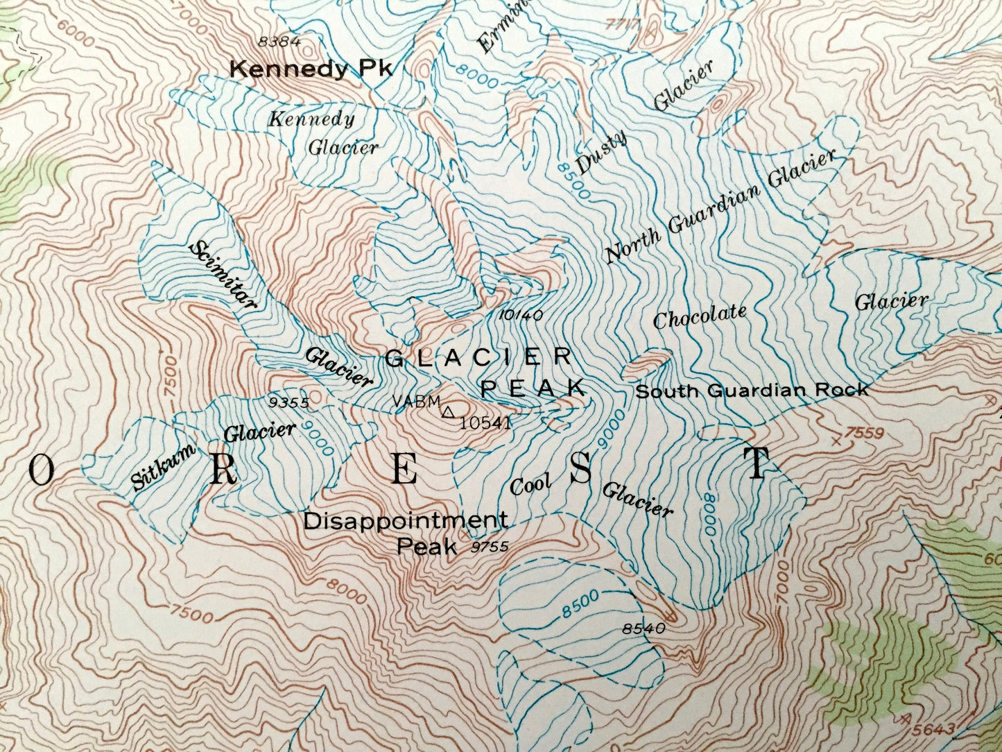
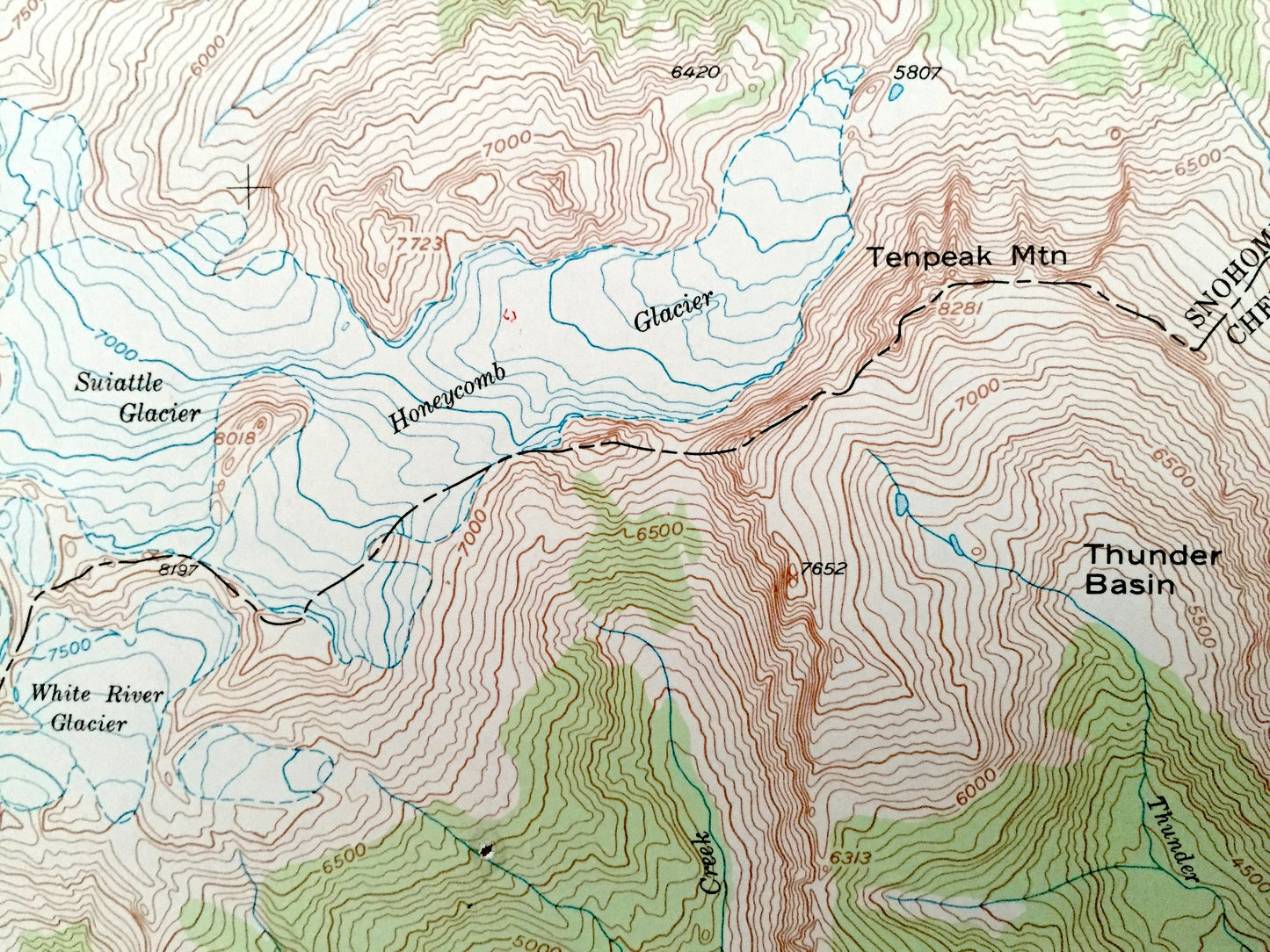
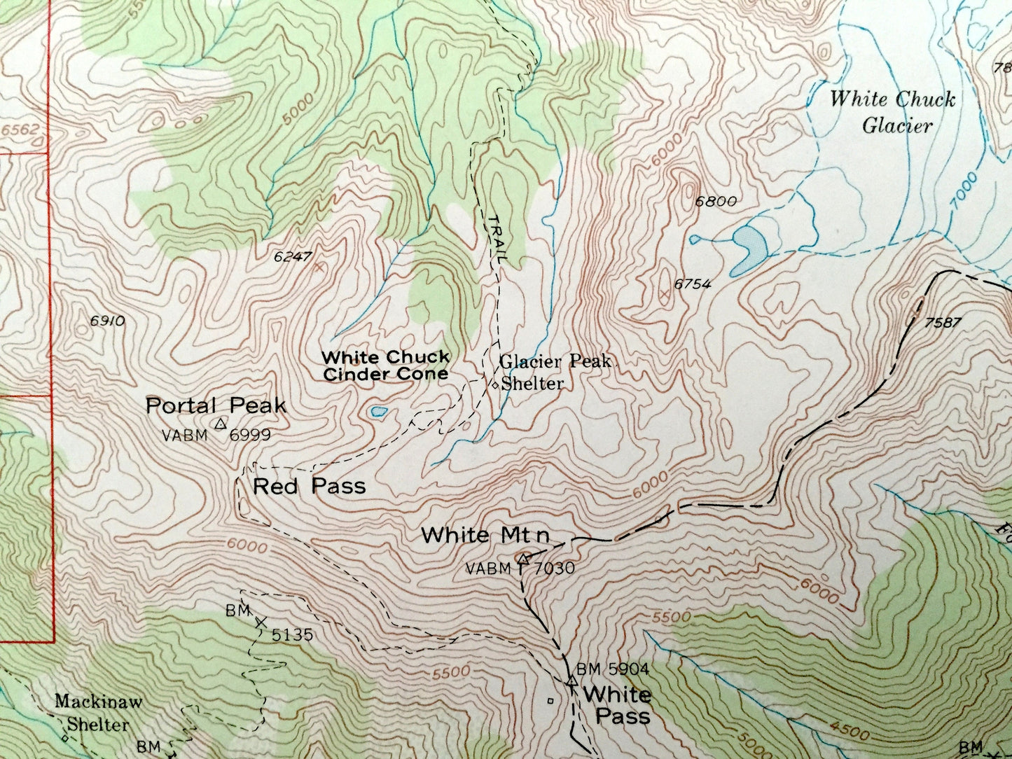
See what Washington looked like 70 years ago. Lots of intricate details and geological contours. Map even has little squares for every house that existed at the time. The USGS cartographers were very thorough back then!
Perfect for the historian, map-lover, the curious or just as a conversation starter. Wonderful and rare. Vintage maps such as these make great gifts.
Edition of 1950, printed 1973
Dimensions: 17" width x 21" height
----
Features
Points of Interest: Glacier Peak, Mt Baker National Forest, Suiattle River, Sauk River, Wenatchee National Forest, Cascade Range, Chelan National Forest, Cascade River, Disappointment Peak, White Chuck Glacier, White River Glacier, Twin Peaks, Dickerman Mountain, Bedal Peak, Sheep Mountain, Sloan Peak, and lots more hills, mountains, creeks, towns, roads and train tracks.
Condition: Very Good condition, commensurate with age. This map is in incredible shape for being over 45 years old.
----
We will happily adjust shipping price for multiple purchases. Maps are rolled up and shipped in sturdy mailing tubes, never folded.
Couldn't load pickup availability
Share