My Store
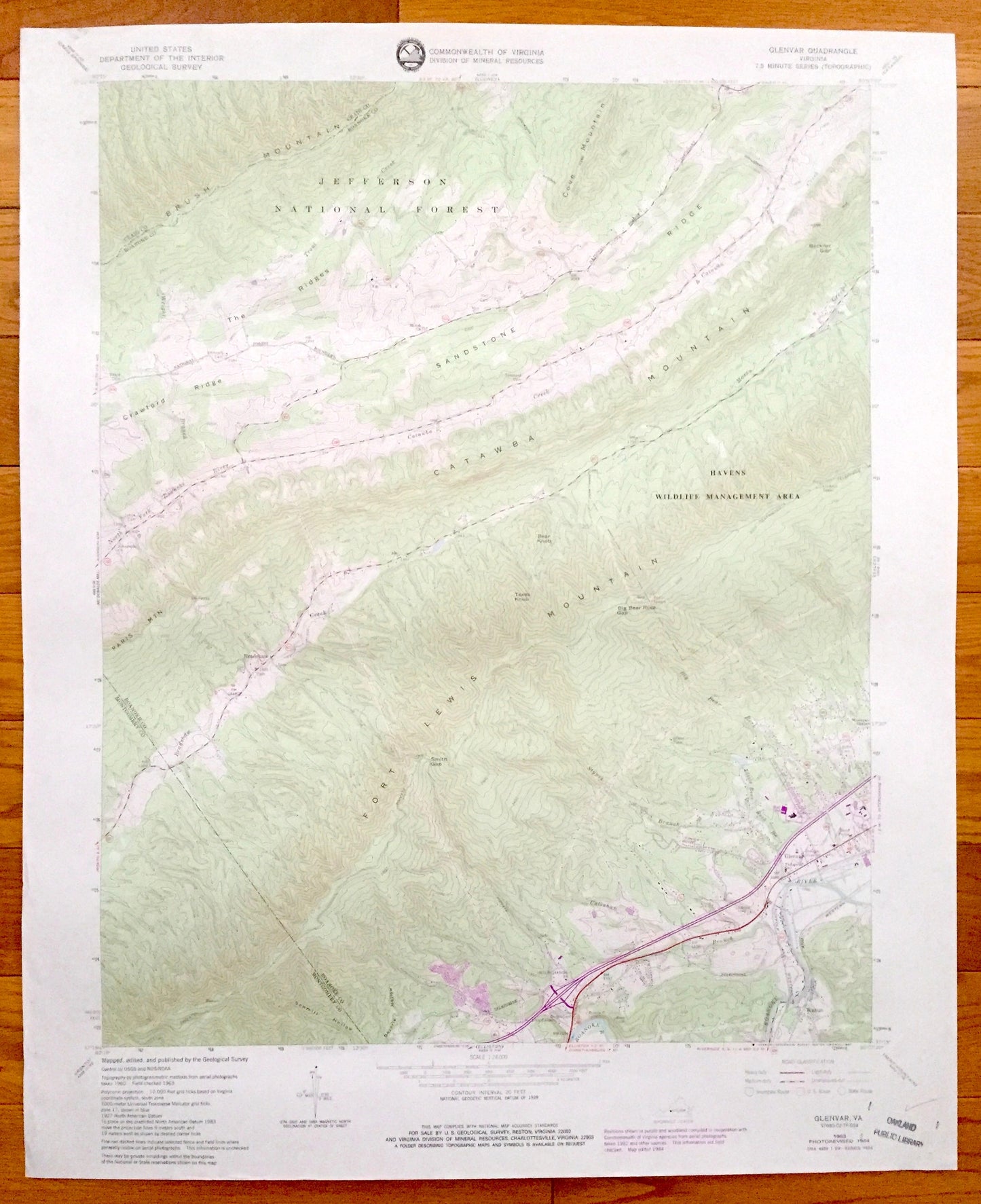
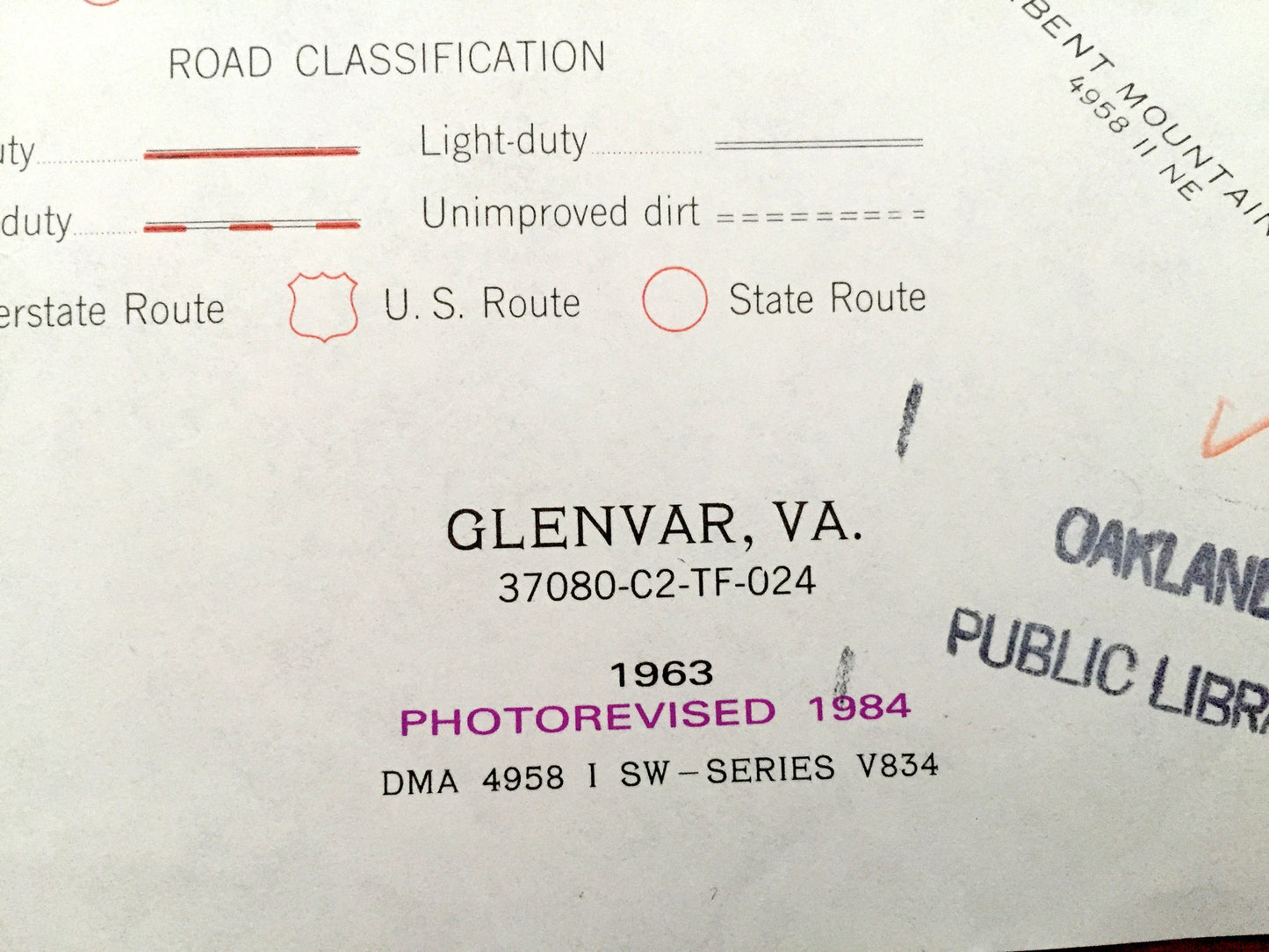
Antique Glenvar, Virginia 1963 US Geological Survey Topographic Map – Jefferson National Forest, Fort Lewis Mountain, Wabun, Roanoke County
Antique Glenvar, Virginia 1963 US Geological Survey Topographic Map – Jefferson National Forest, Fort Lewis Mountain, Wabun, Roanoke County
Beautiful, antique map of Glenvar, Wabun, Bradshaw and Jefferson National Forest, Virginia. This is an authentic 1963 edition, 1984 print from the U.S. Geological Survey and NOT a computer reproduction.
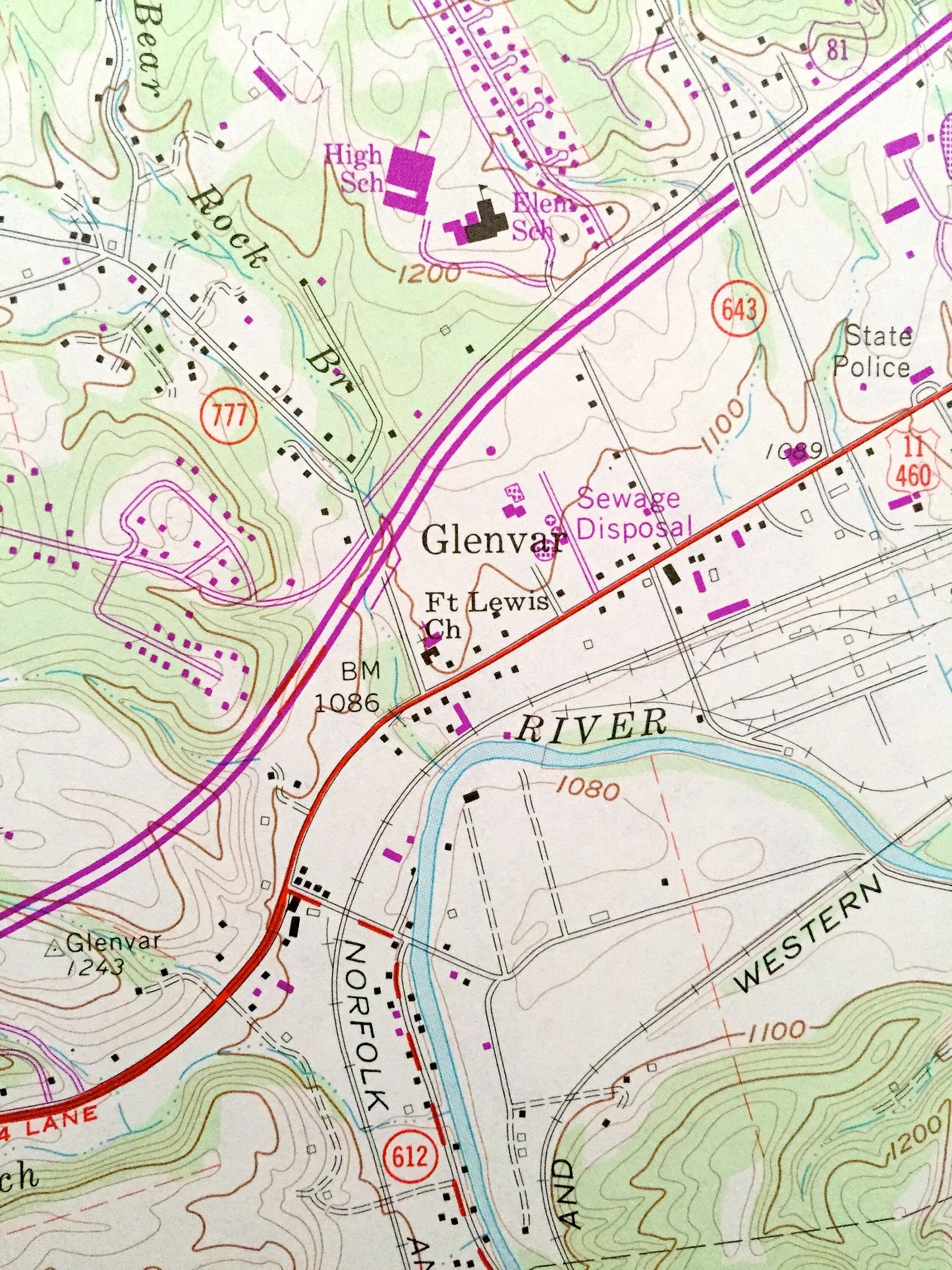
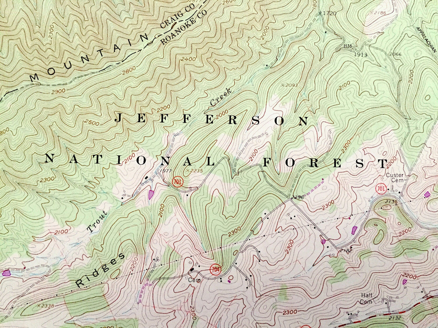
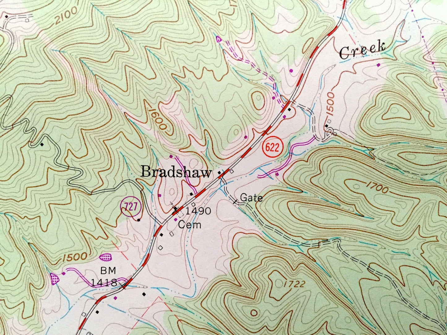
See what Roanoke and Montgomery Counties of Virginia looked like over 50 years ago. Lots of intricate details and geological contours. Map even has little squares for every house that existed at the time. The USGS cartographers were very thorough back then!
Perfect for the historian, map-lover, the curious or just as a conversation starter. Wonderful and rare. Vintage maps such as this make great gifts.
Edition of 1963, printed 1984
Dimensions: 23" width x 27" height
----
Features
Cities & Towns: Wabun, Glenvar, Bradshaw.
Points of Interest: Jefferson National Forest, Brush Mountain, Paris Mountain, Havens Wildlife Management Area, Fort Lewis Mountain, State Police, Ft Lewis Church, Norfolk and Western Railroad, Wesleyan Chapel, North Fork Roanoke River, Sandstone Ridge, Catawba Mountain, and many other roads, mountains, churches and houses.
Condition: Good condition, commensurate with age. This map is in incredible shape for being 40 years old.
----
We will happily adjust shipping price for multiple purchases. Maps are rolled up and shipped in sturdy mailing tubes, never folded.
Couldn't load pickup availability
Share