My Store
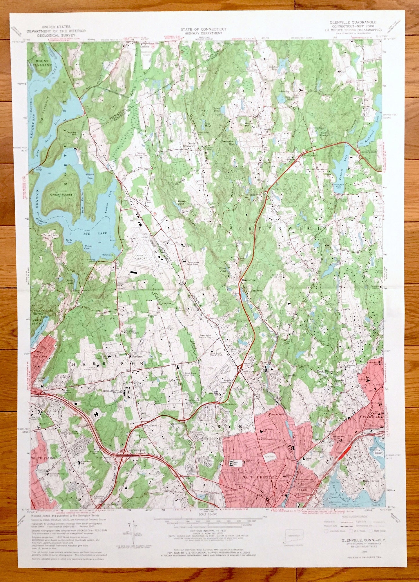
Antique Glenville, Connecticut 1960 US Geological Survey Topographic Map – Greenwich, Mount Pleasant Harrison Purchase Port Chester Byram CT
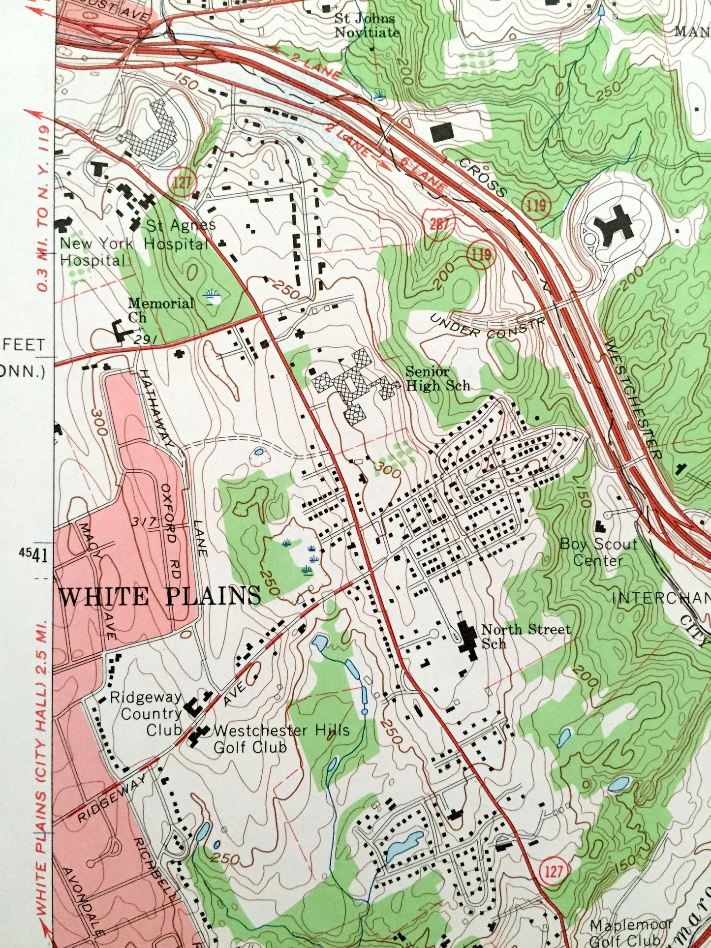
Antique Glenville, Connecticut 1960 US Geological Survey Topographic Map – Greenwich, Mount Pleasant Harrison Purchase Port Chester Byram CT
Beautiful, antique map of Glenville, Connecticut and the surrounding Fairfield County (CT) and Westchester County (NY) areas. This is an authentic 1960 edition, 1966 print from the U.S. Geological Survey and NOT a computer reproduction.
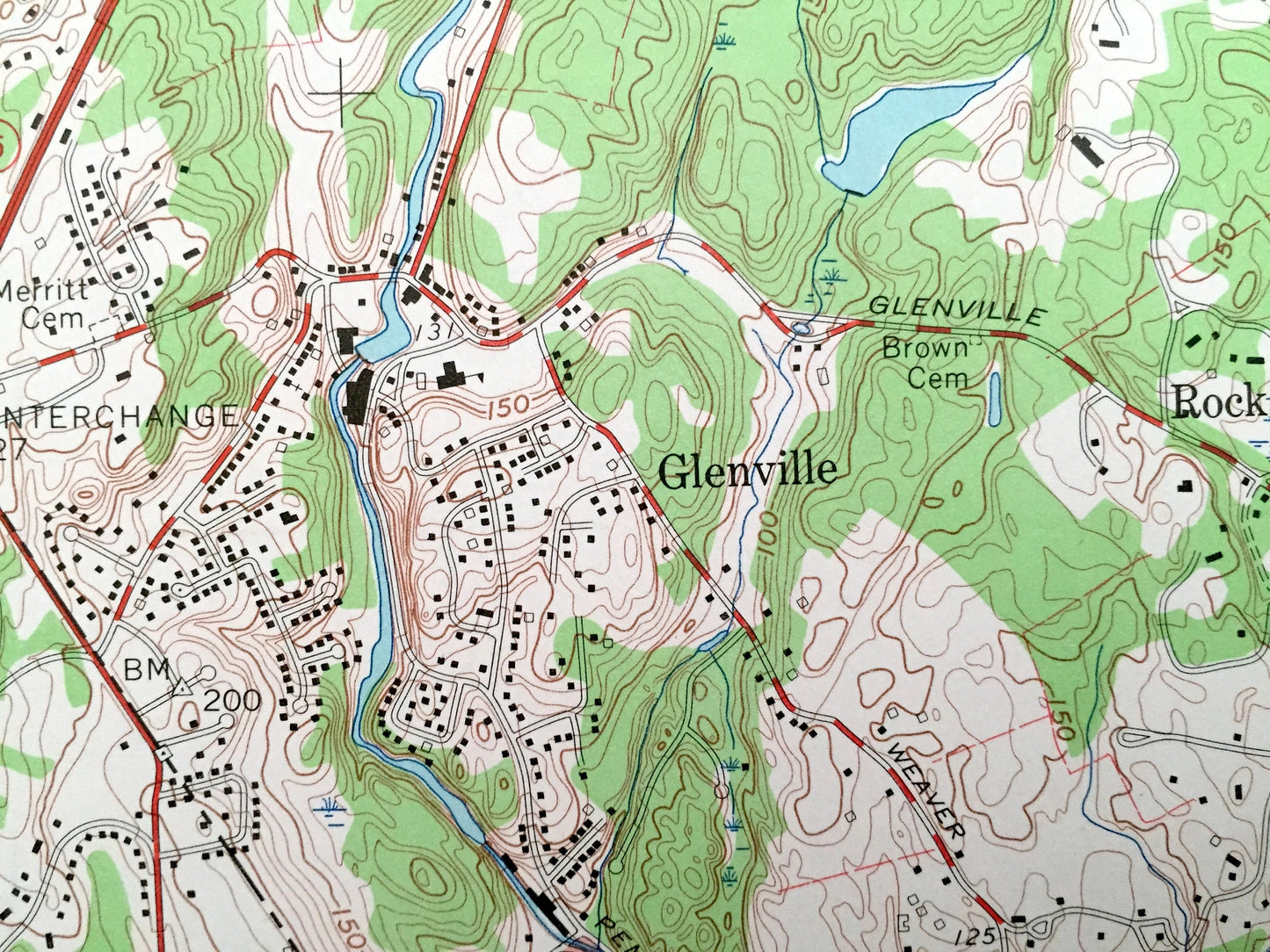
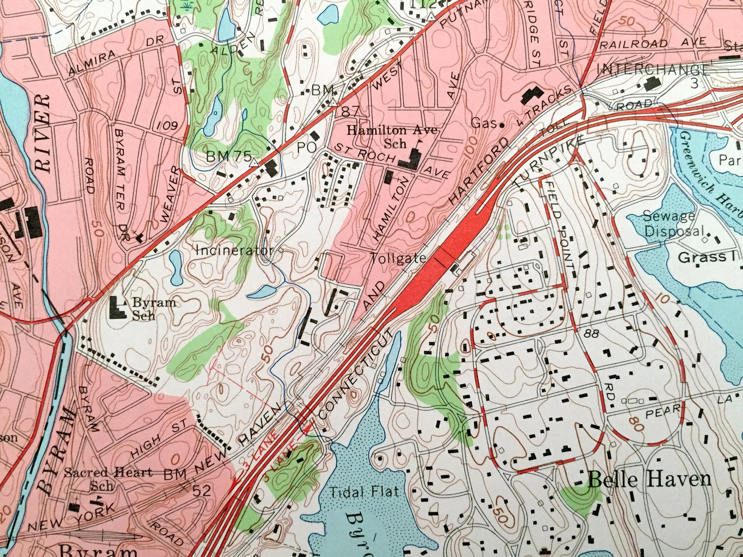
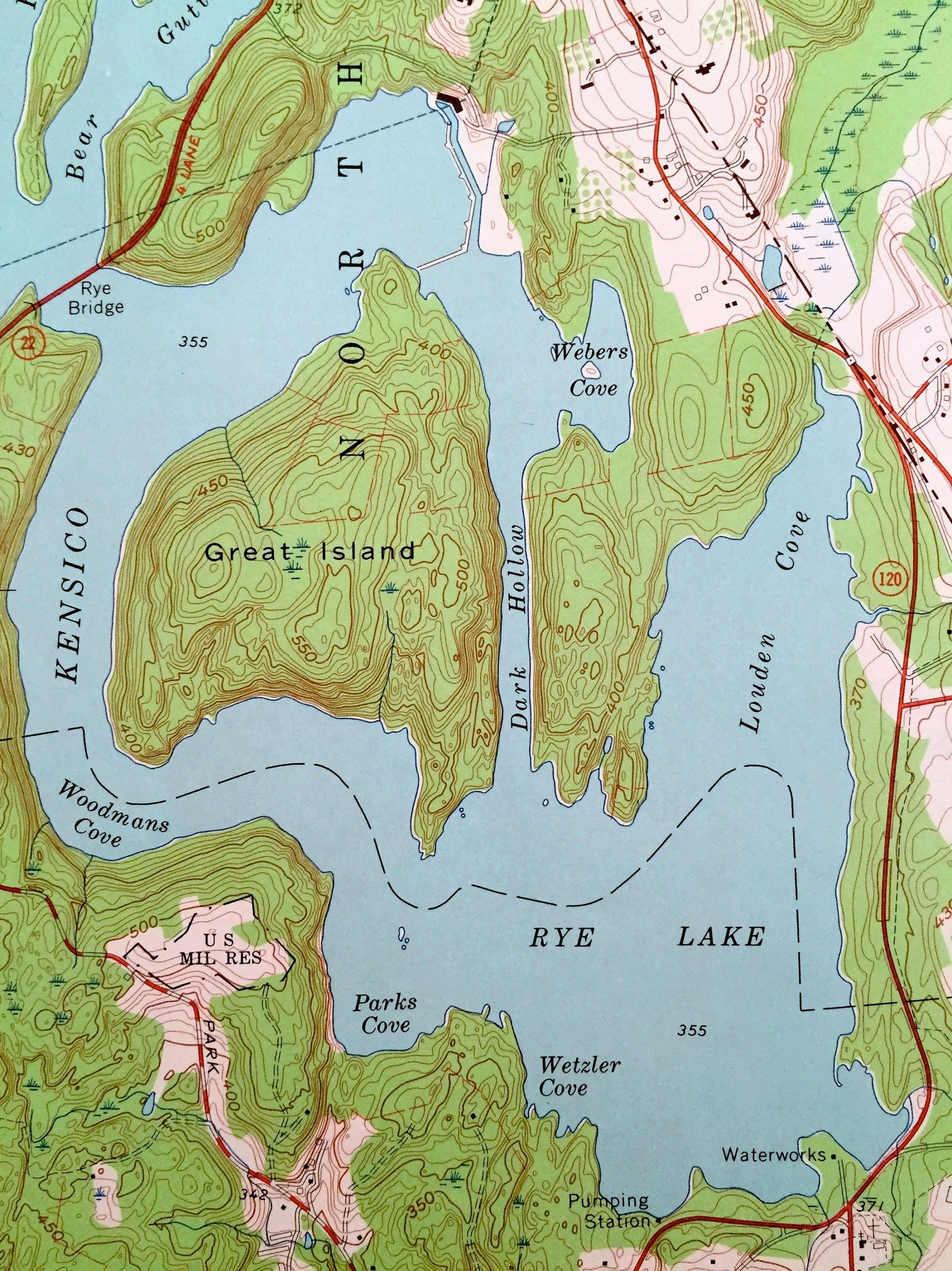
See what Connecticut looked like more than 60 years ago. Lots of intricate details and geological contours. Map even has little squares for every house that existed at the time. The USGS cartographers were very thorough back then!
Perfect for the historian, map-lover, the curious or just as a conversation starter. Wonderful and rare. Vintage maps such as these make great gifts.
Edition of 1960, printed 1966
Dimensions: 19" width x 27" height
----
Features
Cities & Towns: Greenwich, Glenville, Mount Pleasant, White Plains, Harrison, West Harrison, Purchase, Port Chester, Belle Haven, Byram, Pemberwick, Riversville, Rock Ridge, Round Hill, North Greenwich.
Points of Interest: Byram Harbor, Byram River, Silver Lake, North Castle, Kensico Reservoir, Rye Lake, Blind Brook, Putnam Lake, Rockwood Lake, and more roads, houses, ponds, hills, streams, islands and coves.
Condition: Good Vintage condition, commensurate with age. This map is in great shape for being over 55 years old. Map is trimmed on the left side.
----
We will happily adjust shipping price for multiple purchases. Maps are rolled up and shipped in sturdy mailing tubes, never folded.
Couldn't load pickup availability
Share