My Store
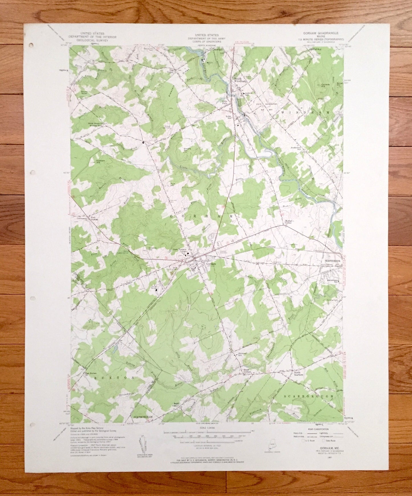
Antique Gorham, Maine 1957 US Geological Survey Topographic Map – York, Cumberland County, Windham, Buxton, Scarborough, Westbrook, ME
Antique Gorham, Maine 1957 US Geological Survey Topographic Map – York, Cumberland County, Windham, Buxton, Scarborough, Westbrook, ME
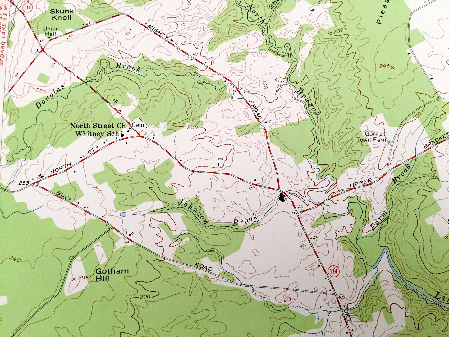
Beautiful, antique map of Gorham, Maine and surrounding York County and Cumberland County areas. This is an authentic 1957 edition, 1958 print from the U.S. Geological Survey and NOT a computer reproduction.
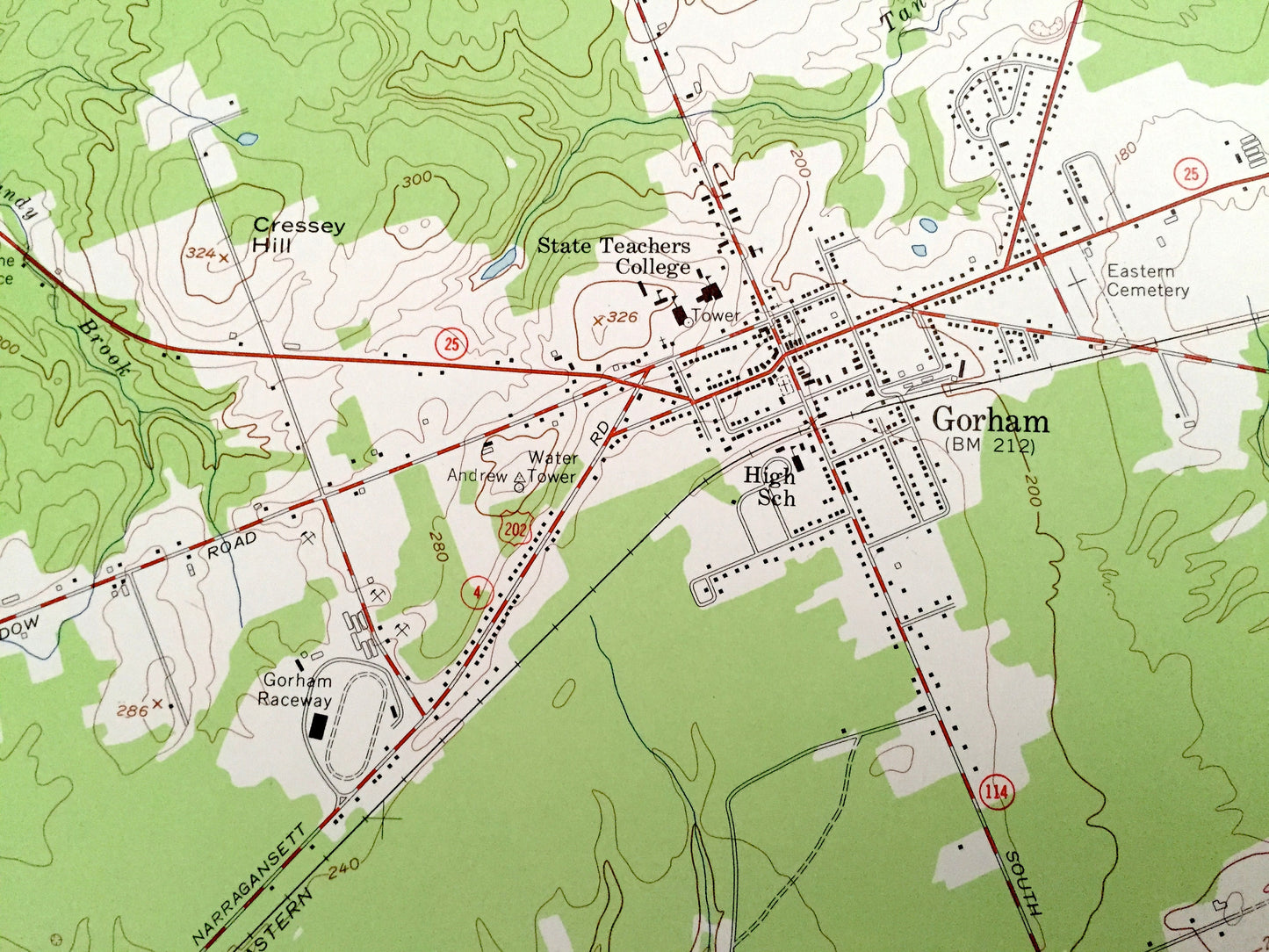
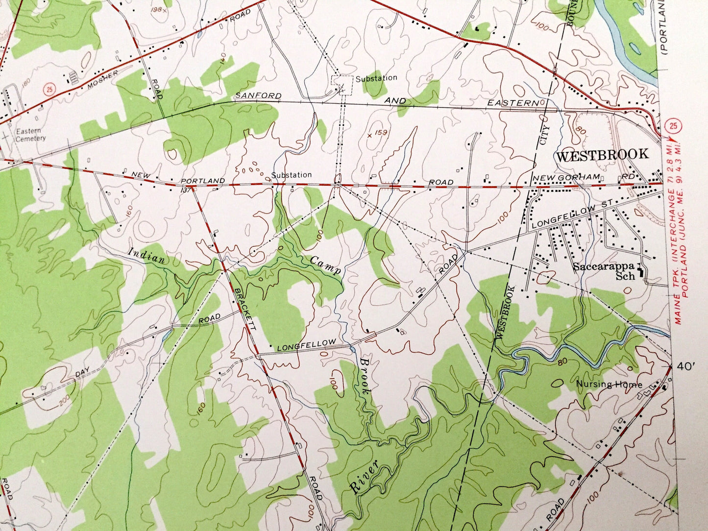
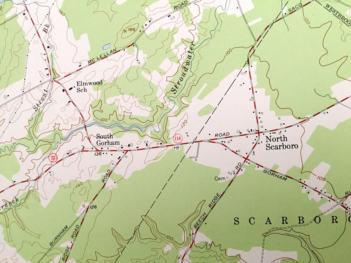
See what Maine looked like over 60 years ago. Lots of intricate details and geological contours. Map even has little squares for every house that existed at the time. The USGS cartographers were very thorough back then!
Perfect for the historian, map-lover, the curious or just as a conversation starter. Wonderful and rare. Vintage maps such as these make great gifts.
Edition of 1957, printed 1958
Dimensions: 22" width x 27" height
----
Features
Cities & Towns: Windham, Buxton, Scarborough, Westbrook, Newhall, South Windham, Little Falls, Gag Corner, West Gorham, Land of Nod, Mosher Corner, Babb Corner, South Gorham, North Scarborough.
Points of Interest: State Teachers College, State Reformatory For Men, Gorham Raceway, Pleasant Ridge, Gotham Hill, Canada Hill, Anderson Hill, Presumpscot River, Little River, Nonesuch River, Stroudwater River, Dering Brook, Gully Brook, and many more hills, streams, beaches, islands, ponds, houses, schools, railroads, churches and roads.
Condition: Very Good Vintage condition, commensurate with age. This map is in great shape for being over 60 years old. Has subtle edge-wear with few stains and a four-hole-punch on the left hand margin, all of which will read as character when framed.
----
We will happily adjust shipping price for multiple purchases. Maps are rolled up and shipped in sturdy mailing tubes, never folded.
Couldn't load pickup availability
Share