My Store
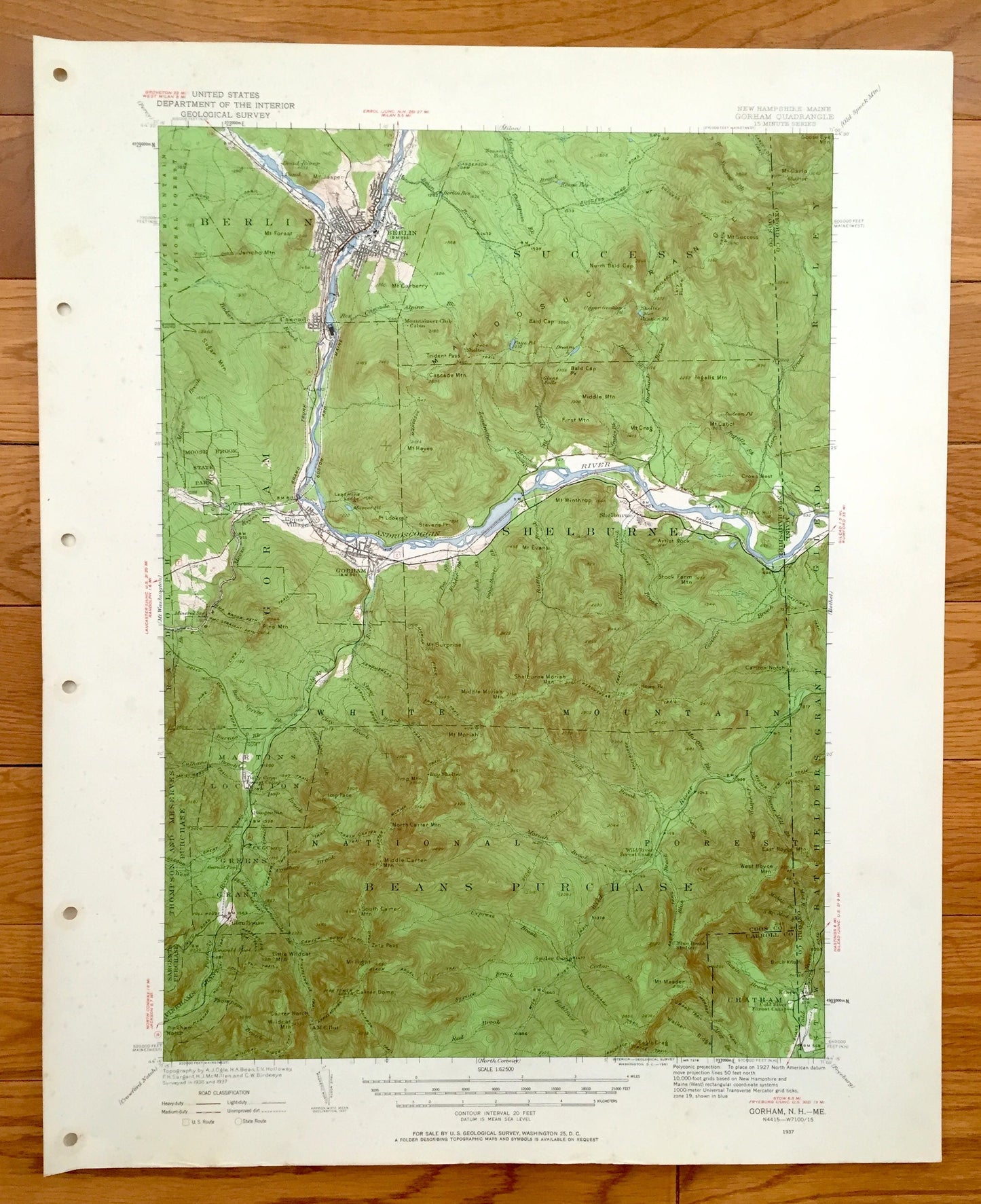
Antique Gorham, New Hampshire 1937 US Geological Survey Topographic Map – Berlin, Success, Shelburne White Mountains Coos County, Carroll NH
Antique Gorham, New Hampshire 1937 US Geological Survey Topographic Map – Berlin, Success, Shelburne White Mountains Coos County, Carroll NH
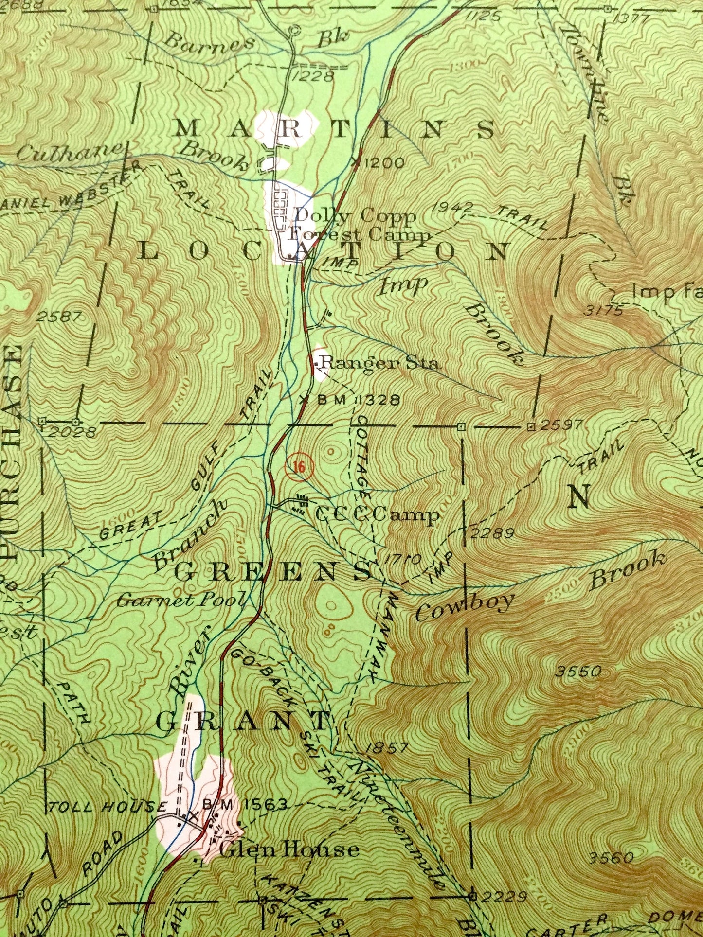
Beautiful, antique map of White Mountain Region, New Hampshire, including Shelburne, Bean Purchase, Chatham, Success, Berlin, and Gorham. This is an authentic 1937 edition, 1961 print from the U.S. Geological Survey and NOT a computer reproduction.
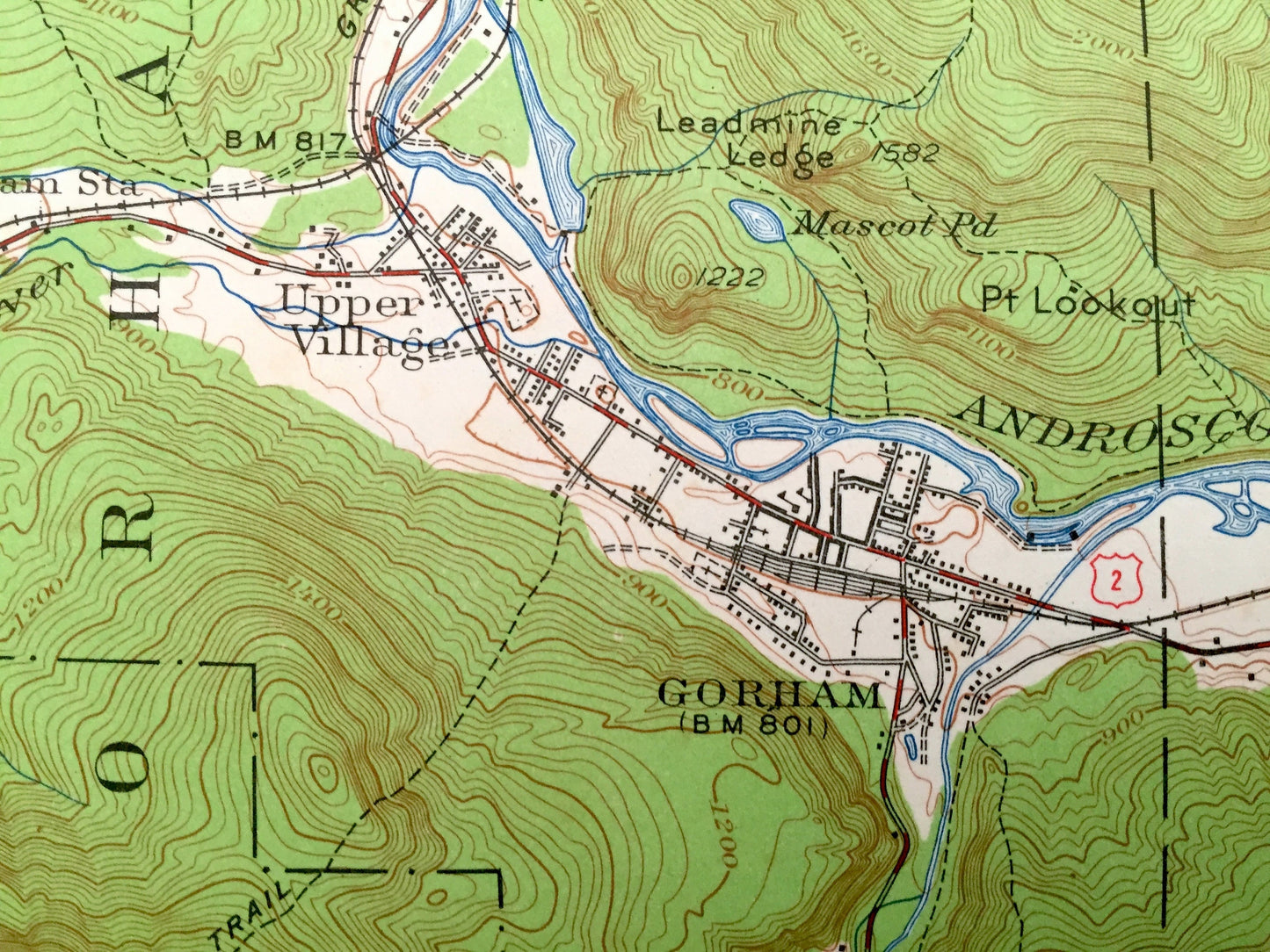
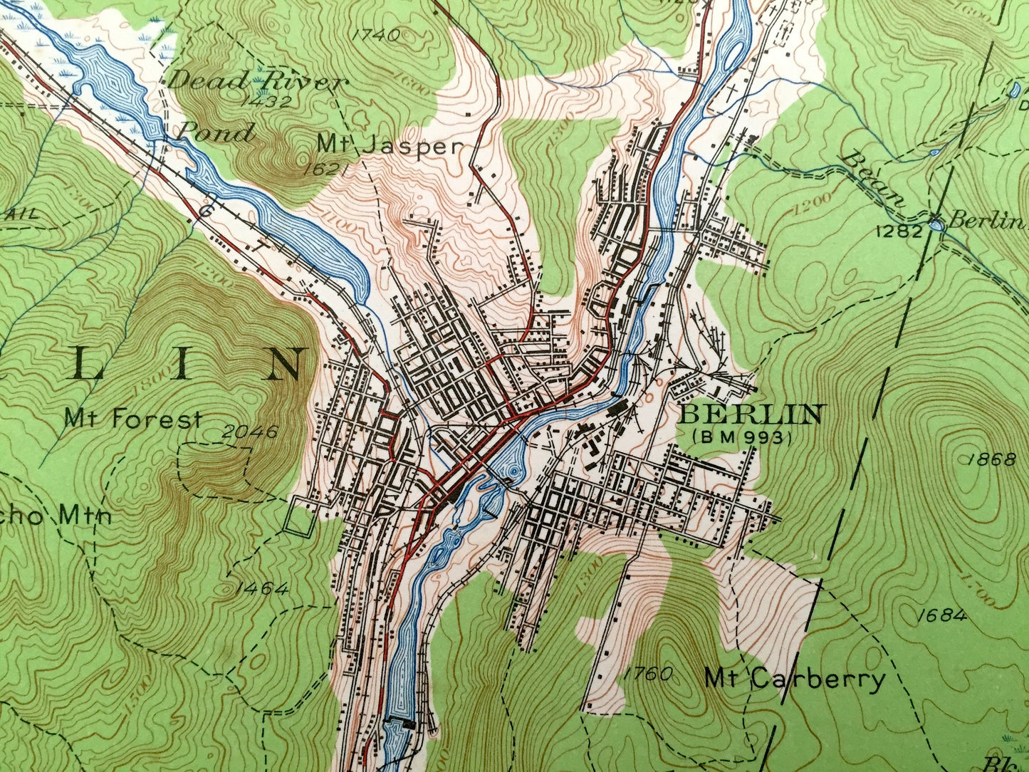
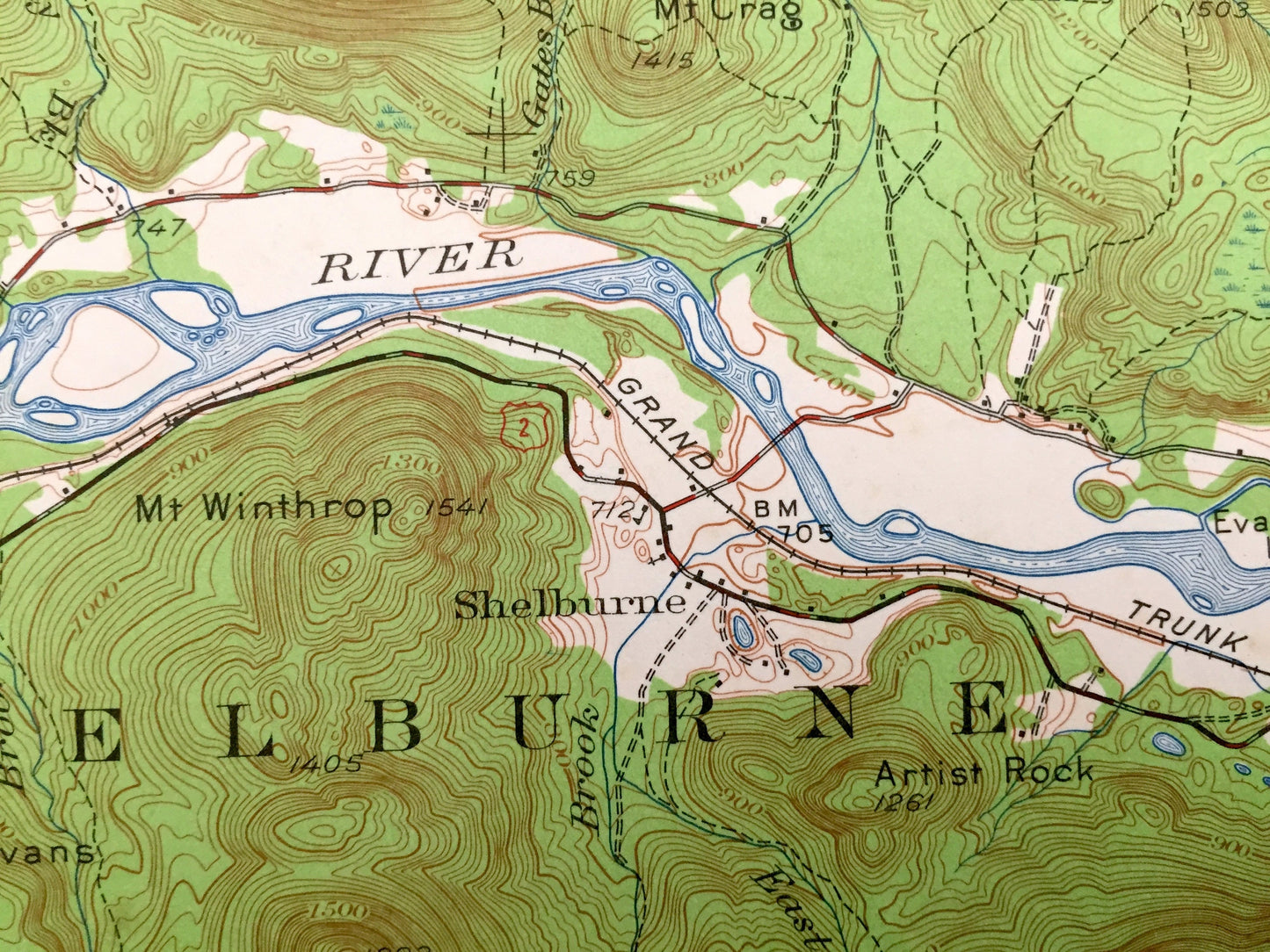
See what the White Mountains of New Hampshire and a glimpse of Maine looked like 80 years ago. Lots of intricate details and geological contours. Map even has little squares for every house that existed at the time. The USGS cartographers were very thorough back then!
Perfect for the historian, map-lover, the curious or just as a conversation starter. Wonderful and rare. Vintage maps such as these make great gifts.
Edition of 1937, printed 1961
Dimensions: 17" width x 21" height
----
Features
Cities & Towns: NEW HAMPSHIRE: Berlin, Success, Gorham, Shelburne, Martin Location, Green's Grant, Thompson & Meserve Purchase, Pinkham Grant, Chatham, Bean Purchase, Upper Village, Cascade.
MAINE: Riley, Gilead, Grant, Batchelders, Stow.
Points of Interest: Coos County, Carroll County, Black Mountain, Mount Florist, Berlin Falls, Mount Success, Bald Cap Dome, Bald Cap Peak, Mount Winthrop, Androscoggin River, Shelburn Moriah Mountain, Mount Surprise, North Carter Mountain, South Carter Mountain, Middle Carter Mountain, Little Wildcat Mountain, Wildcat Mountain, Carter Notch, Mount Madison Path, The Imp, Eagle Crag, West Royce Mountain, Wild River Railroad, Grand Truck Railroad, Boston & Maine Railroad, and lots more hills, mountains, streams, ponds, houses, railroads and roads.
Condition: Very Good condition, commensurate with age. This map is in incredible shape for being almost 60 years old. Map has light edge-wear and punch holes, which are easily concealed with placing a similar-colored paper behind the print, all of which will read as vintage character when framed.
----
We will happily adjust shipping price for multiple purchases. Maps are rolled up and shipped in sturdy mailing tubes, never folded.
Couldn't load pickup availability
Share