My Store
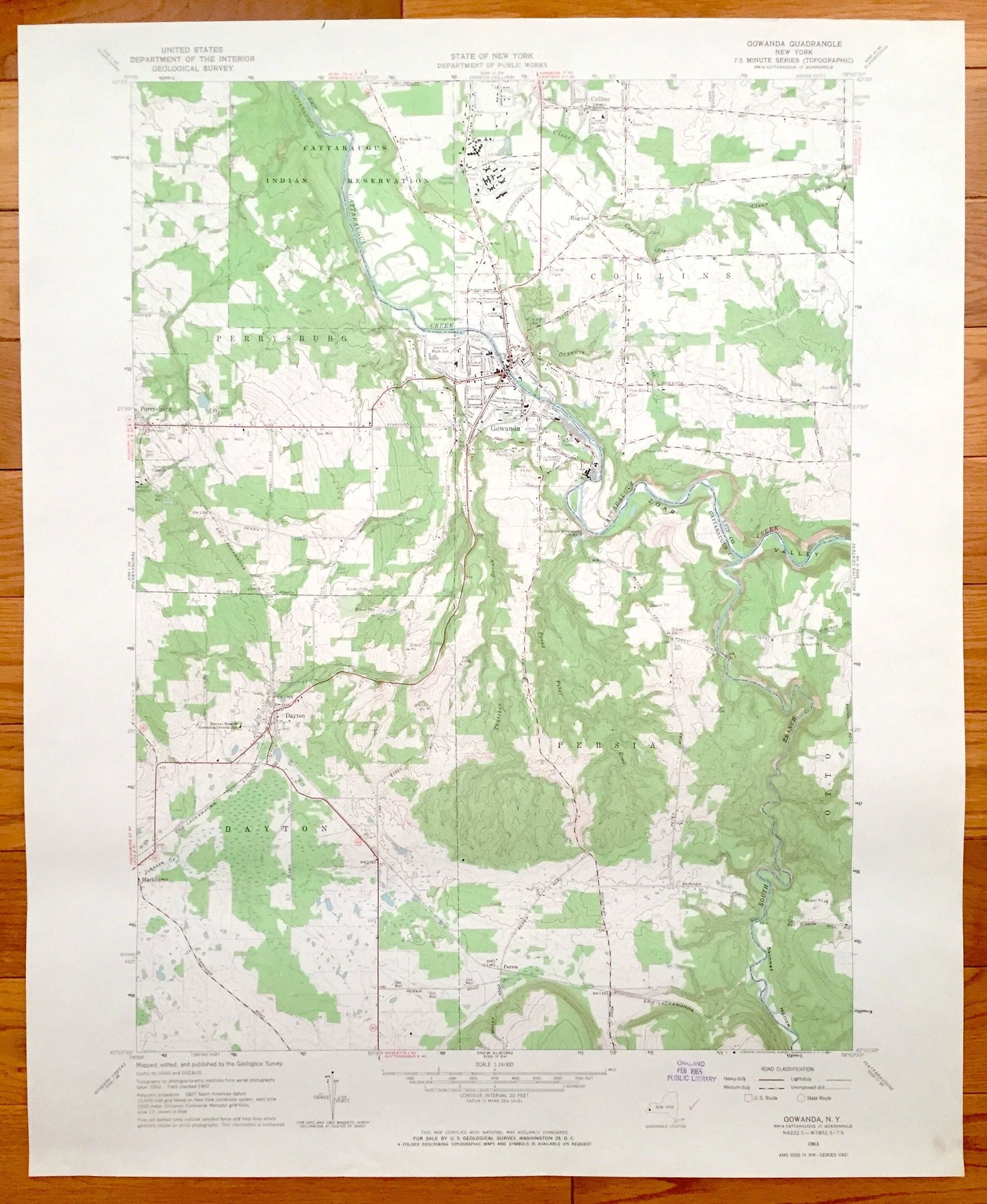
Antique Gowanda, New York 1963 US Geological Survey Topographic Map – Dayton, Collins, Perrysburg, Persia, Otto, Bagdad, Markhams, NY
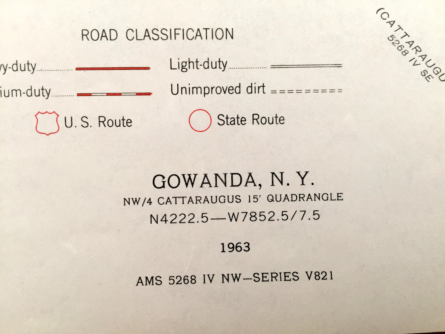
Antique Gowanda, New York 1963 US Geological Survey Topographic Map – Dayton, Collins, Perrysburg, Persia, Otto, Bagdad, Markhams, NY
Beautiful, antique map of Perrysburg, Collins, Gowanda, Otto, Persia, Dayton and Bagdad, New York. This is an authentic 1963 print from the U.S. Geological Survey and NOT a computer reproduction.
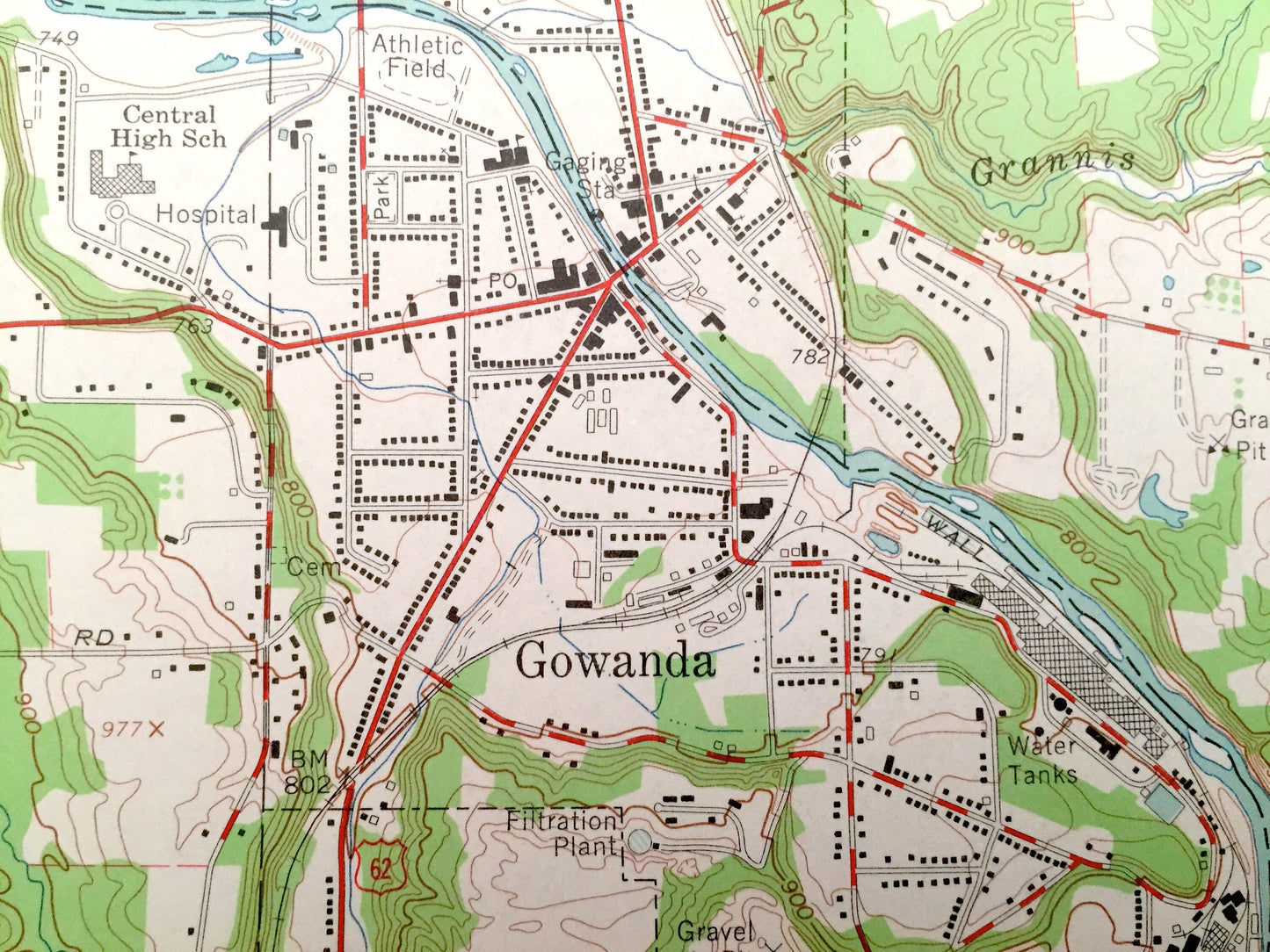
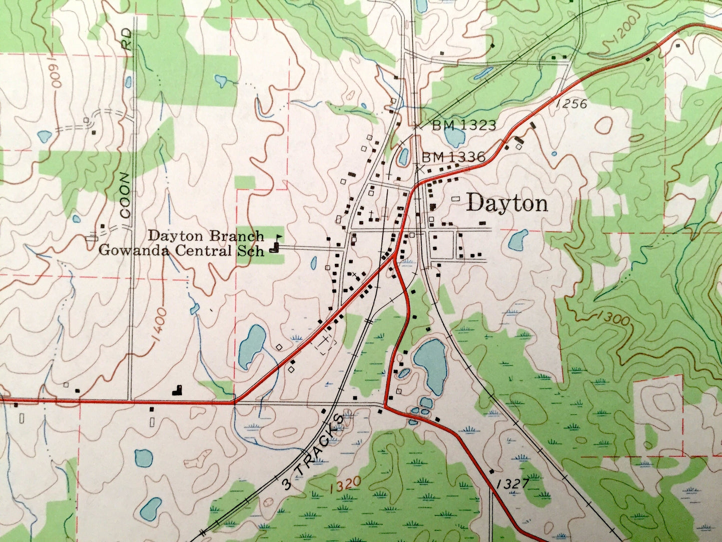
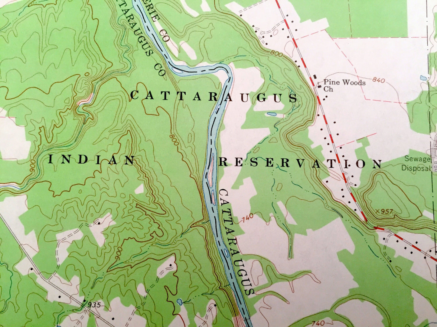
See what Cattarugus and Erie Counties of New York looked like over 50 years ago. Lots of intricate details and geological contours. Map even has little squares for every house that existed at the time. The USGS cartographers were very thorough back then!
Perfect for the historian, map-lover, the curious or just as a conversation starter. Wonderful and rare. Vintage maps such as this make great gifts.
Edition of 1963, printed 1963
Dimensions: 22" width x 27" height
----
Features
Cities & Towns: Perrysburg, Collins, Gowanda, Otto, Persia, Dayton, Bagdad, Markhams.
Points of Interest: Dayton Branch Gowanda Central High School, Erie Lackawanna Railroad, Cattaraugus River, Central High School, Cattaraugus Indian Reservation, Skimmer Hollow, South Branch River, Zoar Valley, and many more roads, streams, schools, houses, and lakes.
Condition: Very Good condition, commensurate with age. This map is in incredible shape for being over 50 years old.
----
We will happily adjust shipping price for multiple purchases. Maps are rolled up and shipped in sturdy mailing tubes, never folded.
Couldn't load pickup availability
Share