My Store
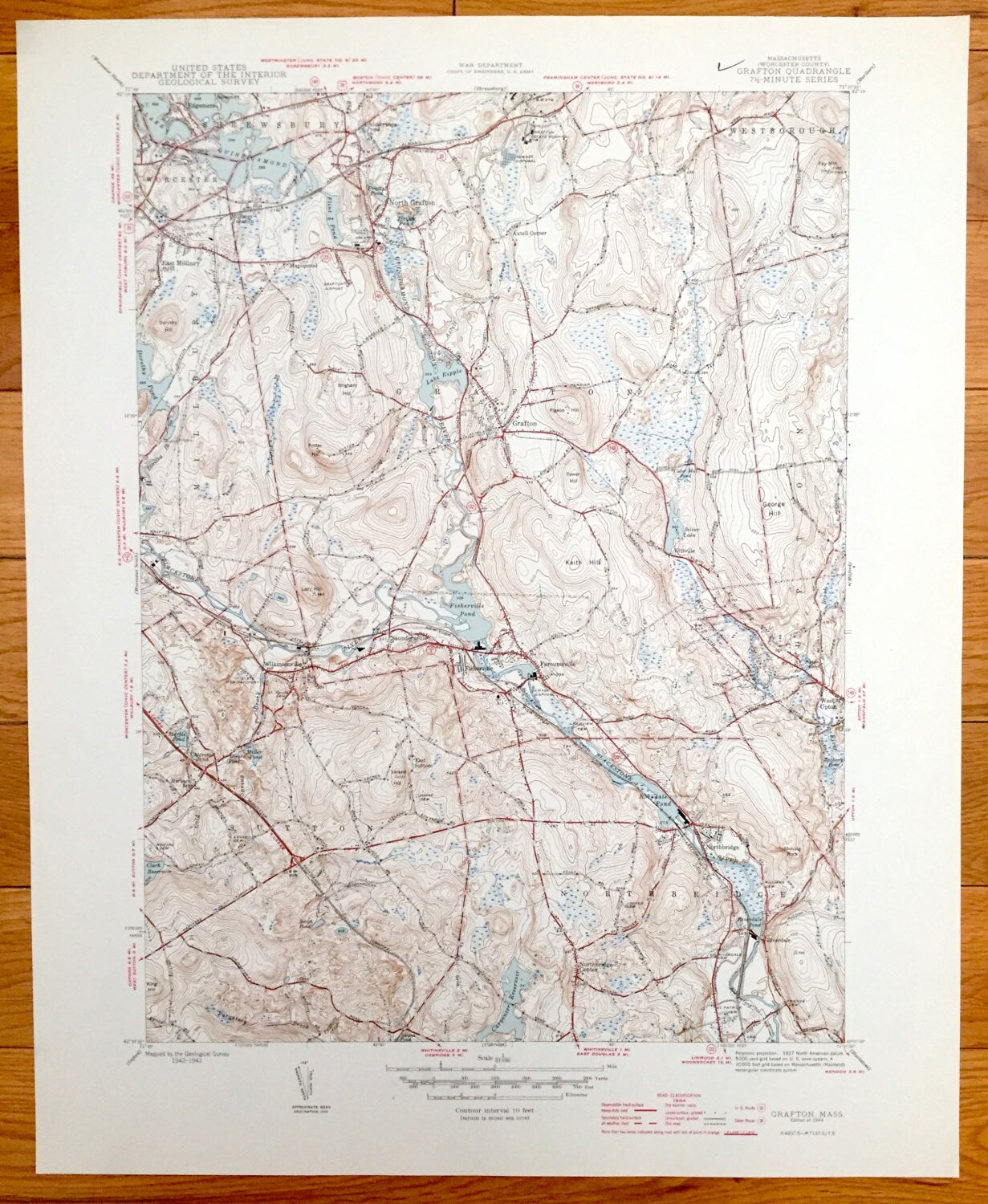
Antique Grafton, Massachusetts 1944 US Geological Survey Topographic Map – Worcester, Westborough, Quinsigamond, Northbridge, Shrewsbury, MA
Antique Grafton, Massachusetts 1944 US Geological Survey Topographic Map – Worcester, Westborough, Quinsigamond, Northbridge, Shrewsbury, MA
Beautiful, antique map of Grafton Massachusetts and surrounding cities and towns. This is an authentic 1944 print from the U.S. Geological Survey and NOT a computer reproduction.
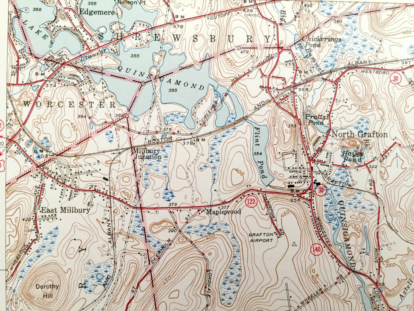
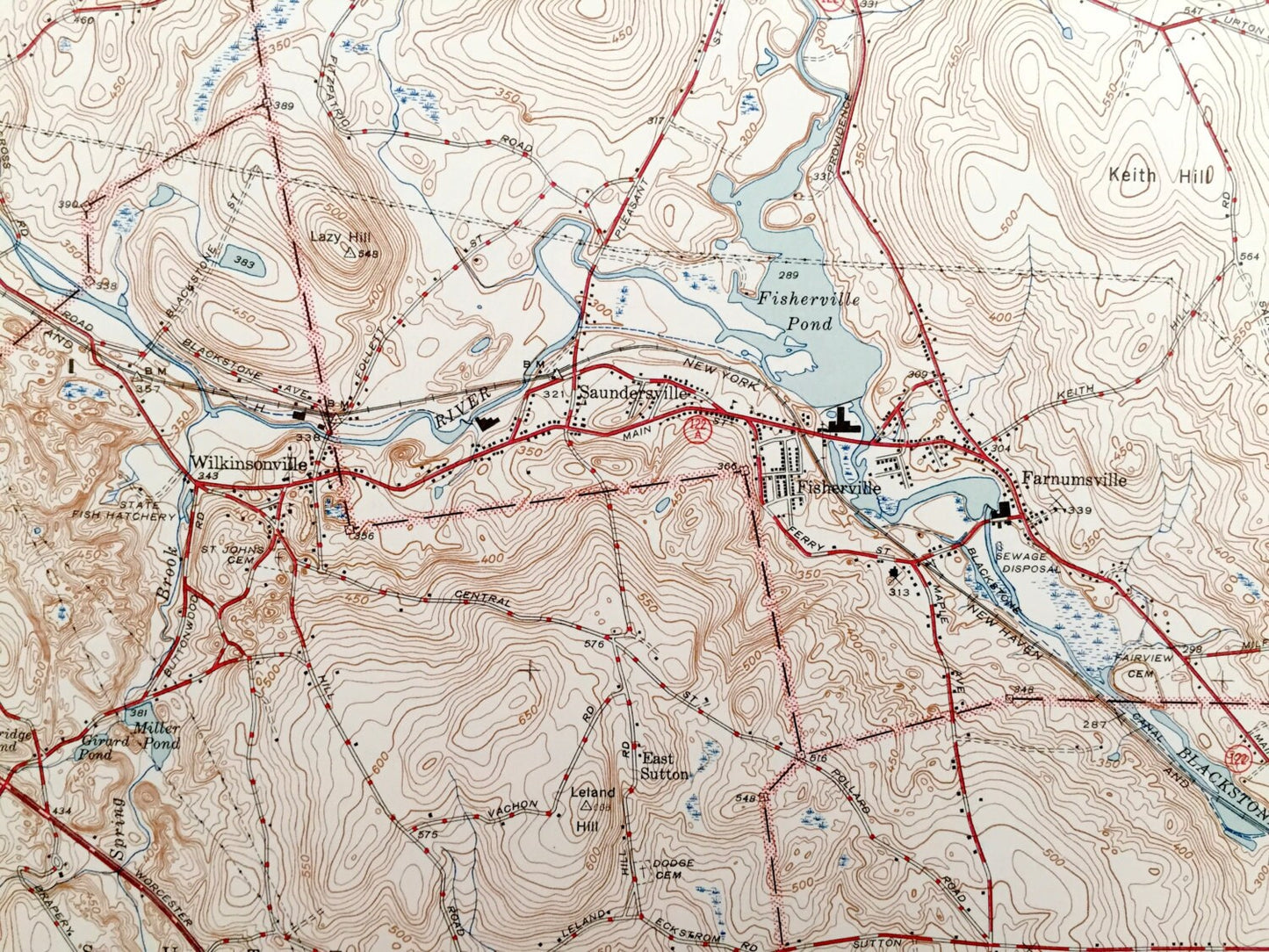
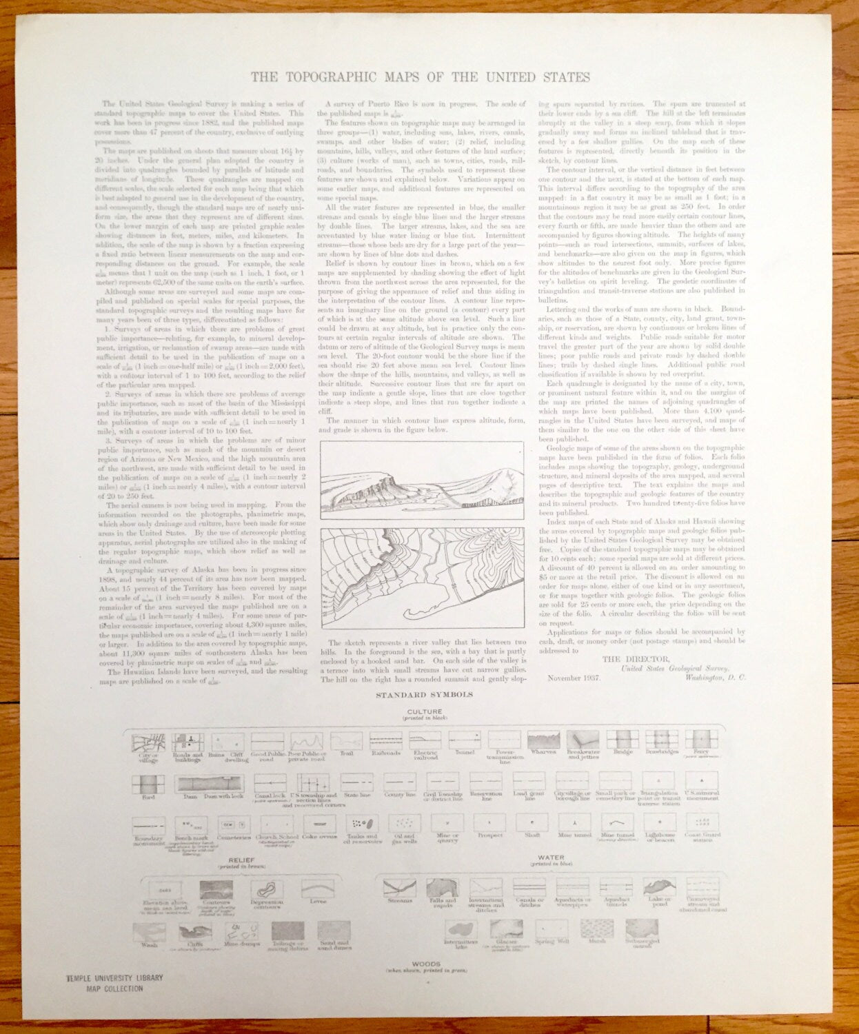
See what the town of Grafton looked like over 75 years ago. Lots of intricate details and geological contours. Map even has little squares for every house that existed at the time. The USGS cartographers were very thorough back then! On the back is a description of topographic symbols and map guide.
Perfect for the historian, map-lover, the curious or just as a conversation starter. Wonderful and rare. Vintage maps such as these make great gifts.
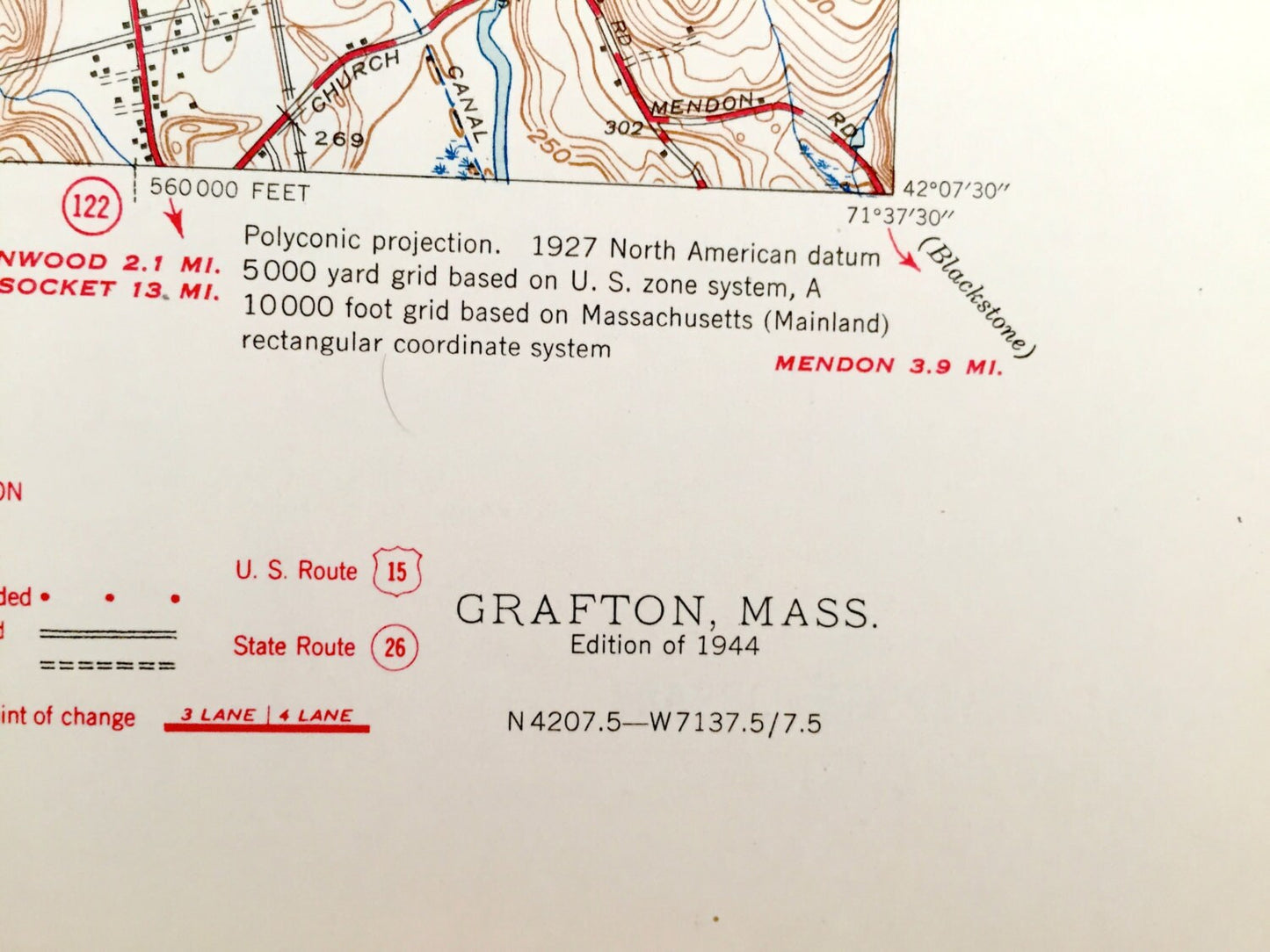
Edition of 1944, printed 1944
Dimensions: 17" width x 21" height
----
Features
Cities & Towns: Shrewsbury, Westborough, North Grafton, Worcester, East Millbury, Grafton, North Grafton, Fisherville, Wilkinsonville, Northbridge, West Upton, Saundersville, Northbridge, West Upton, Saundersville, Kittville, East Sutton, Farnumsville, Northbridge Center, Northbridge, Riverdale, Sutton.
Points of Interest: Lake Quinsigamond, Fay Mountain, Silver Lake, Lake Ripple, Boston and Albany Railroad, Milbury Junction, Fisherville Pond, Blackstone River, New York New Haven and Hargord Railroad, Harback School, State Fish Hatchery, Carpenter Reservoir, and more roads, houses, ponds, hills, streams and mountains.
Condition: Very Good Vintage condition, commensurate with age. This map is in great shape for being over 75 years old.
----
We will happily adjust shipping price for multiple purchases. Maps are rolled up and shipped in sturdy mailing tubes, never folded.
Couldn't load pickup availability
Share