My Store
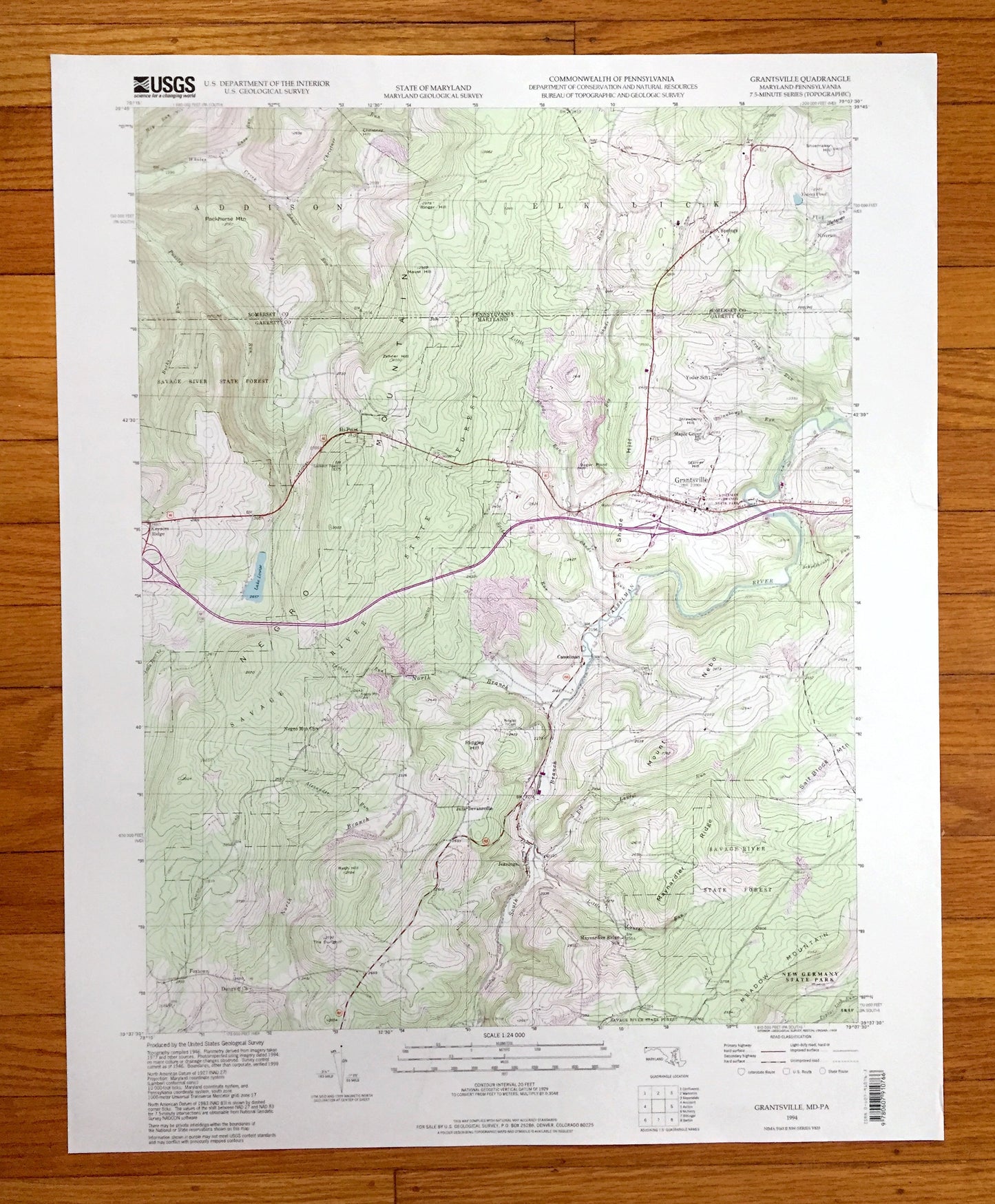
Antique Grantsville, Maryland 1994 US Geological Survey Topographic Map – Garrett County, MD, Somerset County, Addison, Elk Lick, PA
Antique Grantsville, Maryland 1994 US Geological Survey Topographic Map – Garrett County, MD, Somerset County, Addison, Elk Lick, PA
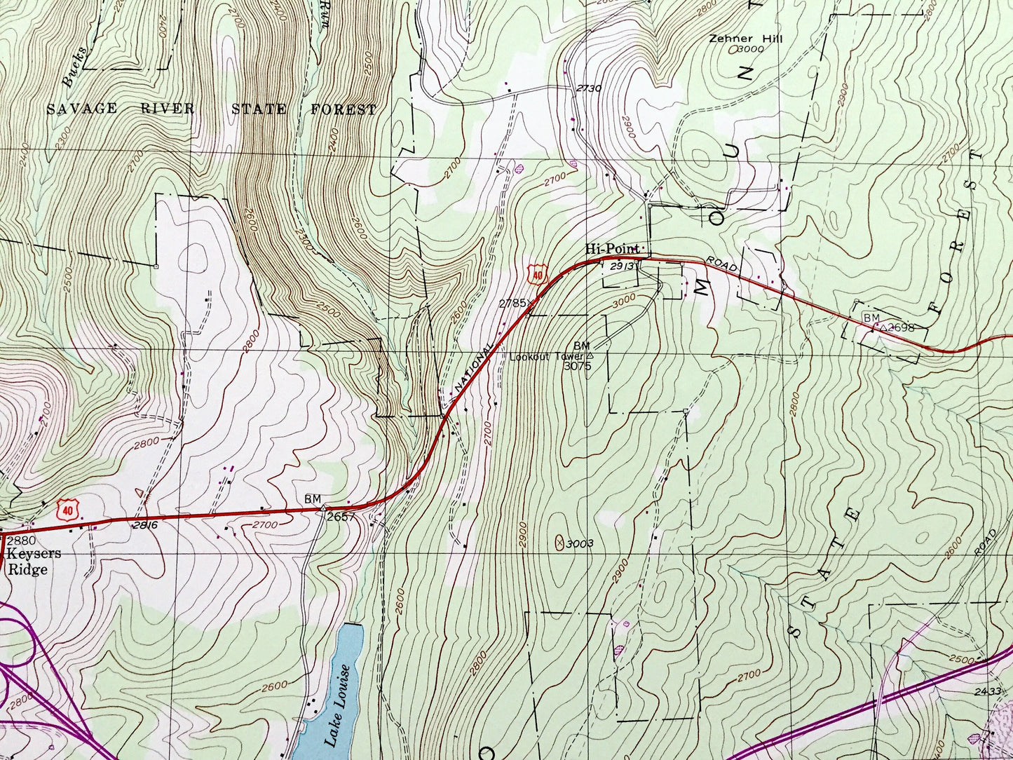
Beautiful, antique map of Grantsville, Maryland and surrounding Garrett County area, including Pennsylvania’s Somerset County. This is an authentic 1994 edition, 1999 print from the U.S. Geological Survey and NOT a computer reproduction.
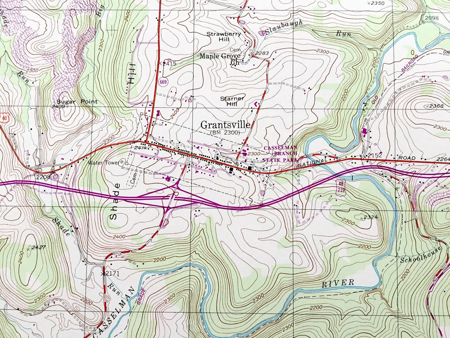
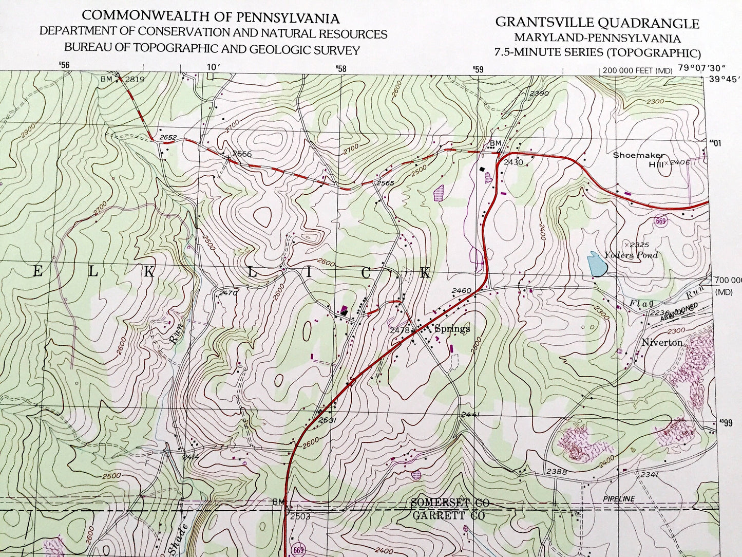
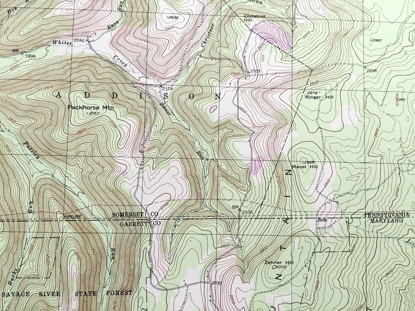
See what Maryland and Pennsylvania looked like about 30 years ago. Lots of intricate details and geological contours. Map even has little squares for every house that existed at the time. The USGS cartographers were very thorough back then!
Perfect for the historian, map-lover, the curious or just as a conversation starter. Wonderful and rare. Vintage maps such as these make great gifts.
Edition of 1994, printed 1999
Dimensions: 21 1/2" width x 27" height
----
Features
Cities & Towns: MARYLAND: Hi-Point, Keysers Ridge, Casselman, Bevansville, Jennings, Foxton.
PENNSYLVANIA: Addison, Elk Lick, Niverton, Springs.
Points of Interest: Savage River State Forest, Casselman Branch State Park, New Germany State Park, Packhorse Mountain, Ringer Hall, Maust Hill, Salt Block Mountain, Maynardier Ridge, Meadow Mountain, Yoders Pond, Casselman River, Lake Louise, North Branch, and many more hills, streams, ponds, houses, schools, railroads, churches and roads.
Condition: Very Good Vintage condition, commensurate with age. This map is in great condition for being over 20 years old. Has subtle edge-wear but will read as character when framed.
----
We will happily adjust shipping price for multiple purchases. Maps are rolled up and shipped in sturdy mailing tubes, never folded.
Couldn't load pickup availability
Share