My Store
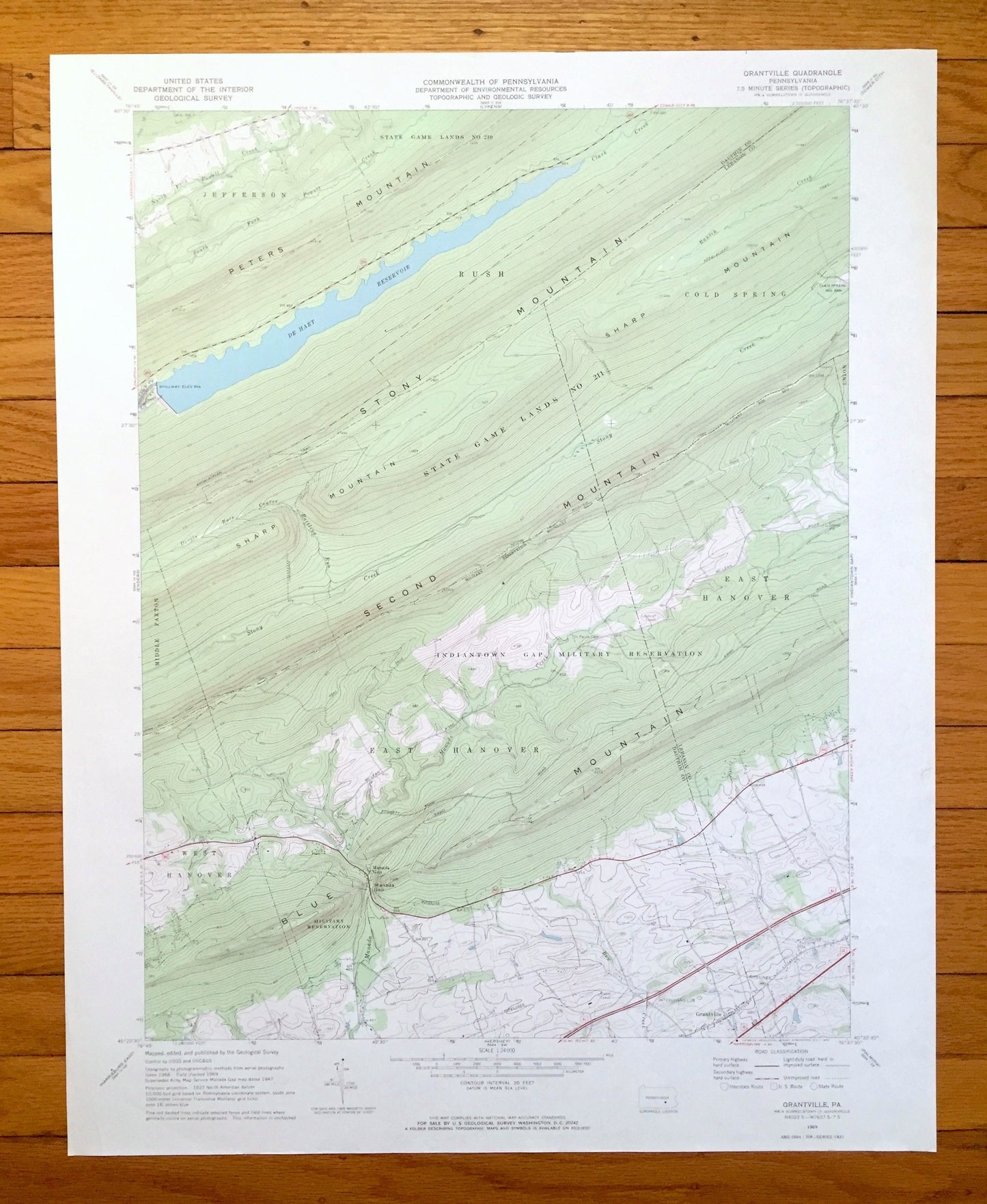
Antique Grantville, Pennsylvania 1969 US Geological Survey Topographic Map – Dauphin, Lebanon County, Jefferson, Rush, Cold Spring, PA
Antique Grantville, Pennsylvania 1969 US Geological Survey Topographic Map – Dauphin, Lebanon County, Jefferson, Rush, Cold Spring, PA
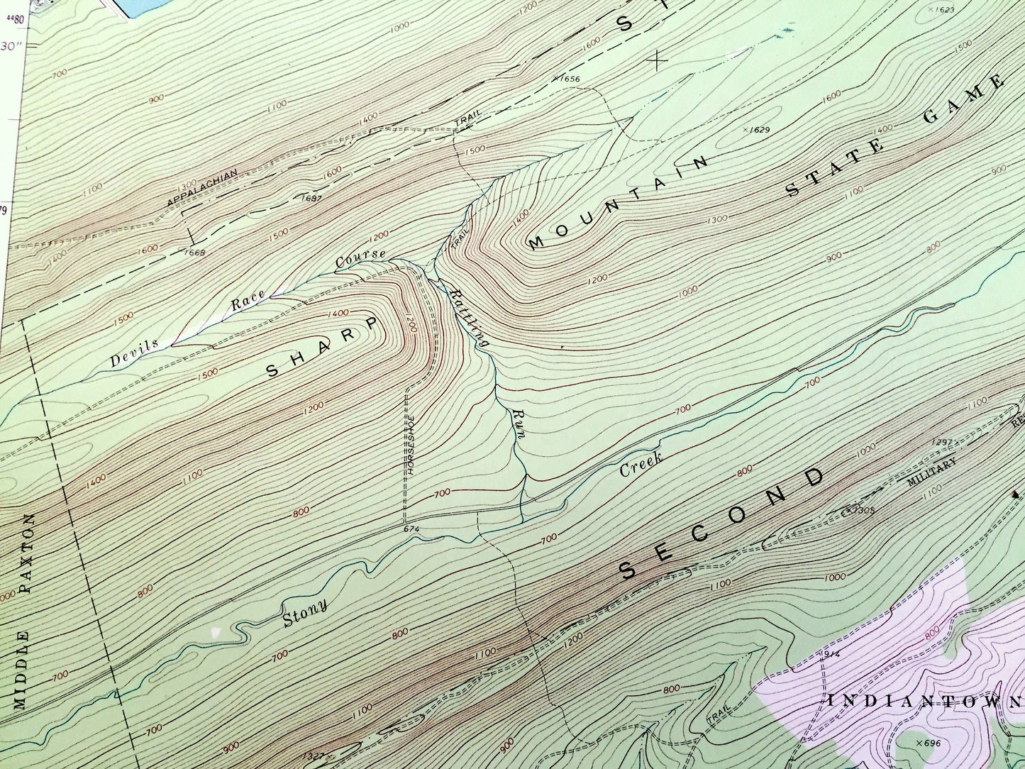
Beautiful, antique map of Grantville, Pennsylvania and surrounding Dauphin County and Lebanon County areas. This is an authentic 1969 edition, 1972 print from the U.S. Geological Survey and NOT a computer reproduction.
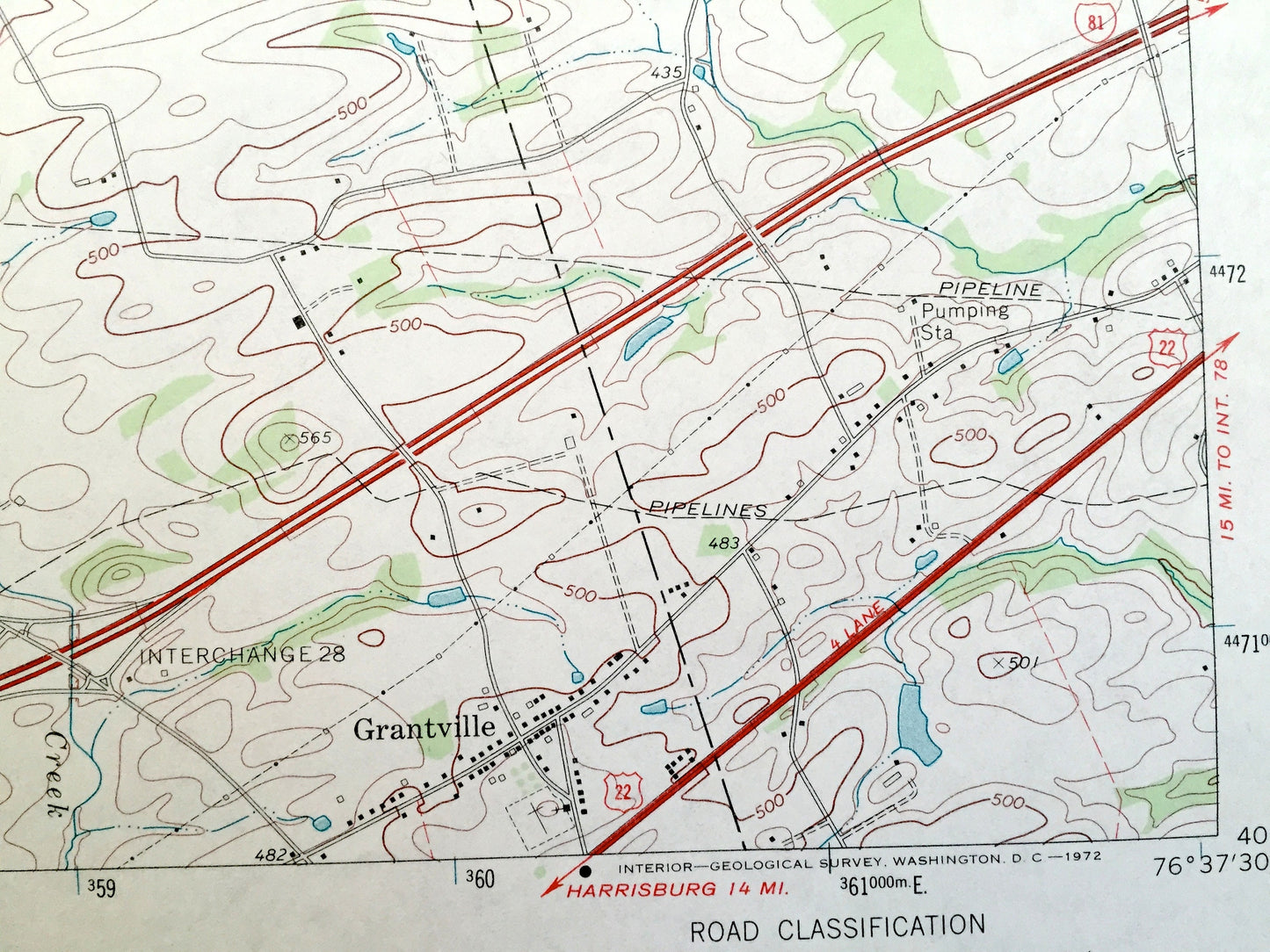
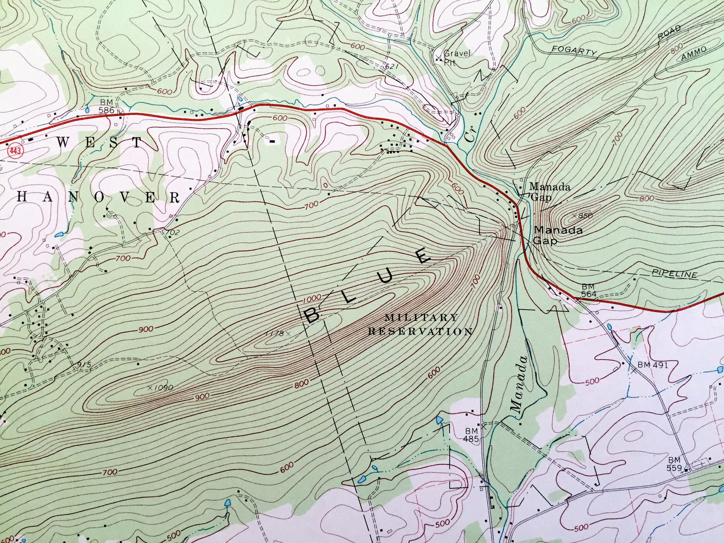
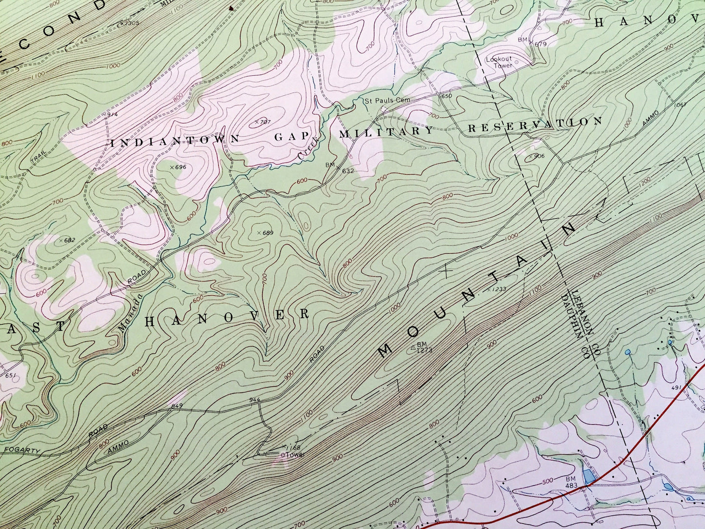
See what Pennsylvania looked like over 50 years ago. Lots of intricate details and geological contours. Map even has little squares for every house that existed at the time. The USGS cartographers were very thorough back then!
Perfect for the historian, map-lover, the curious or just as a conversation starter. Wonderful and rare. Vintage maps such as these make great gifts.
Edition of 1969, printed 1972
Dimensions: 21 1/2" width x 27" height
----
Features
Cities & Towns: Jefferson, Rush, Cold Spring, Middle Paxton, West Hanover, East Hanover, Manada Gap.
Points of Interest: Indiantown Gap Military Reservation, Cold Spring Military Reservation, State Game Lands (No. 210 and 211), Peters Mountain, Stony Mountain, Second Mountain, Blue Mountain, Manada Gap, Sharp Mountain, De Hart Reservoir, South Fork Powell Creek, Rattling Run, Stony Creek, Manada Creek, Rausch Creek, and many more hills, streams, ponds, houses, schools, railroads, churches and roads.
Condition: Very Good Vintage condition, commensurate with age. This map is in great shape for being over 50 years old. Has light edge-wear but all will read as character when framed.
----
We will happily adjust shipping price for multiple purchases. Maps are rolled up and shipped in sturdy mailing tubes, never folded.
Couldn't load pickup availability
Share