My Store
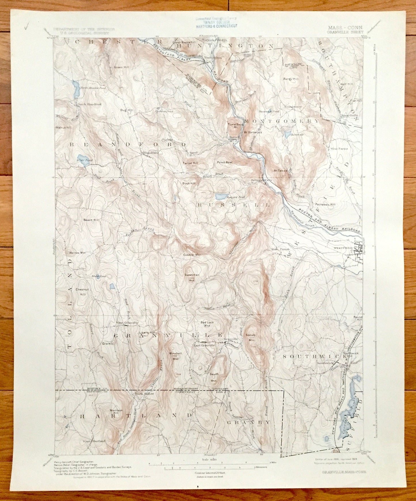
Antique Granville, Massachusetts 1895 US Geological Survey Topographic Map – Montgomery, Blanford, Westfield & Hartland, Granby, Connecticut
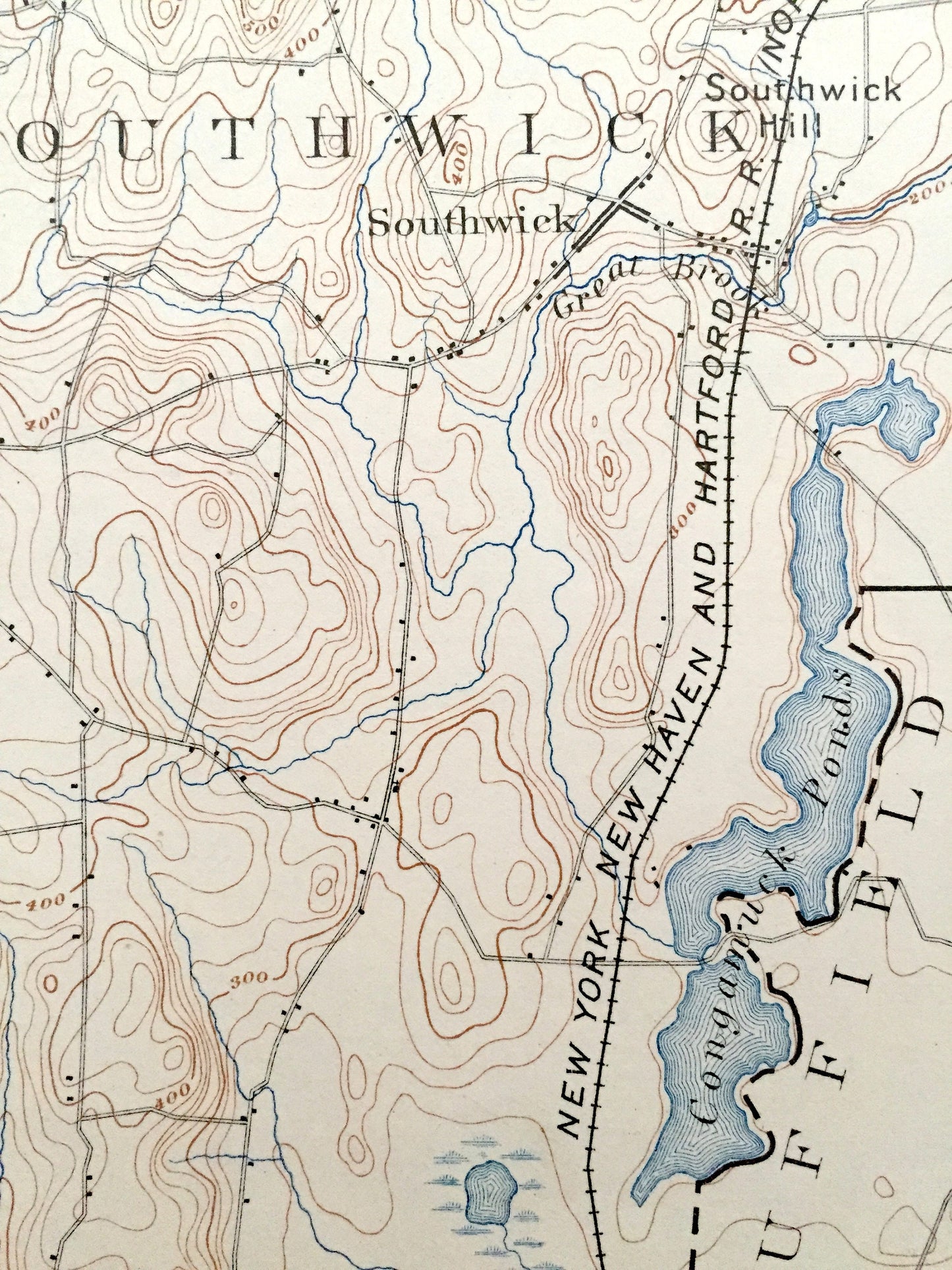
Antique Granville, Massachusetts 1895 US Geological Survey Topographic Map – Montgomery, Blanford, Westfield & Hartland, Granby, Connecticut
Beautiful, antique map of Granville, Blanford, Montgomery, Massachusetts including Hartland and Granby, Connecticut. This is an authentic 1895 edition, 1928 print from the U.S. Geological Survey and NOT a computer reproduction.
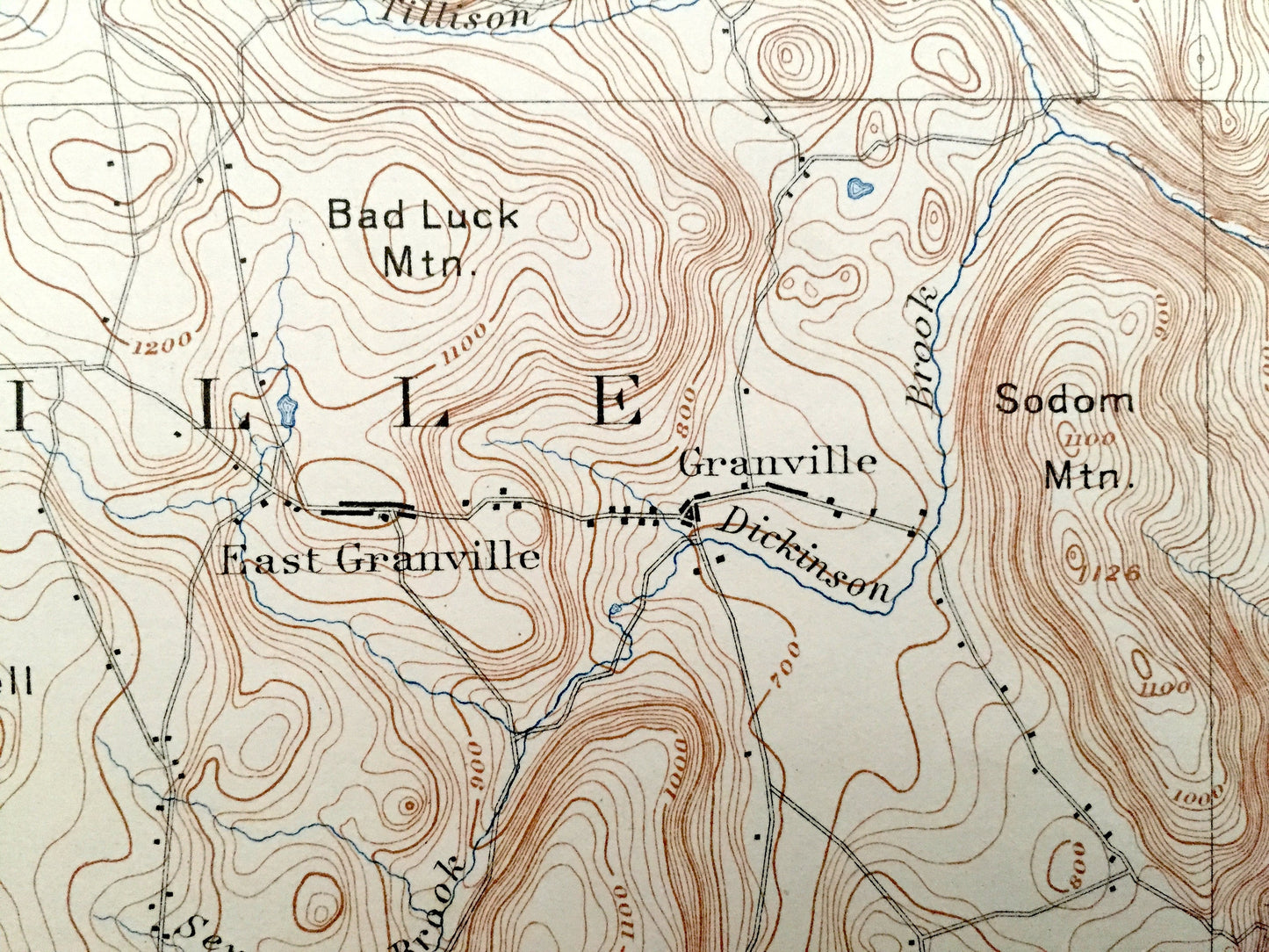
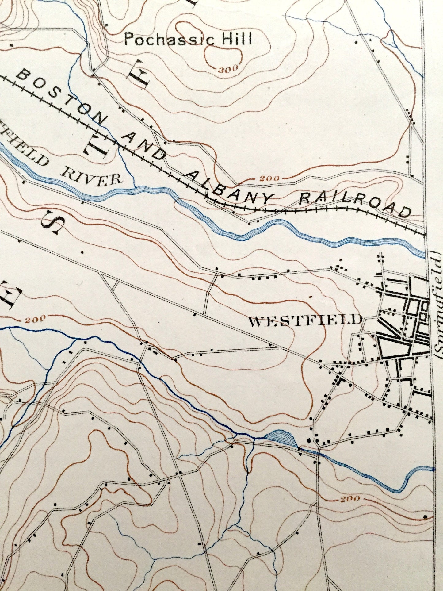
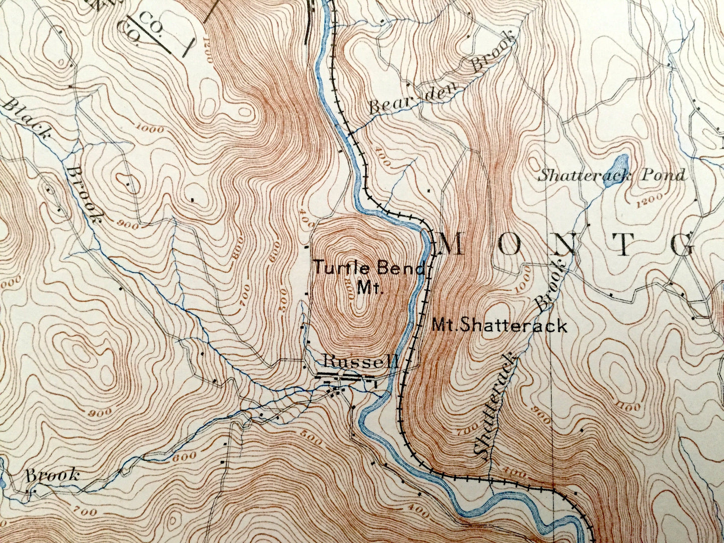
See what the Granville looked like one hundred and twenty one years ago. Lots of intricate details and geological contours. Map even has little squares for every house that existed at the time. The USGS cartographers were very thorough back then!
Perfect for the historian, map-lover, the curious or just as a conversation starter. Wonderful and rare. Vintage maps such as these make great gifts.
Edition of 1895, printed 1928
Dimensions: 16" width x 20" height
----
Features
Cities & Towns: Massachusetts: Chester, Huntington, Southampton, Montgomery, Blanford, West Farms, Russelville, North Blanford, Westfield, West Parish, Tolland, Granville, East Granville, South Wick, Salmon Falls, Russel.
Connecticut: Hartland, Granby, West Hartland, Suffield.
Points of Interest: Mt. Shatterack, Turtle Bend Mountain, Blair Pond, Boston and Albany Railroad, Sweetman Mountain, Bards Mountain, Bad Luck Mountain, New York New Haven and Hartford Railroad, Congamuck Ponds and more roads, houses, reservoirs, railroads, ponds, hills, streams, and mountains.
Condition: Very Good condition, commensurate with age. This map is in incredible shape for being almost a century old.
----
We will happily adjust shipping price for multiple purchases. Maps are rolled up and shipped in sturdy mailing tubes, never folded.
Couldn't load pickup availability
Share