My Store
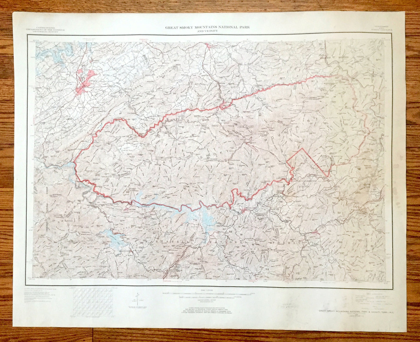
Antique Great Smoky Mountains National Park 1949 US Geological Survey Topographic Map – Tennessee, North Carolina, Maryville, Nantahala, TN
Antique Great Smoky Mountains National Park 1949 US Geological Survey Topographic Map – Tennessee, North Carolina, Maryville, Nantahala, TN
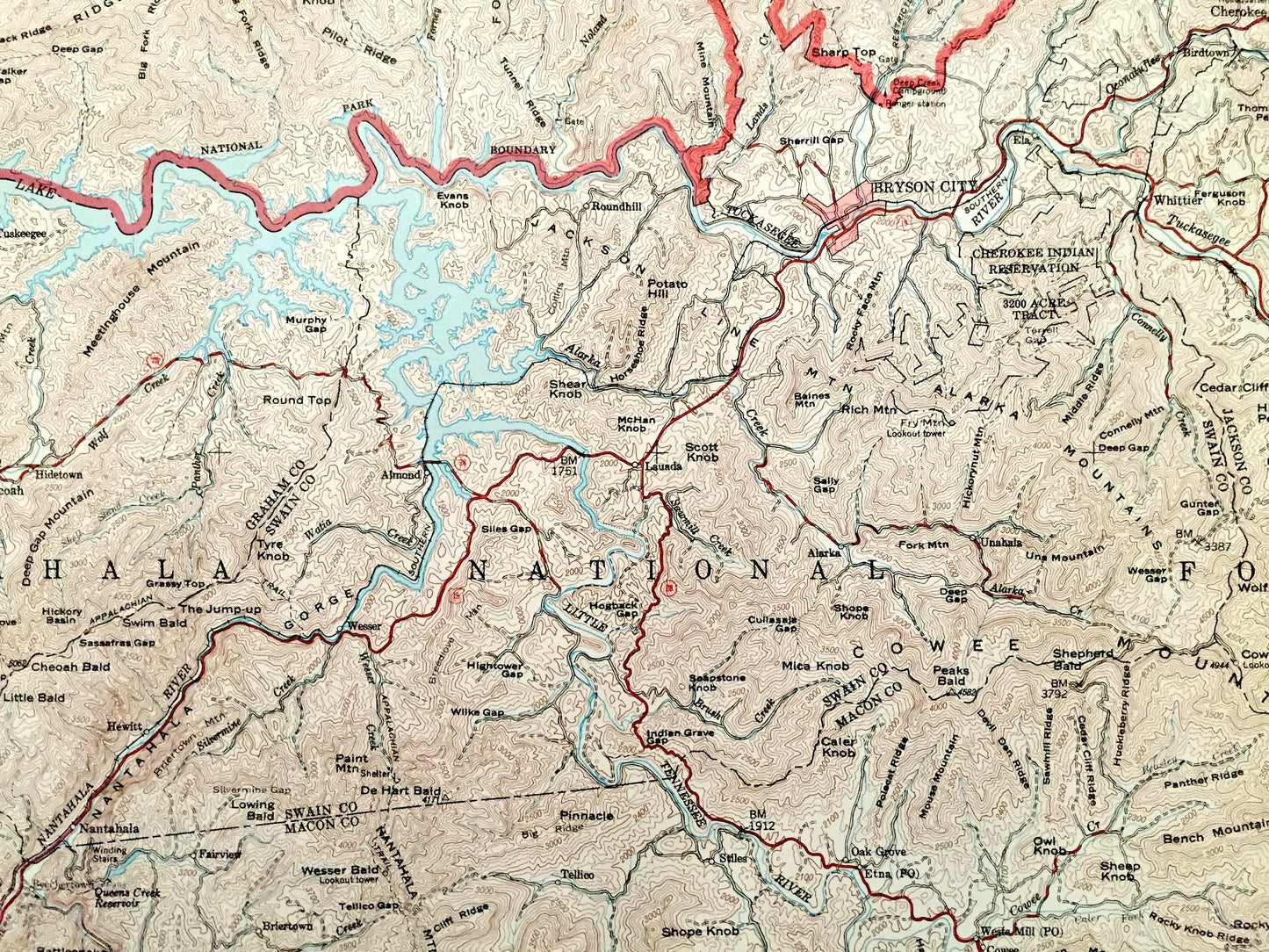
Beautiful, antique map of Great Smoky Mountains National Park, Tennessee and North Carolina and surrounding area. This is an authentic 1949 edition, 1972 print from the U.S. Geological Survey and NOT a computer reproduction.
See what Tennessee & North Carolina looked like over 70 years ago. Map is incredibly large and in the grand 1:250,000 scale. Lots of intricate details and geological contours. The USGS cartographers were very thorough back then!
Perfect for the historian, map-lover, the curious or just as a conversation starter. Wonderful and rare. Vintage maps such as these make great gifts.
Edition of 1949, printed 1972
Dimensions: 36" width x 29" height
----
Features
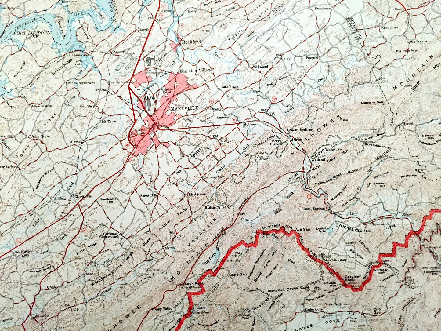
Cities & Towns: Tennessee - Sevierville, Gatlinburg, Maryville, Alcoa, Garland, Rockford, Binfield, Cowan Springs, Hartford, Laurel, Mount Collins, Harrisburg, Clover Hill, Wellsville, Blockhouse, Union Grove, Providence, Knob Creek.
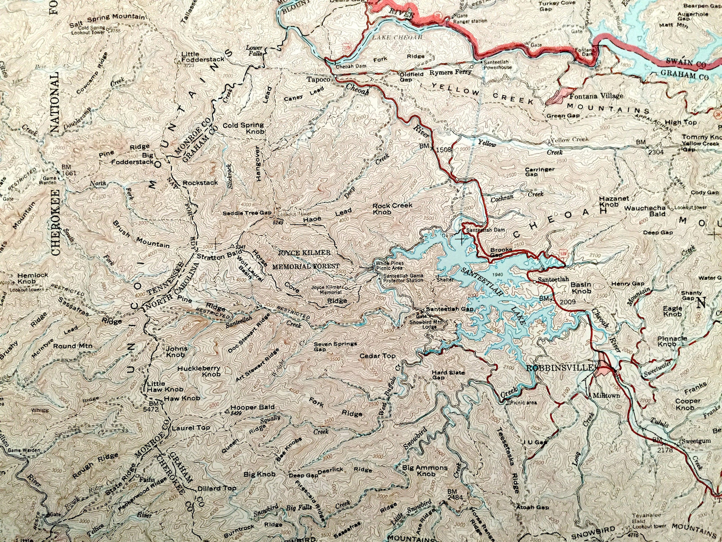
North Carolina - Nantahala, Robbinsville, Fontana Village, Hewitt, Fairview, Stecoah, Hidetown, Tuskeegee, Bryson City, Round Hill, Qualla Tract, Waynesville, Hazelwood, Saunook, Quinland, Sylva, Dillsboro, Oak Grove, Whittier.
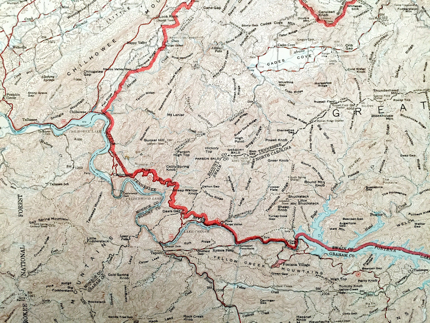
Points of Interest: Tennessee - Great Smoky Mountains, Sugarland Mountains, Webb Mountain, Chilhowee Mountain, Cherokee National Forest, Tennessee River, Fort Loudoun Lake, Mille Cove, Tuckaleechee Cove, Slate Knob, Butterfly Gap and lots more hills, mountains, lakes, islands, bays, highways, railroads.
North Carolina - Great Smokey Mountains, Cheoah Mountains, Snowbird Mountains, Alarka Mountains, Nantahala National Forest, Pisgah National Forest, Cherokee National Forest, Nantahala River, Tuckasegee River, Santeetlah Lake, Cherokee Indian Reservation and lots more hills, mountains, lakes, islands, bays, highways, railroads.
Condition: Good Vintage condition, commensurate with age. This map is in great shape for being 50 years old. Has some edge-wear, toning and staining in right margin (not as prominent as it appears in the photo), but this will all add to its authentic, vintage character when framed.
----
We will happily adjust shipping price for multiple purchases. Maps are rolled up and shipped in sturdy mailing tubes, never folded.
Couldn't load pickup availability
Share