My Store
Antique Greene County, New York 1941 Historical Atlas Map – Catskill, Athens, Coxsackie, Cairo, Greenville, Prattsville, West Kill Hudson NY
Antique Greene County, New York 1941 Historical Atlas Map – Catskill, Athens, Coxsackie, Cairo, Greenville, Prattsville, West Kill Hudson NY
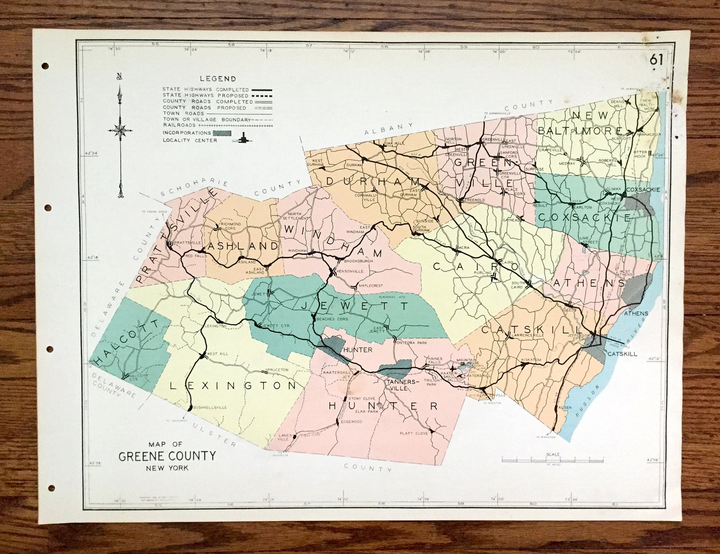
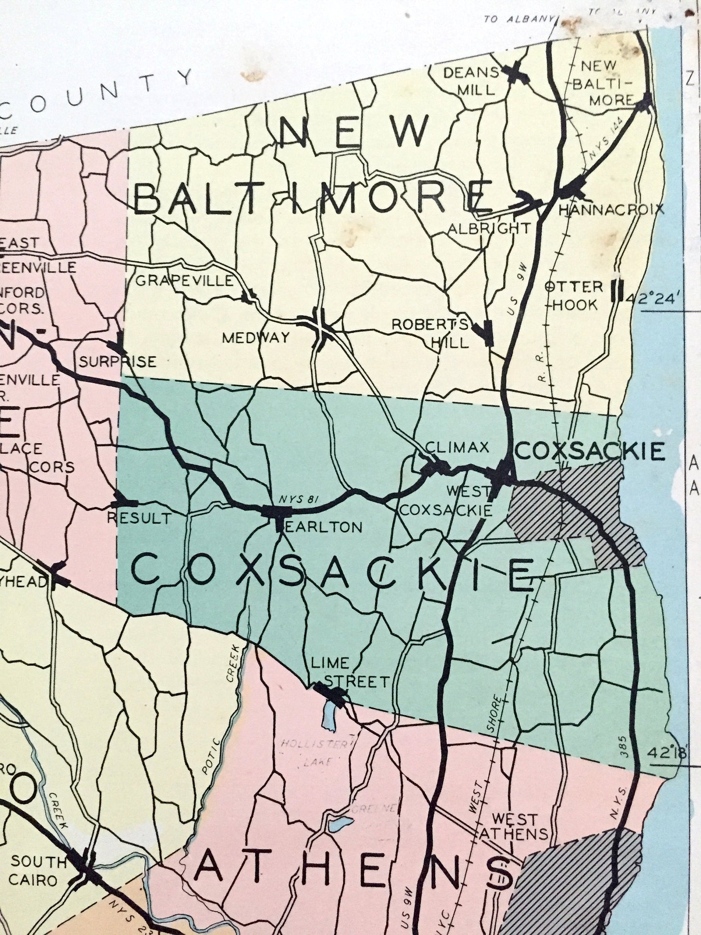
Beautiful, antique map of Greene County, New York, including Catskill, Athens, Coxsackie, Cairo, Greenville, Prattsville & West Kill. This is an authentic map taken from the rare "Historical Atlas of New York State" by William P. Munger, published by Frank E. Richards Co. in 1941, and is NOT a computer reproduction.
See what Greene County looked like more than 80 years ago. Lots of charming details and contours, major cities, towns and roads, as well as geographical points of interest. It is a large, colorful print and will be a showpiece wherever it is presented. Reverse side has an informative history of the county.
Perfect for the historian, map-lover, the curious or just as a conversation starter. Wonderful and rare. Vintage maps such as these make great gifts.
Edition of 1941, printed 1941
Dimensions: 22" width x 16 1/2" height
----
Features
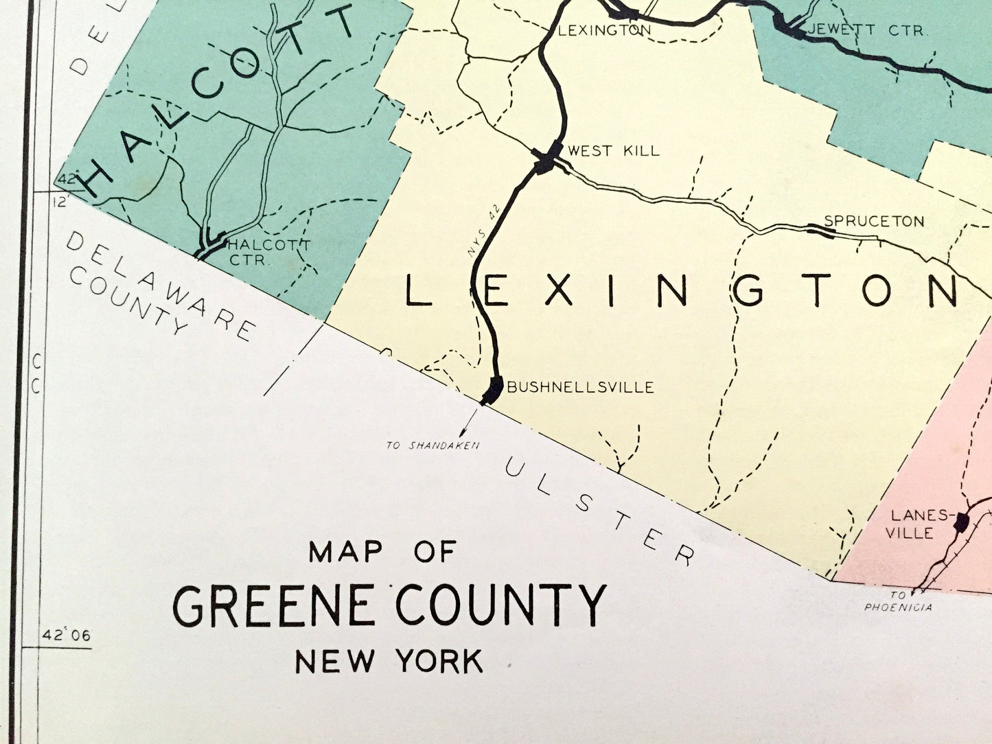
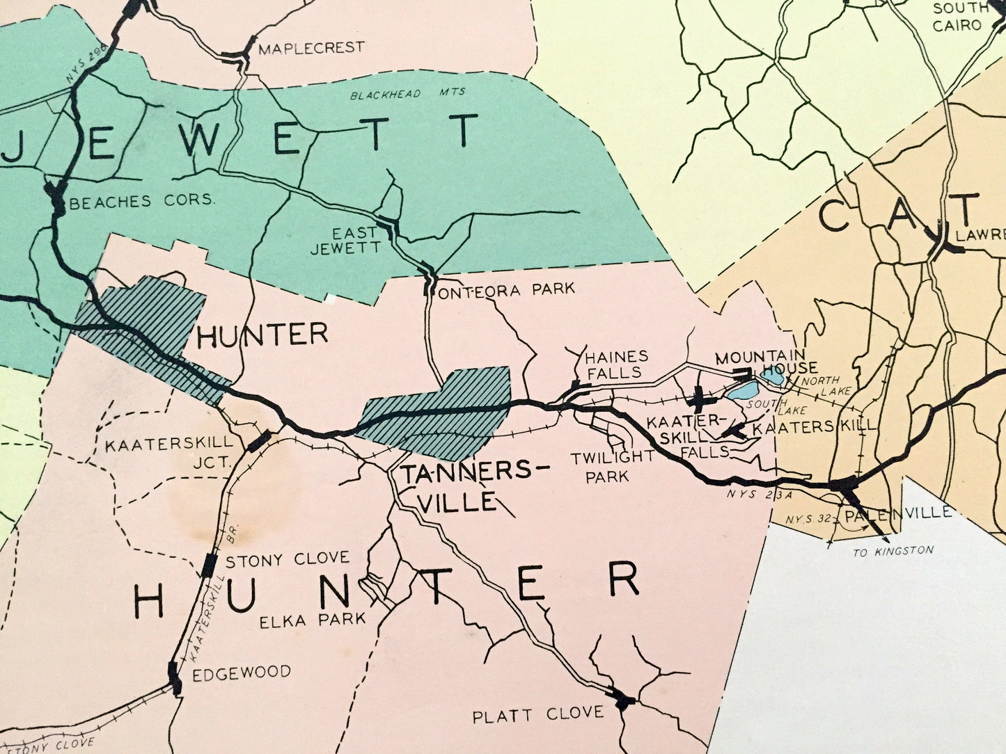
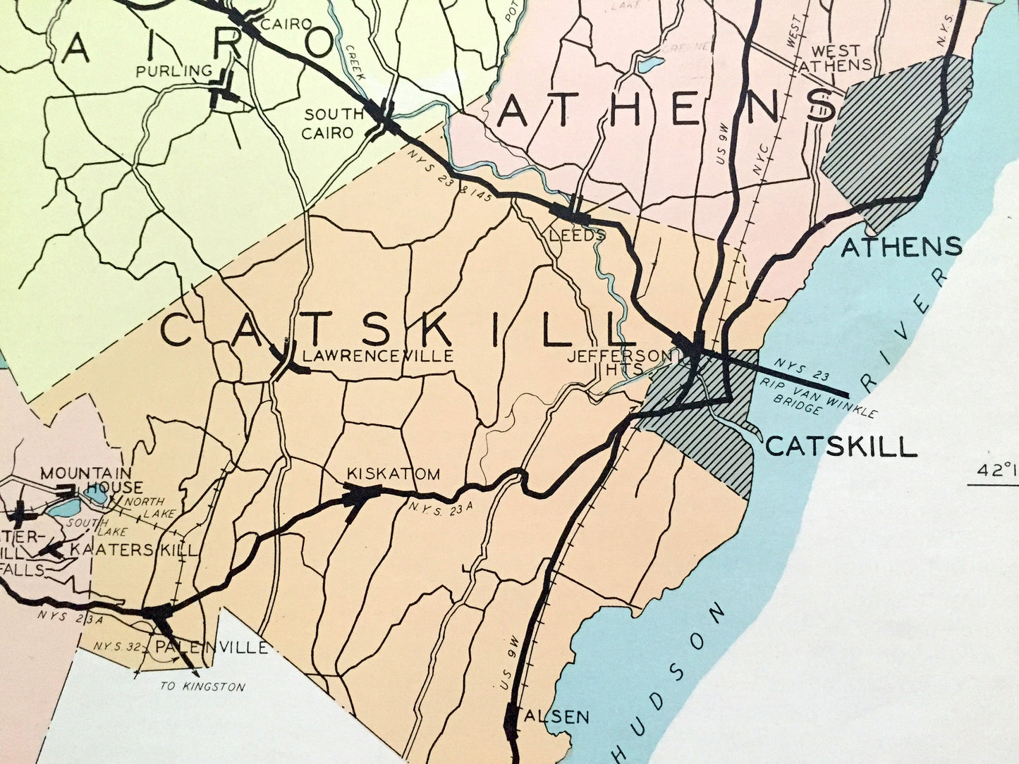
Cities & Towns: Prattsville, Ashland, Windham, Durham, Greenville, New Baltimore, Halcott, Lexington, Jewett, Cairo, Athens, Coxsackie, Hunter, Catskill, Red Falls, Oak Hill, Centerville, Freehold, Norton Hall, Grapeville, Medway, Bushnellville, Spruceton, Beaches Corner, Big Hollow, Hensonville, Limestreet, Twilight Park, Kaaterskill, Stony Clove, Lanesville, Hunter, Onterora Park, Haines Falls, Pelenville, Mountain House, Lawrenceville, Belfast Mills, Kiskatom, Great Falls, Smith Landing, Oak Hill Landing, more.
Points of Interest: Hudson River, Rogers Island, Hotaling Island, Catskill Creek, Indian Ridge, Shingle River, Little West Kill, Bushnellville Creek, Kaaterskill Creek and many more ponds, lakes, creeks, rivers, roads, highways, railroads, farms, school houses and elevations.
----
Condition: Good Vintage condition, commensurate with age. This map is in great shape for being over 80 years old. Has light edge-wear, toning, small area of stains in upper right corner, and holes in margin where the print was removed from atlas, but this will all add to vintage character when framed.
(Images of atlas cover and frontispiece for information only and not included.)
----
We will happily adjust shipping price for multiple purchases. Maps are rolled up and shipped in sturdy mailing tubes, never folded.
Couldn't load pickup availability
Share