My Store
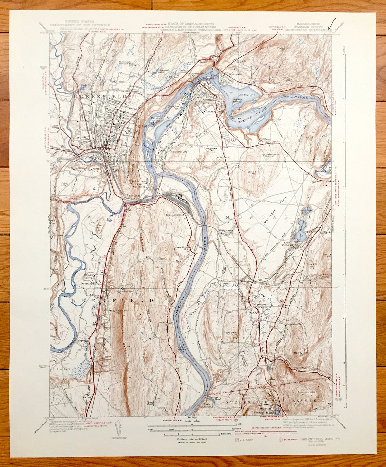
Antique Greenfield, Massachusetts 1941 US Geological Survey Topographic Map – Montague, Turners Falls, Deerfield, Sunderland Gill Wapping MA
Antique Greenfield, Massachusetts 1941 US Geological Survey Topographic Map – Montague, Turners Falls, Deerfield, Sunderland Gill Wapping MA
Beautiful, antique map of Greenfield, Montague & Deerfield Massachusetts. This is an authentic edition of 1941 print from the U.S. Geological Survey and NOT a computer reproduction.
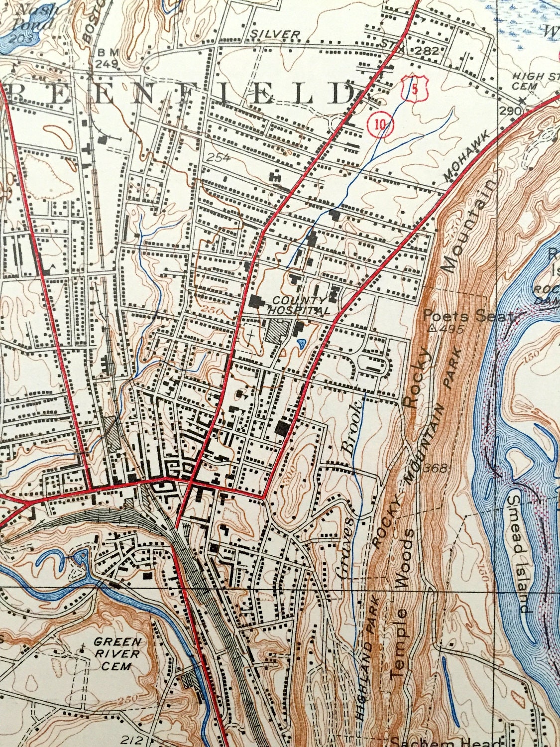
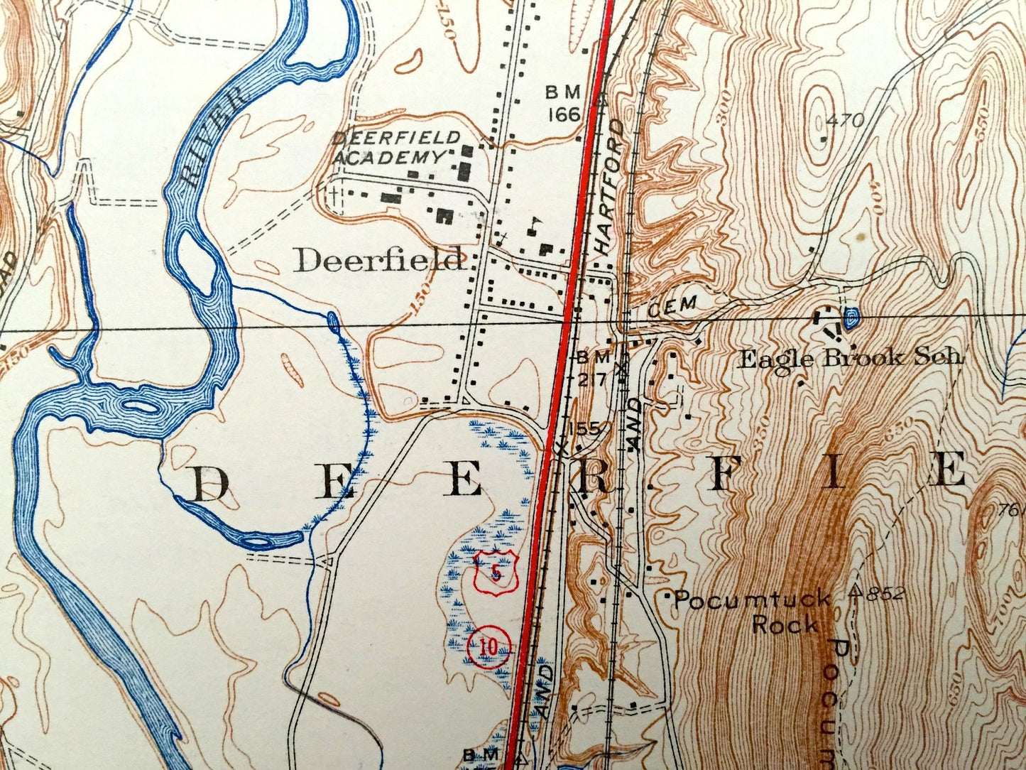
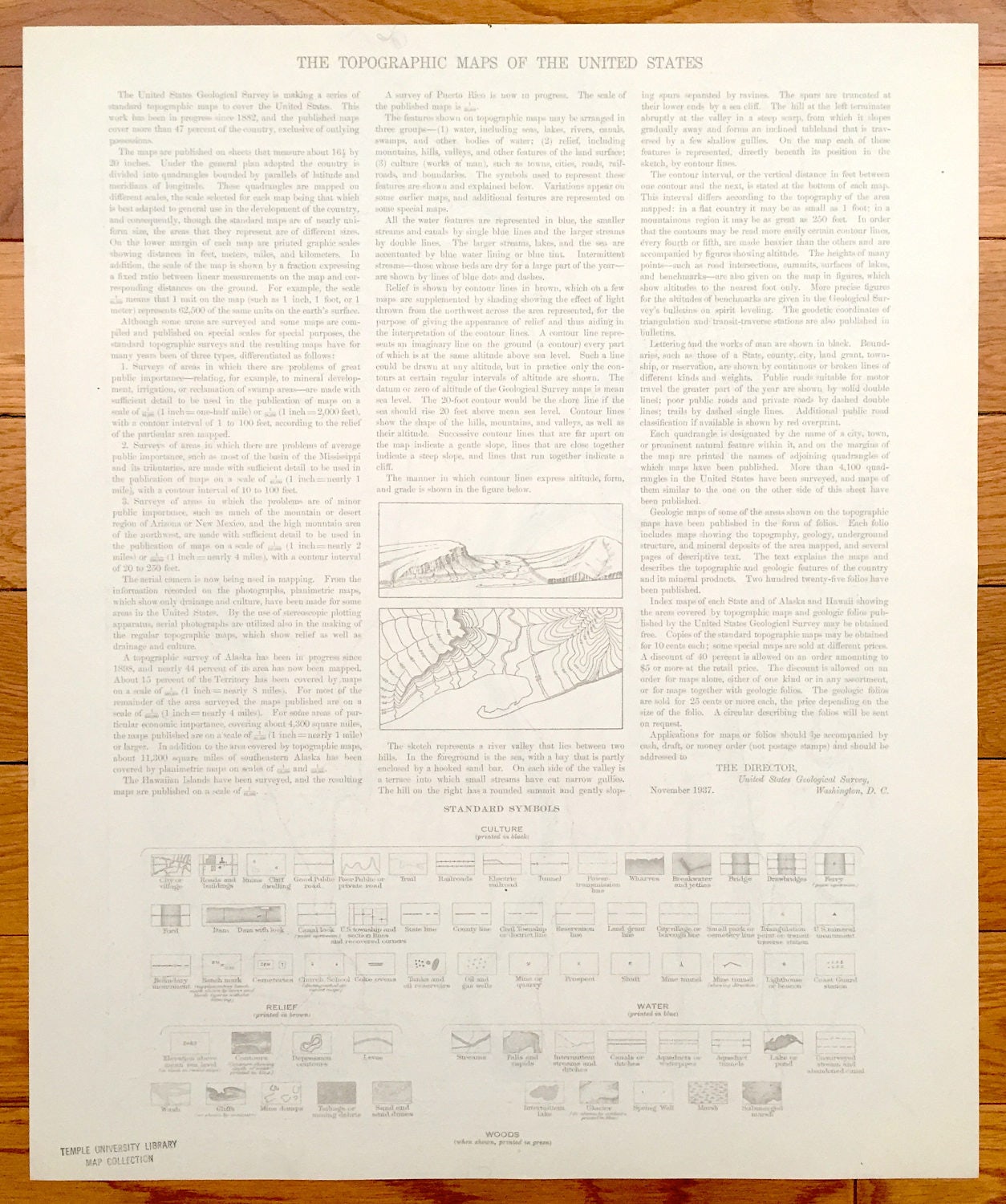
See what the town of Greenfield looked like 80 years ago. Lots of intricate details and geological contours. Map even has little squares for every house that existed at the time. The USGS cartographers were very thorough back then! On the back is a description of topographic symbols and map guide.
Perfect for the historian, map-lover, the curious or just as a conversation starter. Wonderful and rare. Vintage maps such as these make great gifts.
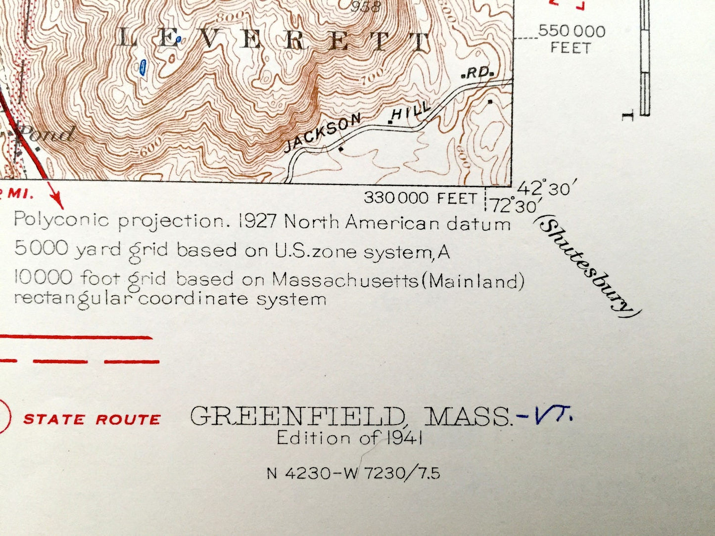
Edition of 1941, printed 1941
Dimensions: 16 1/2" width x 20" height
----
Features
Cities & Towns: Greenfield, Gill, Riverside, Turners Falls, Montague City, Montague, East Greenfield, East Deerfield, Wapping, North Sunderland, Sunderland, Leverett, Lake Pleasant.
Points of Interest: Deerfield Academy, Turner Falls Airport, Stoneleigh Prospect Hill School, Boston Maine Railroad, Connecticut River, Canada Hill School, Mohawk Trail, Temple Woods, Rocky Mountain, Turners Falls Reservoir, Mohawk Meadow Golf Course, Eagle Brook School, Fish Hatchery, Millers Falls, Central Vermont Railroad, Mt. Toby State Forest, Pocumtuck Range, Deerfield River and more roads, houses, ponds, hills, streams and mountains.
Condition: Very Good Vintage condition, commensurate with age. This map is in great shape for being almost 80 years old.
----
We will happily adjust shipping price for multiple purchases. Maps are rolled up and shipped in sturdy mailing tubes, never folded.
Couldn't load pickup availability
Share