My Store
Antique Greenville, Maine 1951 US Geological Survey Topographic Map – Moosehead Lake, Shirley, Elliottsville, Blanchard, Monson, Piscataquis
Antique Greenville, Maine 1951 US Geological Survey Topographic Map – Moosehead Lake, Shirley, Elliottsville, Blanchard, Monson, Piscataquis
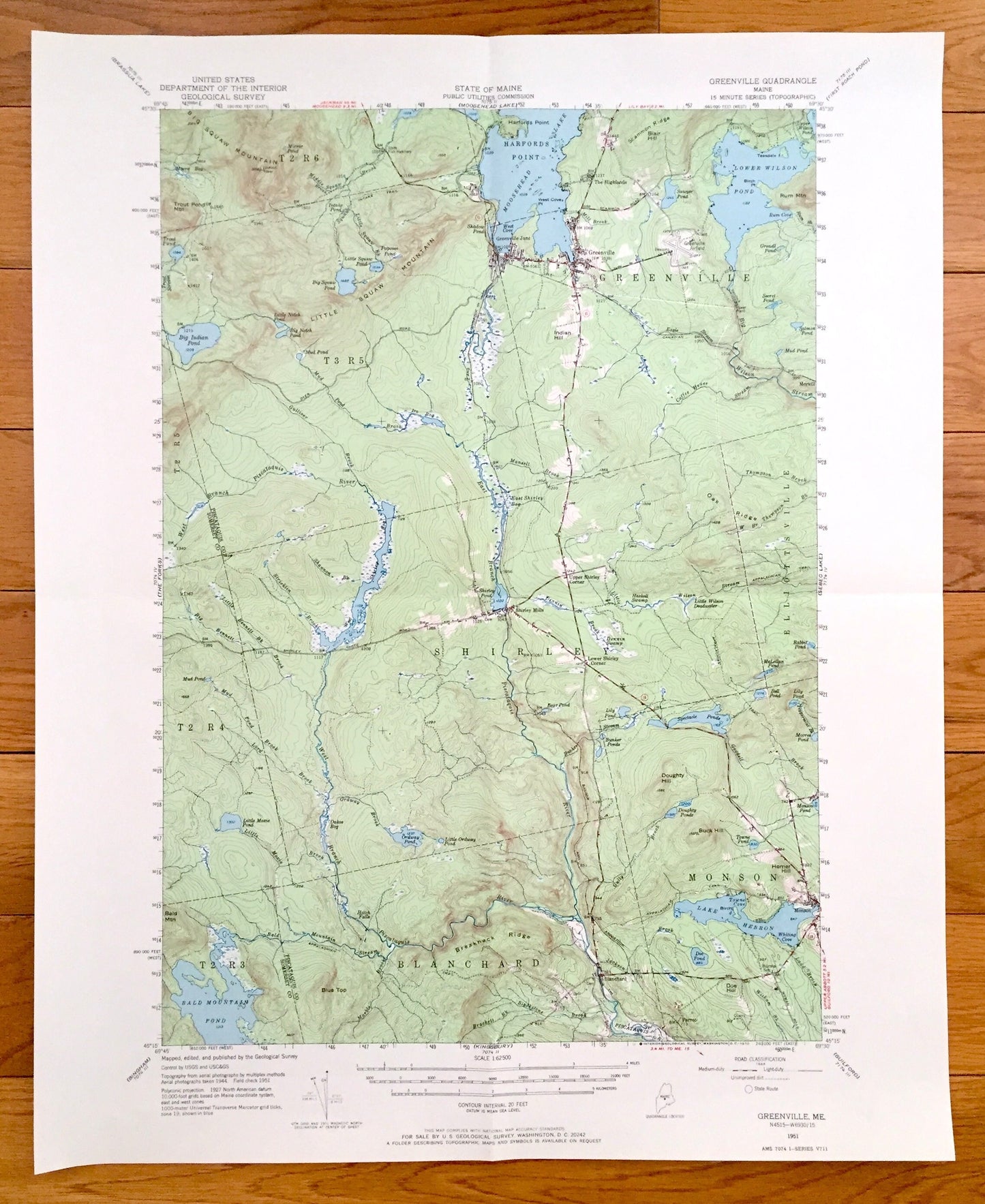
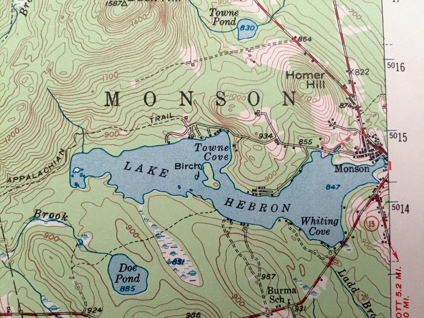
Beautiful, antique map of Greenville, Maine, Moosehead Lake and surrounding Piscataquis & Somerset Counties. This is an authentic 1951 edition, 1970 print from the U.S. Geological Survey and NOT a computer reproduction.
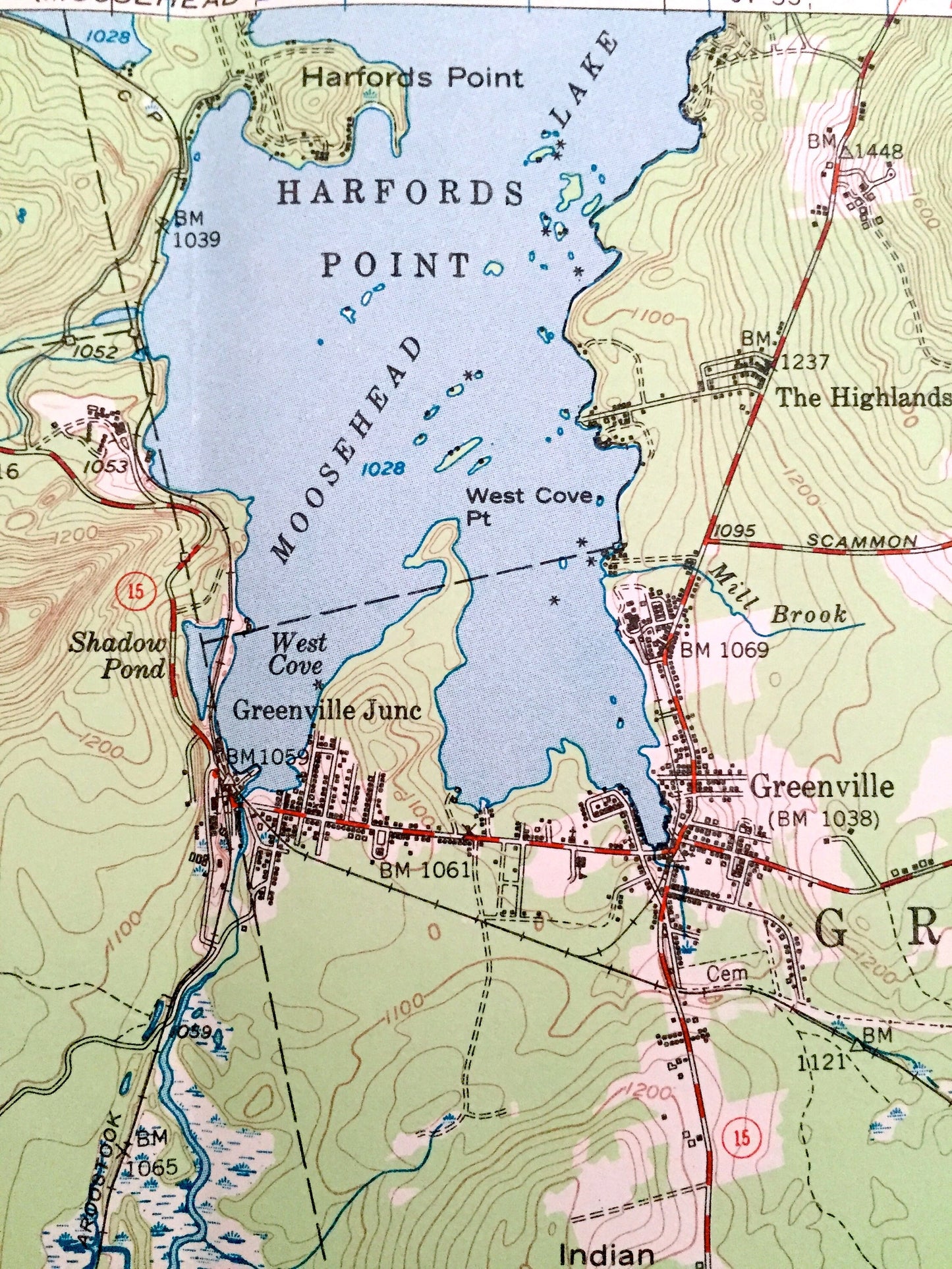
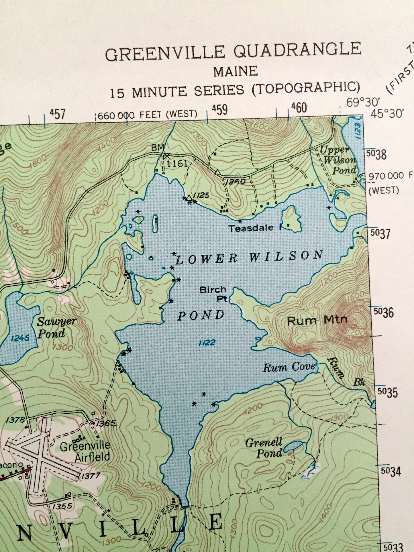
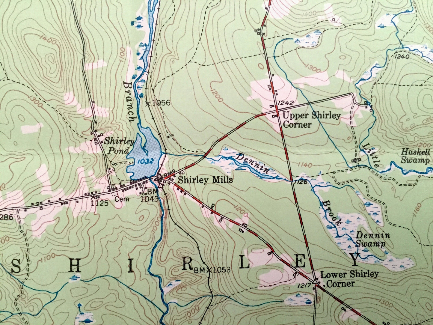
See what Maine looked like almost 70 years ago. Lots of intricate details and geological contours. Map even has little squares for every house that existed at the time. The USGS cartographers were very thorough back then!
Perfect for the historian, map-lover, the curious or just as a conversation starter. Wonderful and rare. Vintage maps such as these make great gifts.
Edition of 1951, printed 1970
Dimensions: 17" width x 21" height
----
Features
Cities & Towns: Greenville, Shirley, Elliottsville, Blanchard, Monson, Greenville Junction, The Highlands, Shirley Mills, Parrot, Morkill, T2 R6, T2 R5, T3 R5, T2 R4, T2 R3.
Points of Interest: Piscataquis County, Somerset County, Moosehead Lake, Lower Wilson Pond, Sawyer Pond, Big Indian Pond, Big Squaw Pond, Papoose Pond, Little Squaw Pond, West Shirley Bog, Bald Mountain Pond, Little Moxie Pond, Lake Hebron, Spectacle Ponds, Ira Bog, Piscataquis River, Bald Mountain Stream, Big Wilson Stream, Coffee House Stream, Harfords Point, West Cove, Big Squaw Mountain, Little Squaw Mountain, Blair Hill, Doughty Hill, Buck Hill, Breakneck Ridge, Oak Ridge, Rum Mountain, Canadian Pacific Railroad, and lots more hills, streams, ponds, marshes, houses, islands, coves and roads.
Condition: Very Good condition, commensurate with age. This map is in incredible shape for being almost 50 years old.
----
We will happily adjust shipping price for multiple purchases. Maps are rolled up and shipped in sturdy mailing tubes, never folded.
Couldn't load pickup availability
Share