My Store
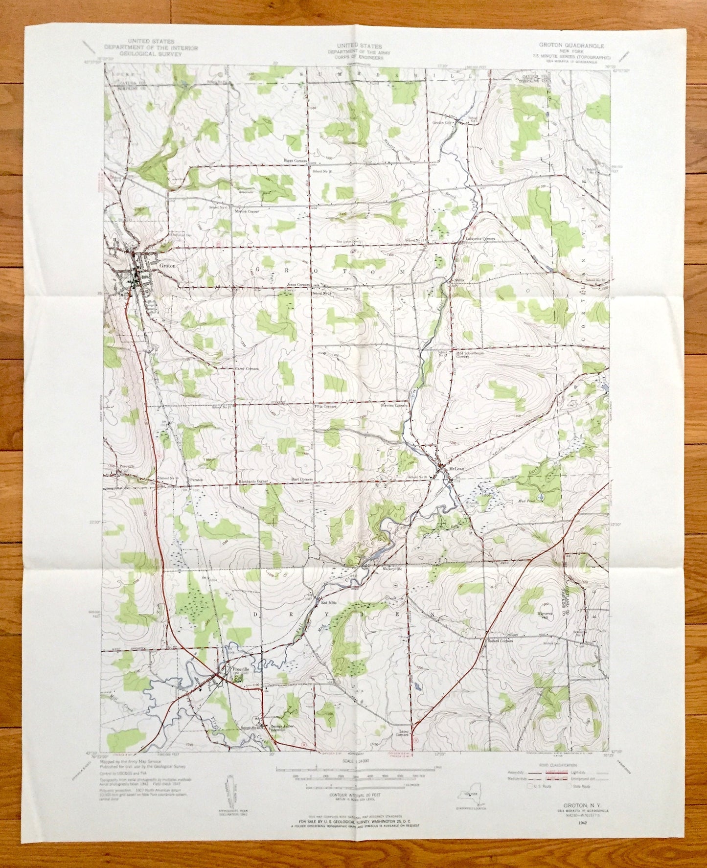
Antique Groton, New York 1942 US Geological Survey Topographic Map – Tompkins County, Locke, Dryden, Red Mills Virgil Freeville Peruville NY
Antique Groton, New York 1942 US Geological Survey Topographic Map – Tompkins County, Locke, Dryden, Red Mills Virgil Freeville Peruville NY
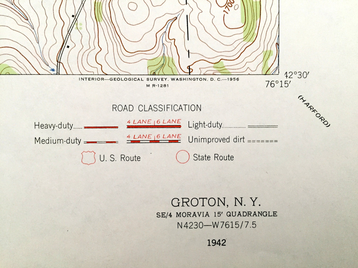
Beautiful, antique map of Groton, New York and surrounding Tompkins, Cortland, and Cayuga County area. This is an authentic 1942 edition, 1956 print from the U.S. Geological Survey and NOT a computer reproduction.
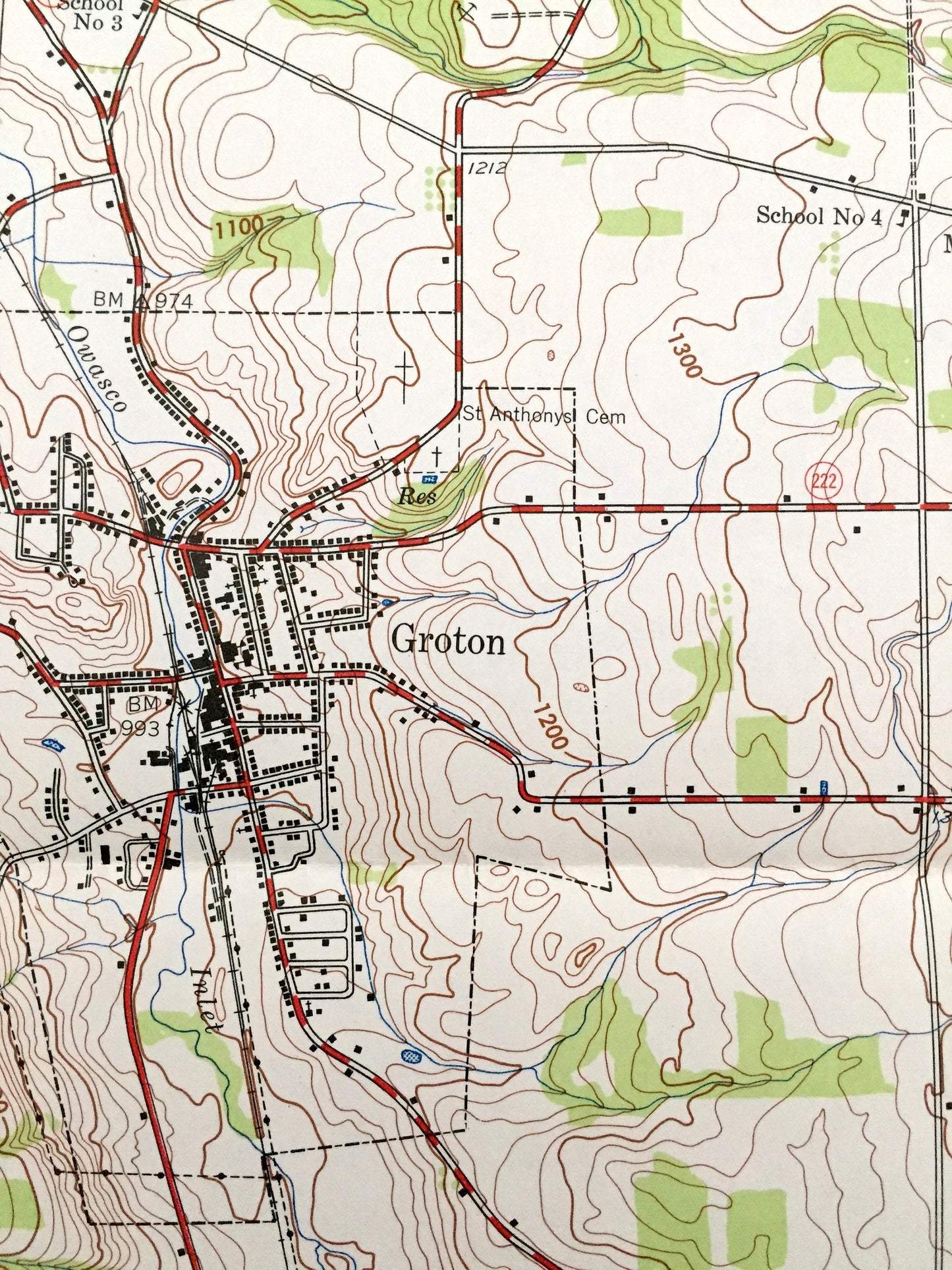
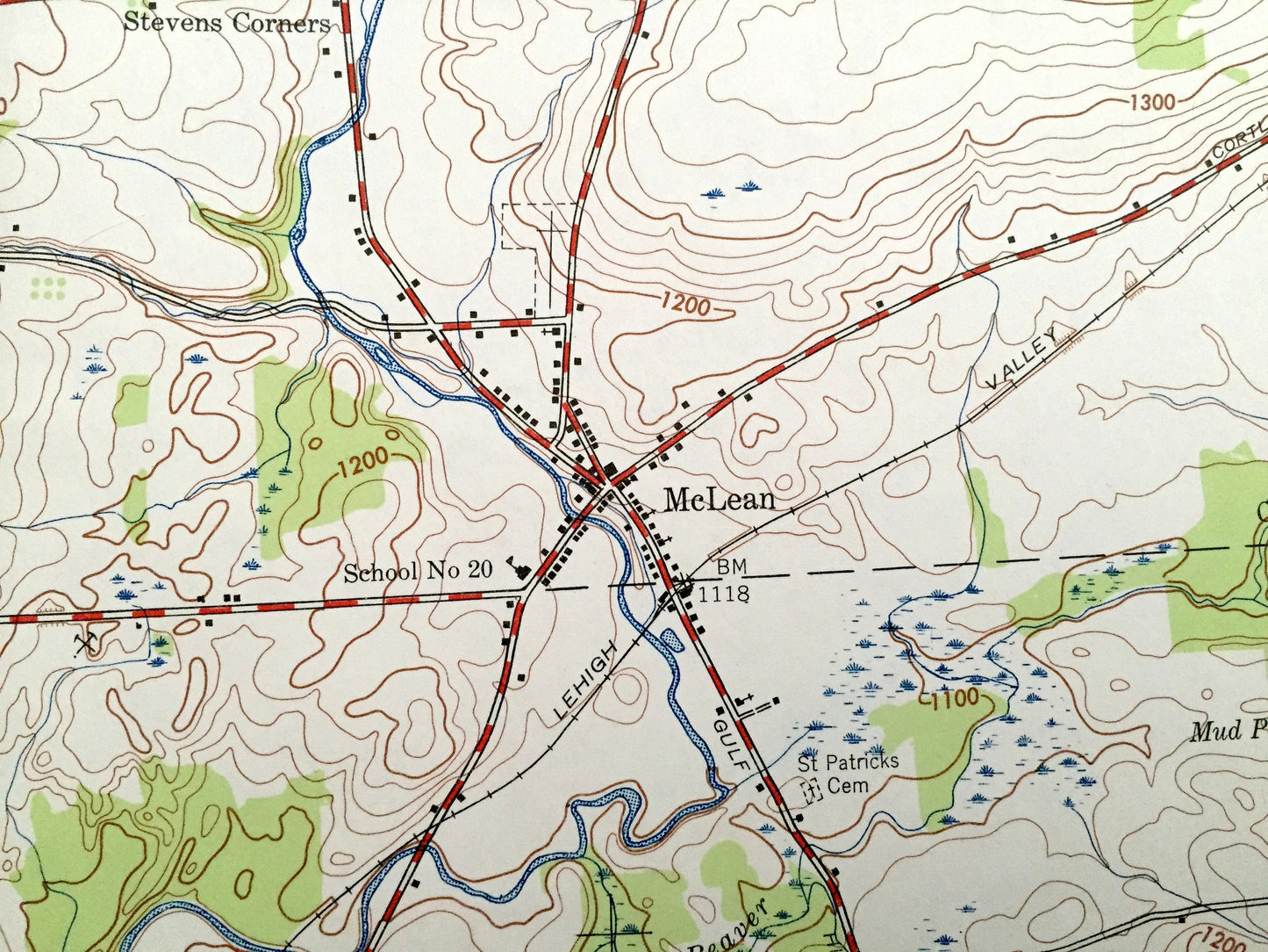
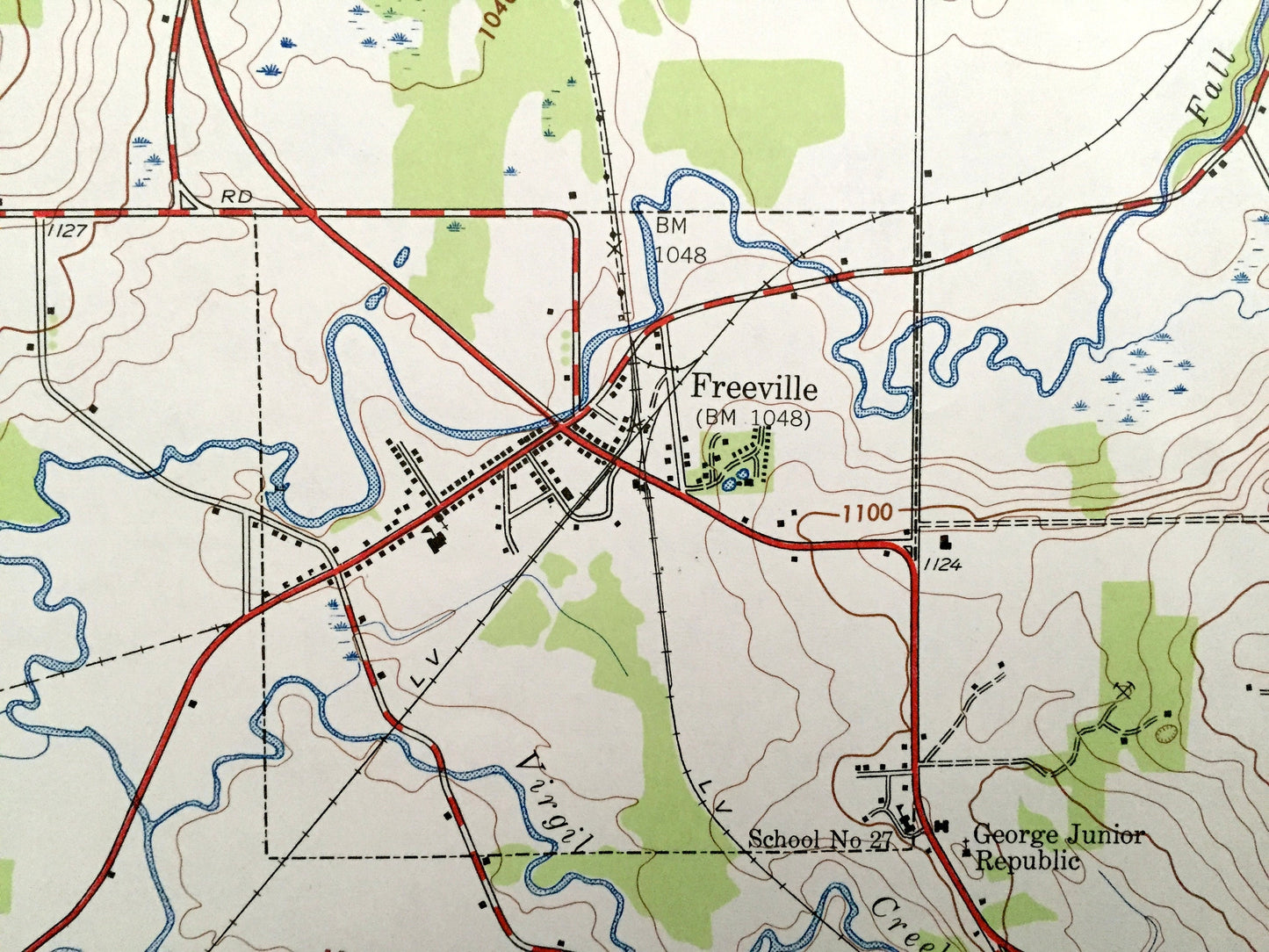
See what New York looked like over 75 years ago. Lots of intricate details and geological contours. Map even has little squares for every house that existed at the time. The USGS cartographers were very thorough back then!
Perfect for the historian, map-lover, the curious or just as a conversation starter. Wonderful and rare. Vintage maps such as these make great gifts.
Edition of 1942, printed 1956
Dimensions: 22" width x 27" height
----
Features
Cities & Towns: Groton, Locke, Summer Hill, Riggs Corners, Groton City, Morton Corner, Lafayette Corners, Cortlandville, Nubia, Jones Corners, Carey Corners, Peruville, Peruton, Malloryville, Red Mills, Dryden, Freeville, Lacey Corners, Ballard Corners, Virgil.
Points of Interest: Fall Creek, Lehigh Valley Railroad, Webster Brook, Mud Pond, Simms Hill, Virgil Creek, Mud Creek, and many more hills, streams, ponds, houses, schools, churches and roads.
Condition: Good Vintage condition, commensurate with age. This map is in great shape for being over 60 years old. Has some fold marks, but these will flatten easily and all will read as vintage character when framed.
----
We will happily adjust shipping price for multiple purchases. Maps are rolled up and shipped in sturdy mailing tubes, never folded.
Couldn't load pickup availability
Share