My Store
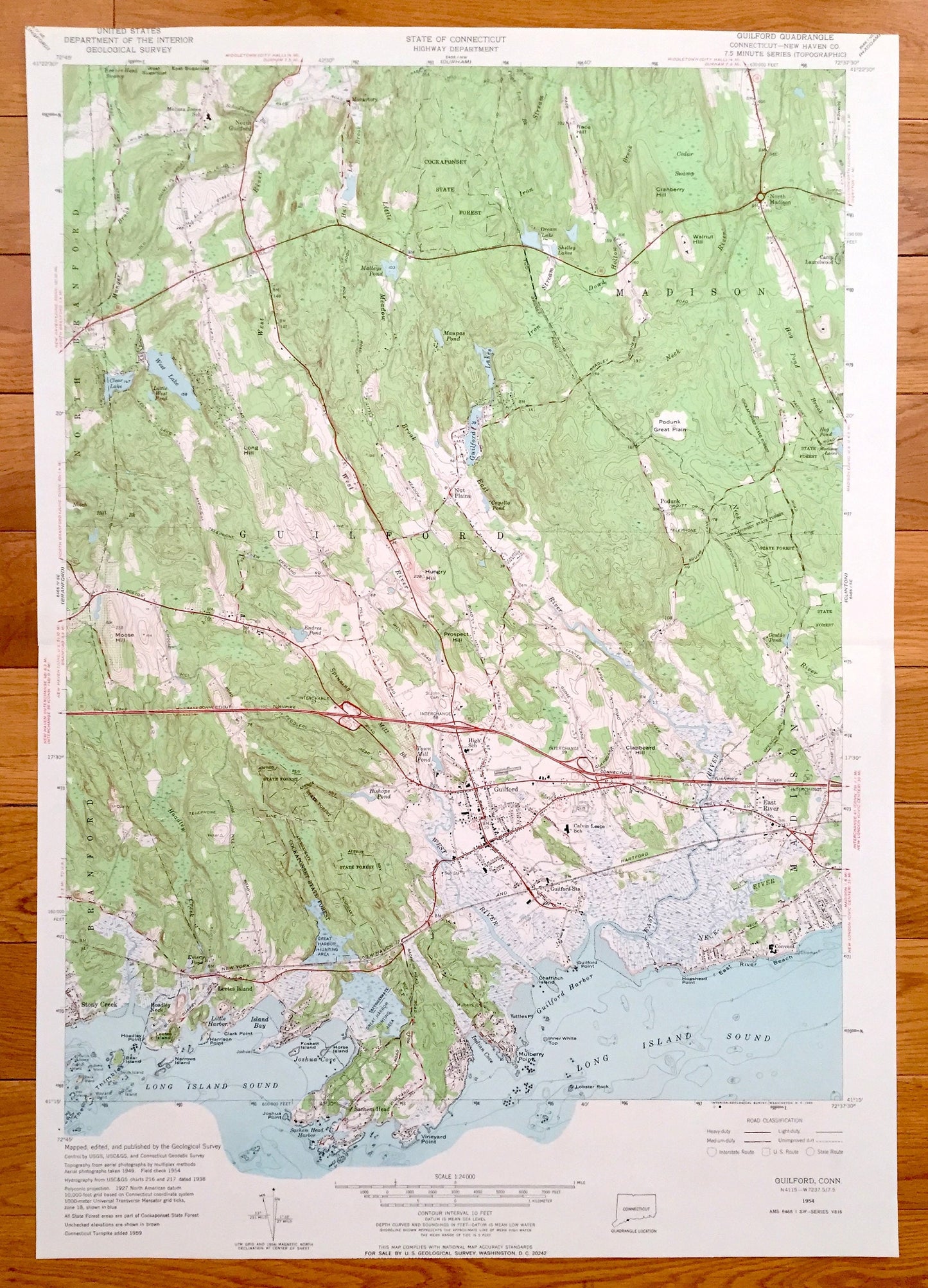
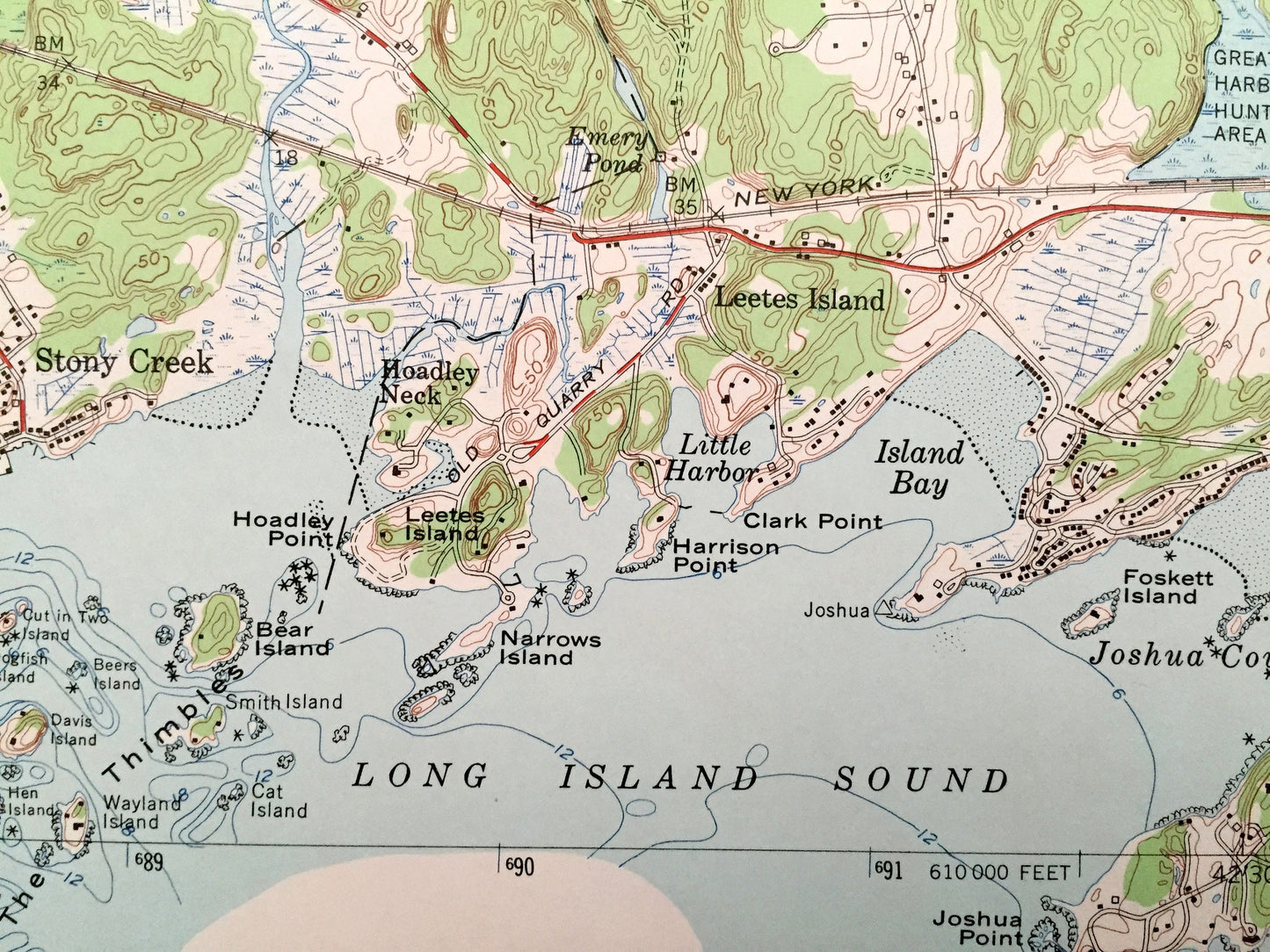
Antique Guilford, Connecticut 1954 US Geological Survey Topographic Map – Madison, Branford, North Branford, Stony Creek New Haven County CT
Antique Guilford, Connecticut 1954 US Geological Survey Topographic Map – Madison, Branford, North Branford, Stony Creek New Haven County CT
Beautiful, antique map of the Connecticut Coast on Long Island Sound. This is an authentic 1954 print from the U.S. Geological Survey and NOT a computer reproduction.
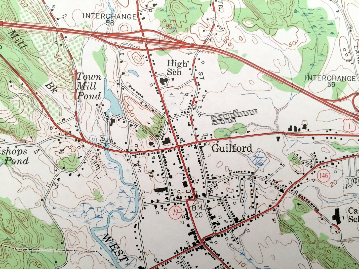
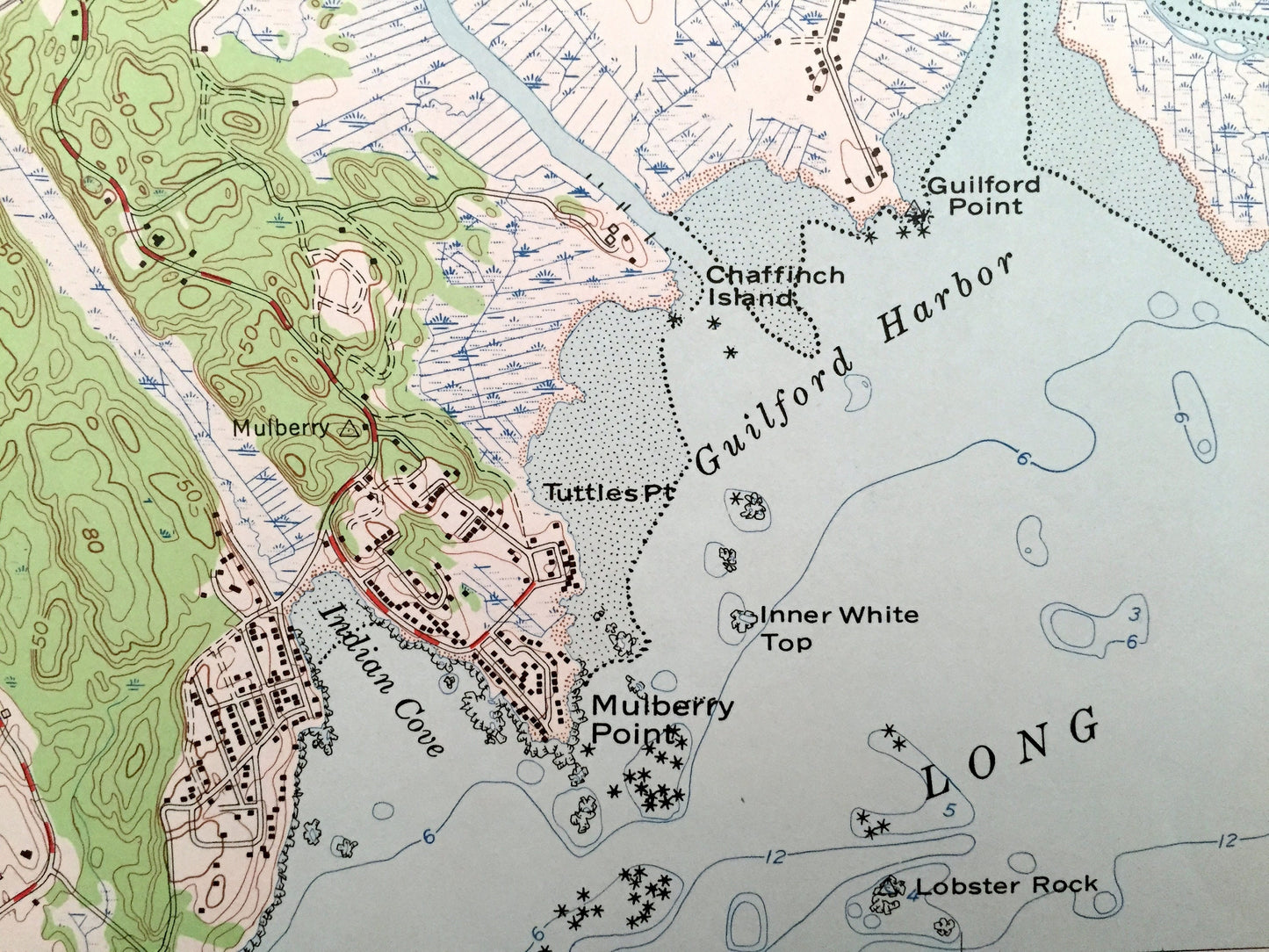
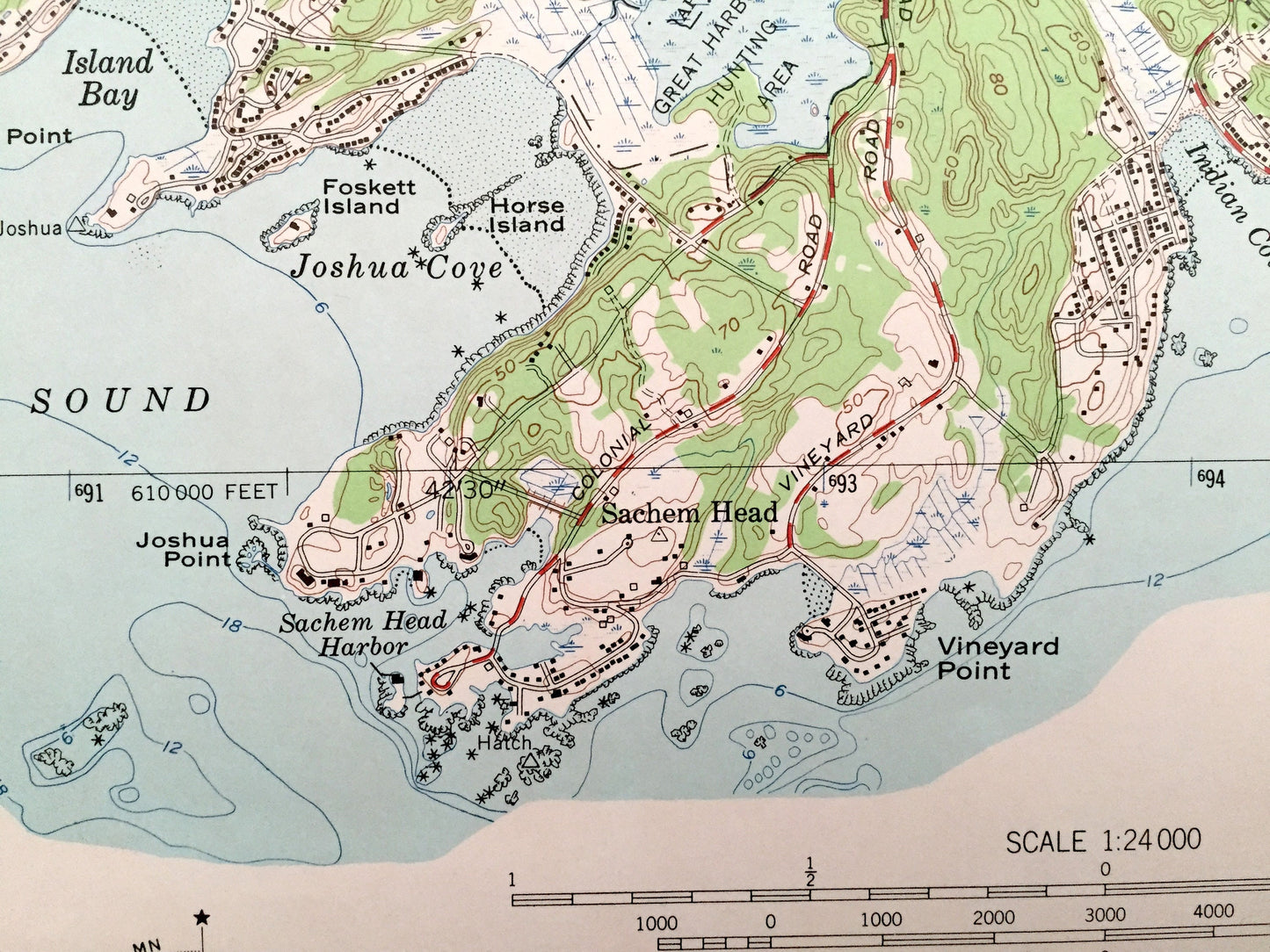
See what Guilford and New Haven County looked like more than 65 years ago. Lots of intricate details and geological contours. Map even has little squares for every house that existed at the time. The USGS cartographers were very thorough back then! On the back is a description of topographic symbols and map guide.
Perfect for the historian, map-lover, the curious or just as a conversation starter. Wonderful and rare. Vintage maps such as these make great gifts.
Edition of 1954, printed 1954
Dimensions: 19" width x 27" height
----
Features
Cities & Towns: Guilford, Madison, Branford, North Branford, Leetes Island, Stony Creek, North Madison, Nut Plains, North Guilford, Sachem Head, Hoadley Neck, Podunk, East River.
Points of Interest: Long Island Sound, Little Harbor, Island Bay, Joshua Cape, Guilford Harbor, Vineyard Point, Mulberry Point, Moose Hill, West Lake, Clear Lake, Guilford Lake, East River, West River, Hungry Hill, Prospect Hill, Bishops Pond, Cockaponset State Forest, Cranberry Hill, Walnut Hill, and more roads, railroads, houses, ponds, hills, streams, islands and coves.
Condition: Very Good Vintage condition, commensurate with age. This map is in great shape for being over 65 years old.
----
We will happily adjust shipping price for multiple purchases. Maps are rolled up and shipped in sturdy mailing tubes, never folded.
Couldn't load pickup availability
Share