My Store
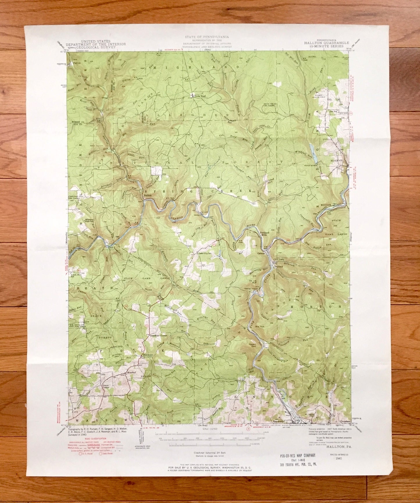
Antique Hallton, Pennsylvania 1940 US Geological Survey Topographic Map - Millstone, Jenks, Highland, Ridgway, Horton Snyder Warsaw Heath PA
Antique Hallton, Pennsylvania 1940 US Geological Survey Topographic Map - Millstone, Jenks, Highland, Ridgway, Horton Snyder Warsaw Heath PA
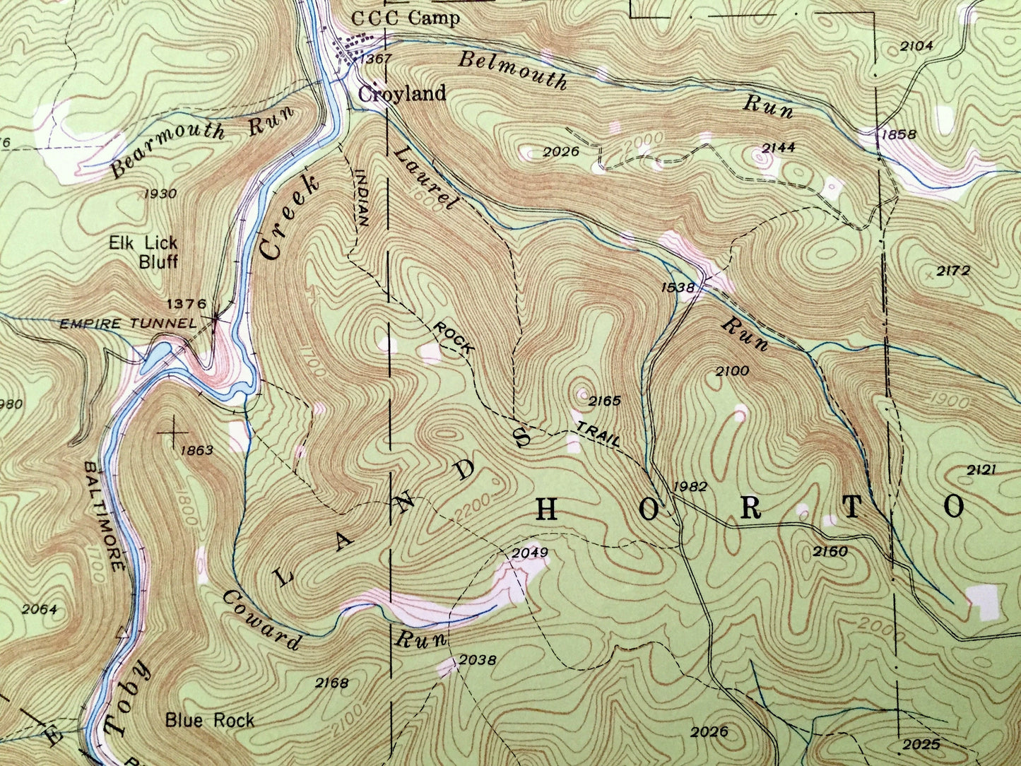
Beautiful, antique map of Hallton, Pennsylvania and surrounding Elk, Jefferson & Forest County areas. This is an authentic 1940 edition, 1958 print from the U.S. Geological Survey and NOT a computer reproduction.
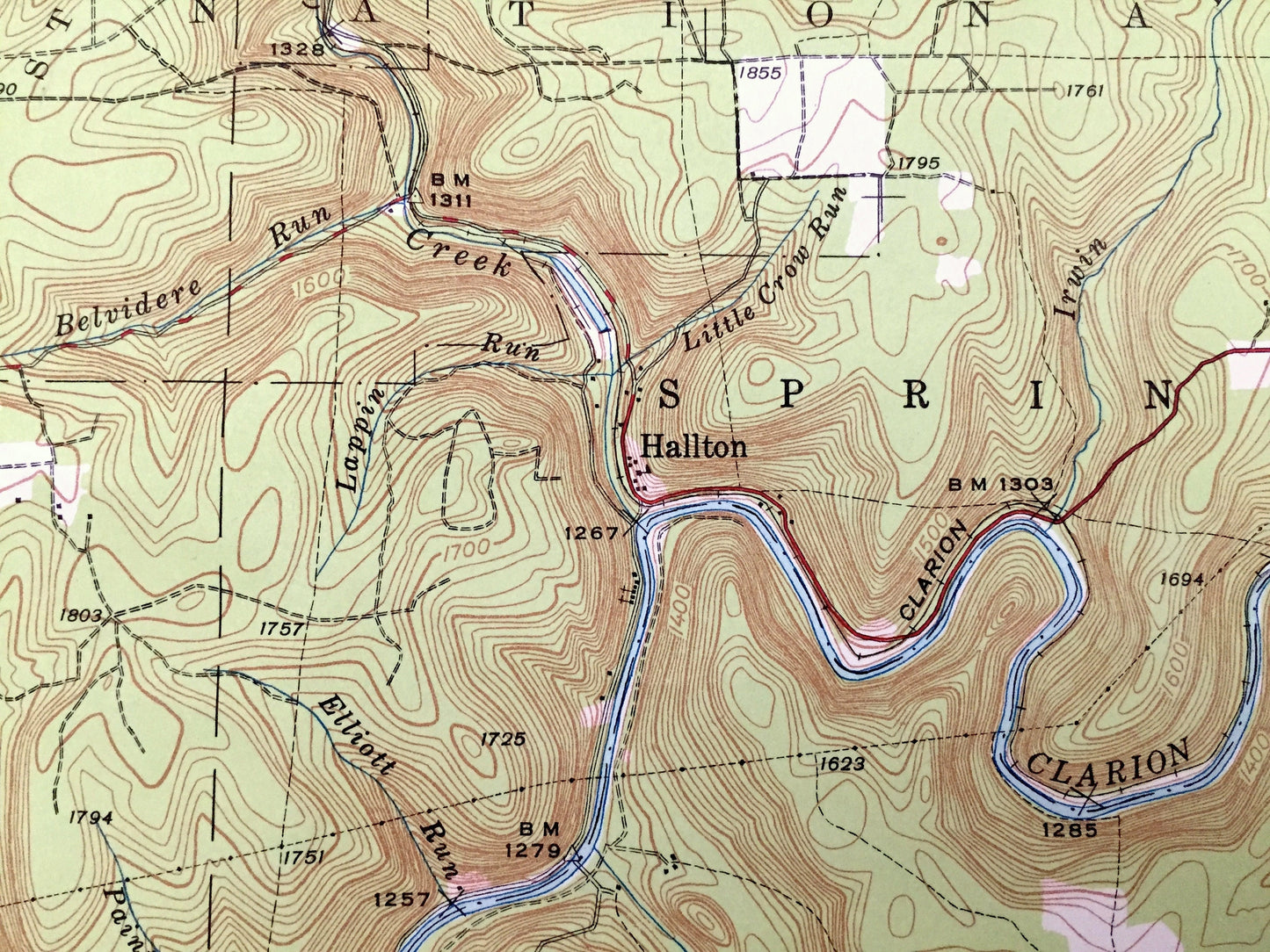
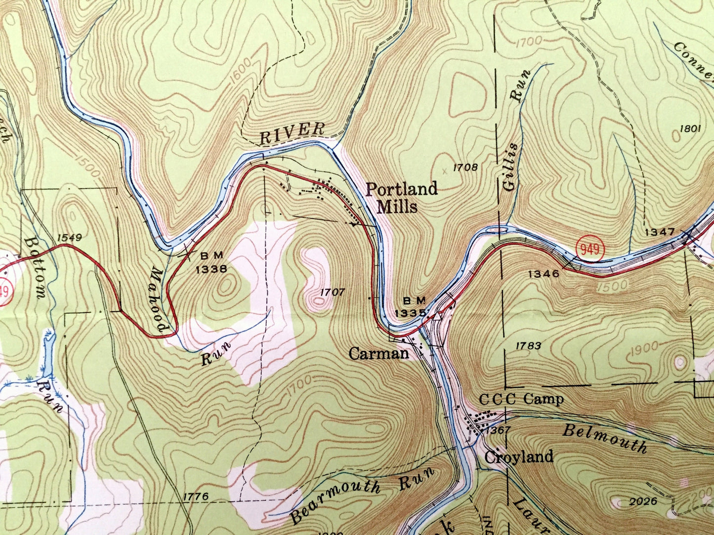
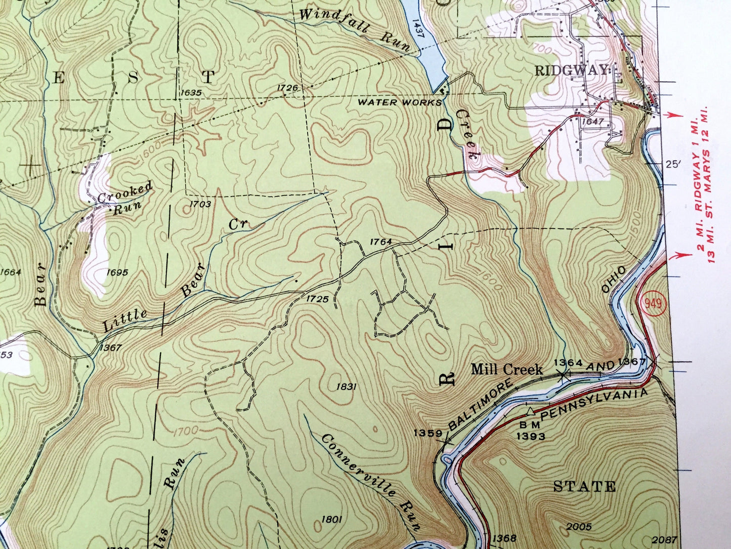
See what Pennsylvania looked like over 80 years ago. Lots of intricate details and geological contours. Map even has little squares for every house that existed at the time. The USGS cartographers were very thorough back then!
Perfect for the historian, map-lover, the curious or just as a conversation starter. Wonderful and rare. Vintage maps such as these make great gifts.
Edition of 1940, printed 1958
Dimensions: 17" width x 21" height
----
Features
Cities & Towns: Hallton, Spring Creek, Polk, Portland Mills, Arroyo, Carman, Munderf, Brockway, Crenshaw, Owls Nest, Croyland, Dixon Corner, Millstone, Jenks, Highland, Ridgway, Horton, Snyder, Warsaw, Heath.
Points of Interest: Elk County, Jefferson County, Forest County, Clarion River, Toby Creek, Mill Creek, Bear Creek, Allegheny National Forest, Laurel Run and more roads, railroads, houses, ponds, hills, creeks, and lakes.
Condition: Good Vintage condition, commensurate with age. This map is in great shape for being over 60 years old. Has light edge-wear, foxing and folds as-issued, but these will flatten easily and all will add to vintage character when framed.
----
We will happily adjust shipping price for multiple purchases. Maps are rolled up and shipped in sturdy mailing tubes, never folded.
Couldn't load pickup availability
Share