My Store
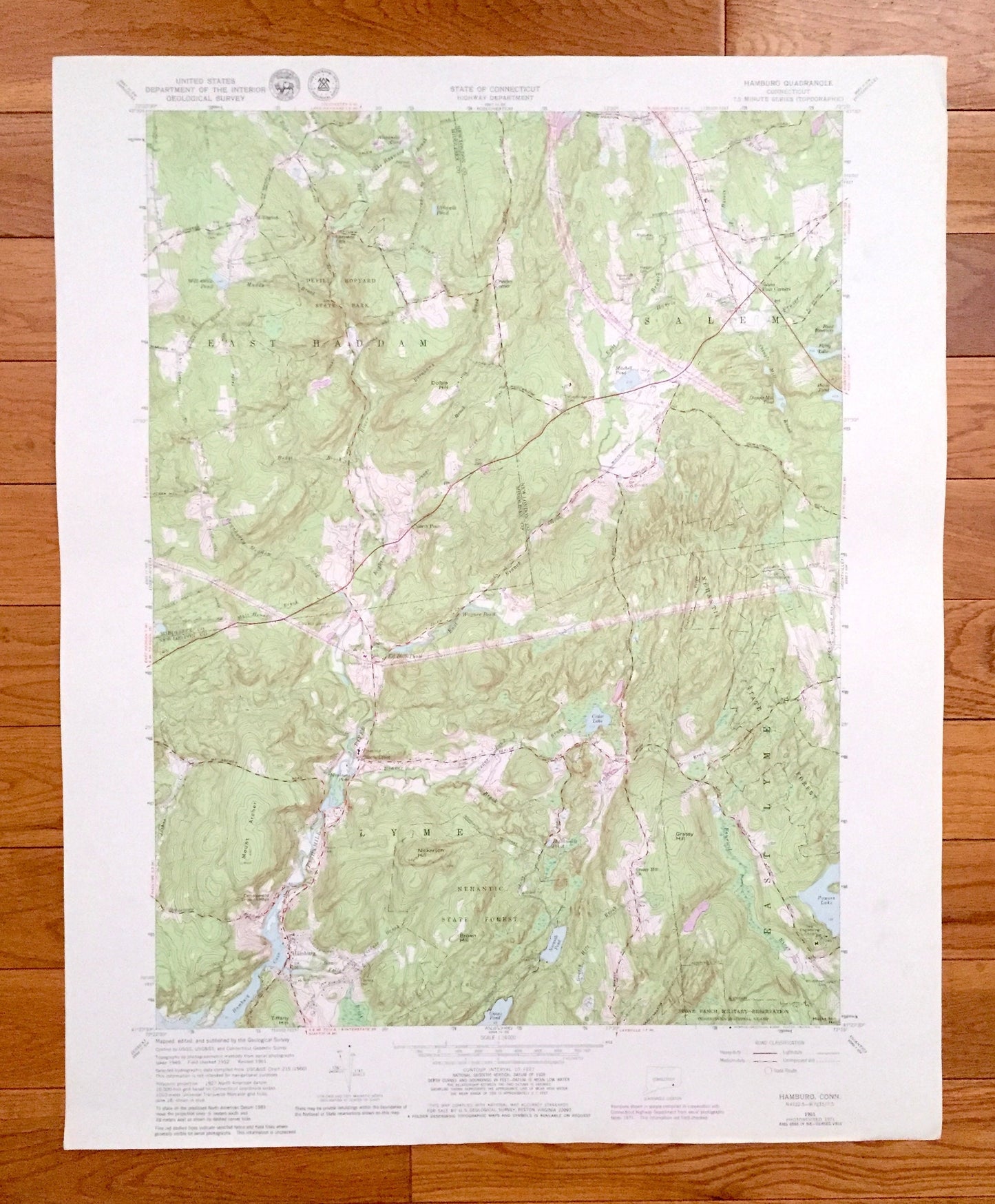
Antique Hamburg, Connecticut 1961 US Geological Survey Topographic Map – Middlesex, New London County, Salem, Lyme, East Haddam, CT
Antique Hamburg, Connecticut 1961 US Geological Survey Topographic Map – Middlesex, New London County, Salem, Lyme, East Haddam, CT
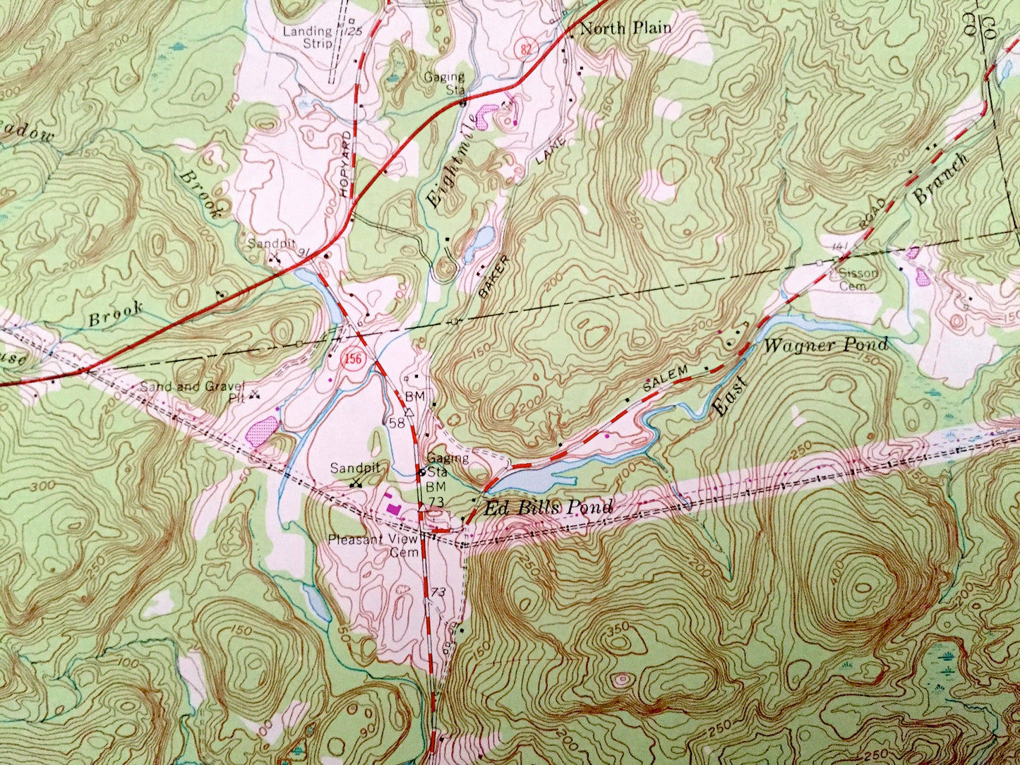
Beautiful, antique map of Hamburg, Connecticut and surrounding Middlesex County and New London County areas. This is an authentic 1961 edition, 1979 print from the U.S. Geological Survey and NOT a computer reproduction.
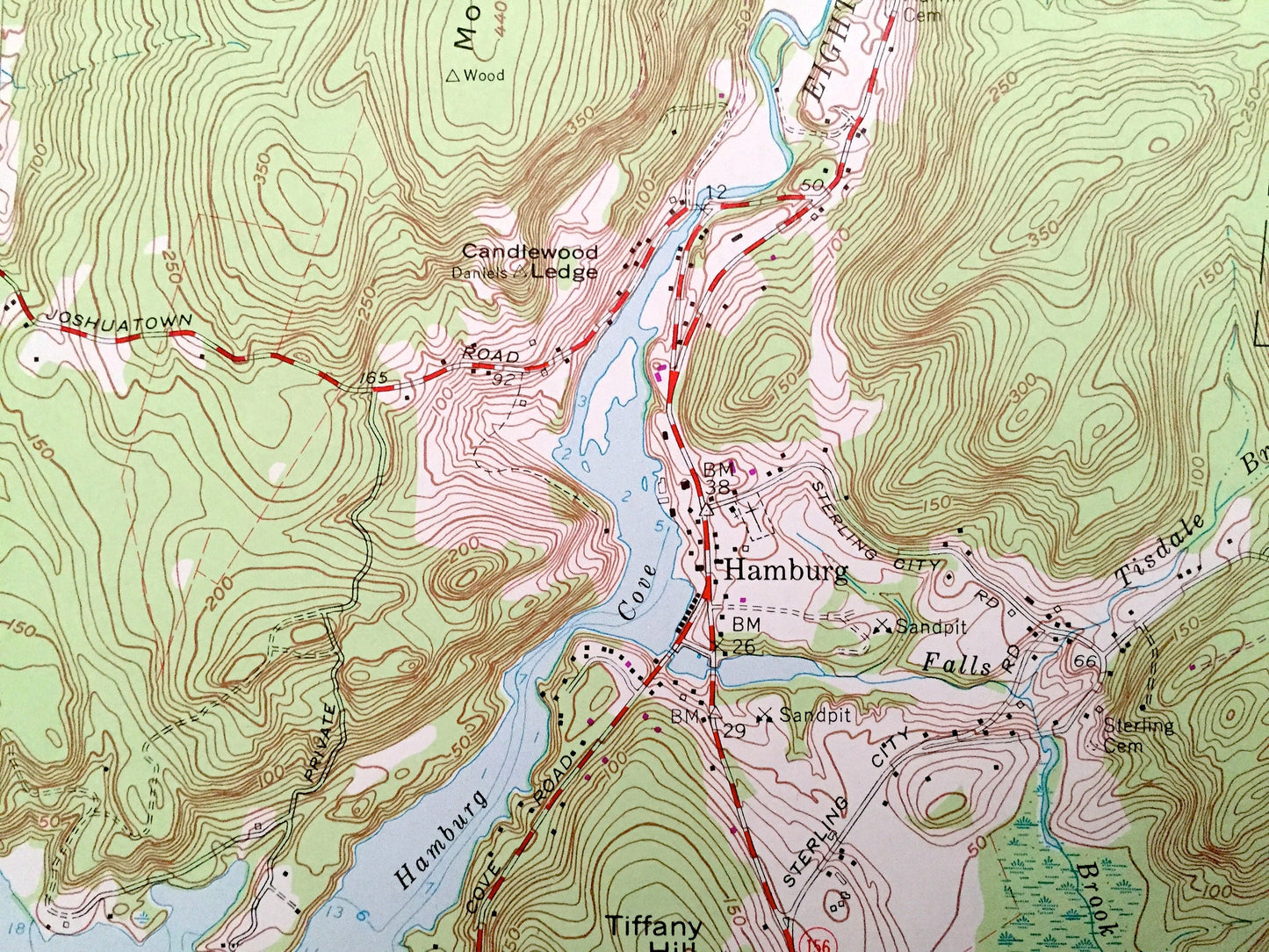
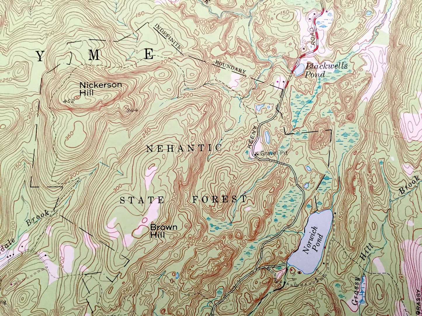
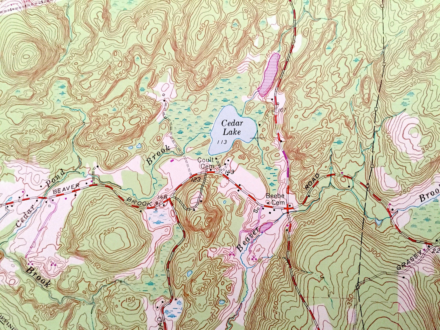
See what Connecticut looked like over 60 years ago. Lots of intricate details and geological contours. Map even has little squares for every house that existed at the time. The cartographers were very thorough back then!
Perfect for the historian, map-lover, the curious or just as a conversation starter. Wonderful and rare. Vintage maps such as these make great gifts.
Edition of 1961, printed 1979
Dimensions: 22" width x 27" height
----
Features
Cities & Towns: Millington, Crowley Corner, Salem Four Corners, North Plain, North Lyme, East Lyme.
Points of Interest: Devils Hopyard State Park, Nehantic State Forest, Stone Ranch Military Reservation, Yale Engineering Camp, Dolbia Hill, Grassy Hill, Mount Archer, Tiffany Hill, Nickerson Hill, Candlewood Ledge, Mitchell Pond, Powers Lake, Eightmile River, East Harris Brook, Shingle Mill Brook, Cedar Pond Brook, Tisdale Brook, Fourmile River, and many more hills, streams, ponds, houses, schools, railroads, churches and roads.
Condition: Very Good Vintage condition, commensurate with age. This map is in great shape for being over 40 years old. Has light edge-wear but will read as character when framed.
----
We will happily adjust shipping price for multiple purchases. Maps are rolled up and shipped in sturdy mailing tubes, never folded.
Couldn't load pickup availability
Share