My Store
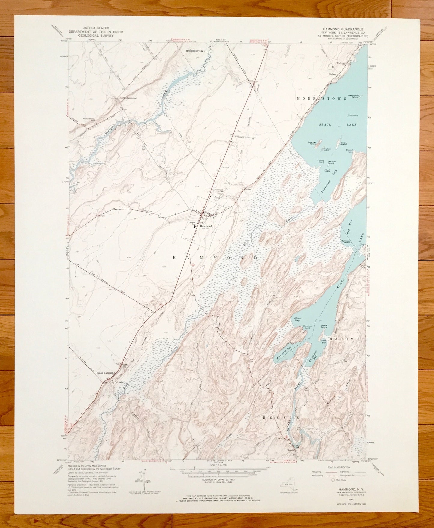
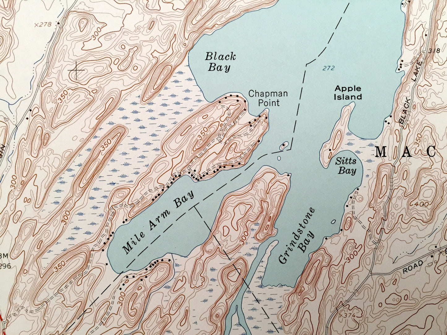
Antique Hammond, New York 1961 US Geological Survey Topographic Map – St Lawrence County, North, Morristown, Oakvale, Rossie, Black Lake, NY
Antique Hammond, New York 1961 US Geological Survey Topographic Map – St Lawrence County, North, Morristown, Oakvale, Rossie, Black Lake, NY
Beautiful, antique map of Hammond, New York and surrounding St. Lawrence County area. This is an authentic 1961 print from the U.S. Geological Survey and NOT a computer reprint.
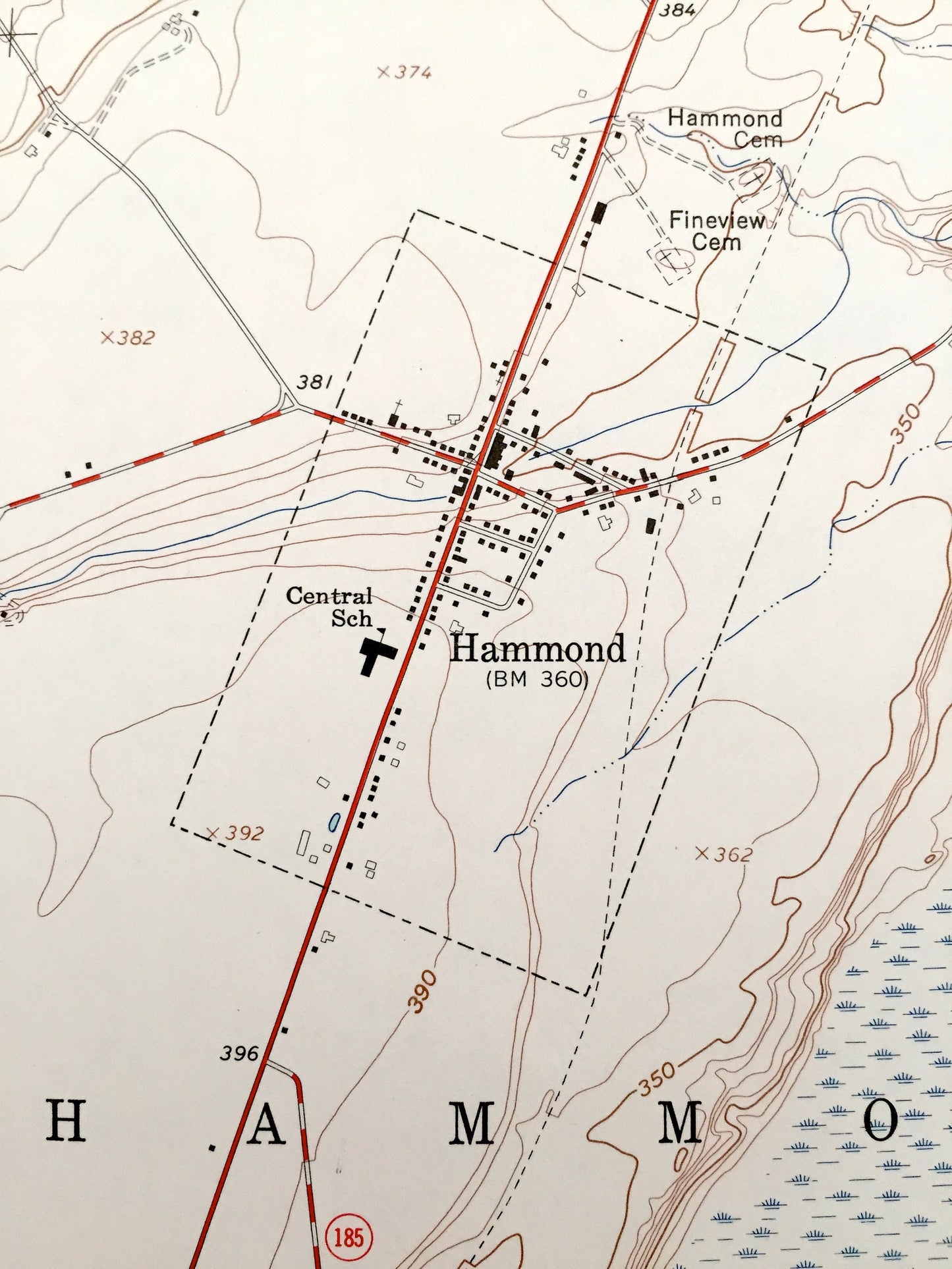
See what New York looked like almost 60 years ago. Lots of intricate details and geological contours. Map even has little squares for every house that existed. The USGS cartographers were very thorough back then!
Perfect for the historian, map-lover, the curious or just as a conversation starter. Wonderful and rare. Vintage maps such as these make great gifts.
Edition of 1961, printed 1961
Dimensions: 22" width x 27" height
----
Features
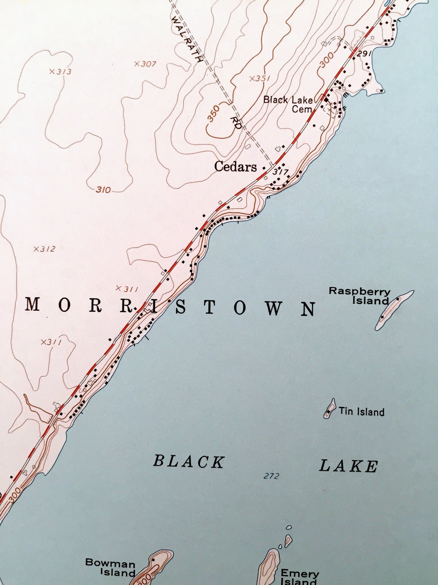
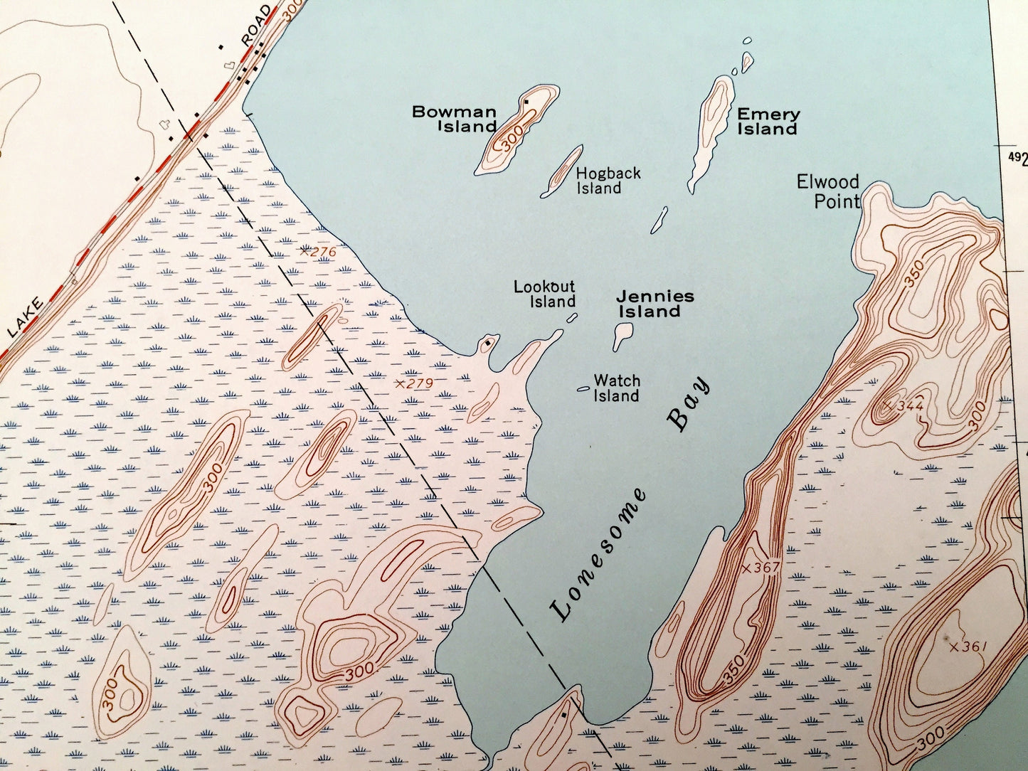
Cities & Towns: Hammond, Morristown, North Hammond, South Hammond, Oakvale, Rossie, Cedars, Macomb.
Points of Interest: Chippewa Creek, Black Lake, Black Creek, Big Bay, Lonesome Bay, Indian River, Emery Island, Mile Arm Bay, and many more smaller lakes, creeks, mountains, valleys, houses, schools, roads, churches and train tracks.
Condition: Very Good condition, commensurate with age. This map is in incredible shape for being almost 60 years old.
----
We will happily adjust shipping price for multiple purchases. Maps are rolled up and shipped in sturdy mailing tubes, never folded.
Couldn't load pickup availability
Share