My Store
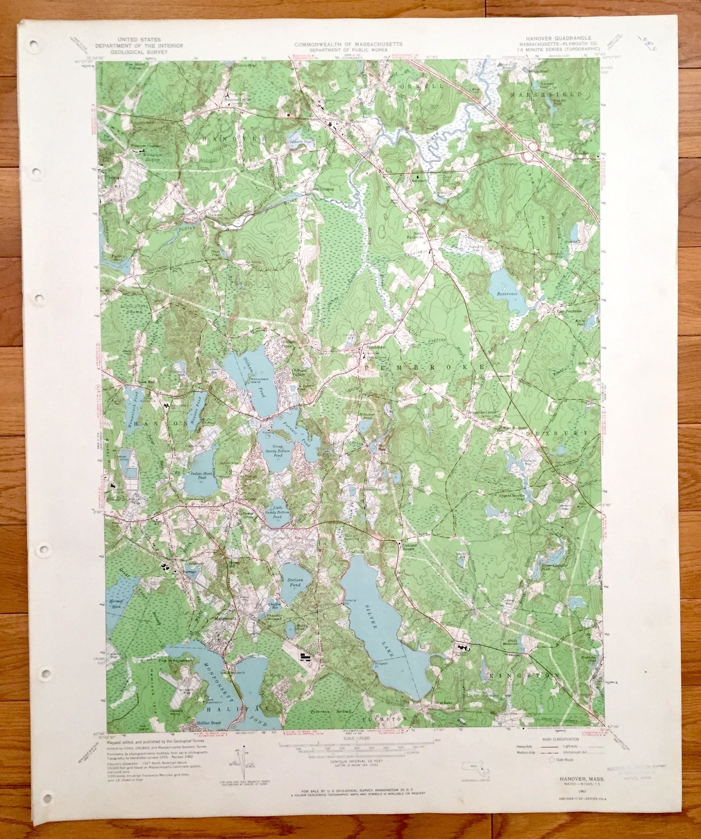
Antique Hanover, Massachusetts 1962 US Geological Survey Topographic Map – Pembrooke, Duxbury, Kingston, Halifax, Hanson, Plympton, MA
Antique Hanover, Massachusetts 1962 US Geological Survey Topographic Map – Pembrooke, Duxbury, Kingston, Halifax, Hanson, Plympton, MA
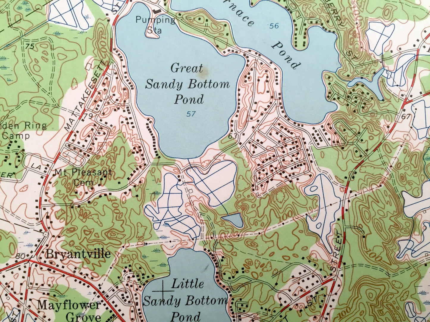
Beautiful, antique map of Hanover, Pembroke, Hanson, Massachusetts and surrounding area. This is an authentic edition of 1940 print from the U.S. Geological Survey and NOT a computer reproduction.
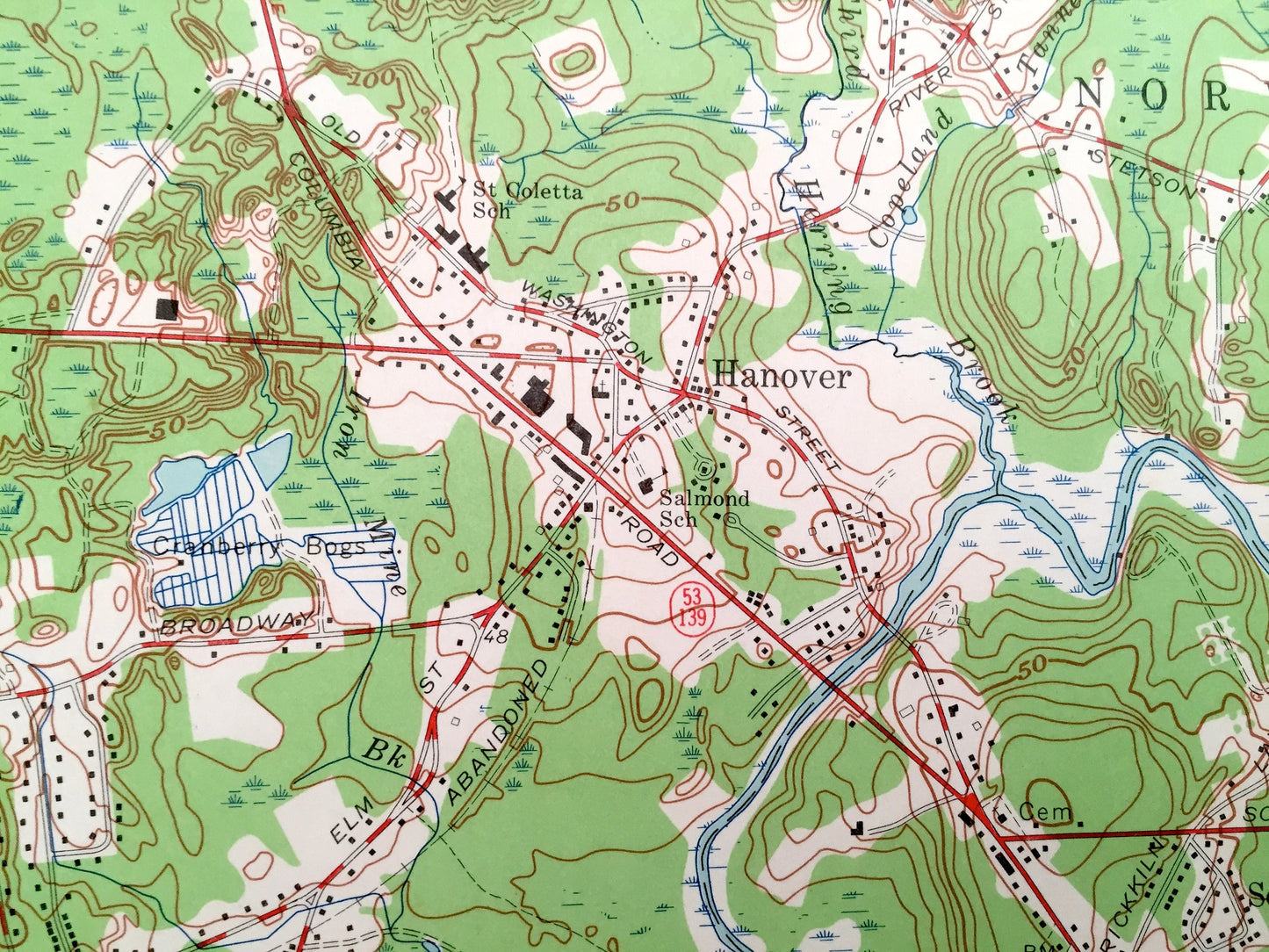
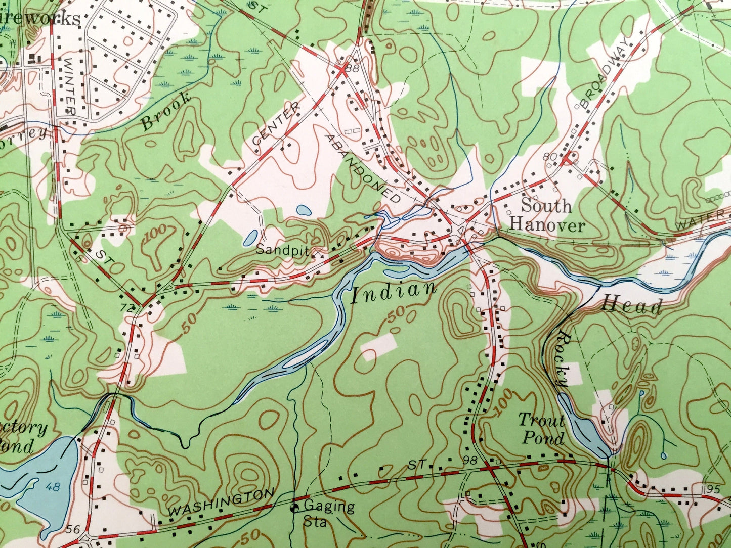
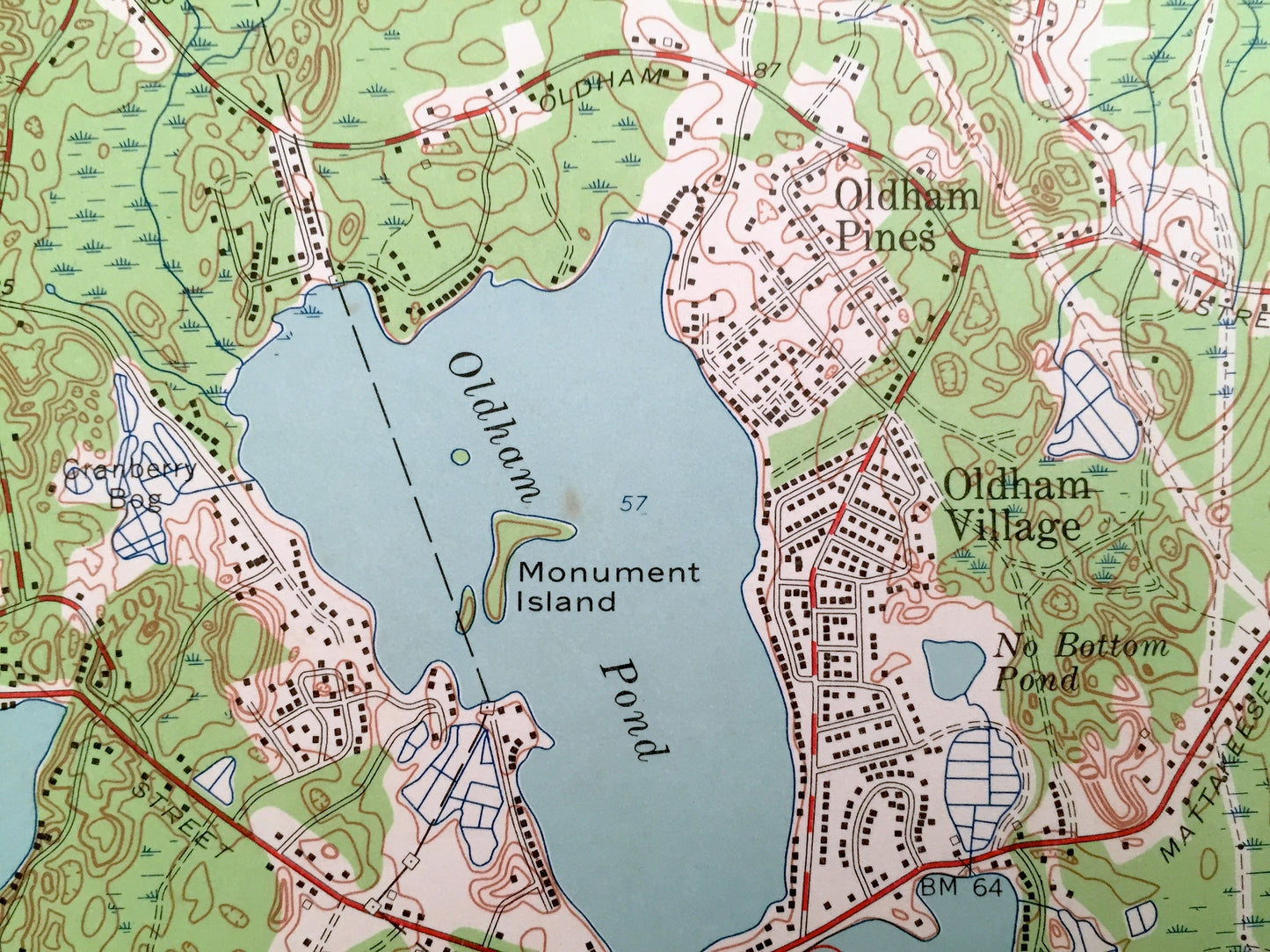
See what Pembroke, Massachusetts looked like over 55 years ago. Lots of intricate details and geological contours. Map even has little squares for every house that existed at the time. The cartographers were very thorough back then! On the back is a description of topographic symbols and map guide.
Perfect for the historian, map-lover, the curious or just as a conversation starter. Wonderful and rare. Vintage maps such as these make great gifts.
Edition of 1962, printed 1962
Dimensions: 22" width x 27" height
----
Features
Cities & Towns: Hanover, Marshfield, Norwell, Hanover Center, South Hanover, North Pembroke, Schooset, Curtis Crossing, East Pembroke, Pembroke, West Duxbury, Duxbury, Kingston, Hanson, Monponsett, Plympton, Halifax.
Points of Interest: Magoun Pond, Arnold School, Bethel Chapel, Factory Pond, Indian Head River, Oldham Pond, Indian Head Pond, Silver Lake, Camp Wampatuck, Wampatuck Pond, Camp Kiwanis, South School, Thomas School, Monponsett Pond, Lady of the Lake Church, New York New Haven and Hartford Railroad, Halifax station, and more roads, stations, houses, ponds, hills, streams and mountains.
Condition: Good Vintage condition, commensurate with age. This map is in great shape for being 60 years old. Map has punch holes but these are easily concealed with framing or placing a similar-colored paper behind the map, as can be seen in the photos.
----
We will happily adjust shipping price for multiple purchases. Maps are rolled up and shipped in sturdy mailing tubes, never folded.
Couldn't load pickup availability
Share