My Store
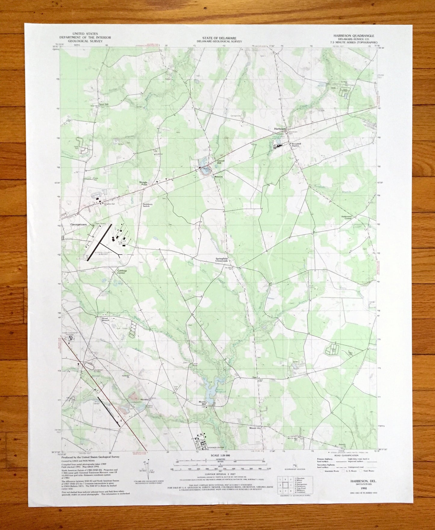
Antique Harbeson, Delaware 1992 US Geological Survey Topographic Map – Sussex County, Georgetown, Gravel Hill, Zohar, Mount Joy, Stockley DE
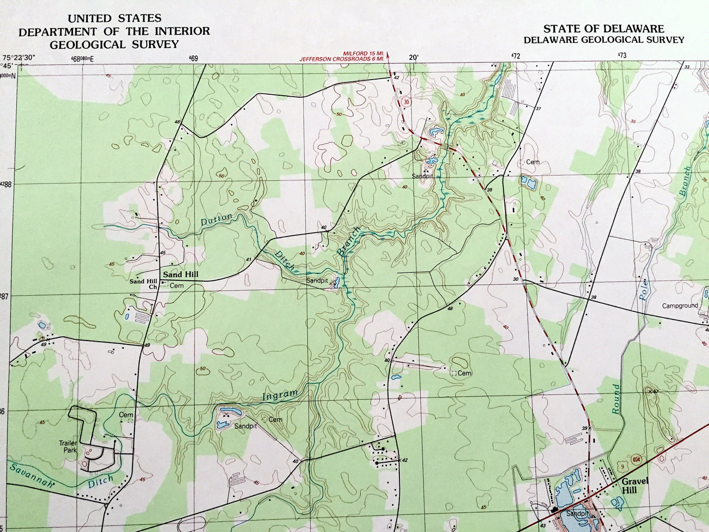
Antique Harbeson, Delaware 1992 US Geological Survey Topographic Map – Sussex County, Georgetown, Gravel Hill, Zohar, Mount Joy, Stockley DE
Beautiful, antique map of Harbeson, Delaware and surrounding Sussex County area. This is an authentic 1992 edition, 1992 print from the U.S. Geological Survey and NOT a computer reproduction.
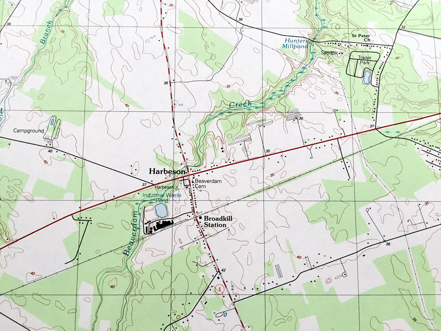
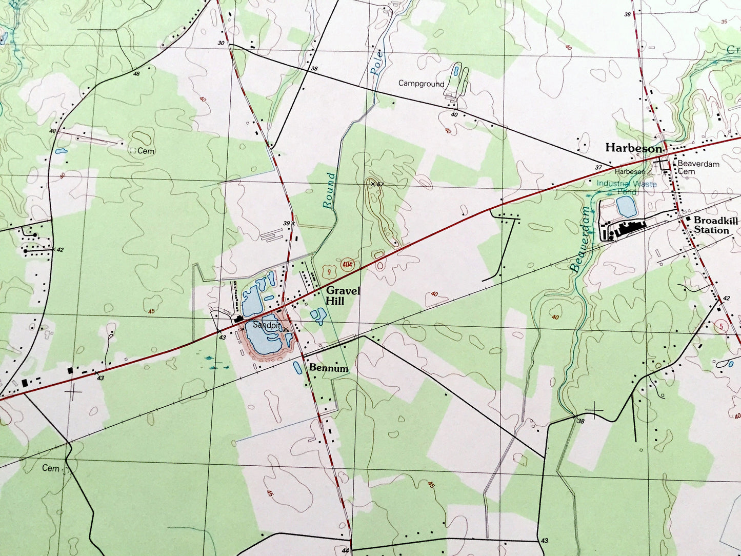
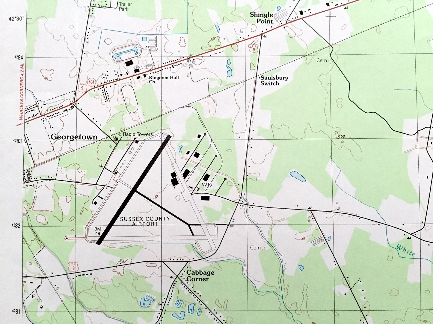
See what Delaware looked like over 30 years ago. Lots of intricate details and geological contours. Map even has little squares for every house that existed at the time. The USGS cartographers were very thorough back then!
Perfect for the historian, map-lover, the curious or just as a conversation starter. Wonderful and rare. Vintage maps such as these make great gifts.
Edition of 1992, printed 1992
Dimensions: 21 1/2" width x 27" height
----
Features
Cities & Towns: Sand Hill, Gravel Hill, Bennum, Cabbage Corner, Springfield Crossroads, Wood Branch, Stockley, Zoar, Morris Mill, Mount Joy, Shingle Point, Saulsbury Switch.
Points of Interest: Sussex County Airport, Georgetown Raceway, Sussex Correctional Institution, Hunters Millpond, Morris Millpond, Ingram Branch, Beaverdam Creek, Peterkins Branch, Round Pole Branch, and many more hills, streams, ponds, houses, schools, railroads, churches and roads.
Condition: Very Good Vintage condition, commensurate with age. This map is in great shape for being over 30 years old. Has subtle edge-wear but will read as character when framed.
----
We will happily adjust shipping price for multiple purchases. Maps are rolled up and shipped in sturdy mailing tubes, never folded.
Couldn't load pickup availability
Share