My Store
Antique Hardin, Illinois 1938 US Geological Survey Topographic Map – Foley, Missouri, Greene, Jersey, Calhoun, Pike, Lincoln County, IL
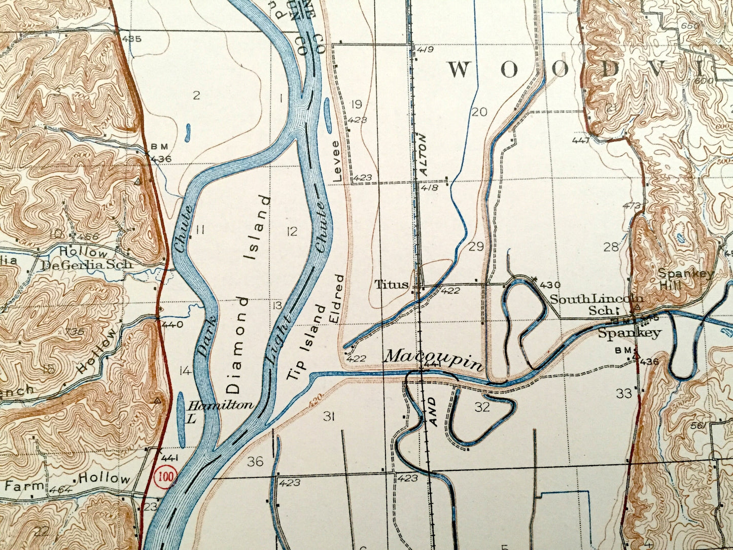
Antique Hardin, Illinois 1938 US Geological Survey Topographic Map – Foley, Missouri, Greene, Jersey, Calhoun, Pike, Lincoln County, IL
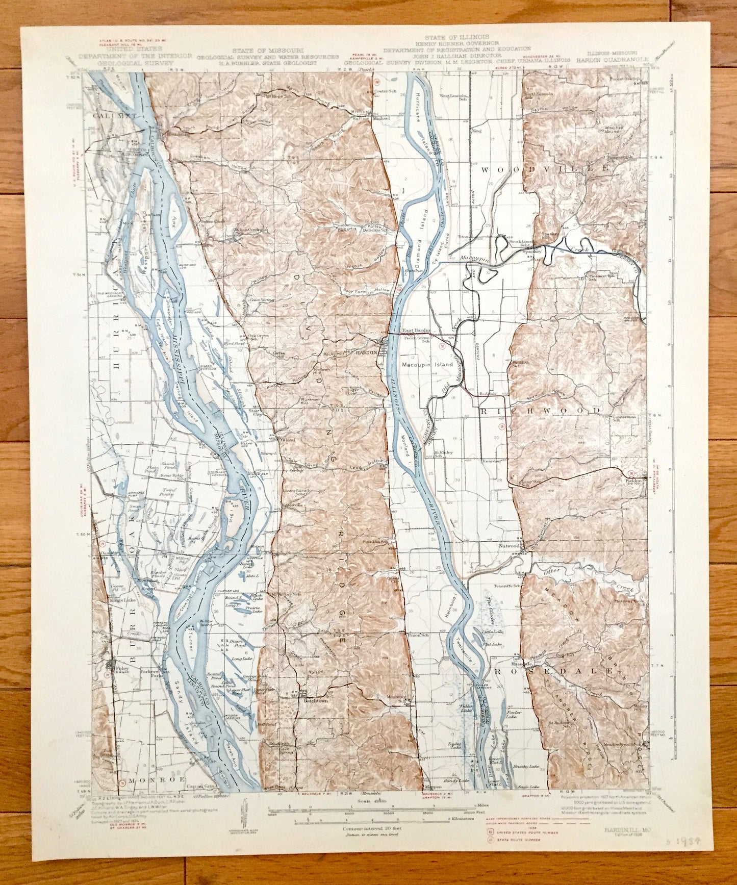
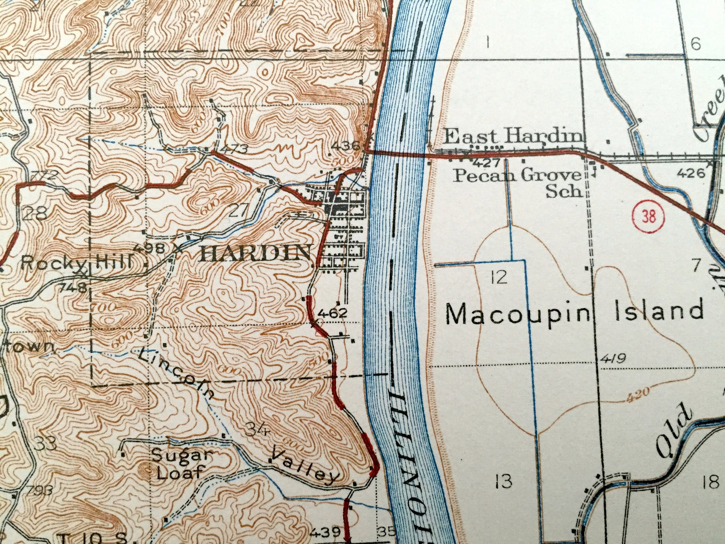
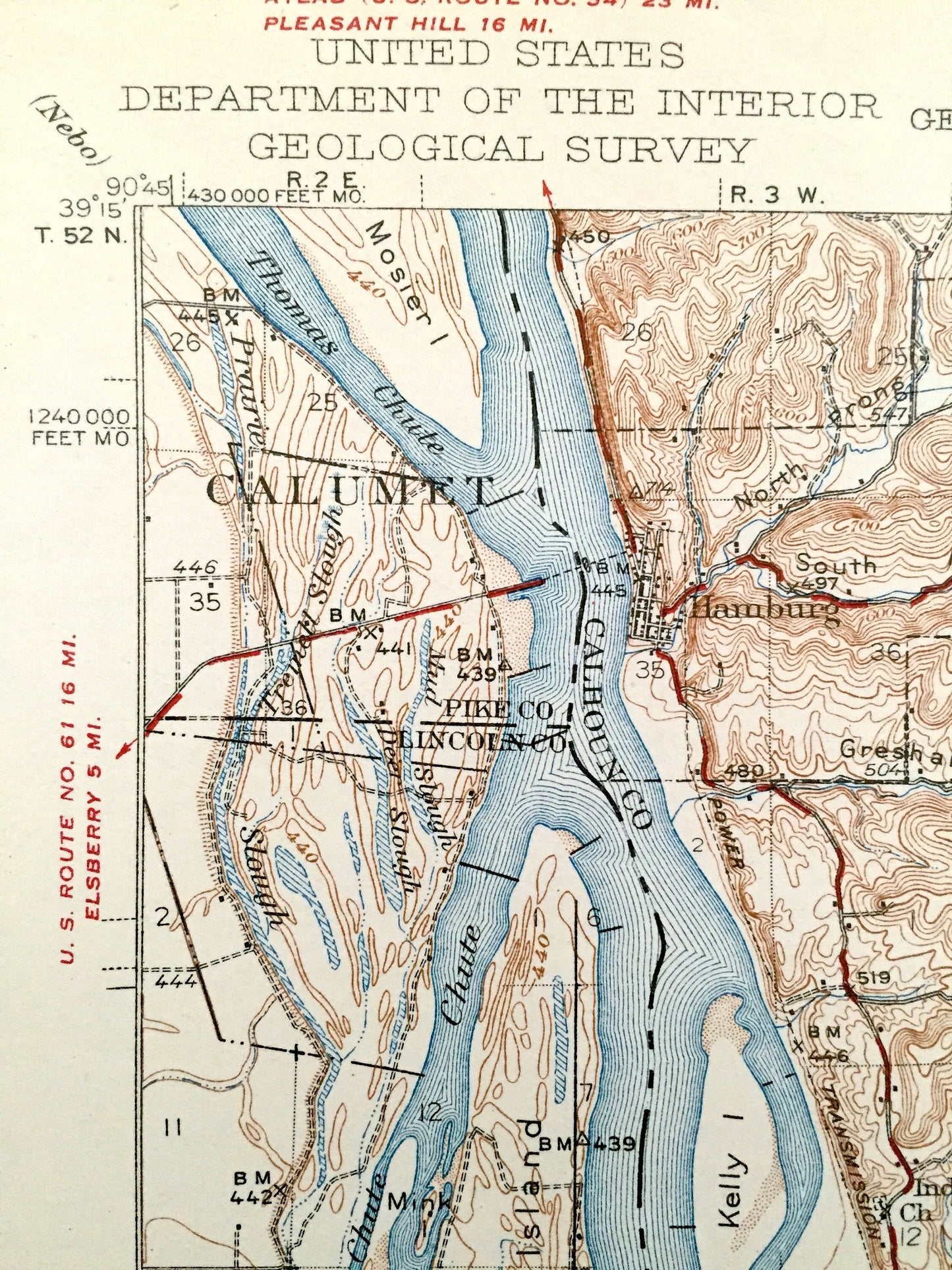
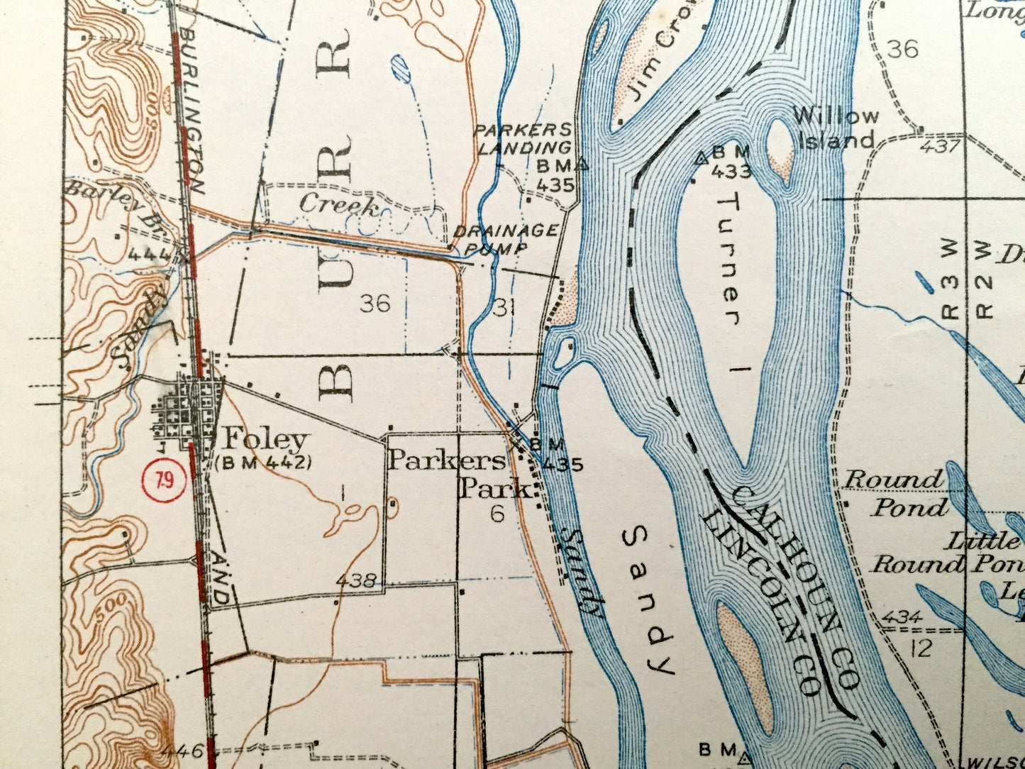
Beautiful, antique map of Hardin, Illinois and surrounding Calhoun, Jersey & Greene County area on the Illinois and Mississippi Rivers, including Lincoln County, Missouri. This is an authentic 1926 print from the U.S. Geological Survey and NOT a computer reproduction.
See what Missouri and Illinois looked like over 80 years ago. Lots of intricate details and geological contours. Map even has little squares for every house that existed at the time. The USGS cartographers were very thorough back then! On the back is a description of topographic symbols and map guide.
Perfect for the historian, map-lover, the curious or just as a conversation starter. Wonderful and rare. Vintage maps such as these make great gifts.
Edition of 1938, printed 1938
Dimensions: 16 1/2" width x 20" height
----
Features
Cities & Towns: ILLINOIS: Woodville, Richwood, Rosedale, Hamburg, Michael, Spankey, Star City, Hardin, Gilead, East Hardin, Kritesville, Reardon, Nutwood, Fieldon, Batchtown, Meppen.
MISSOURI: Calumet, Hurricane, Burr Oak, Munroe, Oasis, Kings Lake, Foley, Parkers Park, Cap an Gris.
Points of Interest: Calhoun County, Jersey County, Greene County, Pike County, Lincoln County, Mississippi River, Illinois River, Macoupin Creek, Otter Creek, Coon Creek, Dividing Ridge, Westport Island, Kelly Island, Mosier Island, Eagle Island, Schwangan Island, Stag Island, Sandy Island, Turner Island, Jim Crow Island, Sarah Ann Island, Hurricane Island, Diamond Island, Tip Island, Macoupin Island, Mortland Island, Twelvemile Island, Deep Lake, Long Lake, Lead Hollow, Spankey Hill, The Narrows, Dug Hill, Fowler Lake, The Glades, Helmbold Island, McNabb Hollow, Chicago Burlington & Quincy Railroad and many more hills, creeks, lakes, towns, schools, churches, roads and train tracks.
Condition: Good Vintage condition, commensurate with age. This map is in g shreatape for being 80 years old. Has light edge-wear and pencil marking in bottom right corner, but this will read as vintage character when framed.
----
We will happily adjust shipping price for multiple purchases. Maps are rolled up and shipped in sturdy mailing tubes, never folded.
Couldn't load pickup availability
Share