My Store
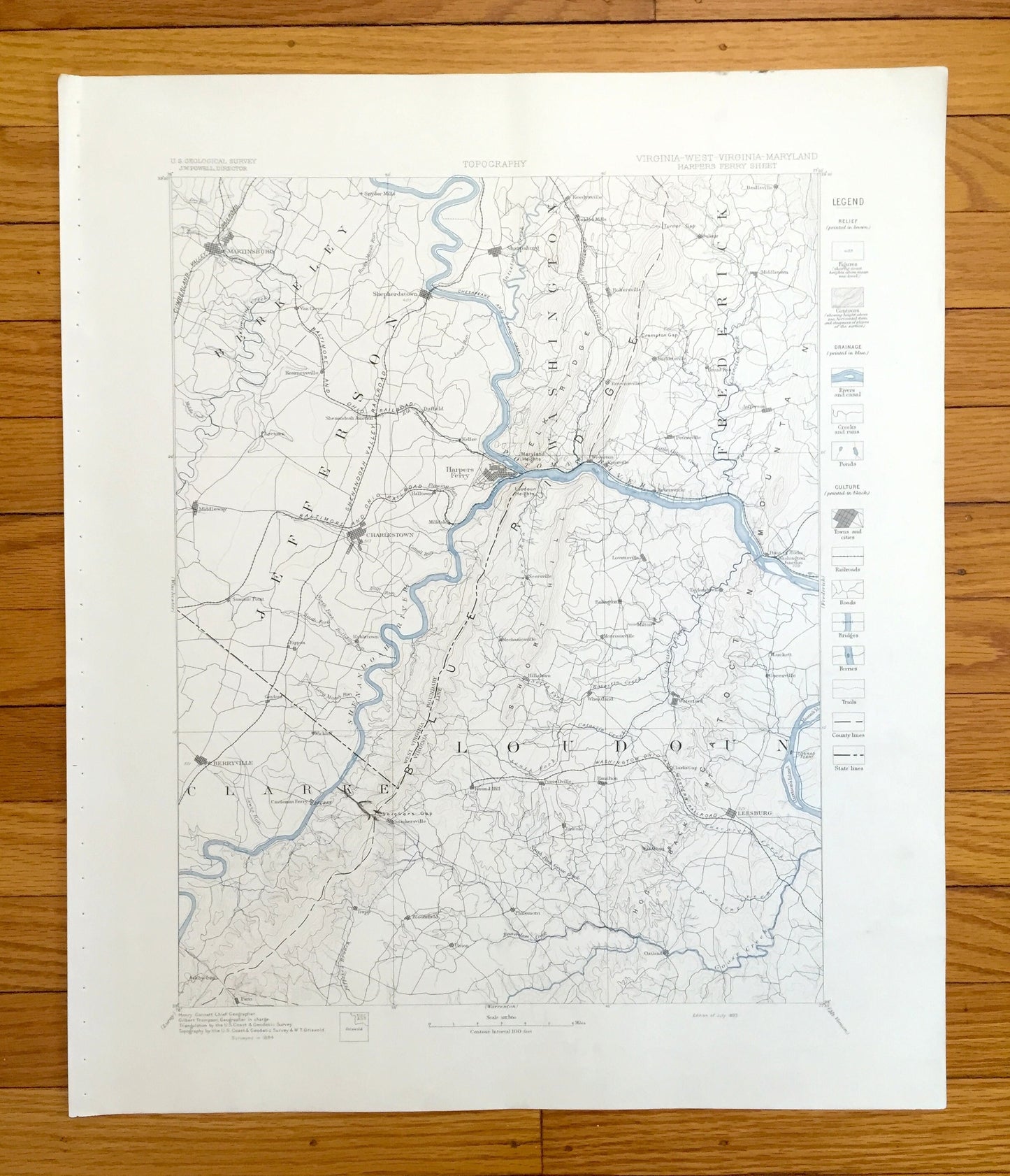
Antique Harpers Ferry, West Virginia 1884 US Geological Survey Topographic Map – Antietam Battlefield, Sharpsburg, Frederick, Maryland WV MD
Antique Harpers Ferry, West Virginia 1884 US Geological Survey Topographic Map – Antietam Battlefield, Sharpsburg, Frederick, Maryland WV MD
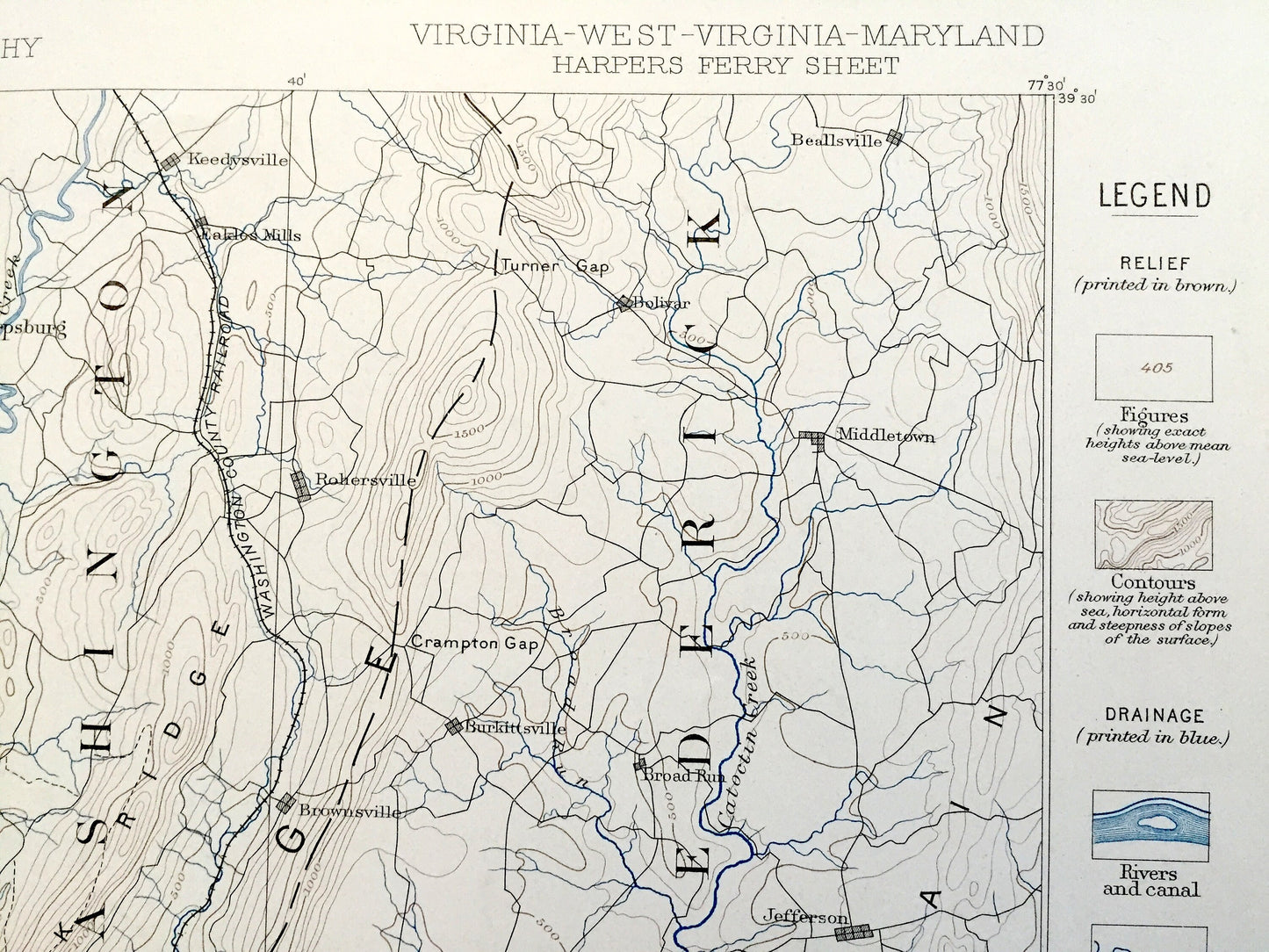
Beautiful, antique map of the Antietam Battlefield, Sharpsbug, Harpers Ferry, the Potomac River and Blue Ridge Mountains of Maryland and Virginia. This is an authentic 1884 edition, 1893 print from the U.S. Geological Survey and NOT a computer reproduction. It is from a Geologic Atlas folio.
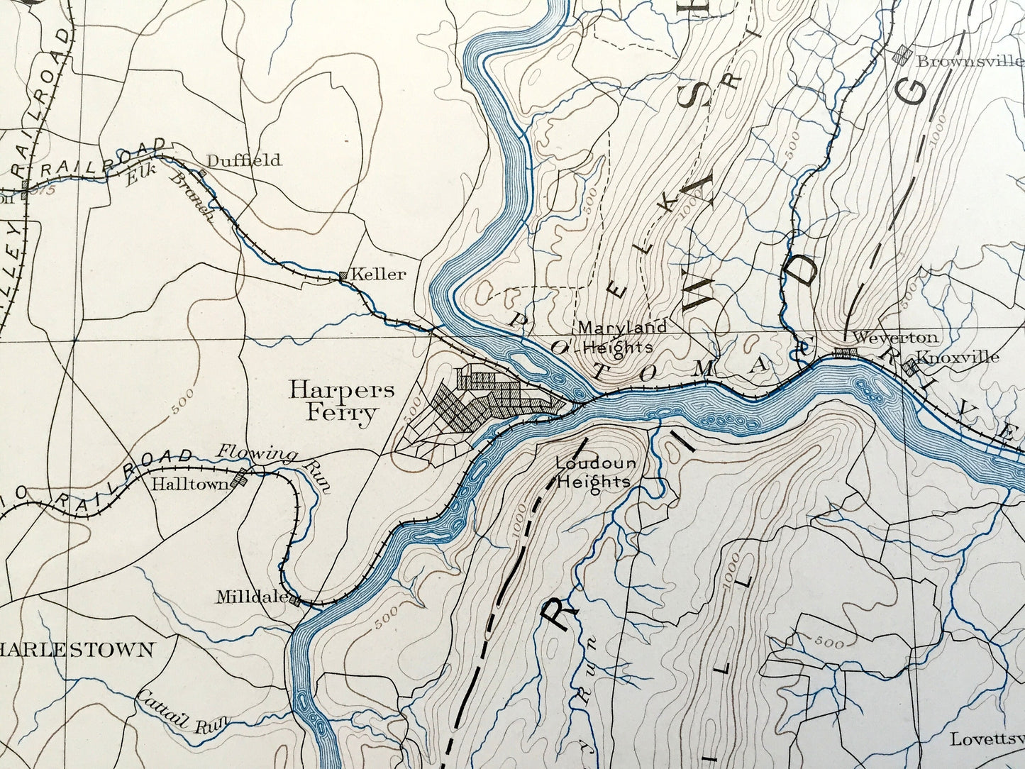
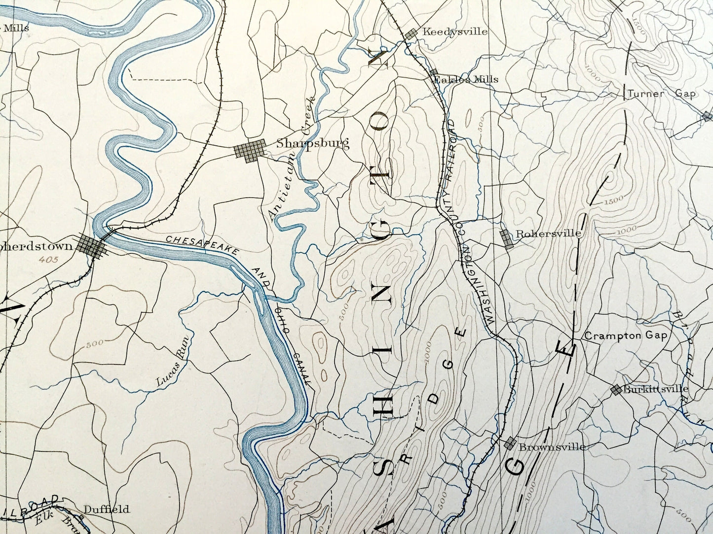
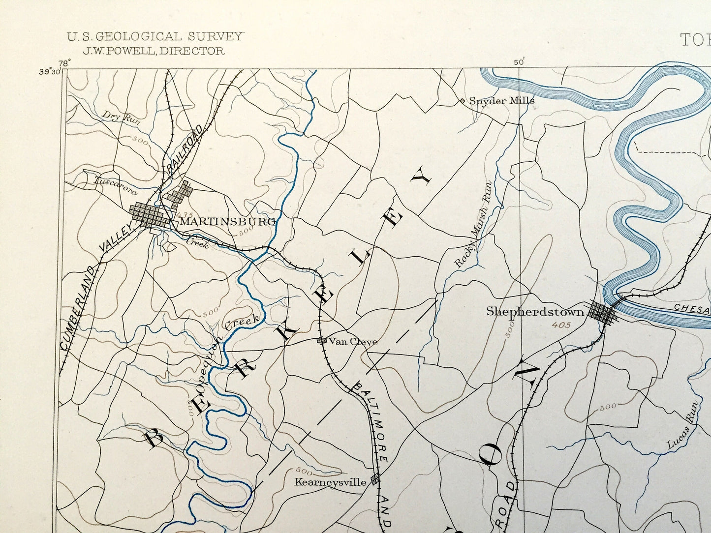
See what Harpers Ferry looked like over 135 years ago, about thirty years after the Civil War. Lots of intricate details and geological contours. The USGS cartographers were very thorough back then! This is one of the rare maps where the topographic symbols and map guide are on the front.
Perfect for the historian, map-lover, the curious or just as a conversation starter. Wonderful and rare. Maps such as these make great gifts.
Edition of 1884, printed 1893
Dimensions: 18 1/2" width x 22" height
----
Features
Cities & Towns:
WEST VIRGINIA: Berkeley, Jefferson, Washington, Martinsburg, Sheperdstown, Snyder Mills, Van Cleve, Kearneysville, Shenandoah Junction, Duffield, Keller, Harpers Ferry, Middleway, Charlestown, Halltown, Milldale, Summit Point, Rippon, Kabletown.
MARYLAND: (after 1910) Washington, Frederick, Sharpsburg, Keedysville, Eakles Mills, Rohersville, Beallsville, Middletown, Burkittsville, Broad Run, Knoxville, Petersville, Jefferson, Brunswick, Point of Rocks, Washington Junction, Weyerton.
VIRGINIA: Clarke, Loudoun, Berryville, Gaylord, Wickliff, Castleman Ferry, Snickersville, Paris, Trapp, Bloomfield, Neersville, Mechanicsville, Hillsboro, Lovettsville, Bolington, Morrisville, Wheatland, Milton, Taylorstown, Waterford, Luckett, Goresville, Round Hill, Purcellville, Lincoln, Hamilton, Union, Philomont, Clarks Gap, Woodburn, Leesburg, Oatlands.
Points of Interest: Antietam Battlefield, Potomac River, Antietam Creek, McClellans Lookout, Dunkard Church, Bloody Lane, Burnside Bridge, Pipers Lane, Elk Ridge, Blue Ridge South Mountain, Pleasant Valley, Catoctin Mountains, Short Hill, Monument Knob, Catoctin Mountain, Maryland Heights, Snickers Gap, Mason's Island, Goose Creek, Bullskin Run, Heaters Island, Harrison's Island, Baltimore & Ohio Railroad and lots more hills, brooks, towns, schools, churches, roads and railroads.
Condition: Very Good Vintage condition, commensurate with age. This map is in great shape for being over 125 years old. Has staple-holes in margin from folio, foxing, toning and edge-wear but this will all add to vintage character when framed.
----
We will happily adjust shipping price for multiple purchases. Maps are rolled up and shipped in sturdy mailing tubes, never folded.
Couldn't load pickup availability
Share