My Store
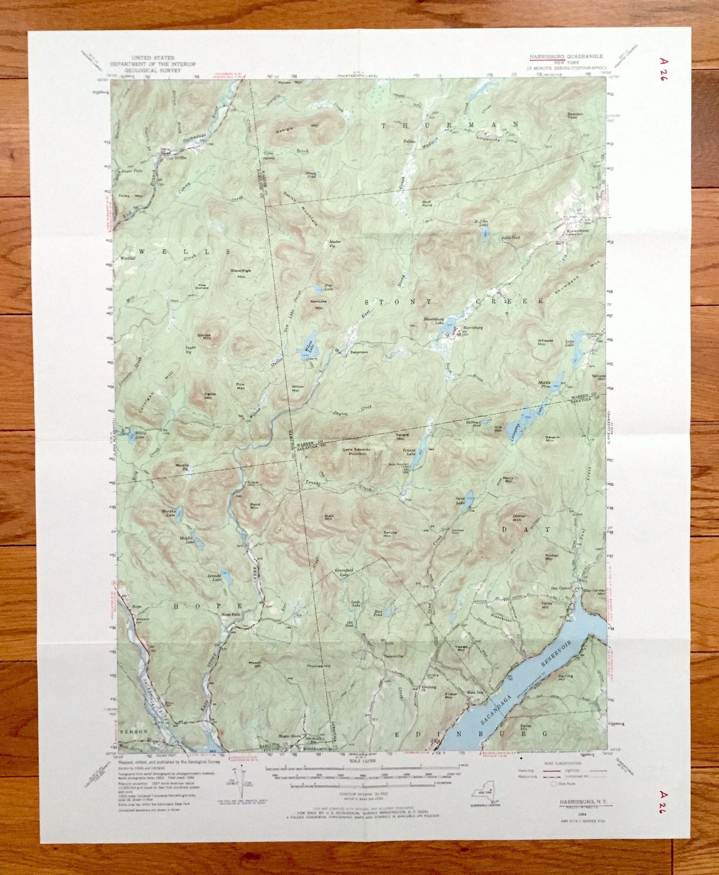
Antique Harrisburg, New York 1954 US Geological Survey Topographic Map – Adirondacks, Sacandaga, Edinburg, Day Hope Falls Saratoga Warren NY
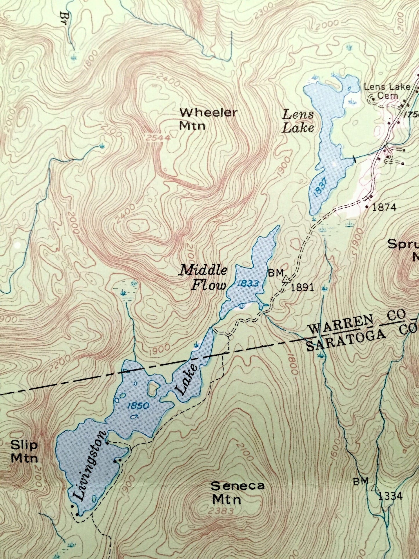
Antique Harrisburg, New York 1954 US Geological Survey Topographic Map – Adirondacks, Sacandaga, Edinburg, Day Hope Falls Saratoga Warren NY
Beautiful, antique map of Harrisburg, New York and surrounding Warren, Hamilton & Saratoga County area. This is an authentic 1954 edition, 1971 print from the U.S. Geological Survey and NOT a computer reproduction.
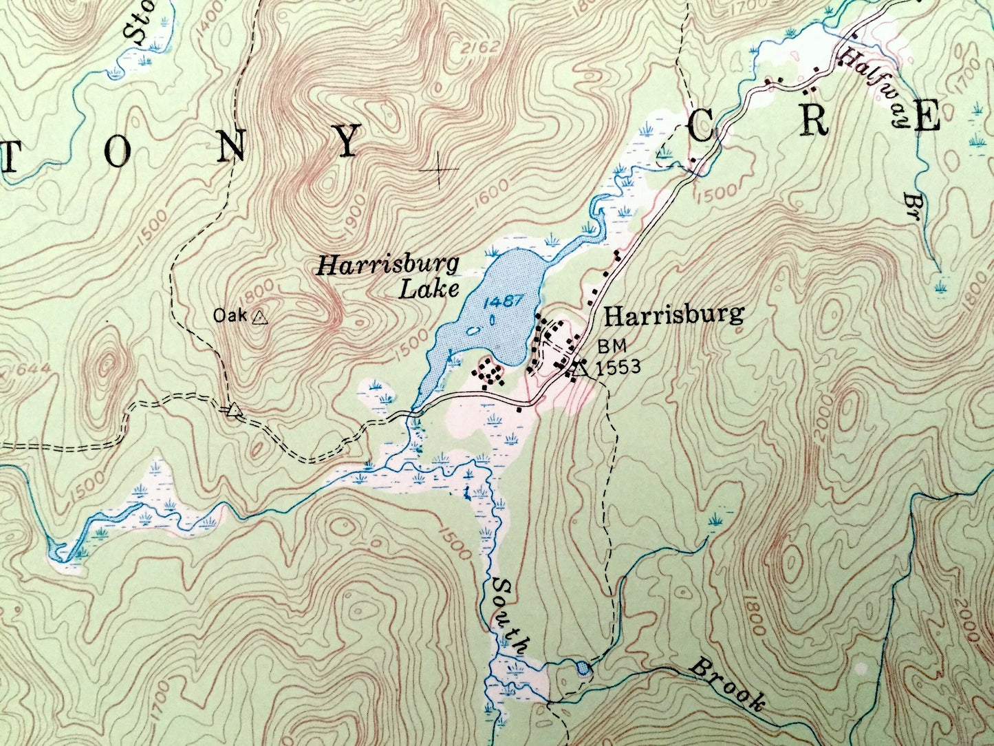
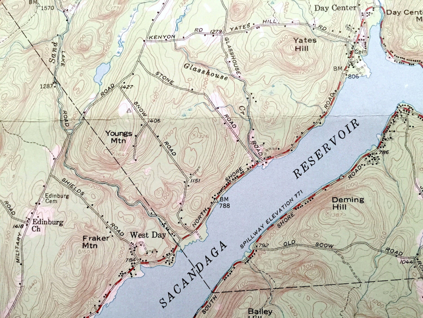
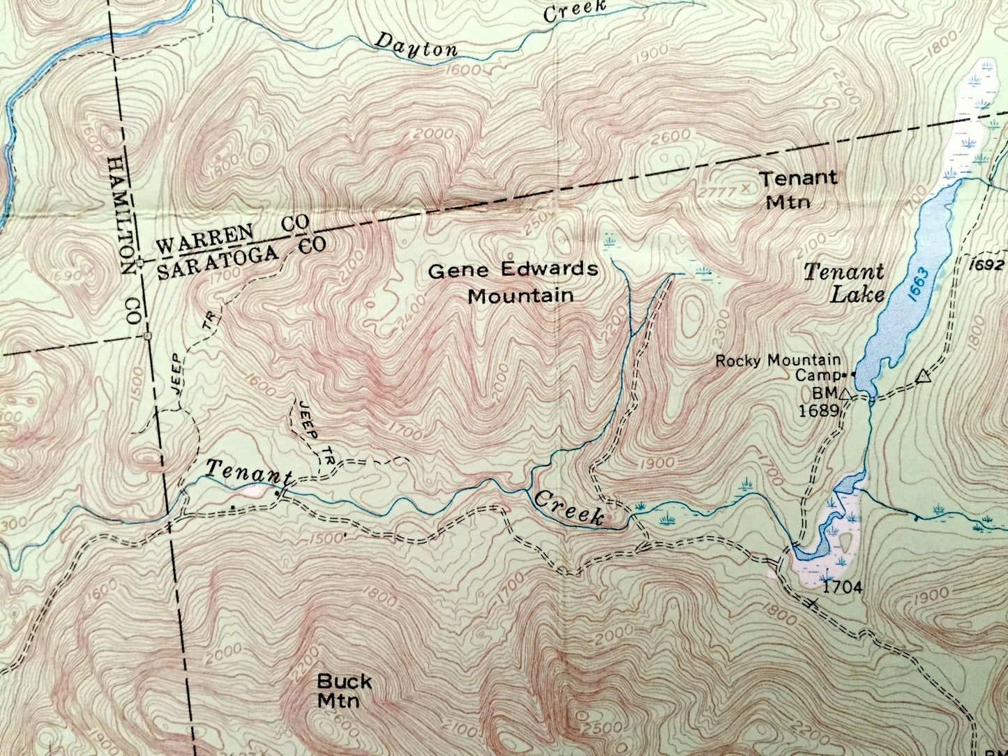
See what The Adirondacks looked like more than 65 years ago. Lots of intricate details and geological contours. Map even has little squares for every house that existed. The USGS cartographers were very thorough back then!
Perfect for the historian, map-lover, the curious or just as a conversation starter. Wonderful and rare. Vintage maps such as these make great gifts.
Edition of 1954, printed 1971
Dimensions: 17" width x 21" height
----
Features
Cities & Towns: Harrisburg, Wells, Thurman, Stony Creek, Hope, Benson, Edinburg, Northampton, Griffin, Knowelhurst, Bakertown, Maple Grove, West Day, Tenantville, Day Center, Hope Falls.
Points of Interest: Warren County, Saratoga County, Hamilton County, Adirondacks, Sacandaga Reservoir, Sacandaga River, Stony Creek, Livingston Lake, Wilcox Lake, Willis Lake, Ohmer Mountain, Bearpen Peak, Georgia Mountain, Wheeler Mountain, Gene Edwards Mountain, Spruce Mountain, Rocky Mountain Camp, and many more lakes, ponds, islands, coves, hills, mountains, houses, train tracks, roads.
Condition: Good Vintage condition, commensurate with age. This map is in incredible shape for being over 45 years old. Has some edge-wear, pen markings and folds as-issued, but these will flatten easily and all will read as vintage character when framed.
----
We will happily adjust shipping price for multiple purchases. Maps are rolled up and shipped in sturdy mailing tubes, never folded.
Couldn't load pickup availability
Share