My Store
Antique Hartford South, Connecticut 1964 US Geological Survey Topographic Map – Middlesex, Hartford County, Newington, Berlin, Rocky Hill CT
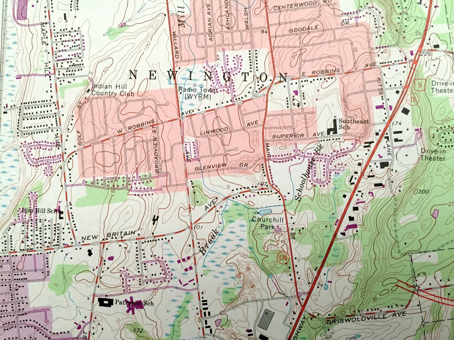
Antique Hartford South, Connecticut 1964 US Geological Survey Topographic Map – Middlesex, Hartford County, Newington, Berlin, Rocky Hill CT
Beautiful, antique map of Hartford South, Connecticut and surrounding Hartford & Middlesex County areas. This is an authentic 1964 edition, 1973 print from the U.S. Geological Survey and NOT a computer reproduction.
See what Connecticut looked like over 55 years ago. Lots of intricate details and geological contours. Map even has little squares for every house that existed at the time. The USGS cartographers were very thorough back then!
Perfect for the historian, map-lover, the curious or just as a conversation starter. Wonderful and rare. Vintage maps such as these make great gifts.
Edition of 1964, printed 1973
Dimensions: 22" width x 27" height
----
Features
Cities & Towns: West Hartford, East Hartford, Glastonbury, Wethersfield, Cromwell, Elmwood, Newington Junction, Hockanum, South Wethersfield, Griswoldville, Goodrich Heights, Portland.
Points of Interest: Trinity College, Hartford State Technical Institute, Cedarcrest State Sanatorium, State Institute for Blind, Goodwin Park, Brainard Field, Mill Woods Park, Bulkeley Park, Cedar Mountain, Vexation Hill, Mustard Bowl, Connecticut River, Wethersfield Cove, Glastonbury Ferry, Keeney Cove, Rockhole Brook, Mattabesset River, Dividend Brook, Goff Brook, and many more hills, streams, ponds, houses, schools, railroads, churches and roads.
Condition: Very Good Vintage condition, commensurate with age. This map is in great shape for being over 45 years old. Has light edge-wear but will read as character when framed.
----
We will happily adjust shipping price for multiple purchases. Maps are rolled up and shipped in sturdy mailing tubes, never folded.
Couldn't load pickup availability
Share