My Store
Antique Haverhill, Massachusetts 1893 US Geological Survey Topographic Map – Merrimac, Methuen, Groveland, Rockingham County, New Hampshire
Antique Haverhill, Massachusetts 1893 US Geological Survey Topographic Map – Merrimac, Methuen, Groveland, Rockingham County, New Hampshire
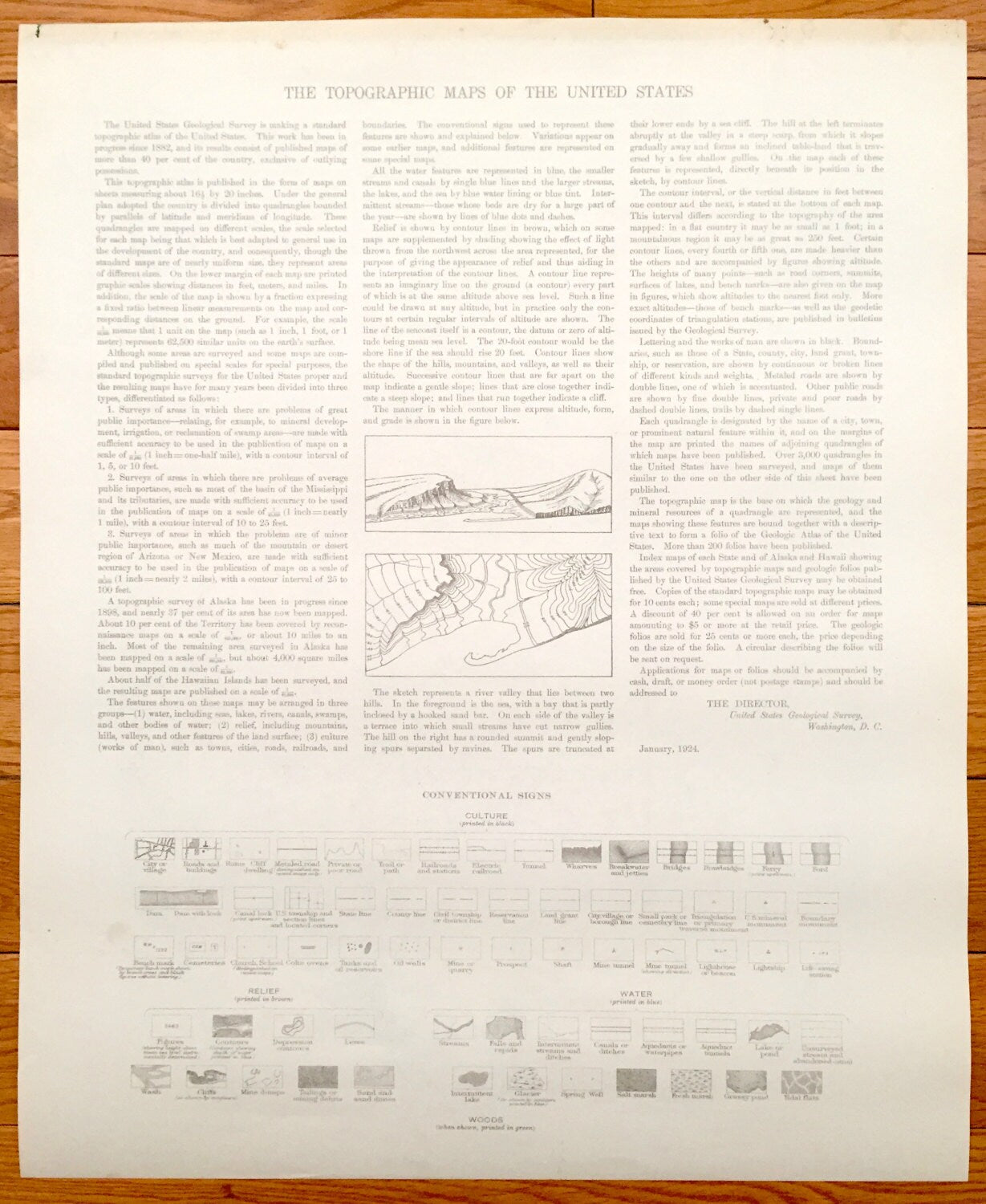
Beautiful, antique map of Massachusetts & New Hampshire around Haverhill, MA on the Merrimack River. This is an authentic edition of 1893 edition, 1924 print from the U.S. Geological Survey and NOT a computer reproduction.
See what Essex County, MA and Rockingham County, NH looked like over 130 years ago. Lots of intricate details and geological contours. Map even has little squares for every house that existed at the time. The USGS cartographers were very thorough back then! On the back is a description of topographic symbols and map guide.
Perfect for the historian, map-lover, the curious or just as a conversation starter. Wonderful and rare. Vintage maps such as these make great gifts.
Edition of 1893, printed 1924
Dimensions: 16 1/2 " width x 20" height
----
Features
Cities & Towns: NEW HAMPSHIRE: Raymond, Chester, Fremont, Brentwood, Exeter, Derry, Sandown, Danvill, Kingston, East Kingston, Hampstead, Newtown, South Hampton, Windham, Salem, Atkinson, Plaistow, North Danville, Marshall Corner, East Kingston, West Hempstead, Cowbell Corners, North Salem, Raglett Grove, Powwow River, Rowes Corner, Canobie Lake, Millville, Salem Depot, Rockingham Park, Mt. Ararat, Hampshire Road. MASSACHUSETTS: Methuen, Haverhill, Merrimac, Groveland, West Newbury, Ayers Village, Bradford, Rocks Village, Riverside.
Points of Interest: Merrimack River, Island Pond, Governors Island, Kenoza Lake, Arlington Mill Reservoir, Country Pond, Great Pond, Wash Pond, Phillips Pond, Mardens Hill, Rock Rimmon Hill, Great Hill, Smith Mountain, Butman Hill, Eastman Hill, Hubbard Hill, Osgood Hill, Smith Mountain, Brandy Rock Hill, Hog Hill, Pine Knoll, Morse Hill, Aspen Hill, Bera Hill, Canobie Lake, Providence Hill, Spicket Hill, World End Pond, Scotland Hill, Parsonage Hill, Poors Hill, Silver Hill, West Meadow Hill, Sweet Hill, Brandy Brow Hill, Job Hill, Kimball Hill, Boston & Maine Railroad Main Line (Georgetown Branch), and more roads, houses, schools, reservoirs, ponds, hills, and streams.
Condition: Very Good Vintage condition, commensurate with age. This map is in great shape for being 100 years old.
----
We will happily adjust shipping price for multiple purchases. Maps are rolled up and shipped in sturdy mailing tubes, never folded.
Couldn't load pickup availability
Share