My Store
Antique Haverstraw, New York 1967 US Geological Survey Topographic Map – Clarkstown, Cortlandt, Stony Point, Croton, Hudson River Valley
Antique Haverstraw, New York 1967 US Geological Survey Topographic Map – Clarkstown, Cortlandt, Stony Point, Croton, Hudson River Valley
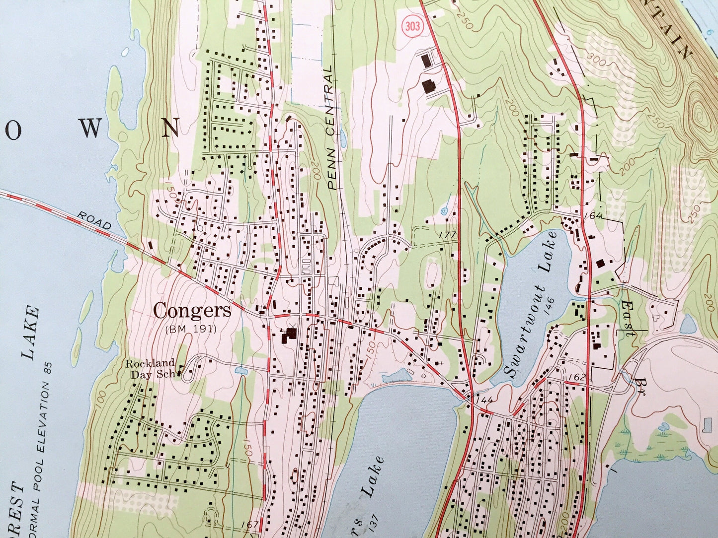
Beautiful, antique map of the Haverstraw, Clarkstown and Cortlandt, New York and surrounding Hudson River Valley area. This is an authentic 1967 edition, 1968 print from the U.S. Geological Survey and NOT a computer reproduction.
See what the Hudson River Valley just north of New York City looked like more than 50 years ago. Lots of intricate details and geological contours. Map even has little squares for every house that existed at the time. The USGS cartographers were very thorough back then! On the back is a description of topographic symbols and map guide.
Perfect for the historian, map-lover, the curious or just as a conversation starter. Wonderful and rare. Vintage maps such as this make great gifts.
Edition of 1967, printed 1968
Dimensions: 22" width x 27" height
----
Features
Cities & Towns: Stony Point, Haverstraw, Clarkstown, Cortlandt, West Haverstraw, Samsondale, Garnersville, Tomkins Cove, Brownsell Corner, Centenary, Brookside Park, Oak Park, New City, New City Park, Durant, Congers, Montrose, Pine Lake Park, Cragers, Oscawana, Croton-on-Hudson, Mt. Airy, Harmon Park, Woodybrook, Chimney, Upper Nyack, and many more.
Points of Interest: Hudson River, Westchester County, Rockland County, Grassy Point, New York Reconstruction Home, Bowlines Point, South Mountain, Hackensack River, Palisades Park, Verdrietege Hook, Rockland Lake, Congers Lake, Snedeker Landing, Short Clove, Greens Cove, Montrose Point, Georges Island, Oscawana Island, Furnace Brook Pond, Croton Point, Croton Point Park, Croton Bay, Tellers Point, Croton River, Torment Hill, and many more small towns, schools, train tracks, roads, hills and creeks.
Condition: Good condition, commensurate with age. This map is in great shape for being over 50 years old. Has some edge-wear but this will add to vintage character when framed.
----
We will happily adjust shipping price for multiple purchases. Maps are rolled up and shipped in sturdy mailing tubes, never folded.
Couldn't load pickup availability
Share