My Store
Antique Heath, Massachusetts 1950 US Geological Survey Topographic Map — Franklin County, Rowe, Colrain, MA, Windham County, Whitingham, VT
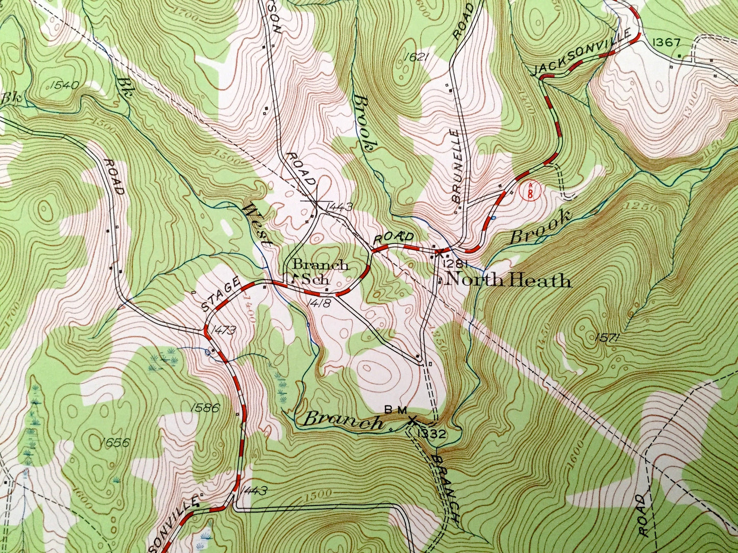
Antique Heath, Massachusetts 1950 US Geological Survey Topographic Map — Franklin County, Rowe, Colrain, MA, Windham County, Whitingham, VT
Beautiful, antique map of Heath, Massachusetts and surrounding Franklin County areas, including Vermont’s Windham County. This is an authentic 1950 edition, 1958 print from the U.S. Geological Survey and NOT a computer reproduction.
See what Massachusetts and Vermont looked like over 70 years ago. Lots of intricate details and geological contours. Map even has little squares for every house that existed at the time. The USGS cartographers were very thorough back then!
Perfect for the historian, map-lover, the curious or just as a conversation starter. Wonderful and rare. Vintage maps such as these make great gifts.
Edition of 1950, printed 1958
Dimensions: 22" width x 27" height
----
Features
Cities & Towns: MASSACHUSETTS: Rowe, Colrain, Charlemont, North Heath, Dell, Adamsville.
VERMONT: Whitingham, Halifax.
Points of Interest: Colrain State Forest, Clark Hill, Phillips Hill, Underwood Hill, Spruce Hill, Stone Mountain, Burnt Hill, Bald Mountain, Pocumtuck Mountain, Catamount Hills, Panel Hill, Shippee Pond, Crouch Pond, East Branch North River, Deerfield River, West Branch North River, Taylor Brook, Wilder Brook, Davis Mine Brook, Mill Brook, and many more hills, streams, ponds, houses, schools, railroads, churches and roads.
Condition: Very Good Vintage condition, commensurate with age. This map is in great shape for being over 60 years old. Has light edge-wear but will read as character when framed.
----
We will happily adjust shipping price for multiple purchases. Maps are rolled up and shipped in sturdy mailing tubes, never folded.
Couldn't load pickup availability
Share