My Store
Antique Helena, Montana 1903 US Geological Survey Topographic Map – Deer Lodge, Lewis & Clark, Silver Bow, Jefferson County, Blackfoot, MT
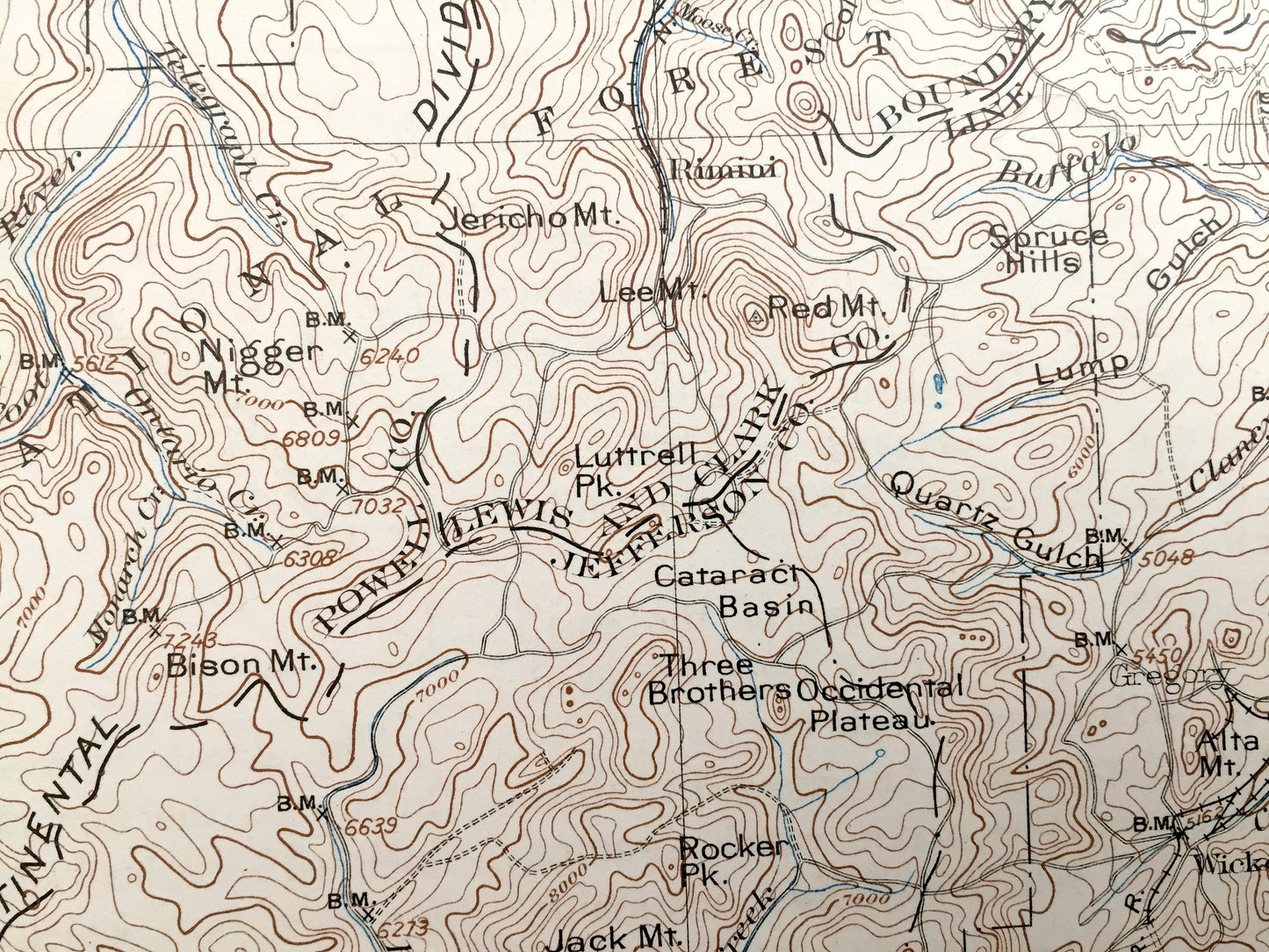
Antique Helena, Montana 1903 US Geological Survey Topographic Map – Deer Lodge, Lewis & Clark, Silver Bow, Jefferson County, Blackfoot, MT
Beautiful, antique map of Helena, Montana and surrounding Powell, Lewis & Clark, Silver Bow, Jefferson and Deer Lodge County area. This is an authentic 1903 edition, 1929 print from the U.S. Geological Survey and NOT a computer reprint.
See what Montana looked like 120 years ago. Lots of intricate details and geological contours. Map even has little squares for every house that existed. The USGS cartographers were very thorough back then! On the back is a description of topographic symbols and map guide.
Perfect for the historian, map-lover, the curious or just as a conversation starter. Wonderful and rare. Vintage maps such as these make great gifts.
Edition of 1903, printed 1929
Dimensions: 16 1/2" width x 20" height
----
Features
Towns: Helena, Lincoln, Gould, Marysville, Mitchells, Johns, Pioneer, Yam Hill, Garrison, Ophir, Elliston, Blossburg, Bald Butte, Silver City, Birdsey, Austin, Ft. Harrison, Unionville, Racetrack, Bernice, Basin, Rimini, Jefferson, Wickes, Warm Springs, Anaconda, Stuart, Gregson, Silver Bow, Walkerville, Butte, Elk Park, Woodville, Gunderson, south Butte, Boulder.
Points of Interest: Lewis & Clark County, Powell County, Deer Lodge County, Silver Bow County, Jefferson County, Continental Divide, Garnet Range, Ivan Valley, Helena National Forest, Deer Lodge National Forest, Blackfoot River, Sevemile Creek, Boulder River, Warm Springs Creek, Bull Mountain, Mt. Ascension, Little Blackfoot River, Whitetail Peak, Cliff Mountain, Jack Mountain, Mullan Pass, Little Prickly Pear Creek, Granite Peak, Dog Creek, Great Northern Railroad, and many more smaller lakes, streams, houses, schools, roads, churches and train tracks.
Condition: Good Vintage condition, commensurate with age. This map is in great shape for being over 90 years old. Has light wear and pen markings, but this will read as vintage character when framed.
----
We will happily adjust shipping price for multiple purchases. Maps are rolled up and shipped in sturdy mailing tubes, never folded.
Couldn't load pickup availability
Share