My Store
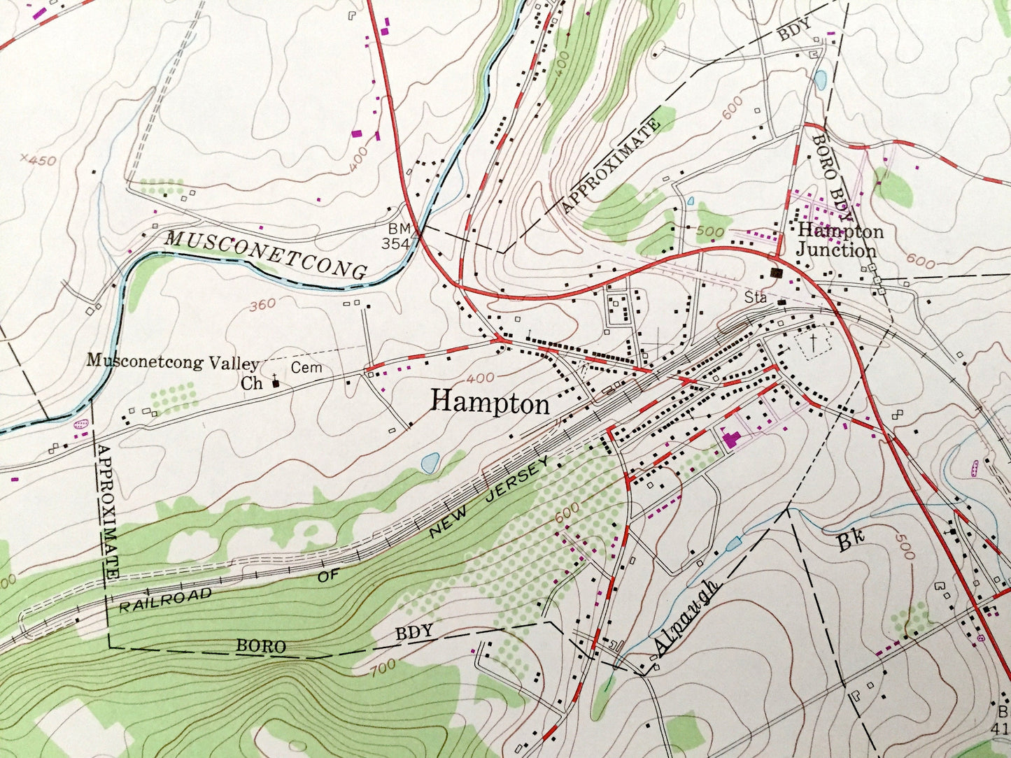
Antique High Bridge, New Jersey 1954 US Geological Survey Topographic Map – Warren, Hunterdon County, Washington, Bethlehem, Lebanon, NJ
Antique High Bridge, New Jersey 1954 US Geological Survey Topographic Map – Warren, Hunterdon County, Washington, Bethlehem, Lebanon, NJ
Beautiful, antique map of High Bridge, New Jersey and surrounding Warren and Hunterdon County areas. This is an authentic 1954 edition, 1979 print from the U.S. Geological Survey and NOT a computer reproduction.
See what New Jersey looked like over 65 years ago. Lots of intricate details and geological contours. Map even has little squares for every house that existed at the time. The USGS cartographers were very thorough back then!
Perfect for the historian, map-lover, the curious or just as a conversation starter. Wonderful and rare. Vintage maps such as these make great gifts.
Edition of 1954, printed 1979
Dimensions: 22" width x 27" height
----
Features
Cities & Towns: Changewater, New Hampton, Hampton Junction, Bells Crossing, Hampton, Bethlehem, Charlestown, Van Syckel, Norton, Union, Hensfood, Union, Franklin, Clinton, High Bridge, Annandale, Cedar Heights, Stone Mill, Bunnvale, Woodglen, Newport, Red Mill.
Points of Interest: Pohatcong Mountain, Musconetcong Valley, Central Railroad of New Jersey, Musconetcong Mountain, Township Consolidated School, Lehigh Valley Railroad, Lake Solitude, Voorhees State Park, Township Elementary School, Camp Watchung, and many more hills, streams, ponds, houses, schools, railroads, churches and roads.
Condition: Very Good Vintage condition, commensurate with age. This map is in great shape for being over 40 years old. Has very light edge-wear, which will read as character when framed.
----
We will happily adjust shipping price for multiple purchases. Maps are rolled up and shipped in sturdy mailing tubes, never folded.
Couldn't load pickup availability
Share