My Store
Antique Hillsboro, New Hampshire 1957 US Geological Survey Topographic Map – Bradford, Warner, Henniker, Deering, Weare, Antrim, Francestown
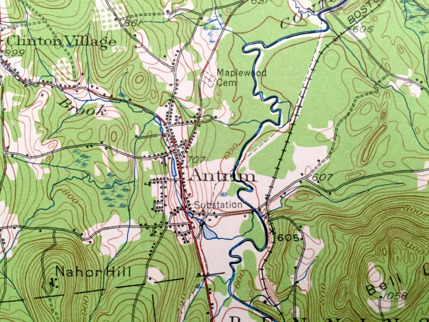
Antique Hillsboro, New Hampshire 1957 US Geological Survey Topographic Map – Bradford, Warner, Henniker, Deering, Weare, Antrim, Francestown
Beautiful, antique map of Hillsboro, Deering, Weare, Antrim, Bennington, Francestown, Bradford, Warner, New Hampshire. This is an authentic 1957 print from the U.S. Geological Survey and NOT a computer reproduction.
See what Hillsboro and Merrimack Counties looked like over 60 years ago. Lots of intricate details and geological contours. Map even has little squares for every house that existed at the time. The USGS cartographers were very thorough back then!
Perfect for the historian, map-lover, the curious or just as a conversation starter. Wonderful and rare. Vintage maps such as these make great gifts.
Edition of 1957, printed 1957
Dimensions: 17" width x 21" height
----
Features
Cities & Towns: Bradford, Warner, Henniker, Hillsboro, Deering, Weare, Antrim, Bennington, Francestown, Hancock North Branch, Hillsboro Upper Village, Hillsboro Lower Village, Hillsboro Center, Henniker June, Diamond, Bradford Center, West Henniker, Chase Village, Antrim Center, East Deering,
Points of Interest: Lake Massasecum, Liberty Union School, Long Pond, Hemlock School, Contoocook River, Pleasant Pond, Quaker School, Candlewood Hill, Bell Ledges, Crotched Mountain, Nahor Hill, Greggmere Camp, Camp Sachem, Gregg Lake, Jackman Reservoir, Birthplace of Franklin Pierce, Merrill School, Emerson Station, Boston & Maine Railroad, and lots more hills, mountains, streams, ponds, houses, schools and roads.
Condition: Very Good condition, commensurate with age. This map is in incredible shape for being 60 years old. Has light edge-wear and pencil marking, but this will read as vintage character when framed. Map has punch holes but these are easily concealed with framing or placing a similar-colored paper behind the map, as can be seen in the photos.
----
We will happily adjust shipping price for multiple purchases. Maps are rolled up and shipped in sturdy mailing tubes, never folded.
Couldn't load pickup availability
Share