My Store
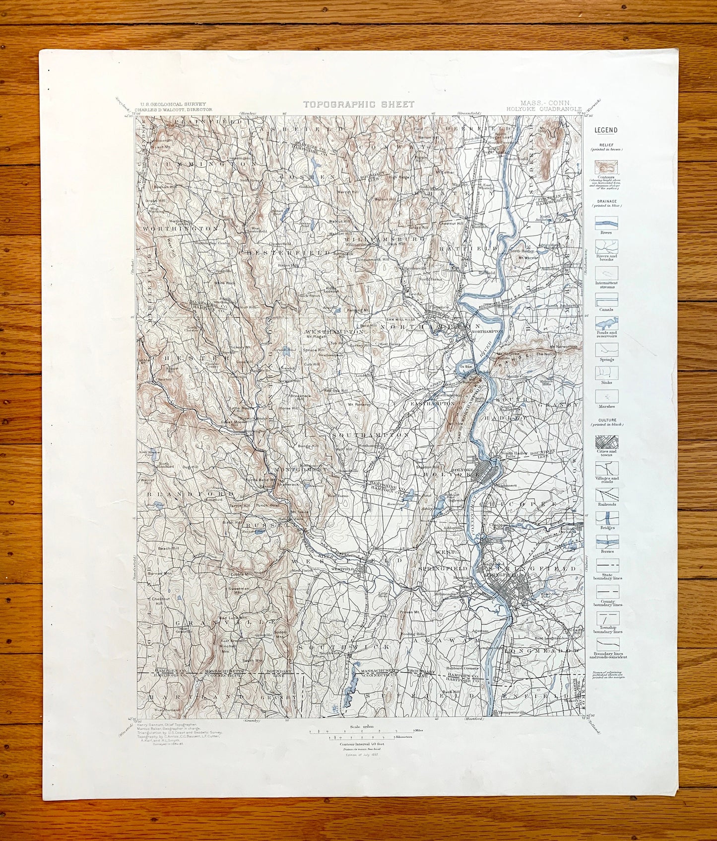
Antique Holyoke, Massachusetts 1897 US Geological Survey Topographic Map – Springfield, Northampton, Deerfield, Amherst, Ashfield, MA
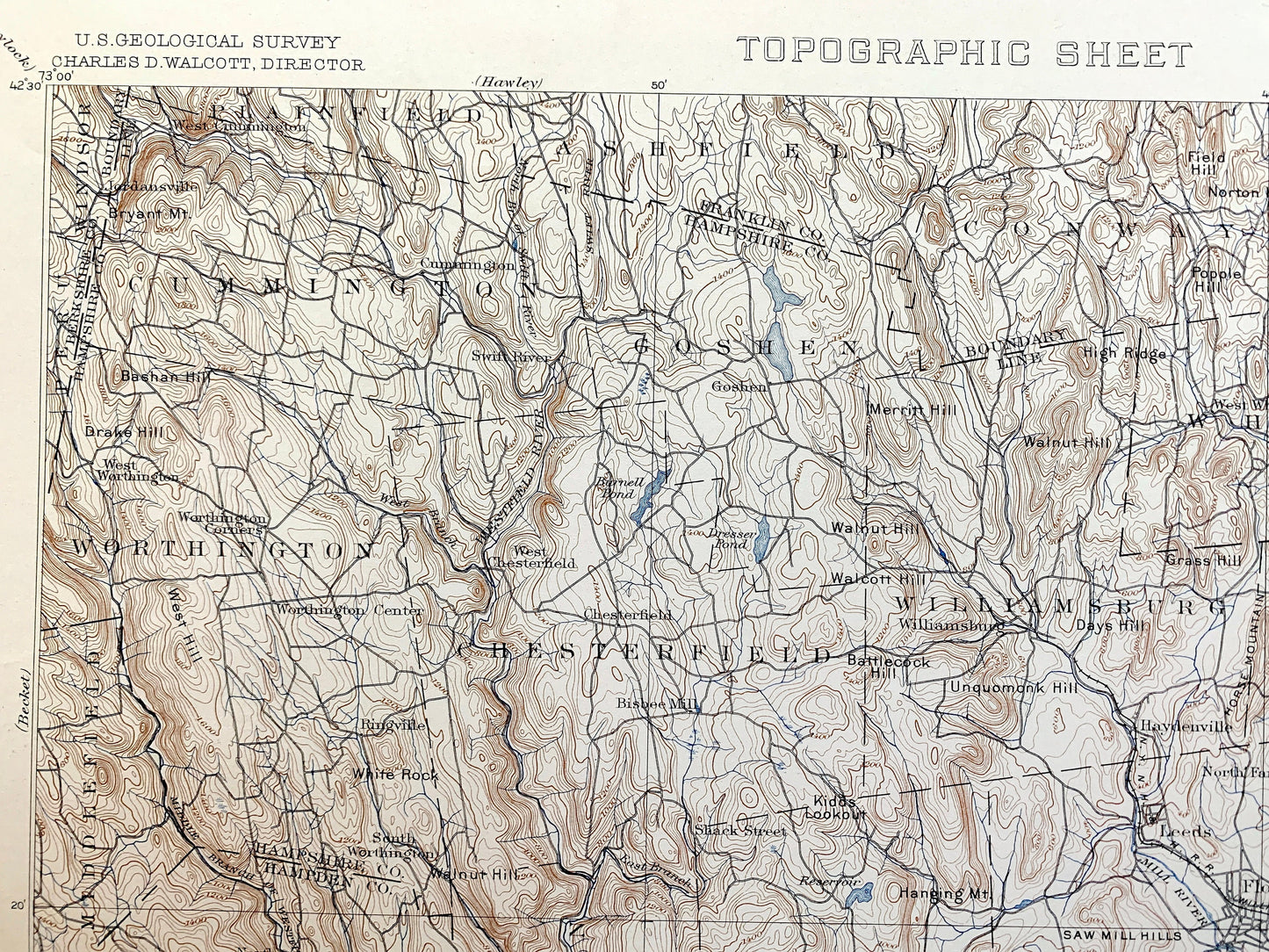
Antique Holyoke, Massachusetts 1897 US Geological Survey Topographic Map – Springfield, Northampton, Deerfield, Amherst, Ashfield, MA
Beautiful, antique map of Hampshire & Hamden County Massachusetts including Northampton, Amherst, Deerfield, Ashfield, Hadley, Springfield and other surrounding towns and cities. This is an authentic 1897 edition, 1897 print from the U.S. Geological Survey and is NOT a computer reproduction. It is from a Geologic Atlas folio.
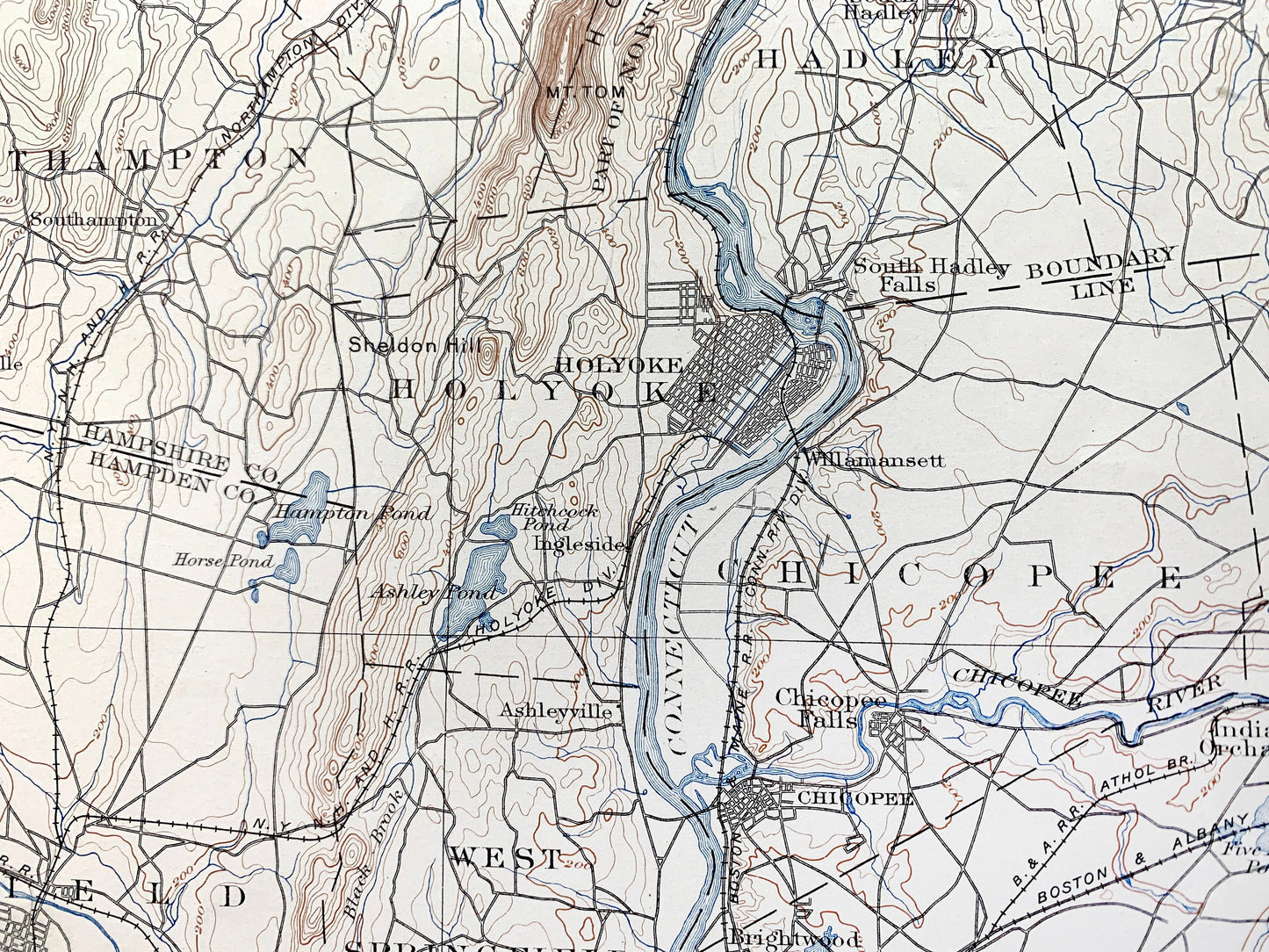
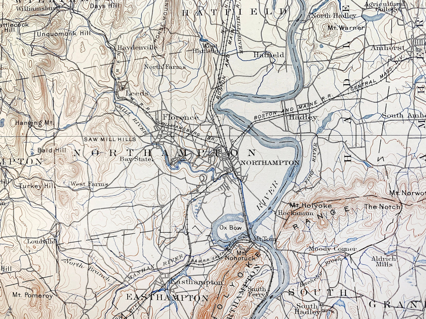
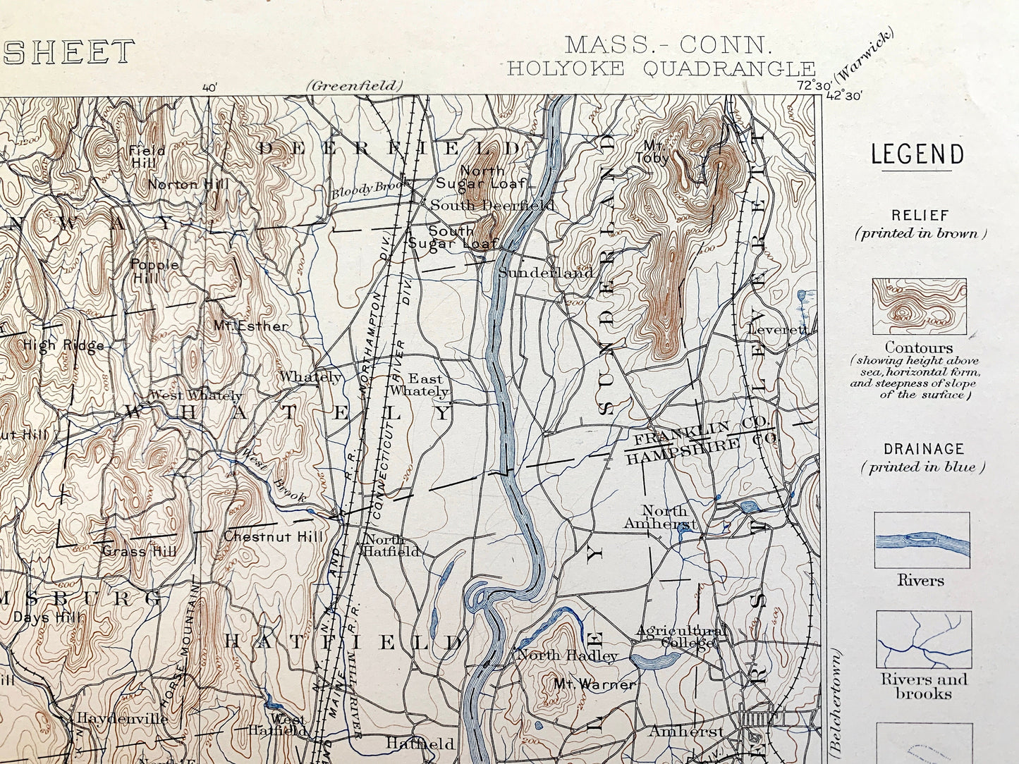
See what Massachusetts looked like over 120 years ago. Lots of intricate details and geological contours. Map even has little squares for every house that existed at the time. The USGS cartographers were very thorough back then! This is one of the rare maps where the topographic symbols and map guide are on the front.
Perfect for the historian, map-lover, the curious or just as a conversation starter. Wonderful and rare. vintage maps such as these make great gifts.
Edition of 1897, printed 1897
Dimensions: 18 1/2" width x 22" height
----
Features
Cities & Towns: Plainfield, Ashfield, Conway, Deerfield, Sunderland, Leverret, Whately, Williamsburg, Hatfield, Hadley, Amherst, South Amherst, North Amherst, North Hadley, Leeds, Northampton, West Farms, West Hampton, Wast Hampton, South Hadley, Granby, Cummington, Goshen, Chesterfield, Middlefield, Chester, Huntington, Holyoke, Southampton, Montgomery, Worthtington, Blanford, Russel, Westfield, Granville, Chicopee, Springfield, Longmeadow, West Springfield, Southwick, Agawam.
Connecticut: Harland, Granby, Suffield, Enfield
Points of Interest: Agricultural College (Amherst), Boston and Maine Railroad, Holyoke Range, Aldrich Mills, South Hadley Falls, Bad Luck Mountain, Connecticut River, Barnes Mountain, Hazard Pond and more roads, houses, reservoirs, ponds, hills, streams, and mountains.
Condition: Very Good Vintage condition, commensurate with age. This map is in great shape for being 120 years old. Has some edge-wear, toning, foxing and staple holes in margin, but this will all add to vintage character when framed.
----
We will happily adjust shipping price for multiple purchases. Maps are rolled up and shipped in sturdy mailing tubes, never folded.
Couldn't load pickup availability
Share