My Store
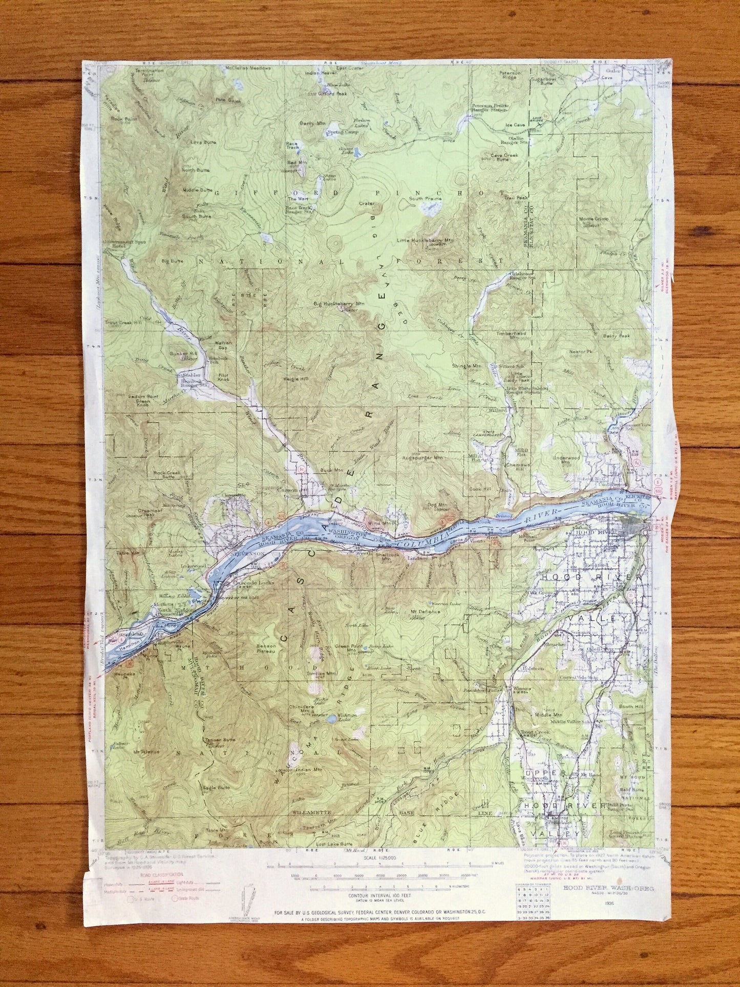
Antique Hood River, Oregon 1926 US Geological Survey Topographic Map – Skamania County, Columbia River, Cascade Range, Carson, Washington OR
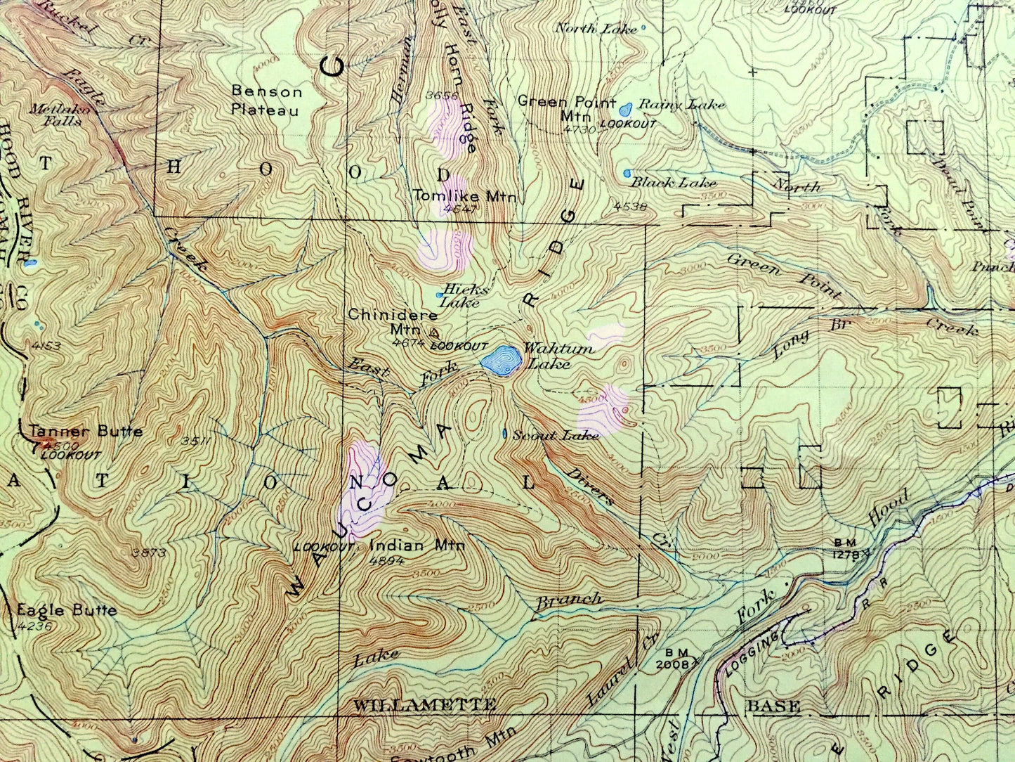
Antique Hood River, Oregon 1926 US Geological Survey Topographic Map – Skamania County, Columbia River, Cascade Range, Carson, Washington OR
Beautiful, antique map of Hood River, Oregon and surrounding Hood River, Skamania & Klickatat County, Washington area on the Columbia River. This is an authentic 1926 edition, 1955 print from the U.S. Geological Survey and is NOT a computer reproduction.
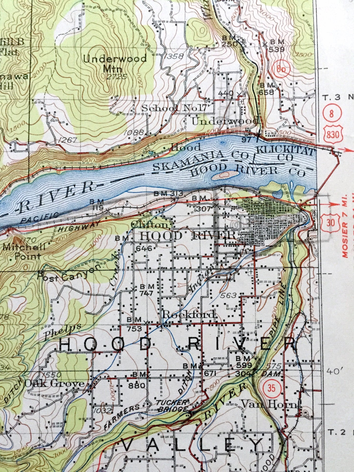
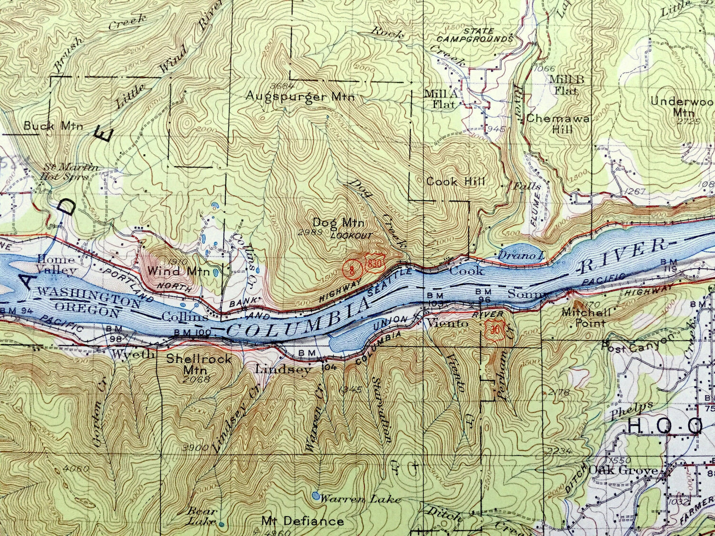
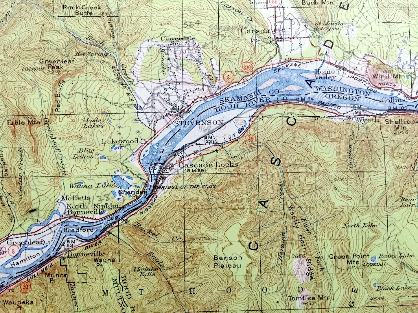
See what Oregon and Washington looked like more than 95 years ago. Lots of intricate details and geological contours. Map even has little squares for every house that existed at the time. The USGS cartographers were very thorough back then!
Perfect for the historian, map-lover, the curious or just as a conversation starter. Wonderful and rare. Vintage maps such as this make great gifts.
Edition of 1926, printed 1955
Dimensions: approx. 13" width x 19 1/2" height
----
Features
Cities & Towns: OREGON: Hood River, Bonneville, Cascade Locks, Wyeth, Lindsey, Viento, Clifton, Rockford, Oak Grove, Summit, Van Horn, Bloucher, Odell, Lenz, Holsteen, Dee, Trout Creek, Woodworth, Parkdale, Mt Hood, Winans.
WASHINGTON: Greenleaf, Bonneville, Moffetts, North Nipignon, Lakewood, Cloverdale, Stevenson, Carson, Home Valley, Underwood, Stabler, Government Springs Hotel, Willard, Pleasant View, Guler.
Points of Interest: Hood River County, Skamania County, Klickatat County, Columbia River, Cascade Range, Gifford Pinchot National Forest, Mt Hood National Forest, Upper Hood River Valley, Hood River Valley, Big Lava Bed, Blue Ridge, Waucoma Ridge, Mt Defiance, Benson Plateau, Mt Talapus, Eagle Butte, Table Mountain, Augspurger Mountain, Dog Mountain, Underwood Mountain, Monte Cristo, Baldy Peak, Timberhead Mountain, Wind River, Hood River, Warren Gap, The Wart, Gifford Peak, Shingle Mountain, Big Huckleberry Mountain, Hamilton Island, Woolly Horn Ridge, Olallie Ranger Station, Chinidere Mountain, and many more towns, houses, roads, ranger stations, train tracks, mountains, creeks and rivers.
Condition: Good Vintage condition, commensurate with age. This map is in great shape for being over 75 years old. Has some edge-wear, toning, foxing, stamp in margin, as well as margin trimming, but this will all read as vintage character when framed.
----
We will happily adjust shipping price for multiple purchases. Maps are rolled up and shipped in sturdy mailing tubes, never folded.
Couldn't load pickup availability
Share