My Store
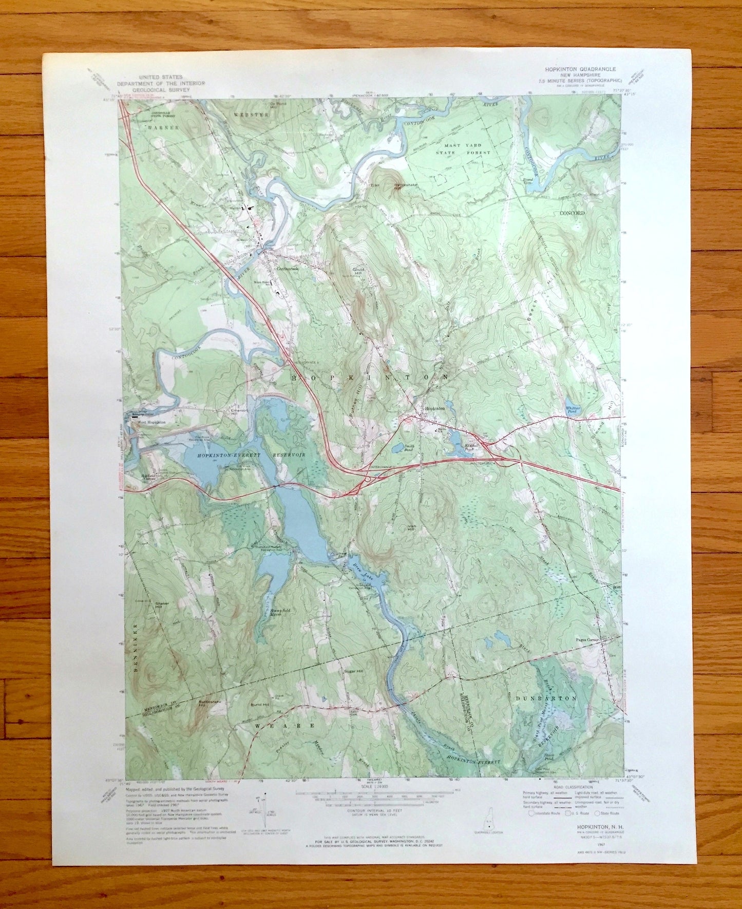
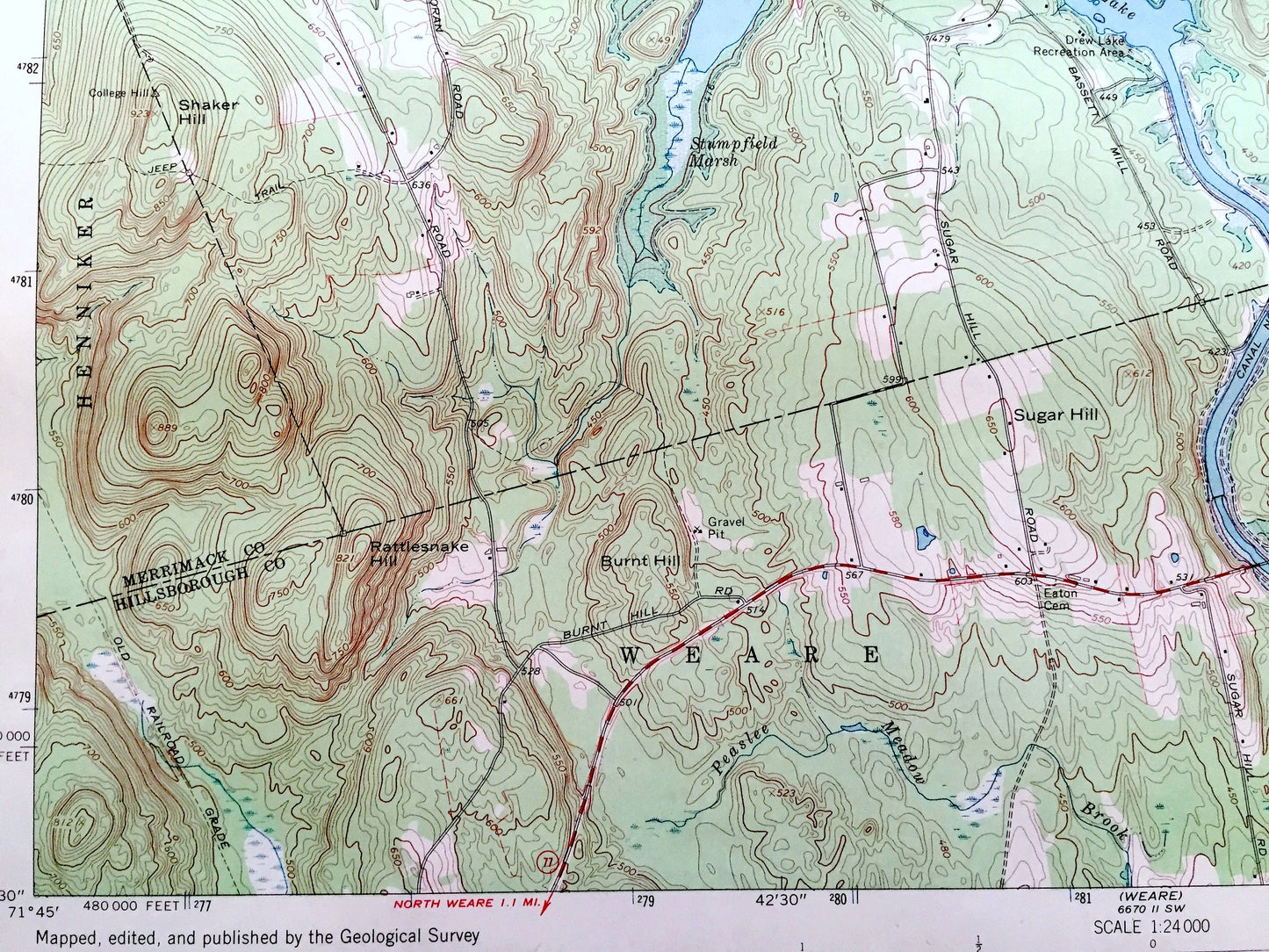
Antique Hopkinton, New Hampshire 1967 US Geological Survey Topographic Map – Merrimack, Hillsborough County, Contoocook, Everett Lake, NH
Antique Hopkinton, New Hampshire 1967 US Geological Survey Topographic Map – Merrimack, Hillsborough County, Contoocook, Everett Lake, NH
Beautiful, antique map of Hopkinton, New Hampshire and surrounding Hillsborough County & Merrimack County area. This is an authentic 1967 edition, 1971 print from the U.S. Geological Survey and NOT a computer reproduction.
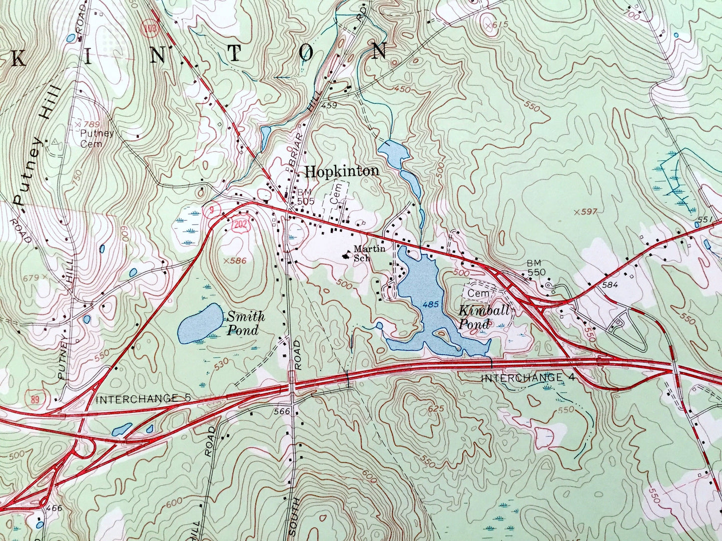
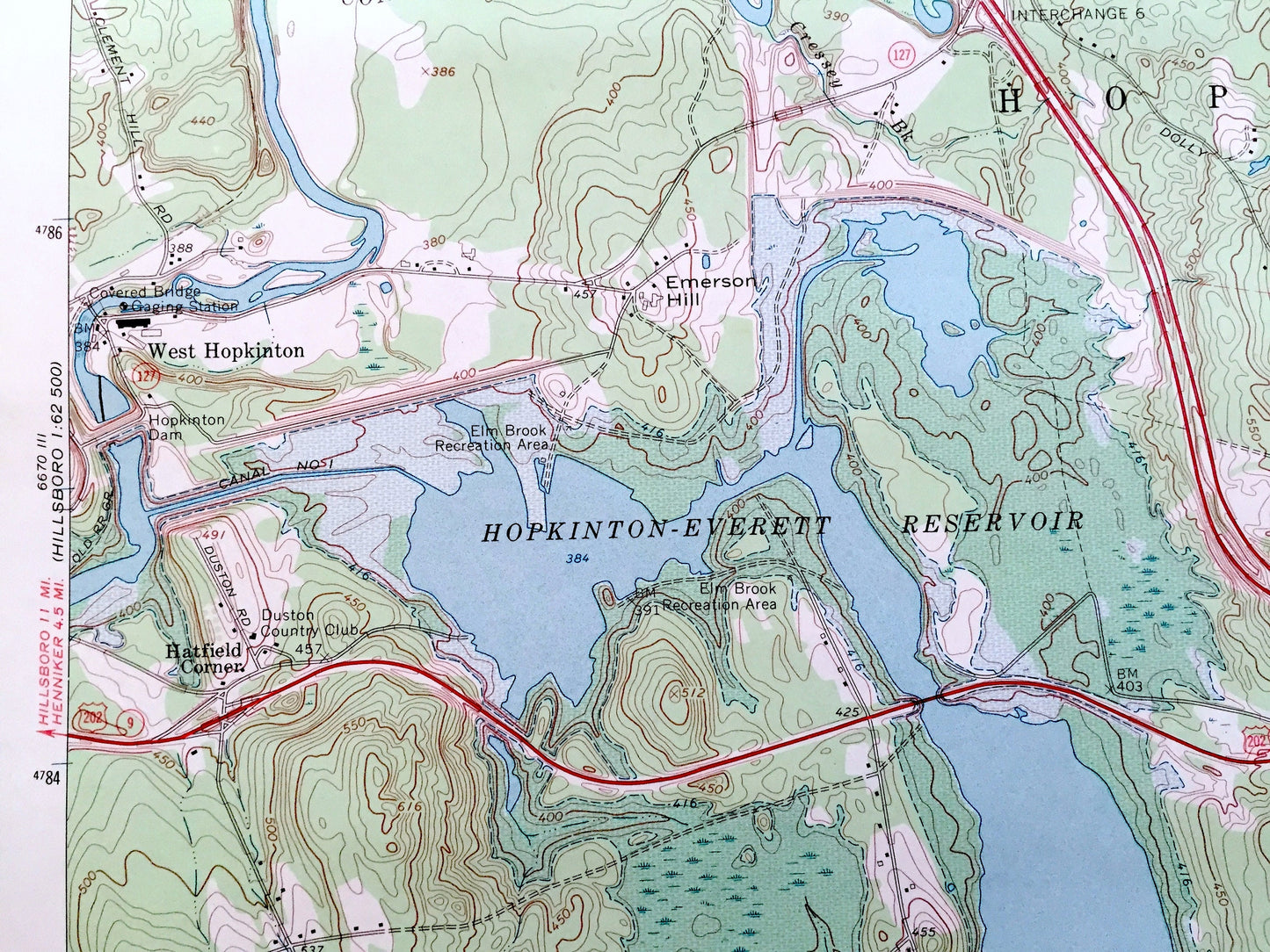
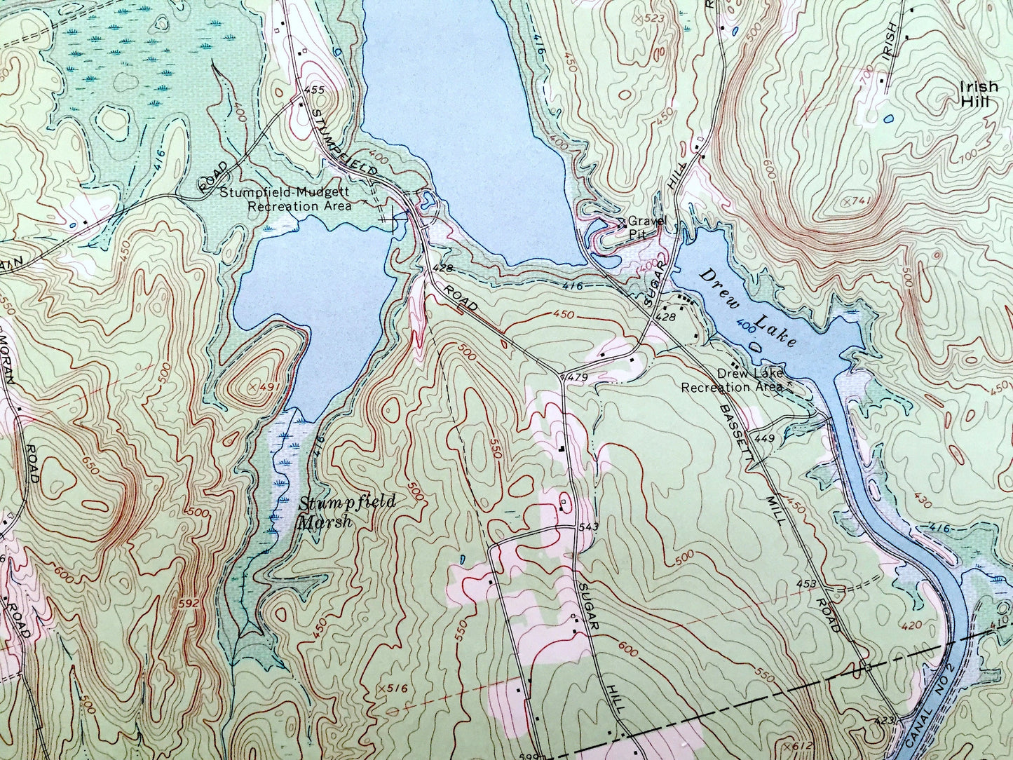
See what New Hampshire looked like over 55 years ago. Lots of intricate details and geological contours. Map even has little squares for every house that existed at the time. The USGS cartographers were very thorough back then!
Perfect for the historian, map-lover, the curious or just as a conversation starter. Wonderful and rare. Vintage maps such as these make great gifts.
Edition of 1967, printed 1971
Dimensions: 22" width x 27" height
----
Features
Cities & Towns: Hopkinton, Warner, Webster, Henniker, Concord, Weare, Dunbarton, Contoocook, West Hopkinton, Pages Corner.
Points of Interest: Merrimack County, Hillsborough County, Hopkinton-Everett Reservoir, Davisville State Forest, Mast Yard State Forest, Drew Lake, Contoocook River, Stumpfield-Mudgett Recreation Area, Kimball Pond, Warner River, Gould Hill, Rattlesnake Hill, Blackwater River, Smith Hill, Irish Hill, Shaker Hill, Sugar Hill Burnt Hill, Stark Brook, and many more hills, streams, ponds, houses, schools, railroads, churches and roads.
Condition: Very Good Vintage condition, commensurate with age. This map is in great shape for being over 50 years old. Has light edge-wear, but this will read as character when framed.
----
We will happily adjust shipping price for multiple purchases. Maps are rolled up and shipped in sturdy mailing tubes, never folded.
Couldn't load pickup availability
Share