My Store
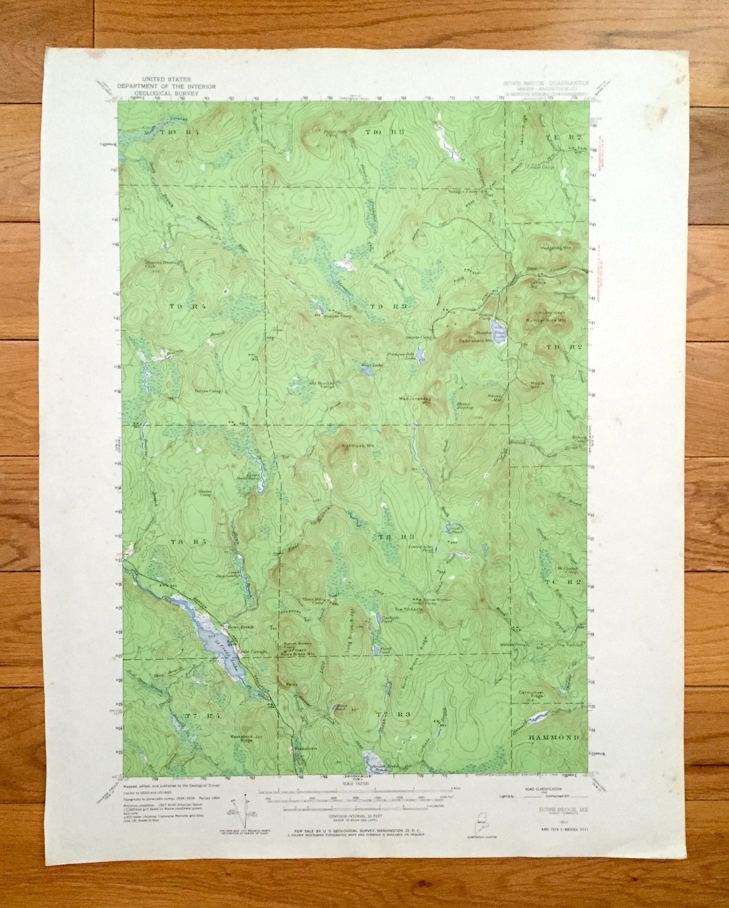
Antique Howe Brook, Maine 1954 US Geological Survey Topographic Map – Hammond, St Croix Lake, Nine Lake, Scott Pond, Aroostook County, ME
Antique Howe Brook, Maine 1954 US Geological Survey Topographic Map – Hammond, St Croix Lake, Nine Lake, Scott Pond, Aroostook County, ME
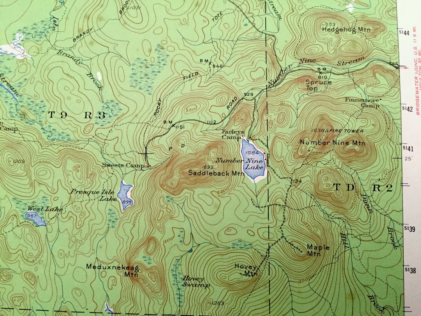
Beautiful, antique map of Howe Brook, Maine and surrounding Aroostook County area. This is an authentic 1954 print from the U.S. Geological Survey and NOT a computer reproduction. This map also a rare, advance sheet.
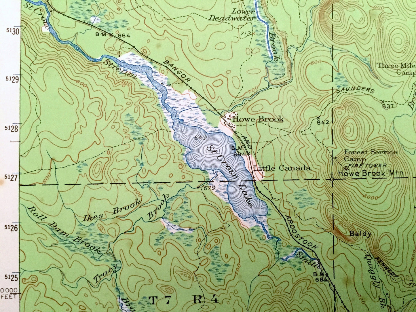
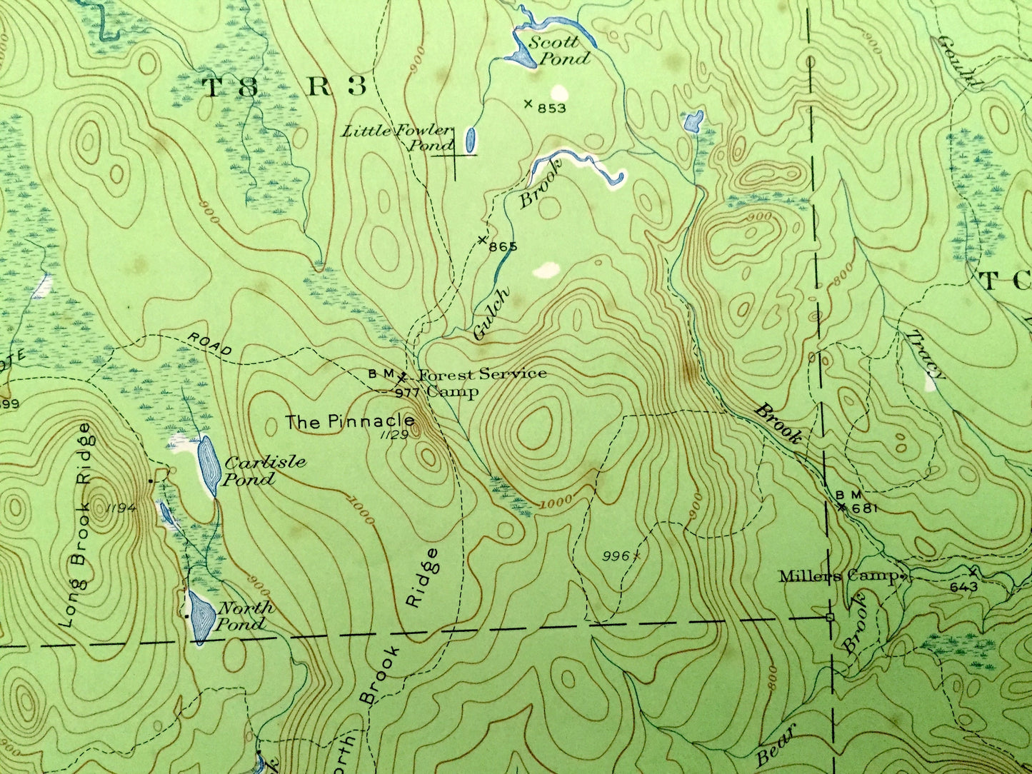
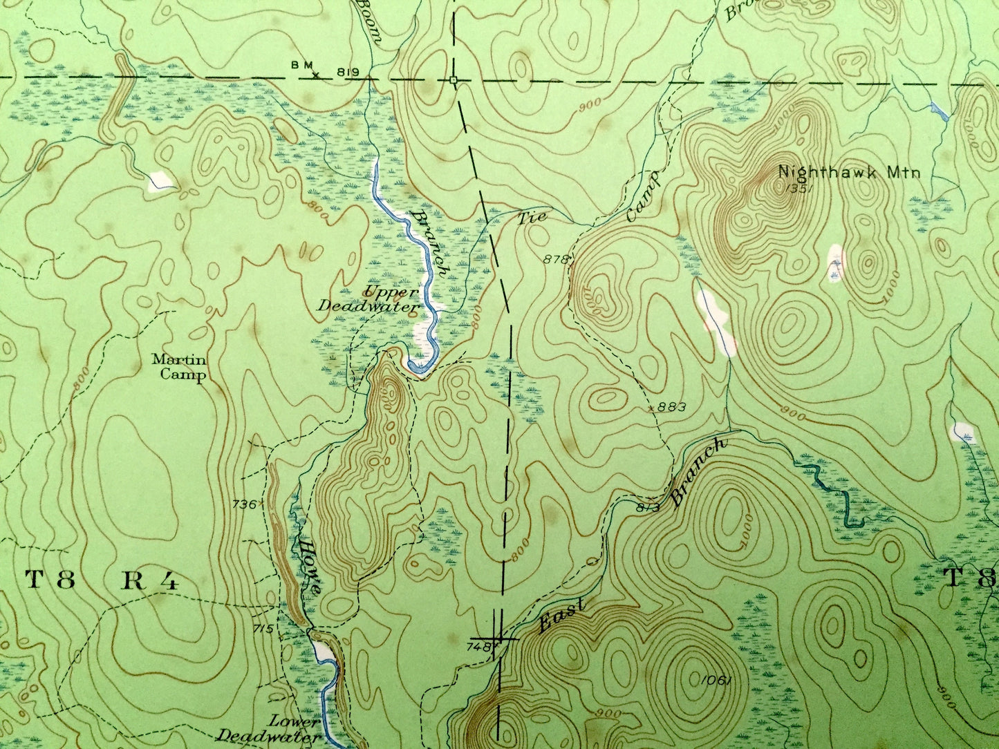
See what Aroostook County of Maine looked like over 60 years ago. Lots of intricate details and geological contours. Map even has little squares for every house that existed at the time. The USGS cartographers were very thorough back then!
Perfect for the historian, map-lover, the curious or just as a conversation starter. Wonderful and rare. Vintage maps such as these make great gifts.
Edition of 1954, printed 1954
Dimensions: 16 1/2" width x 21" height
----
Features
Cities & Towns: Howe Brook, Weeksboro, Hammond, Delong Camp, Little Canada.
Points of Interest: St Croix Lake, Nine Lake, Scott Pond, Beaver Brook, Howard Brook, Smith Brook Pond, Mineola Hunting Club, and many more streams, ponds, villages and mountains.
Condition: Good Vintage condition, commensurate with age. This map is in great shape for being over 85 years old. Has light wear but this will add to vintage character when framed. Some wear and discoloration in margins, but this will all add to vintage character when framed.
----
We will happily adjust shipping price for multiple purchases. Maps are rolled up and shipped in sturdy mailing tubes, never folded.
Couldn't load pickup availability
Share