My Store
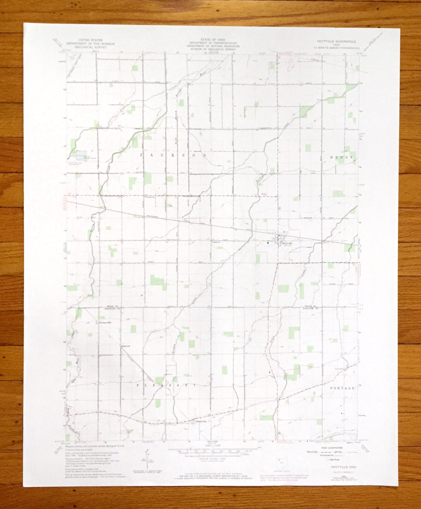
Antique Hoytville, Ohio 1960 US Geological Survey Topographic Map — Wood, Hancock County, Jackson, Henry, Pleasant, Portage, Butlers Mill OH
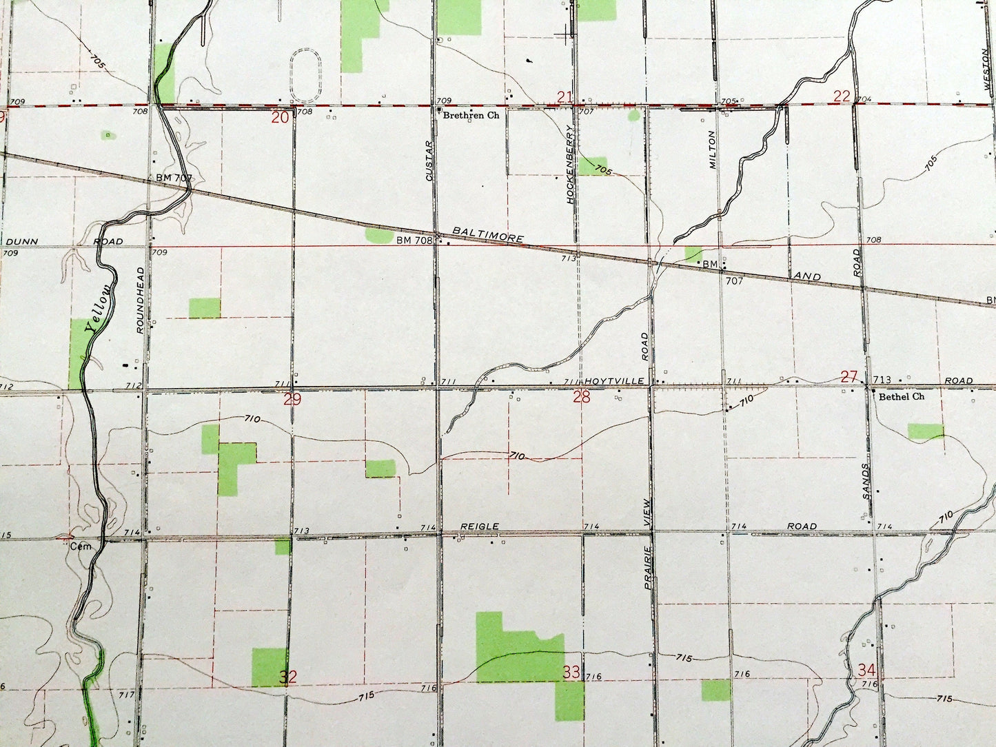
Antique Hoytville, Ohio 1960 US Geological Survey Topographic Map — Wood, Hancock County, Jackson, Henry, Pleasant, Portage, Butlers Mill OH
Beautiful, antique map of Hoytville, Ohio and surrounding Wood County and Hancock County areas. This is an authentic 1960 edition, 1974 print from the U.S. Geological Survey and NOT a computer reproduction.
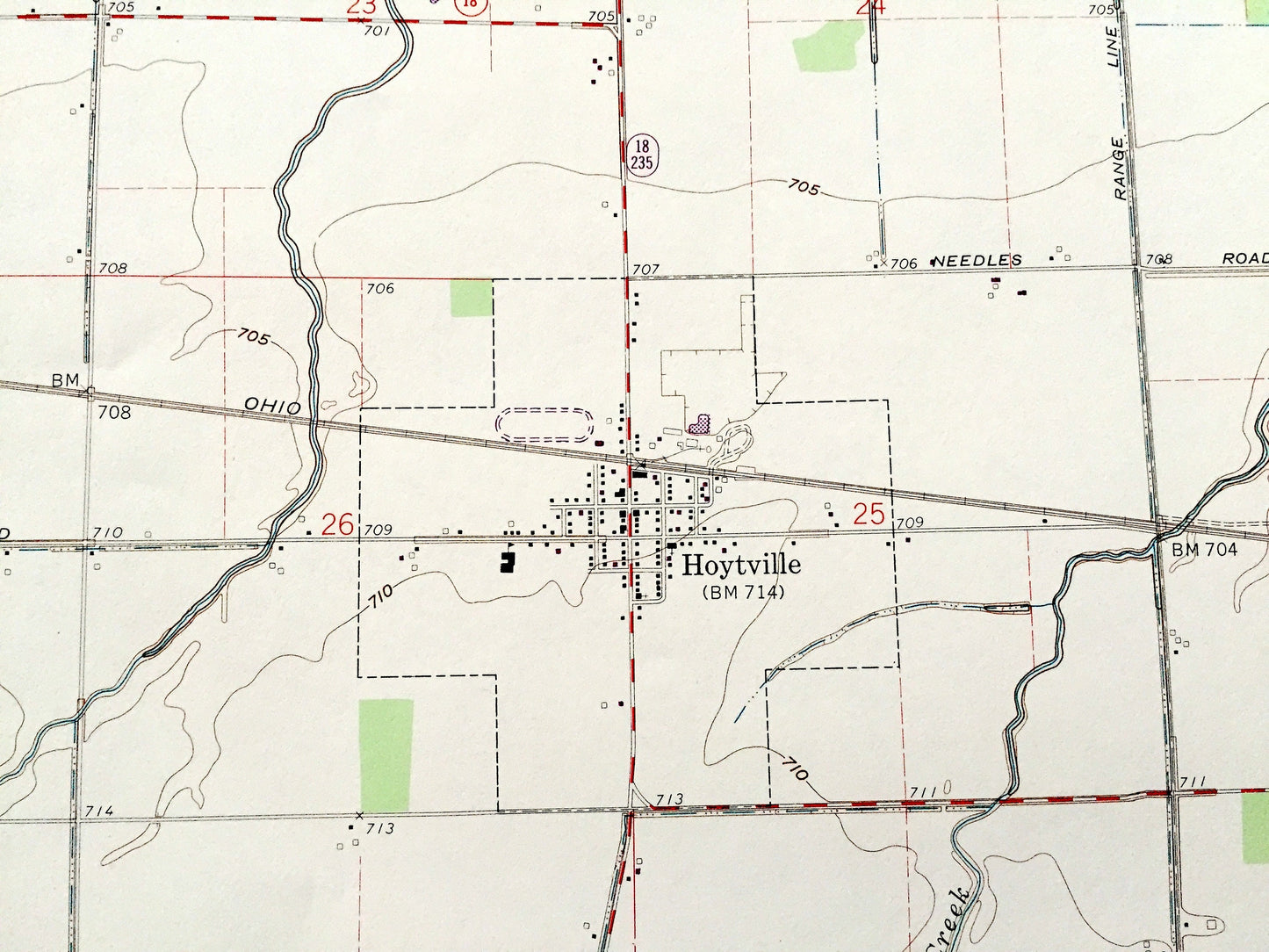
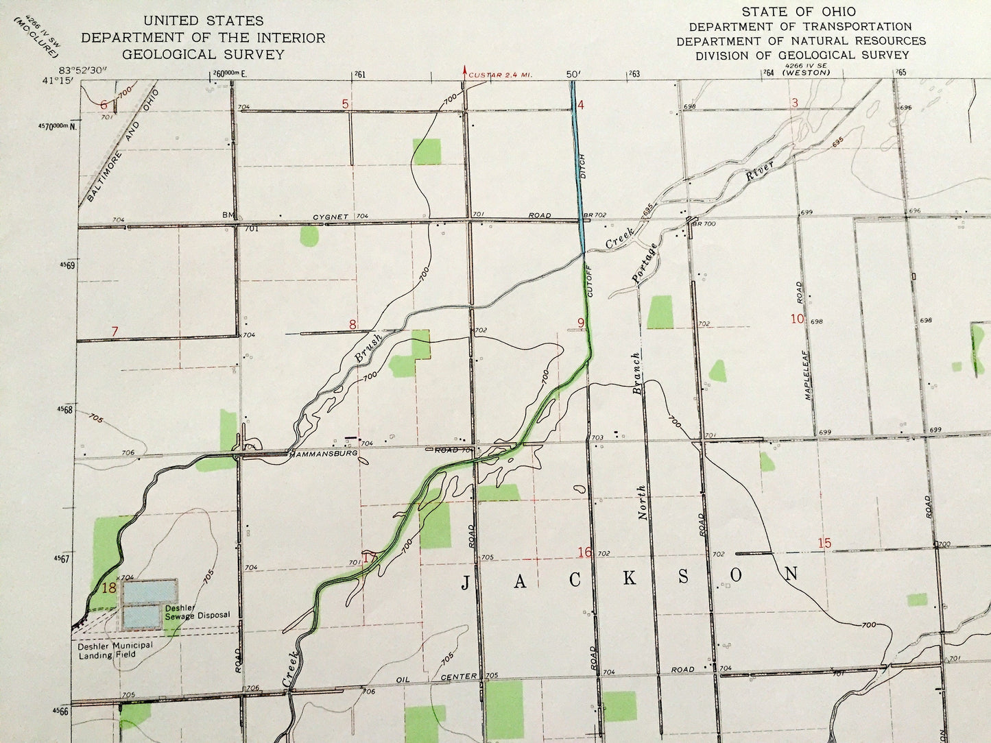
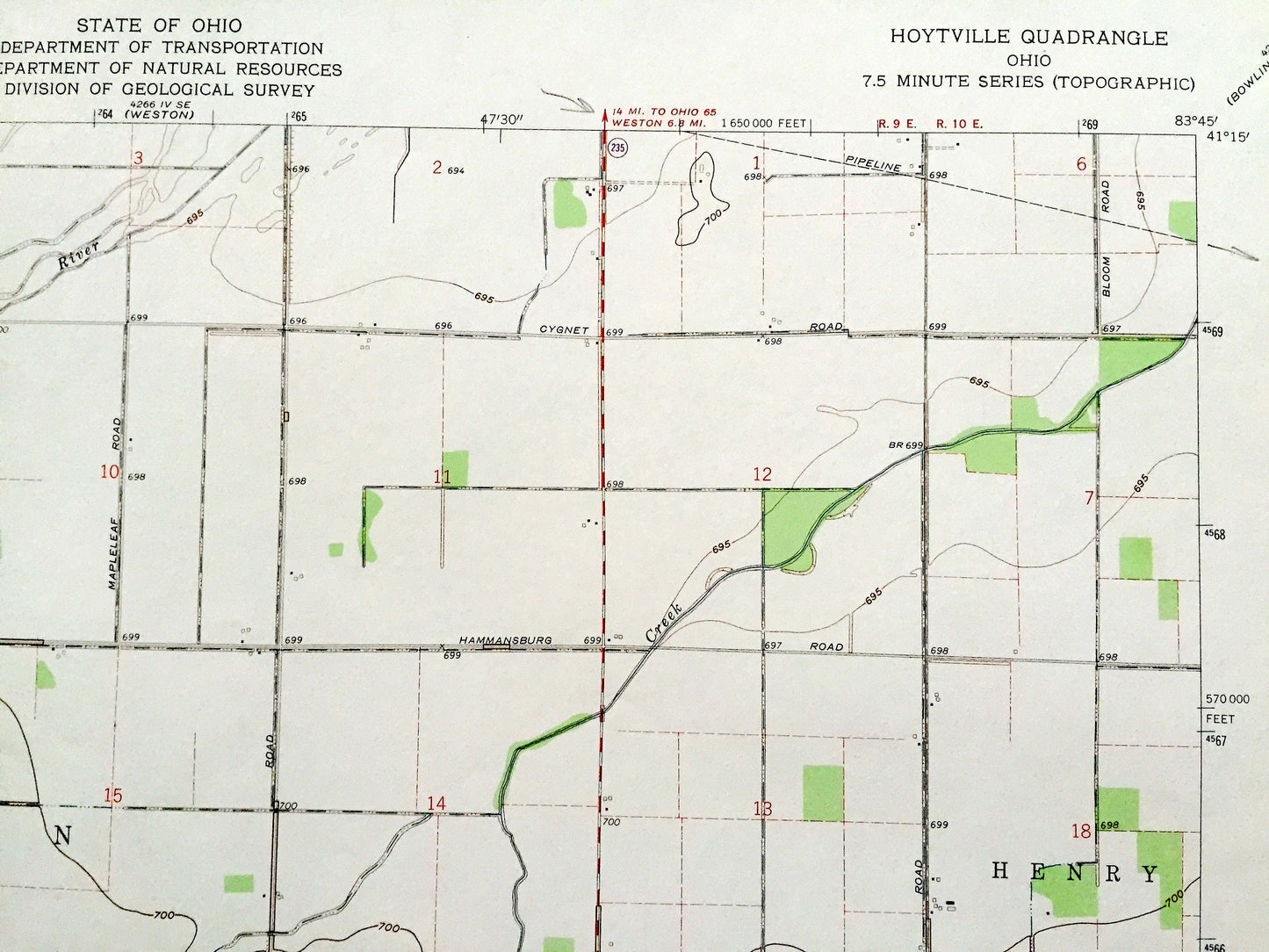
See what Ohio looked like over 60 years ago. Lots of intricate details and geological contours. Map even has little squares for every house that existed at the time. The USGS cartographers were very thorough back then!
Perfect for the historian, map-lover, the curious or just as a conversation starter. Wonderful and rare. Vintage maps such as these make great gifts.
Edition of 1960, printed 1974
Dimensions: 22" width x 27" height
----
Features
Cities & Towns: Jackson, Henry, Pleasant, Portage, Butlers Mill, Hancock, Deweyville.
Points of Interest: Deshler Municipal Landing Field, Deshler Sewage Disposal, Brush Creek, Portage River, North Branch, Needles Creek, Yellow Creek, West Creek, Rader Creek, and many more hills, streams, ponds, houses, schools, railroads, churches and roads.
Condition: Very Good Vintage condition, commensurate with age. This map is in great shape for being over 45 years old.
----
We will happily adjust shipping price for multiple purchases. Maps are rolled up and shipped in sturdy mailing tubes, never folded.
Couldn't load pickup availability
Share