My Store
Antique Hudson, Massachusetts 1950 US Geological Survey Topographic Map – Boxborough, Harvard, Bolton, Stow, Marlborough, Fryville Berlin MA
Antique Hudson, Massachusetts 1950 US Geological Survey Topographic Map – Boxborough, Harvard, Bolton, Stow, Marlborough, Fryville Berlin MA
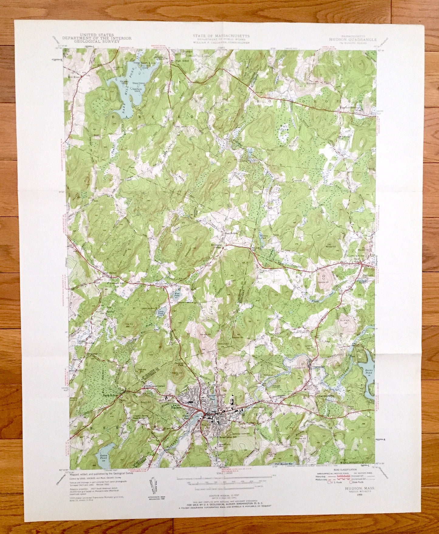
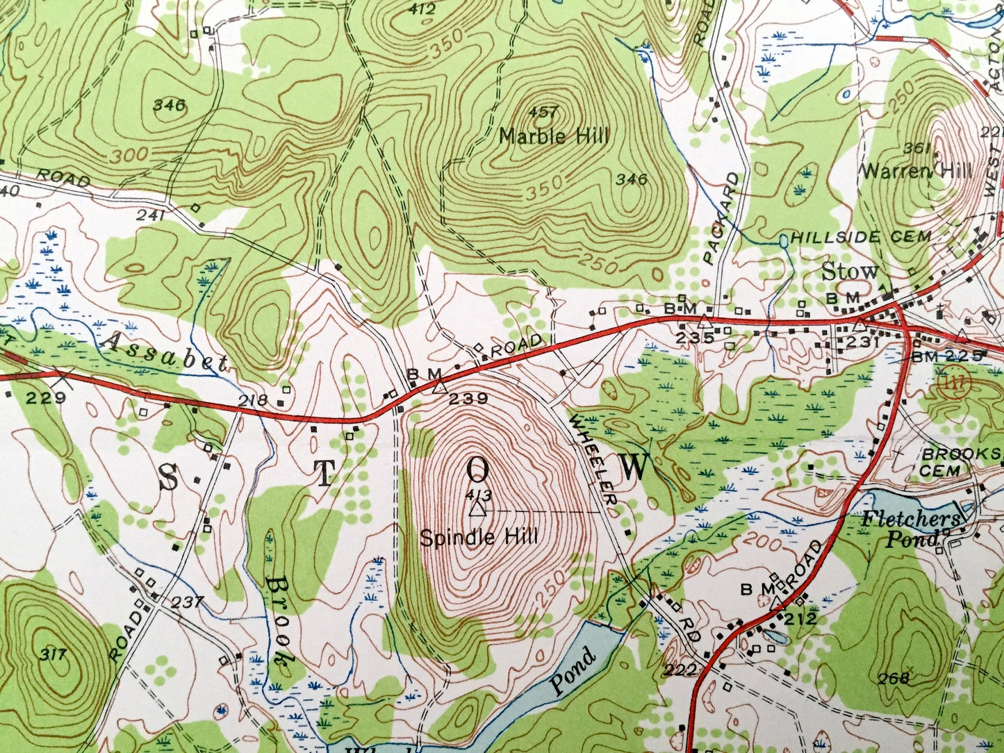
Beautiful, antique map of Harvard, Hudson, Boxborough and Bolton, Massachusetts. This is an authentic edition of 1950 print from the U.S. Geological Survey and NOT a computer reproduction.
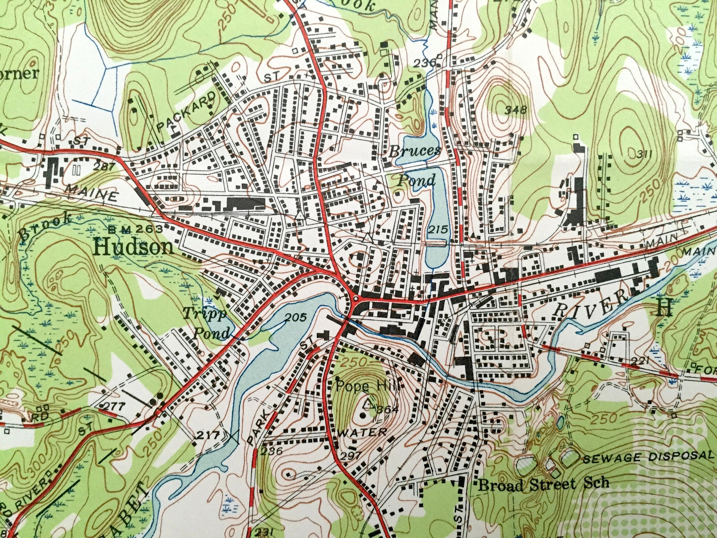
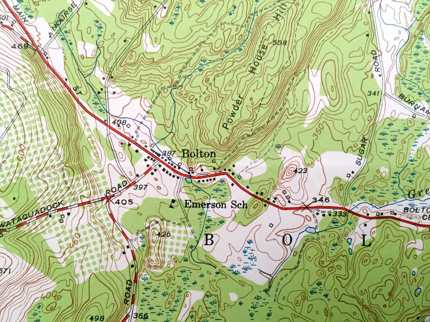
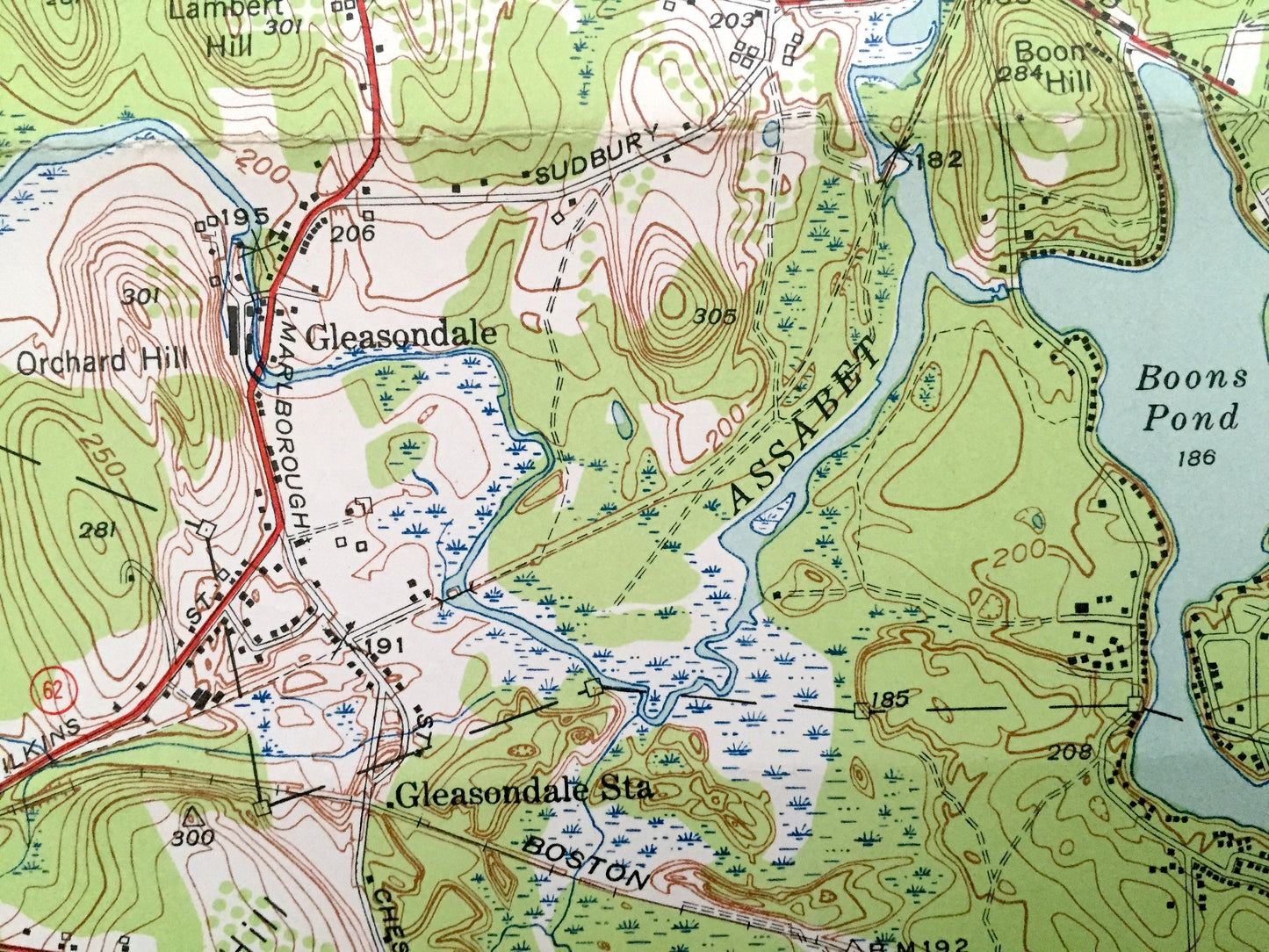
See what Massachusetts looked like 70 years ago. Lots of intricate details and geological contours. Map even has little squares for every house that existed at the time. The cartographers were very thorough back then!
Perfect for the historian, map-lover, the curious or just as a conversation starter. Wonderful and rare. Vintage maps such as these make great gifts.
Edition of 1950, printed 1950
Dimensions: 22" width x 27" height
----
Features
Cities & Towns: Harvard, Boxborough, Bolton, Stow, Hudson, Still River, East Bolton, Brockway Corner, Fryville, South Bolton, Marlborough, Gleasondale, Berlin.
Points of Interest: Bare Hill Pond, Blanchard Memorial School, Wolf Swamp, Harvard High School, Bromfield Academy, Camp Green Eyrie (now a Girls Scout Camp) Old Quaker Church (Fryville), Broad Street School, Boons Pond, Camp resolute (now a Boys Scout Camp), Camp Viginia, Stow Country Club, Emerson School, Spindle Hill, Gospel Hill and more roads, houses, ponds, hills, streams, and mountains.
Condition: Very Good condition, commensurate with age. This map is in great shape for being 70 years old. Has some fold marks, but these will read as vintage character when framed.
----
We will happily adjust shipping price for multiple purchases. Maps are rolled up and shipped in sturdy mailing tubes, never folded.
Couldn't load pickup availability
Share