My Store
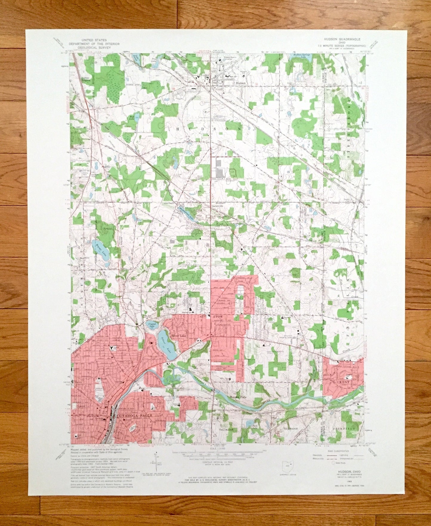
Antique Hudson, Ohio 1963 US Geological Survey Topographic Map – Summit County, Streetsboro, Northampton, Cuyahoga Falls, Franklin, Kent, OH
Antique Hudson, Ohio 1963 US Geological Survey Topographic Map – Summit County, Streetsboro, Northampton, Cuyahoga Falls, Franklin, Kent, OH
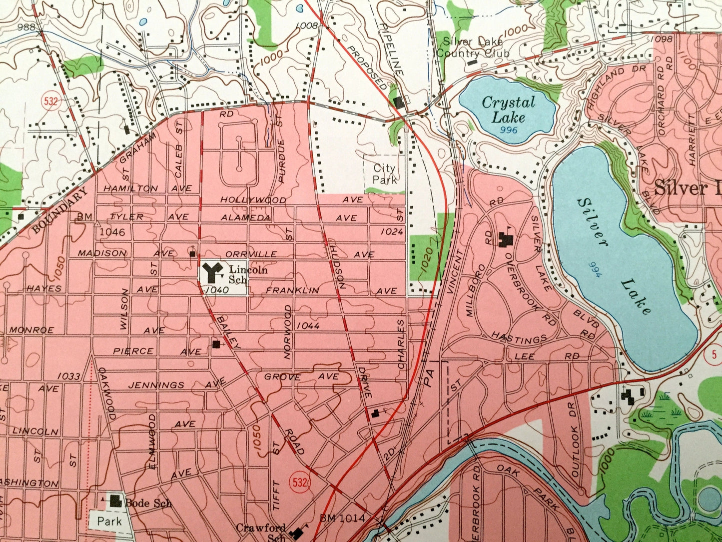
Beautiful, antique map of Hudson, Ohio and surrounding Summit & Portage County areas. This is an authentic 1963 edition, 1964 print from the U.S. Geological Survey and NOT a computer reprint.
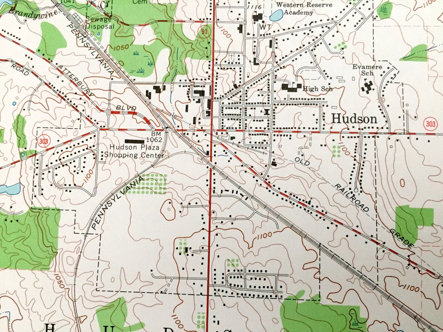
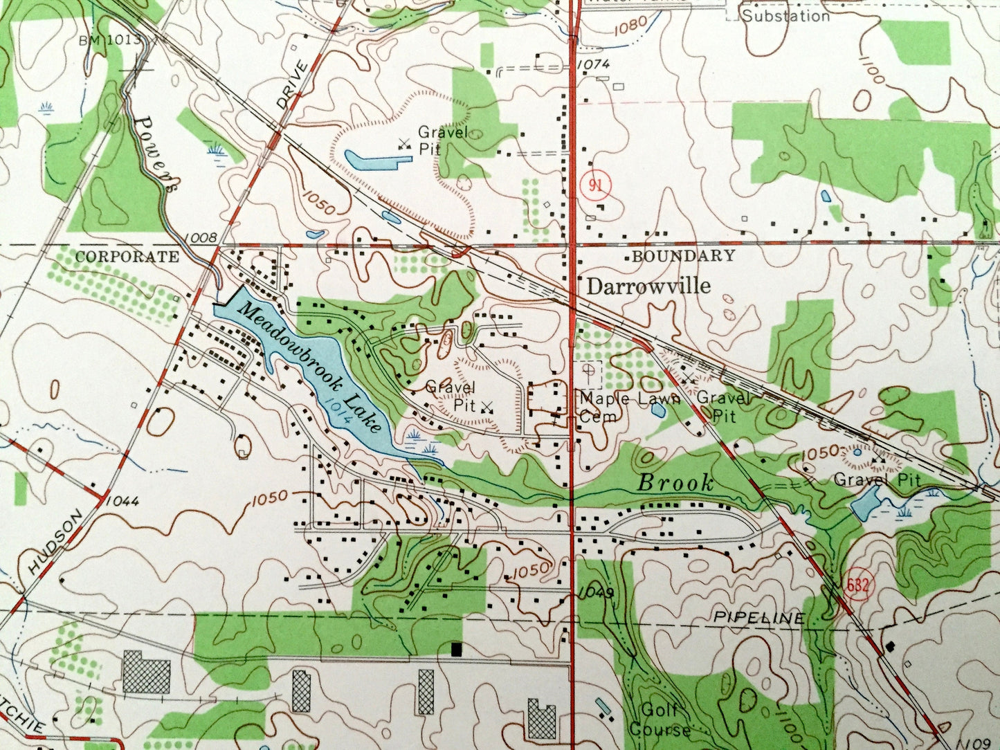
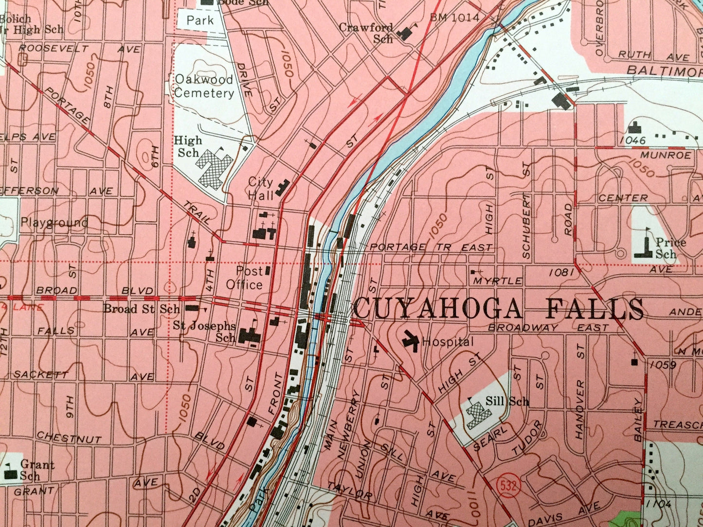
See what Ohio looked like over 55 years ago. Lots of intricate details and geological contours. Map even has little squares for every house that existed. The USGS cartographers were very thorough back then!
Perfect for the historian, map-lover, the curious or just as a conversation starter. Wonderful and rare. Vintage maps such as these make great gifts.
Edition of 1963, printed 1964
Dimensions: 22" width x 27" height
----
Features
Cities & Towns: Boston, Boston Heights, Silver Lake, Tallmadge, Brimfield, Munroe Falls, Stow, Darrowville.
Points of Interest: Brookledge Golf Course, Silver Lake Country Club, Kent-State University Airport, Western Reserve Academy, Waterworks Park, Golf Course, Lake Forrest, Pine Lake, Mud Lake, Meadowbrook Lake, Wyoga Lake, Crystal Lake, Silver Lake, Powers Brook, Cuyahoga River, Fish Creek, and many more hills, ditches, streams, creeks, ponds, houses, schools, railroads, churches and roads.
Condition: Very Good Vintage condition, commensurate with age. This map is in great shape for being over 55 years old.
----
We will happily adjust shipping price for multiple purchases. Maps are rolled up and shipped in sturdy mailing tubes, never folded.
Couldn't load pickup availability
Share